
Mastrang
A tiny Kinnaur hamlet and ITBP checkpoint on the Rakcham to Chitkul road, where the Baspa River spreads wide over a rocky bed, pine forests climb the slopes, and the only reason to stop is that the valley is too good to drive past
- Roadside Meadows
- ~3,200 m
- Between Rakcham & Chitkul
- Apr to Oct
- Baspa Valley, Kinnaur
What makes it special
Mastrang is not a place you plan a trip around. It is a small cluster of houses and an ITBP checkpoint on the valley road between Rakcham and Chitkul, sitting at roughly 3,200 metres in the Baspa Valley. The settlement falls under the Chitkul gram panchayat, and the handful of families who live here tend apple orchards on the slopes and keep to themselves. There is no market, no temple that draws visitors, no tourist infrastructure of any kind. What Mastrang has is the Baspa River, which widens here into a broad, rocky channel, and pine forests rising steeply on both sides of the valley.
The stretch of riverbed near Mastrang is what brought attention to this spot. The Baspa spreads out over stones and gravel bars, running grey green with snowmelt in summer, with flat grassy banks on one side and dense pine forest climbing the opposite slope. Film crews and advertising teams found the spot a few years ago, and a few camping operators, most notably Ibex Camp, now run small riverside setups nearby during the season. But most travellers still drive past without stopping. Those who do pull over, walk out toward the river, take a few photos across the wide stony channel, and continue toward Chitkul. That is roughly the right amount of time.
The honest framing: Mastrang is a 15 to 20 minute stop on the Chitkul drive, not a separate destination. The ITBP checkpoint here is a reminder that this is a sensitive border zone, and the valley beyond narrows steadily as you approach Chitkul. If you are staying in Sangla or Rakcham and driving north, you will pass through Mastrang. Stop for the river and the pines. Walk for ten minutes. Then carry on.
Quick answers
- What is Mastrang?
- Mastrang is a small hamlet and ITBP checkpoint on the road between Rakcham and Chitkul in the Baspa Valley, at roughly 3,200 metres. The draw is the wide, rocky stretch of the Baspa River with pine forests on the slopes and apple orchards between the houses. It is not a destination. It is a spot where you pull over for ten minutes on the Chitkul drive.
- How much time do I need?
- Fifteen to twenty minutes. Walk toward the river, take in the stony channel and the pine forest, and drive on. If you want to camp, operators like Ibex Camp run minimalist riverside setups during the season, but expect basic conditions.
- Is there anything at Mastrang?
- An ITBP checkpoint and a few houses with apple orchards. No accommodation in the village, no food, no shops, and almost no mobile signal. The nearest facilities are in Rakcham (about 5 km south) or Sangla (about 15 to 18 km south). Ibex Camp operates a seasonal riverside camp nearby. Carry everything you need.
Quick facts
Everything you need to know at a glance.
At a glance
- Altitude
- Approx 3,200 m
- Location
- On the road between Rakcham and Chitkul, Baspa Valley, Kinnaur
- Nearest settlement
- Rakcham (about 5 km south), Sangla (about 15 to 18 km)
- Open season
- Generally April to October, depending on snowfall and road conditions
- Time needed
- 15 to 20 min roadside stop; overnight if camping
- Entry fee
- No fee
- Effort level
- Flat walk from road to riverbed
On the ground
- Mobile network
- Almost none. BSNL faint at best. Jio and Airtel dead. Download offline maps before entering the valley.
- ATM
- None. Nearest in Reckong Peo. Carry cash.
- Fuel
- None. Fill at Reckong Peo before entering Kinnaur.
- Food
- None in the village. Ibex Camp serves meals to guests only.
- Stay
- None in the village. Ibex Camp runs a seasonal riverside camp nearby. Nearest homestays in Rakcham.
- Permits
- No permit for Indian travellers. Foreign nationals should confirm current Inner Line Permit rules for Kinnaur.
- Drone
- Sensitive border area. Do not fly drones.
Seasonal weather
- Apr to Jun20°5°Summer (Apr to Jun)
- Jul to Sep18°8°Monsoon (Jul to Sep)
- Oct to Nov14°-2°Autumn (Oct to Nov)
- Dec to Mar6°-10°Winter (Dec to Mar)
Suitable for
- Couples — with some care
- Families — with some care
- Seniors — with some care
- Solo — with some care
- First-timers — not suitable
- Pet-friendly — not suitable
How to reach Mastrang
1 approach route, with seasonal access.
From Sangla or Rakcham (on the Chitkul road)
Generally April to October- Distance
- About 15 to 18 km from Sangla, about 5 km from Rakcham
- Time
- Part of the Chitkul drive, roughly 30 to 45 min from Sangla
- Road
- Narrow surfaced valley road
You pass through Mastrang on the road from Sangla to Chitkul. It is a point on the valley road, not a turn off. Watch for the stretch where the Baspa River opens up into a wide, rocky channel on the left side of the road, with pine forest climbing the opposite bank. This is roughly between Rakcham and Chitkul. There is no signboard. Tell your driver to slow down and stop.
Best time to visit
Season by season, so you can plan around the weather rather than hope.
- Recommended
Summer
April to June
Green slopes, full river, clear roads. The best window to stop.
- Temperature
- 5 to 20°C
- River and forest
- Baspa running full, pine forests thick, apple orchards in leaf
- Roads
- Open from Shimla via Karcham. Generally clear.
- Crowds
- Very few stop here, even in peak season
- Photography
- Strong. Clean light on the stony riverbed, pine slopes, snow peaks behind.
- Families
- Fine for a quick roadside stop. No facilities for extended stays.
- Seniors
- Short flat walk to the river. Comfortable in a private vehicle.
April to June is when the Mastrang stretch looks its best. The pine forests are thick and dark on the slopes, apple orchards are in leaf between the houses, and the Baspa runs full and fast over its wide, rocky bed. Daytime temperatures sit around 10 to 20 degrees, but early mornings at 3,200 metres still need a jacket. The road from Sangla to Chitkul is generally clear through this period. May and June weekends bring more vehicles heading to Chitkul, but almost nobody stops at Mastrang itself, so the riverbed stays quiet. Pull over in the morning, when the light is direct and the valley is at its sharpest.
Monsoon
July to September
The valley is at its greenest, but the highway into Kinnaur is the gamble.
- Temperature
- 8 to 18°C
- Rain
- Intermittent, sometimes heavy. Landslide risk on access highways.
- Roads
- Valley road usually fine. NH5 highway is the risk.
- Crowds
- Very low
- Photography
- Moody cloud and river shots. Light is inconsistent.
- Families
- Not advisable. Highway risk and no facilities here.
- Seniors
- Avoid during peak monsoon due to road conditions.
Mastrang itself is fine in monsoon. The pine forests are dripping, the Baspa runs high and brown, and low clouds sit heavy on the valley walls. The problem is not Mastrang. The problem is NH5 between Rampur and Karcham, which is one of the most landslide prone stretches in Himachal during July and August. Road closures can strand you for hours or days before you even reach the Baspa Valley. The Sangla to Chitkul road inside the valley is usually passable. If you are already in the valley and driving to Chitkul, Mastrang is still worth a stop. But planning a trip specifically for this stretch during peak monsoon is a gamble on road access. September is drier and more reliable.
- Recommended
Autumn
October to November
Golden light, quiet valley, cold mornings. Worth the jacket.
- Temperature
- -2 to 14°C
- Landscape
- Apple harvest, golden slopes, dark pine forest, clear river
- Roads
- Generally stable after monsoon. Clear through October.
- Crowds
- Almost nobody
- Photography
- Best golden light of the year. Long afternoon shadows on the riverbed.
- Families
- October works for a quick stop. Bundle up for cold mornings.
- Seniors
- Comfortable with warm clothing. Flat walk, easy stop.
October is when the Baspa Valley shifts from green to gold. The apple orchards around Mastrang are in harvest, the pine forests stay dark against the golden slopes, and the Baspa runs lower and clearer over its stony bed. Tourist traffic drops sharply. You will probably have the riverbank to yourself. The light in the afternoons is warm and long, and the valley feels stripped down and clean after the monsoon. Temperatures drop fast, especially after sunset, touching zero by late October. Early November still works if you are dressed for it. Late November is a risk for road access.
- Closed
Winter
December to March
Snow on the ground, road access uncertain. Not a practical stop.
- Temperature
- -10 to 6°C
- Snow
- Common from December. Heavy in January and February.
- Roads
- Road from Sangla to Chitkul frequently blocked.
- Access
- Not practical. No facilities, no shelter, no help.
- Families
- Not suitable. Road closures and no facilities.
- Seniors
- Not recommended. Extreme cold, no medical help nearby.
The upper Baspa Valley beyond Sangla gets heavy snowfall from December onward, and the road between Sangla and Chitkul can be blocked for days or weeks. Mastrang, on this road with no facilities of any kind, is not a sensible stop in winter. The river still runs, but the banks are frozen and snow covered, the ITBP checkpoint controls movement more tightly, and there is no shelter, food, or help. Unless you are a winter trekker passing through with full gear and a clear plan, skip this window.
Things to see & do
3 things worth your time at Mastrang.
Walk to the Baspa riverbed
15 to 30 minPull over on the road between Rakcham and Chitkul and walk out toward the Baspa River. The river widens here into a broad, stony channel, with gravel bars and shallow braids in summer. Pine forests climb the opposite slope. Apple trees dot the flat ground near the road. No trail, no markers. You walk across the grass and stones until you reach the water. Ten to twenty minutes is enough. The morning is best, when the light is flat and sharp and the valley is still quiet.
Camp by the river (Ibex Camp or self sufficient)
OvernightA few operators, most notably Ibex Camp, run seasonal riverside camping setups near Mastrang. Expect basic tented accommodation with meals arranged by the camp. If you prefer to go solo, the flats near the Baspa are one of the quieter wild camping spots in the valley, but you will need your own tent, food, and water. Check local rules before pitching. Regulations on camping in this stretch can vary, and the ITBP presence means you should carry valid ID and avoid flying drones.
Photography along the stony riverbed
20 to 40 minThe wide, open stretch of the Baspa near Mastrang is one of the better photography spots in the valley. The stony channel, with braided water in summer, pine forests on the far slope, and snow peaks in the distance gives you a layered frame without needing a telephoto. Morning light is sharpest. Autumn afternoons give the warmest tones. Bring a wide angle if you have one. The scale of the riverbed does not come through on a phone camera as well as you would expect.
Know before you visit Mastrang
The practical bits, from people who have been.
The ground realityAlmost nothing here. ITBP checkpoint, a few houses, the river. Carry everything.
There is almost nothing at Mastrang. A few houses, an ITBP checkpoint, apple orchards, and the river. No shops, no food stalls, no water supply, no accommodation in the settlement itself, and no mobile signal worth counting on. Ibex Camp operates a seasonal riverside camp nearby, but the village has zero tourist infrastructure.
If you are driving to Chitkul, you will pass through Mastrang without realising it unless you are watching for the wide, stony riverbed on the left. Tell your driver to slow down between Rakcham and Chitkul and look for the point where the Baspa opens up into a broad channel with pine forest behind it.
For wild camping, you need to be fully self sufficient. Tent, sleeping bag, food, water, cooking gear. Check locally about current camping rules. This is a border area with active ITBP presence. Carry valid ID. Do not fly drones.
Who Mastrang suitsPhotographers, Chitkul drive stoppers, and riverside campers. Not a standalone destination.
Will enjoy it. Photographers who want river and forest shots without another person in the frame. Couples on the Chitkul drive looking for a quiet five minute stop. Self sufficient campers or those booking with Ibex Camp who want a night by the Baspa away from the bustle of Sangla.
Will not miss much by skipping it. Anyone short on time heading straight to Chitkul. Families with small children, since there is no washroom, no shade structure, and no food available. First time Kinnaur visitors who would get more from spending time at Chitkul or Rakcham.
Senior travellers. The walk from the road to the riverbed is flat and short, so seniors in a private vehicle can stop comfortably. But do not wander far from the car in a spot with no help available.
Safety and border area noteActive ITBP checkpoint. Carry ID. No medical help. No drone flying.
Mastrang has an active ITBP checkpoint, and the entire stretch from here to Chitkul is a border sensitive zone. Carry valid government ID at all times. Photography near military installations is not permitted. Do not fly drones.
No medical facilities anywhere nearby. The nearest basic help is in Rakcham (about 5 km). Anything more serious requires reaching Sangla (about 15 km) or Reckong Peo (roughly 40 km).
The altitude at around 3,200 metres is moderate, but if you have driven up from the plains quickly, even a short walk to the riverbed can leave you winded. Drink water, take it slow, and do not push it on your first day at this elevation.
What to carryNo supplies available. Carry water, snacks, warm layers, and cash.
There is nothing to buy at Mastrang. If you are stopping for a quick walk, carry drinking water and a warm layer even in summer. Mornings at 3,200 metres are colder than you expect.
If you are camping, bring everything: tent, sleeping bag rated for near zero nights, food, cooking gear, water purification, and a torch. There is no power outlet, no tap, and no shop within walking distance.
Cash is essential anywhere in the Baspa Valley. UPI and card payments do not work where there is no signal. Withdraw cash in Reckong Peo before entering the valley.
Nearby attractions
Other places worth the detour.
Rakcham
About 5 km south
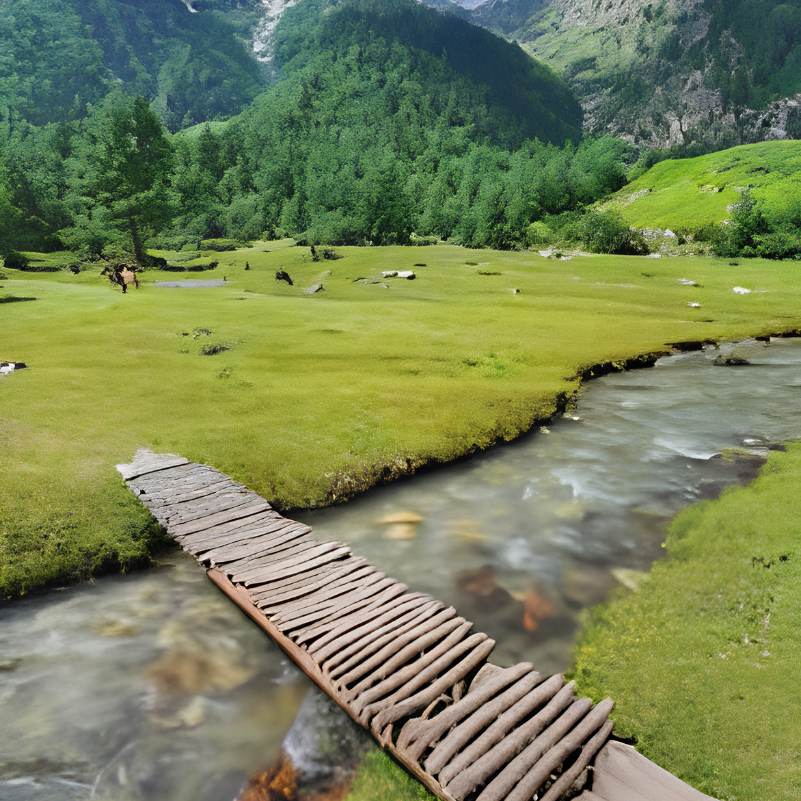
A quiet Kinnauri village with traditional wooden houses, wide riverside flats, and a few homestays. The nearest settlement with any overnight options and the closest thing to a base for exploring this stretch of the valley.
Chitkul
About 8 km north
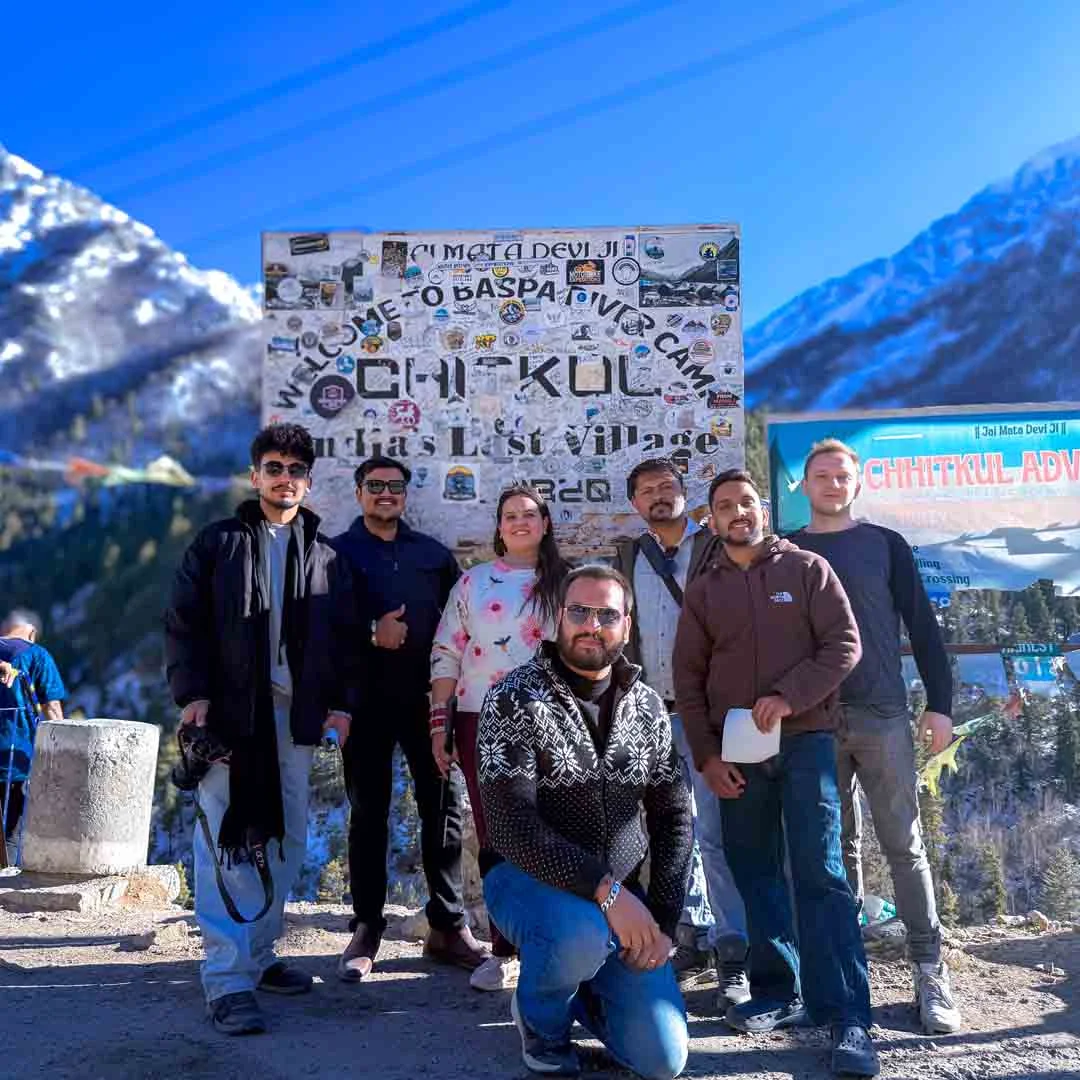
The last village on the old Indo Tibet road at around 3,450 metres. The usual reason people are on this road in the first place. Two old temples, the Baspa River, and the signboard at Hindustan Ka Akhri Dhaba.
Sangla Valley
About 15 to 18 km south
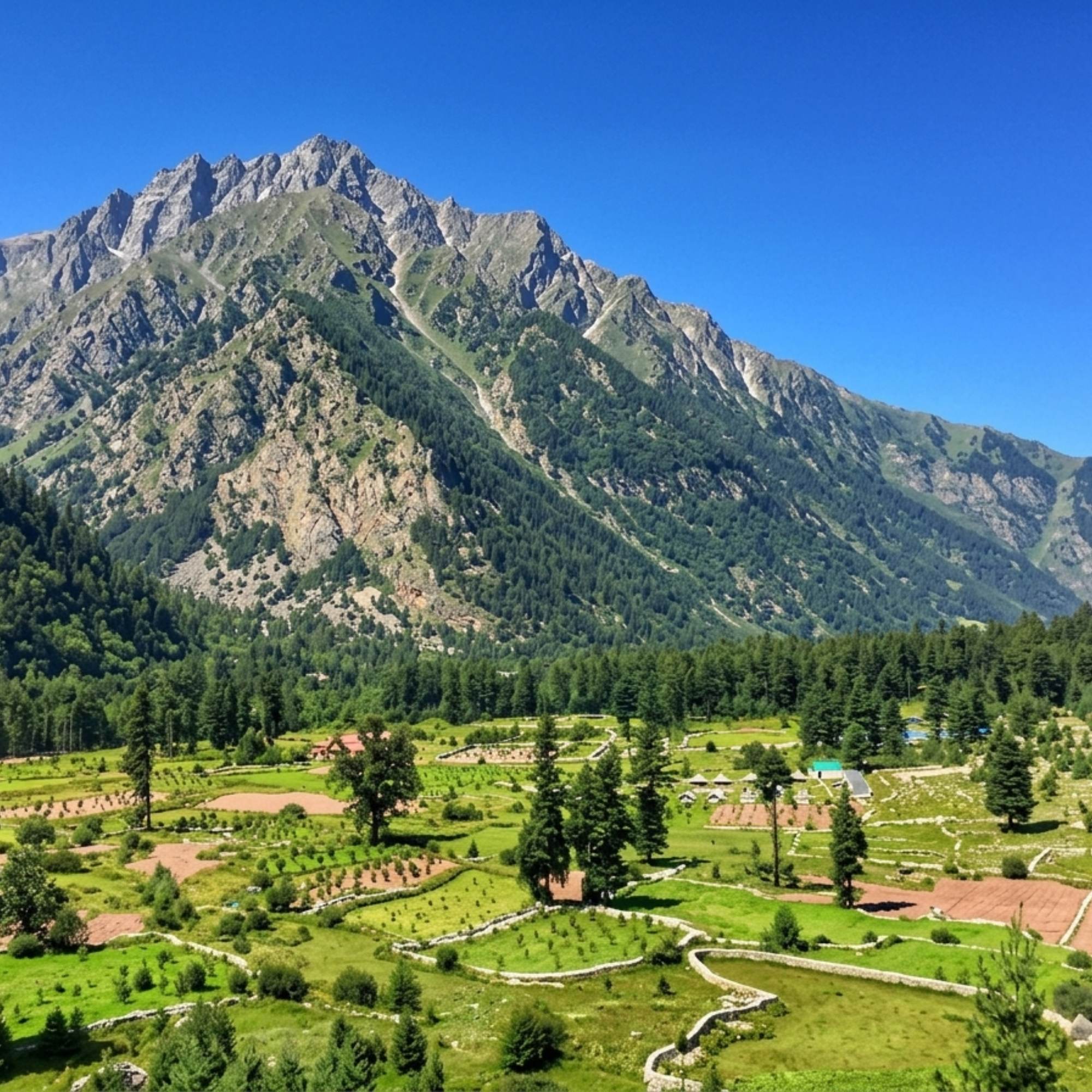
The main town of the Baspa Valley with hotels, a market, and the starting point for valley exploration. Your logistics and supply base before heading up toward Chitkul.
Kamru Fort
About 18 km (above Sangla)
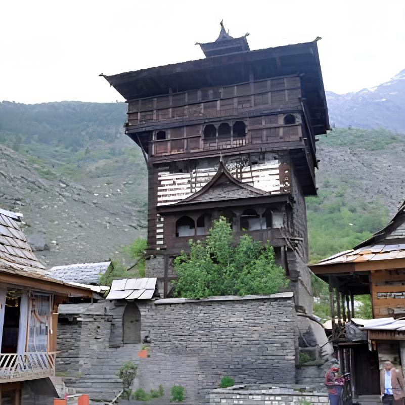
A five storey Kathkuni tower and temple complex above Sangla town. The strongest heritage stop in the valley, easily combined with the Chitkul drive.
Our packages with Mastrang
Curated trips that include a visit to Mastrang.
 Group Tour5D/4N
Kinnaur Valley Weekend Group Trip With Sangla Chitkul and Kalpa
1D Sangla•1D Kalpa
₹7,999₹9,999SAVE INR 2,000/ person
Common questions about Mastrang
Where is Mastrang?
Mastrang is a small settlement and ITBP checkpoint on the road between Rakcham and Chitkul in the Baspa Valley, Kinnaur district, Himachal Pradesh. It sits at roughly 3,200 metres, about 5 km north of Rakcham and 8 km south of Chitkul, under the Chitkul gram panchayat.
What is there to see at Mastrang?
The wide, rocky stretch of the Baspa River, pine forests on the slopes, and apple orchards near the road. There is no temple, fort, or structured attraction. The riverbed and the forest are the draw, and they are worth a stop on the Chitkul drive if you have ten minutes.
How much time do I need at Mastrang?
Fifteen to twenty minutes for a walk to the riverbed and photos. If you are camping at Ibex Camp or going self sufficient, plan for an overnight. Mastrang is a roadside stop, not a standalone destination.
Is there any accommodation or food at Mastrang?
Nothing in the village itself. No rooms, no food stall, no shops, no ATM, no fuel. Ibex Camp operates a seasonal riverside setup nearby with basic tented accommodation and meals. Otherwise, carry everything you need from Sangla or Reckong Peo. The nearest homestays are in Rakcham, about 5 km south.
What is the best time to visit Mastrang?
April to June for the fullest river and greenest slopes. October for golden light and empty roads. Monsoon (July to September) is possible but the highway into Kinnaur is landslide prone. Winter is not practical because the road can be blocked and there is nothing at Mastrang to sustain a stop. Travellers should confirm road status before leaving, as conditions change with the season.
Can I camp at Mastrang?
Yes. Ibex Camp runs a seasonal riverside setup nearby with basic tents and meals. For wild camping, you need your own gear, food, and water. There are no facilities. Check local rules before pitching, as regulations can change. This is a border area with active ITBP presence, so carry valid ID and do not fly drones.
Is Mastrang suitable for families with children?
As a quick ten minute stop on the Chitkul drive, it works fine for families. But there is no washroom, no shade, and no food. Families with small children should not plan to spend extended time here. Camping at Mastrang is not suitable for families unless you are at Ibex Camp and prepared for very basic conditions.
How do I reach Mastrang?
You pass through Mastrang on the road from Sangla to Chitkul. It is a point on the valley road, not a separate turn off. Look for the stretch where the Baspa River widens into a broad, stony channel with pine forest behind it, roughly between Rakcham and Chitkul. There is no signboard. Tell your driver to stop when you see the open riverbed.
Does mobile network work at Mastrang?
Almost not at all. BSNL may catch a faint signal occasionally. Jio and Airtel are generally dead here. Do not rely on data, navigation, or UPI at Mastrang. Download offline maps and carry cash before entering the Baspa Valley.
Is Mastrang worth a separate trip?
No. Mastrang works as a ten to twenty minute stop on the drive between Rakcham and Chitkul, or as an overnight if you are camping at Ibex Camp. It is not a destination you would build a trip around. If you are driving through the Baspa Valley, stop for the river and the pines. If you are not, Rakcham or Chitkul offer far more.
Is Mastrang safe for solo travellers?
The spot is safe for a brief stop during daylight. ITBP presence adds a layer of security on this stretch. For overnight camping alone, you need to be genuinely self sufficient and carry valid ID. Let someone know your plans before heading out, since there is no mobile signal to call for help.
Related guides
Posts about Kinnaur
- Yulla Kanda Trek Guide 2026: Route, Best Time, Cost and Planning
- Kinnaur Snowfall Guide 2026: When & Where to Look for Snow
- Christmas & New Year in Kinnaur: A 2026-27 Winter Trip Guide
- Kinnaur in November 2026: Weather, Snow Chances & 7-Day Trip Plan
- Yulla Kanda Trek Distance and Route 2026: Yulla Khas to the Lake
- Yulla Kanda Krishna Temple in 2026: Location, Beliefs & Visiting Etiquette