
Sangla Valley
A green river valley in Kinnaur where apple orchards, Kinnauri villages, an ancient fort, and the Baspa River sit between the highway and the border
- Valley & Villages
- ~2,600 m
- Shimla · ~230 km
- Apr to Oct
- Baspa River, Kinnaur
What makes it special
Sangla Valley is technically the Baspa Valley, named after the river that cuts through it. Nobody calls it that, though. Everybody says Sangla, after the largest town, and that is what shows up on bus signs, search results, and every itinerary you will find. The valley branches off the main Kinnaur highway at Karcham and follows the Baspa River roughly 25 km northeast to Chitkul, the last village on the old Indo Tibet road.
The first thing you notice is the river. The Baspa runs fast and milky turquoise where the snowmelt is fresh, turning grey green as it picks up silt further downstream. The colour changes with the season and the time of day, bluer in the morning, greener by afternoon. Then the orchards register. The valley is one of the most productive apple growing belts in Himachal Pradesh. Kinnaur Golden and Royal Delicious are the main varieties you will see, and from late August through October the branches hang heavy enough to brush the path in places. Walk through an orchard on a warm October morning and the air is thick with the smell of overripe fruit on the ground, mixed with pine resin and the particular dry smoke of deodar wood fires. That combination is specific to this valley.
The villages are old. Sangla, Batseri, Rakcham, Chitkul. Built in the Kinnauri style: stacked stone and deodar timber interlocked in the earthquake resistant Kathkuni technique, with thick slate roofs that darken to near black over decades of sun and rain, and carved wooden balconies that lean slightly outward over narrow lanes. The smell inside these houses is always the same, woodsmoke and stored grain and faintly sweet apple wood. Rakcham is the one that catches most people off guard: a small cluster of these slate roofed houses with smoke curling out of chimneys, sitting above the river with almost no tourist infrastructure around it.
Above Sangla town, Kamru Fort occupies a rocky spur with a five storey wooden tower that has stood for the better part of a thousand years. This was the original seat of the Bushahr dynasty, one of the oldest princely states in the western Himalaya. The kingdom eventually moved its capital to Sarahan and then Rampur, but Kamru never stopped being a place of worship. The Kamakhya Devi idol on an upper floor of the tower is traditionally believed to have been brought from Guwahati in Assam by the Bushahr kings, and a fair honouring the deity is still held roughly once every three years. At the far end of the valley, Chitkul sits at around 3,450 metres with nothing beyond it but the border.
Getting here is part of the story. From Shimla, the drive is roughly 230 to 240 km and takes a solid 8 to 10 hours, best split over two days. After Rampur, the highway enters the Sutlej gorge and things get serious. The stretch through Tranda Dhank is the one people remember: a narrow shelf of road carved into sheer cliff, the river hundreds of metres below, no guardrails in places, and oncoming trucks that expect you to reverse. It is not dangerous if you drive slowly and stick to daylight hours. But it is the kind of road where passengers go quiet for a while.
Most travellers spend two to three nights in the valley, using Sangla town as a base and driving up to Chitkul for a day. That is the right amount of time. More than three nights and you have covered everything. Fewer than two and you are just passing through. The food is honest mountain cooking: thukpa, momos, rajma chawal, and fresh apple juice pressed from whatever variety is in season. The culture blends Hindu and Buddhist traditions without anyone making a fuss about it. The Bering Nag temple in Sangla, the Kamru Fort complex with its Kamakhya Devi shrine, and the Mathi Devi temple near Chitkul all sit alongside Buddhist prayer flags and small monastery shrines. It just is what it is.
Quick answers
- Is Sangla Valley worth visiting?
- Yes. The Baspa River changes colour through the day, shifting from pale blue to deep green as the light moves, apple orchards line both slopes, the villages have genuine old Kinnauri architecture, and Kamru Fort alone justifies the detour. You get a real Himalayan valley experience without extreme altitude or brutal drives, though the road through Tranda Dhank on the way in will test your nerves. Two to three nights is right.
- How many days do you need in Sangla Valley?
- Two nights minimum, three if you want to slow down. That covers Kamru Fort in the morning, a Chitkul day trip, a village walk to Batseri, and an evening by the river. One night means you are just sleeping and leaving. Beyond three, most travellers are ready to move to Kalpa or deeper into Kinnaur.
- Is Sangla Valley good for families?
- One of the better Kinnaur options. The altitude is moderate at around 2,600 metres, the valley walks are flat and easy, and the drive from Shimla, while long, avoids the extreme passes. The Kamru Fort climb is steep for very small children. Chitkul gets cold even in June, so pack layers for the day trip. The Tranda Dhank road section can unsettle nervous passengers, so sit on the mountain side if that is a concern.
Quick facts
Everything you need to know at a glance.
At a glance
- Altitude
- Sangla town at approx 2,600 m; Chitkul at approx 3,450 m
- Location
- Baspa Valley, Kinnaur district, Himachal Pradesh
- Nearest highway town
- Karcham (NH 5 junction), about 18 km
- Open season
- Generally April to October. Winter (December to March) is difficult and road access is often restricted by snow.
- Time needed
- 2 to 3 nights recommended
- Entry fee
- No fee to enter the valley or villages
- Effort level
- Easy to moderate; gentle valley walks, one steep climb at Kamru
On the ground
- Mobile network
- Airtel and BSNL work in Sangla town. Jio is patchy. Coverage drops sharply toward Chitkul where only BSNL is intermittently reliable.
- ATM
- Limited and unreliable in Sangla. Carry cash from Reckong Peo or Rampur.
- Fuel
- No reliable fuel pump in the Baspa Valley. Fill up at Reckong Peo or Rampur.
- Food
- Hotels and homestays serve North Indian, Kinnauri, and Tibetan food. Fresh Kinnaur Golden apple juice in season. Ask for siddu and aktori.
- Stay
- Hotels, homestays, and riverside camps in Sangla and Batseri. Budget to mid range. Book ahead in peak season.
- Permits
- No permit for Indian travellers. Foreign nationals may need an Inner Line Permit for parts of Kinnaur. Confirm current rules locally.
- Drone
- Border area. Do not fly drones without explicit permission.
Seasonal weather
- Apr to Jun24°8°Summer (Apr to Jun)
- Jul to Sep22°12°Monsoon (Jul to Sep)
- Oct to Nov18°2°Autumn (Oct to Nov)
- Dec to Mar10°-5°Winter (Dec to Mar)
Suitable for
- Couples — suitable
- Families — suitable
- Seniors — suitable
- Solo — suitable
- First-timers — suitable
- Pet-friendly — with some care
How to reach Sangla Valley
4 approach routes, with seasonal access.
From Shimla
Generally April to October- Distance
- Approx 230 to 240 km
- Time
- 8 to 10 hours; best split over 2 days
- Road
- NH 5 mountain highway; narrow cliff sections through Tranda Dhank
- Last fuel
- Rampur, Reckong Peo
The standard approach, and the drive itself is a story. Shimla to Rampur is the easier half: wide highway, decent surface, nothing dramatic. After Rampur, the road drops into the Sutlej gorge and the character changes completely. You will know you have reached Tranda Dhank when the tarmac narrows to a single lane pinned against bare rock, with the Sutlej a long, silent drop below. Trucks coming from the opposite direction flash headlights and expect you to find room where none exists. Your driver will know the drill, but first time passengers tend to go very quiet through this stretch. It takes roughly 30 to 40 minutes to clear, and it is perfectly safe at slow speed in daylight. Just do not try it after dark. At Karcham, you leave the highway and turn left into the Baspa Valley, and the road quiets down. Most people split this journey with a night at Narkanda, Sarahan, or Rampur. Doing it in one shot is possible but unwise, especially with kids or nervous passengers.
From Reckong Peo (Kinnaur district HQ)
Generally April to October- Distance
- Approx 35 to 40 km
- Time
- 1.5 to 2 hours
- Road
- Mountain road via Karcham
- Last fuel
- Reckong Peo
If you are already in Kinnaur, coming from Kalpa or Reckong Peo, you drive down to Karcham on NH 5 and take the left fork into the Baspa Valley. The valley road is mostly surfaced but narrow in places. Fill fuel and withdraw cash at Reckong Peo before entering. There is no reliable fuel pump or ATM inside the valley.
From Delhi
Generally April to October- Distance
- Approx 560 to 590 km
- Time
- 2 to 3 days by road
- Road
- Highway then mountain roads; cliff sections after Rampur
- Last fuel
- Chandigarh or Solan area, Rampur, Reckong Peo
Drive or take a Volvo bus to Shimla or Rampur, then continue toward Karcham. Three driving days is comfortable: one to Narkanda or Sarahan, one to Sangla, with the Tranda Dhank section in between when you are fresh in the morning. Compressing it into two days means long hours on cliff roads while tired, which is not worth the time saved.
From Chandigarh
Generally April to October- Distance
- Approx 350 to 370 km
- Time
- 10 to 12 hours; best split over 2 days
- Road
- NH then mountain highway
- Last fuel
- Shimla area, Rampur
Through Shimla or bypassing it via Kufri and Narkanda, then NH 5 to Rampur and Karcham. The Sangla turnoff is at Karcham. A comfortable plan is one night in the Shimla or Narkanda area, then onward the next morning when you are fresh for the gorge roads.
Best time to visit
Season by season, so you can plan around the weather rather than hope.
- Recommended
Summer
April to June
The main window. Roads open, the Baspa at its bluest, days warm, nights cool.
- Temperature
- Roughly 15 to 24°C day, 8 to 12°C night
- Crowds
- Moderate to high, peaks on long weekends
- Roads
- Generally open; Tranda Dhank passable in daylight
- Orchards
- Green and leafy; apricot blossoms in April and May
This is when most people come, and the reasons are straightforward. The road from Shimla is generally clear, including the Tranda Dhank section. The valley is green, the Baspa shifts between pale blue and deep turquoise depending on the hour and how much melt is feeding it, and the orchards are leafy with new fruit setting on the branches. Apricot blossoms appear in April and May if you time it right. Days are warm enough for a single layer, nights need a proper jacket. Long weekends in May and June bring real crowds to Sangla town. Visit midweek if you can.
Monsoon
July to September
The valley turns lush but the highway turns risky. Late July and August are the toughest weeks.
- Temperature
- Roughly 14 to 22°C day, 12 to 14°C night
- Crowds
- Lower than summer
- Roads
- Landslide risk on the highway, especially late July and August
- Rain
- Intermittent showers; heaviest in late July and August
The valley itself turns intensely green and the orchards get heavy. But the Kinnaur highway between Rampur and Karcham is where monsoon hits hardest. The Tranda Dhank section and the Sutlej gorge are landslide country in this season. Road closures can strand you for hours or days. Late July and August are the riskiest weeks. If you are travelling in this window, check weather and road reports daily, keep one or two buffer days in your plan, and do not lock into rigid onward connections. Inside the valley, conditions are usually fine, but getting in and out is the gamble.
- Recommended
Autumn
October to early November
Apple harvest, sharp pine air, golden light, thin crowds. Quietly the best season.
- Temperature
- Roughly 10 to 18°C day, 2 to 6°C night
- Crowds
- Low
- Roads
- Generally good; past the monsoon landslide window
- Orchards
- Kinnaur Golden and Royal Delicious harvest; golden light
If you can handle cold mornings and genuinely cold evenings, October is the time to come. The orchards are in full harvest, with Kinnaur Golden and Royal Delicious apples being picked and packed in wooden crates along every road, the smell of ripe fruit carrying through the cold air. The light is clean and warm until late afternoon, and the valley has a quiet that peak summer simply does not have. The Baspa runs lower and greener. The pine scent is sharper in the cold air. Evenings drop fast, so pack proper warm layers. Late October can bring early snow on the higher stretches toward Chitkul.
Winter
December to March
Often restricted by snow. Road access is unreliable and conditions are harsh. Only for prepared winter travellers.
- Temperature
- Roughly 0 to 10°C day, minus 5 to minus 10°C night
- Crowds
- Very few visitors
- Roads
- Often blocked by snow; Karcham to Sangla road frequently impassable
- What stays open
- A few hotels in Sangla; most camps closed; supplies limited
December to March is genuinely difficult and often not possible at all. Heavy snow regularly blocks the road from Karcham into the valley, sometimes for days or weeks at a stretch. The Tranda Dhank section on the highway can also close after snowfall, cutting off the entire approach. Even when the road is technically open, black ice and single lane snow clearance make driving risky without chains and an experienced mountain driver. Most riverside camps shut entirely. A few hotels in Sangla town stay open, but supplies run thin, heating is basic, and the nearest hospital at Reckong Peo may itself be hard to reach. The slate roofed villages look striking with fresh snow on the roofs and woodsmoke rising in the still, cold air, but this is a window only for travellers with a reliable 4x4, real cold weather gear, flexible dates, and a willingness to be snowed in. Do not plan a winter visit casually.
Things to see & do
7 things worth your time at Sangla Valley.
Walk along the Baspa River in the evening
1 to 2 hoursThe Baspa changes colour through the day. In the morning, it runs milky turquoise with fresh snowmelt. By evening, the water turns grey green and the light catches it differently. You walk along the banks from Sangla town through fields and orchards of Kinnaur Golden and Royal Delicious apple trees, crossing small wooden bridges, the smell of pine needles and damp earth sharp in the air. This is not a paved promenade. It is a valley floor path shared with local families and the occasional cow. If you are staying at one of the riverside camps near Batseri, the sound of the Baspa at night is the kind of white noise that actually works.
Climb to Kamru Fort
1.5 to 2 hoursA short, steep climb from Sangla town through apple orchards and the old village of Kamru. At the top sits the original seat of the Bushahr dynasty, one of the oldest princely states in the western Himalaya. The five storey tower is built in the Kathkuni style, alternating deodar beams and stone courses interlocked for earthquake resistance, and it has been standing here since roughly the 10th or 11th century. The Kamakhya Devi idol on an upper floor was traditionally brought all the way from Guwahati in Assam by the Bushahr kings, and a fair honouring the deity still happens roughly once every three years. You will be given a Kinnauri cap and Gachhi belt before entering the temple area. The tower itself is locked to visitors. Photography inside the temple is banned. Budget about 90 minutes for the whole visit including the walk, and go in the morning when the sun hits the carved deodar panels directly.
Drive to Chitkul
Half day round tripAbout 25 km from Sangla, at the end of the valley road. The drive follows the Baspa upriver, past Rakcham with its cluster of dark slate roofed houses and smoking chimneys, then through terrain that gets barer and colder as you climb. Chitkul itself is small: a wooden temple, a few homestays, the Hindustan Ka Akhri Dhaba, and a wind that bites even in June. Pack a proper jacket regardless of the month. Nights at 3,450 metres can drop close to freezing even in peak summer, and the wind coming off the snowfields does not care what the calendar says. You will not need more than a couple of hours in the village, but the drive and the feeling of reaching the literal end of the road stick with you.
Walk to Batseri village
1 to 2 hoursA 3 km walk from Sangla to one of the most intact Kinnauri villages in the valley. Batseri has stone paved lanes worn smooth by centuries of foot traffic, old wooden houses with carved balconies blackened by deodar woodsmoke, and the Badri Narayan temple with its mix of Hindu and Buddhist architectural details. You can cross the wooden footbridge over the Baspa, and if the light is right in late afternoon, the pale blue water framed by dark timber makes one of the better photos in the valley. The air here carries the scent of pine resin and apple wood fires, and a grandmother drying buckwheat on a rooftop will not look up as you pass.
Trout fishing and the trout farm near Batseri
1 to 2 hoursThe Baspa is one of the better trout streams in Himachal Pradesh, and the government trout farm near Batseri is a small but interesting stop, especially if you are travelling with kids. Brown trout and rainbow trout both thrive in the cold, fast water. If you are into angling, some local operators can arrange fishing permits for catch and release on designated stretches of the river, though rules and availability change with the season. Confirm locally before counting on it. The trout farm itself takes about 20 to 30 minutes and is free to visit.
Shop for Kinnauri caps, chilgoza, and apples
30 min to 1 hourSangla town has a functioning market with a few shops selling Kinnauri caps, shawls, dried fruits, chilgoza (pine nuts), and local honey. Prices are reasonable compared to Shimla or Delhi. Batseri also has a small handicraft centre. If you want to bring something home, chilgoza and the hand woven caps are the two things worth buying. In season, you can also buy boxes of Kinnaur Golden and Royal Delicious apples directly from orchard owners on the roadside, often fresher and cheaper than anything in the market.
Camp in an apple orchard by the river
OvernightSeveral camps between Sangla and Batseri pitch tents under apple trees right beside the Baspa. You sleep with the river audible through the canvas, the smell of pine needles in the air, and the temperature dropping enough by midnight that you are grateful for the extra blanket. It sounds like a brochure line until you are actually lying there at 2 AM listening to the river and nothing else. Banjara Camps near Batseri is one of the better established setups, with proper tents and meals included. Newer operators along the river are worth checking reviews for. This is the way to do the valley if you want the full sensory version.
Know before you visit Sangla Valley
The practical bits, from people who have been.
Sangla, Batseri, Rakcham, or Chitkul: where to staySangla for convenience, Batseri for orchards and river, Rakcham for quiet, Chitkul for frontier
Sangla town is the hub. Most hotels, restaurants, and the main market are here, and it is the easiest base for day trips to Kamru Fort (2 km uphill), Batseri (3 km), and Chitkul (25 km). If you want connectivity, food options, and access, this is the practical choice.
Batseri sits about 3 km away, quieter than Sangla, with some of the valley's best riverside camps tucked into apple orchards. The village itself has stone lanes and old carved houses. If sleeping next to the river under apple trees is what you came for, base yourself here.
Rakcham is the one most people do not plan for and then wish they had. Roughly halfway to Chitkul, it is a tiny hamlet of dark slate roofed wooden houses with smoke curling from the chimneys, almost no tourist infrastructure, and a riverside setting that feels genuinely remote. A few homestays operate here for travellers who want isolation.
Chitkul is the end of the road. A handful of basic homestays and guesthouses, popular for the frontier atmosphere and the "last village" tag. Stay here if that matters to you. Otherwise, a day trip from Sangla covers it well.
Rates range from basic guesthouses (Rs 800 to 1,500 per night) to mid range hotels (Rs 2,000 to 4,000) and riverside camps with nicer tents and meals (Rs 4,000 to 8,000 or more). Book ahead in May, June, and during long weekends. Showing up without a booking in peak season is risky.
Who Sangla Valley suits and who should know what to expectGreen, gentle, accessible. Not for travellers chasing stark high altitude landscapes.
Will get a lot out of it. Couples and small groups who want a green, accessible Himalayan valley without extreme altitude. Families with older kids who can handle a long drive. Solo travellers looking for river walks, village lanes, and good simple food. Photographers who work with orchard light, old wood textures, and that milky turquoise river colour. People on the Kinnaur circuit who want a softer counterpoint to Spiti's bareness.
Might feel let down. Travellers chasing stark high altitude drama. The valley is green and gentle, not Spiti, not Ladakh, not even Kalpa. If bare mountain desert is your thing, Sangla is too soft. Peak season weekends also bring crowds to Sangla town that the place does not absorb gracefully.
Families with small kids. One of the better Kinnaur options. The altitude is moderate, the drives are shorter than deeper Kinnaur, and there are flat walks along the river through orchards. The Kamru Fort climb is too steep for very small children, but everything else works.
Senior travellers. Comfortable for healthy seniors in a private vehicle with a patient driver. The valley walks are gentle. The drive from Shimla, particularly the Tranda Dhank stretch, is the part that tests nerves. Break the journey and you will be fine.
Pets. Some camps accept pets. Most hotels and homestays do not. Check in advance. The temple areas at Kamru Fort and Bering Nag do not allow animals.
The road in, the weather, and what to take seriouslyTranda Dhank road, late July monsoon risk, Chitkul cold even in summer, border area rules
The road in is the main thing to respect. The Kinnaur highway (NH 5) between Rampur and Karcham passes through the Sutlej gorge, and the stretch at Tranda Dhank is a narrow cliff shelf with a vertical drop to the river, no guardrails, and oncoming traffic. It is manageable in daylight at careful speed, but it is not a road to underestimate or drive after dark. Landslides are common during monsoon, especially in late July and August when the rainfall peaks in this part of Kinnaur. Road closures can strand you for hours or days.
If you are travelling between late July and early September, check weather and road reports daily. The valley itself is usually fine, but the highway feeding into it is where trips get disrupted. Keep one or two buffer days in your plan and do not lock yourself into rigid onward connections.
Sangla sits at roughly 2,600 metres. Not extreme, but if you have driven up from the plains in a day, drink water, skip alcohol on the first night, and do not rush up to Kamru Fort within hours of arriving. Chitkul at 3,450 metres is colder than most people expect: even in June, nights can drop close to freezing and the wind off the snowfields cuts through thin layers. Pack warm regardless of when you visit.
Medical facilities in Sangla are basic. The nearest proper hospital is at Reckong Peo. Carry your own kit: prescription medicines, painkillers, ORS, and basic first aid. The valley is also a border area. Do not fly drones without explicit permission, do not wander off marked trails near Chitkul, and carry valid ID at all times.
How to build your Sangla Valley tripTwo to three nights in Sangla, paired with Kalpa, optionally Spiti
Most Kinnaur trips pair Sangla Valley with Kalpa as the two main stops in lower Kinnaur. A pattern that works well is two nights in Sangla (with a Chitkul day trip) and two nights in Kalpa, before heading to Nako and Spiti or looping back to Shimla.
The full Kinnaur to Spiti circuit looks like this: Shimla, Sarahan (one night), Sangla (two nights), Kalpa (one to two nights), Nako (one night), Tabo, Kaza, Chandratal, Manali. Allow 10 to 12 days to do it properly without racing.
Short on time? Five to six days covers the core of lower Kinnaur: Shimla, Sarahan (one night), Sangla (two nights with a Chitkul day trip), Kalpa (one to two nights), then back to Shimla. You miss Spiti, but you get the best of the Baspa Valley without the commitment.
One thing to keep in mind: road conditions, permit rules, and local norms can shift with the season. Always reconfirm details with your operator or a recent local source before you leave. This is especially important if you are travelling in late July or August, when monsoon activity peaks in this geography.
What I would tell a friend before they goMorning for Kamru, early start for Chitkul, warm layers, cash in hand, eat local
Go to Kamru Fort in the morning. The sun hits the deodar carvings directly, the courtyard is quiet, and the view down to the turquoise Baspa is sharpest before the haze builds.
Drive to Chitkul early. The road is narrow and tourist traffic thickens by mid morning. Chitkul at 9 AM, with cold air and empty lanes and smoke rising from the slate roofs, is a completely different place from Chitkul at noon when the buses pull in. Also, pack warmer than you think you need. Even in June, the wind at 3,450 metres will remind you this is not Sangla.
Walk to Batseri in the late afternoon. The light turns warm, the pine scent gets stronger as the air cools, and the village is winding down. Cross the wooden footbridge for one of the better photo spots on the whole trip.
Carry cash. ATMs in Sangla are unreliable and sometimes empty. UPI works when the network cooperates, which is not always. Most homestays, village shops, and smaller camps run on cash.
Fill fuel at Reckong Peo or Rampur. There is no reliable fuel pump inside the Baspa Valley. If you are driving yourself, this is non negotiable.
Eat what the locals eat. Ask your homestay to cook siddu (steamed wheat bread with walnut or poppy seed filling), aktori (buckwheat pancake), or fresh trout if they have it. The standard dal chawal is fine, but the Kinnauri dishes are the reason you drove all the way here.
Nearby attractions
Other places worth the detour.
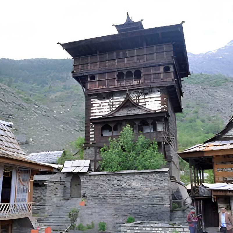
Kamru Fort
2 km uphill from Sangla town
A five storey Kathkuni wooden tower and living temple complex on a rocky spur above Sangla. The best single stop in the valley for architecture, history, and the valley view.
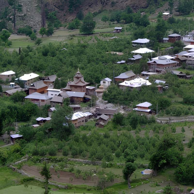
Batseri village
3 km from Sangla
A quiet, traditional Kinnauri settlement with stone lanes, old wooden houses, a Badri Narayan temple, and a wooden footbridge over the Baspa. Less visited and flatter than Kamru.
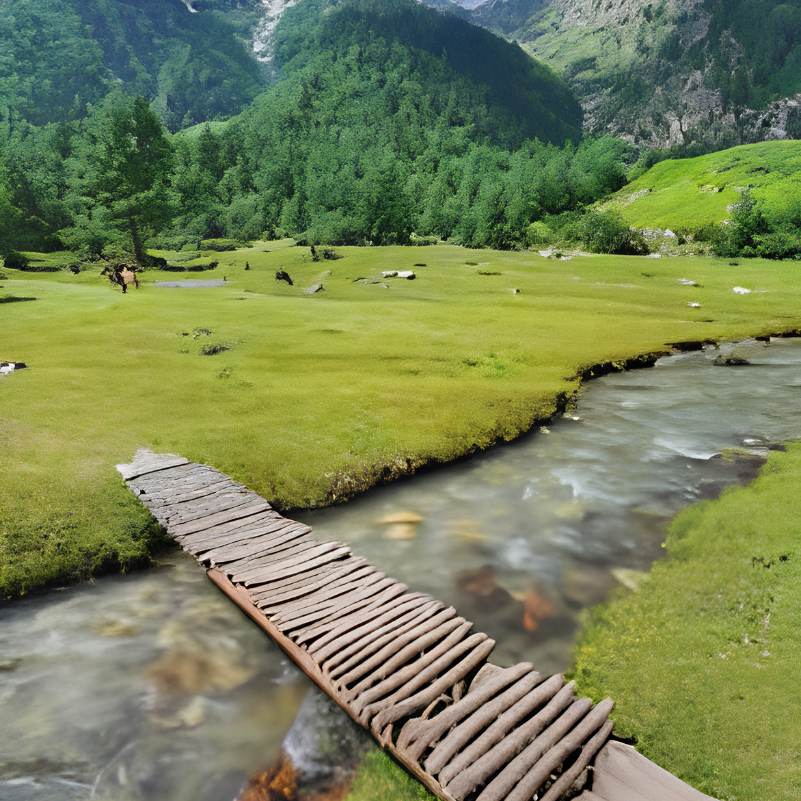
Rakcham
15 km from Sangla
A small, quiet hamlet on the road to Chitkul, with a few homestays and a riverside setting. Good for a lunch stop or for travellers who want isolation.
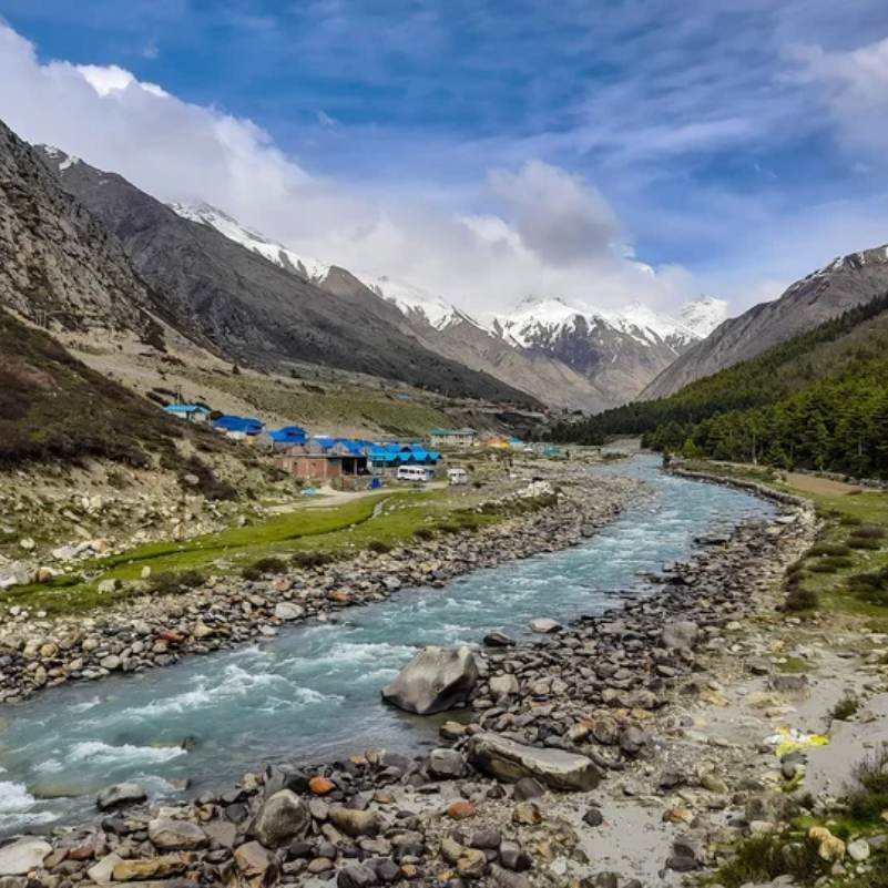
Chitkul
25 km from Sangla
The last village on the old Indo Tibet road, at around 3,450 metres. A half day trip from Sangla that most itineraries include. Worth it for the drive and the frontier feel.
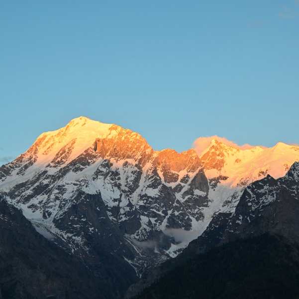
Kalpa and Kinner Kailash viewpoint
About 55 km from Sangla via Karcham
The other main stop in lower Kinnaur, higher and drier, and known for its direct views of the Kinner Kailash range. Most travellers combine Sangla and Kalpa in a single trip.
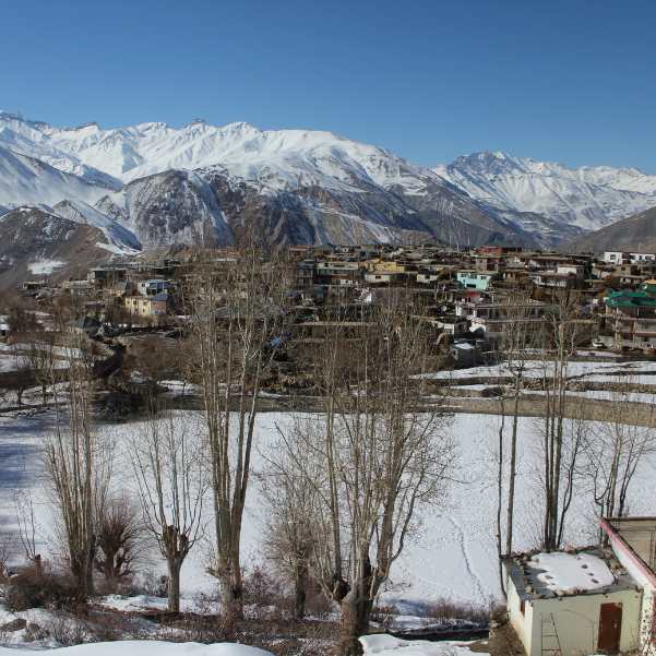
Nako Lake and Village
150 km from Sangla
A Buddhist village around a sacred high altitude lake in upper Kinnaur. Worth a night if you are continuing the Kinnaur to Spiti circuit.
Our packages with Sangla Valley
Curated trips that include a visit to Sangla Valley.
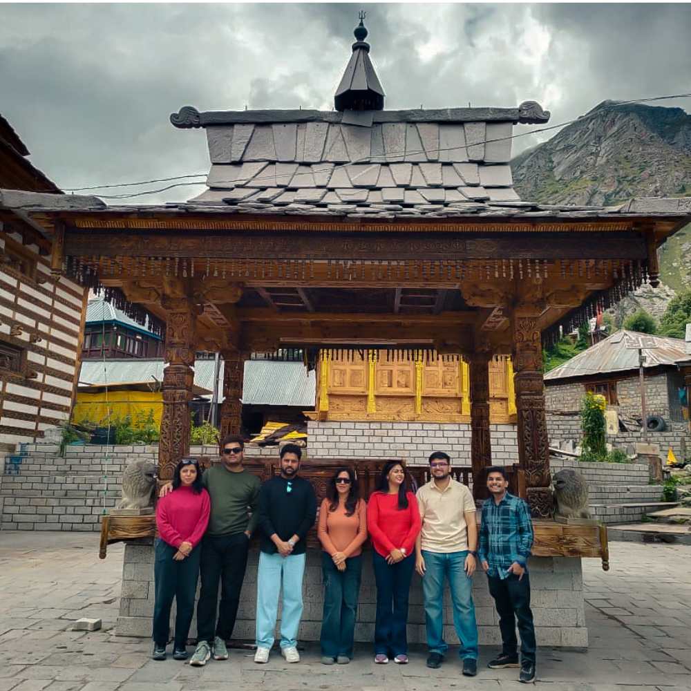 Group Tour5D/4N
Kinnaur Valley Weekend Group Trip With Sangla Chitkul and Kalpa
1D Sangla•1D Kalpa
₹7,999₹9,999SAVE INR 2,000/ person 4D/3N
4D/3NKinnaur Valley Scenic Circuit With Sangla Chitkul and Kalpa
1D Shimla•1D Sangla+1
₹16,999₹17,999SAVE INR 1,000/ person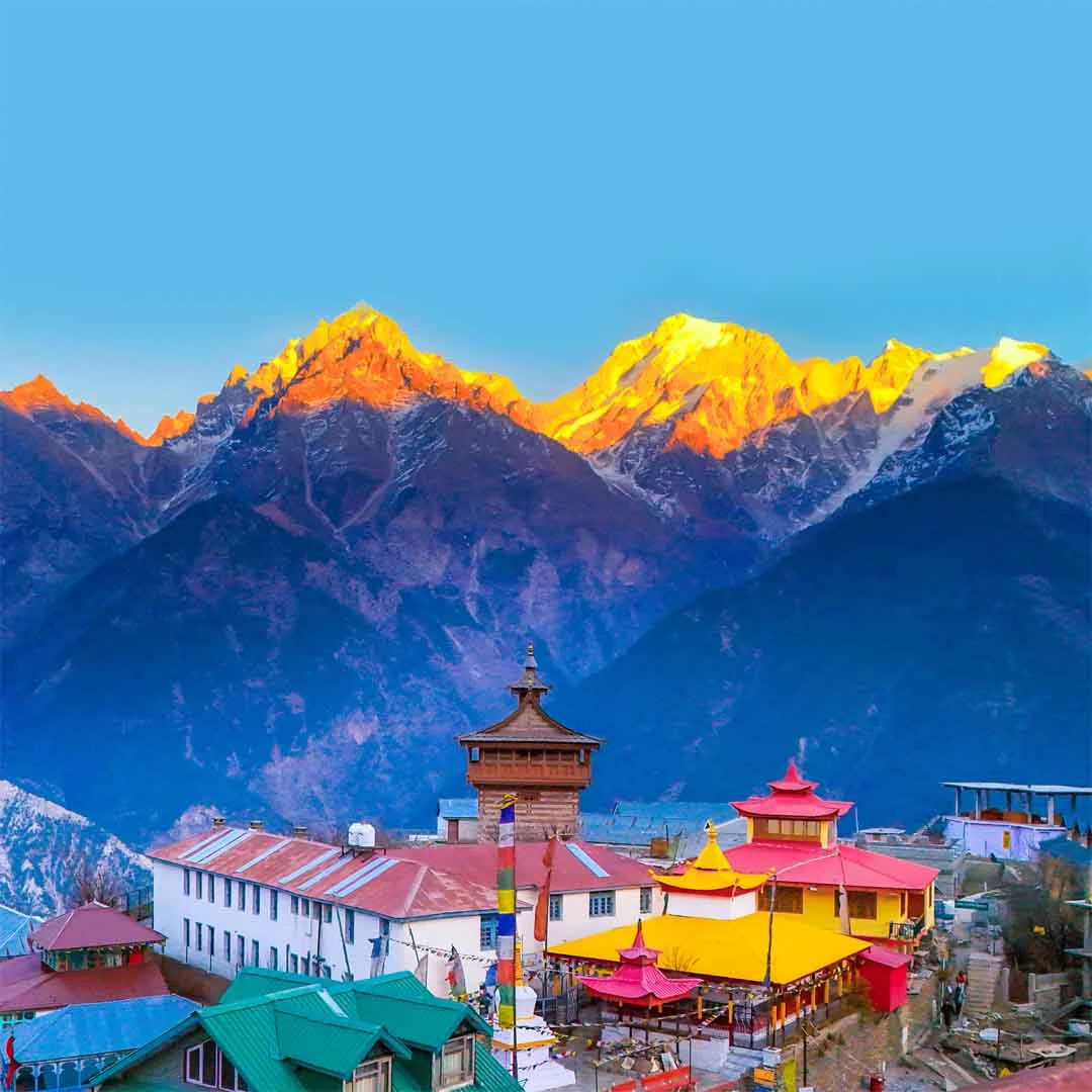 5D/4N
5D/4NClassic Kinnaur Valley Circuit With Sarahan Sangla Chitkul and Kalpa
1D Shimla•1D Sarahan+2
₹19,999₹21,999SAVE INR 2,000/ person
Common questions about Sangla Valley
Where exactly is Sangla Valley?
Sangla Valley, also called the Baspa Valley, is in Kinnaur district, Himachal Pradesh. It branches off the main Kinnaur highway (NH 5) at Karcham and runs about 25 km northeast along the Baspa River. Sangla town sits at roughly 2,600 metres above sea level.
What is the best time to visit Sangla Valley?
April to June for warm weather and open roads. October for apple harvest (Kinnaur Golden and Royal Delicious in the orchards), golden light, and thin crowds. July to September is possible but the Kinnaur highway is landslide prone, especially in late July and August. December to March is difficult and often restricted by snow, with the road from Karcham into the valley frequently blocked.
How many days should I spend in Sangla Valley?
Two to three nights is the sweet spot. That gives you Kamru Fort in the morning, a day trip to Chitkul, a walk through Batseri, and an evening by the Baspa. One night is too rushed. More than three and you have covered everything.
How do I reach Sangla from Delhi or Chandigarh?
Drive or take a bus to Shimla or Rampur, then continue to Karcham via NH 5. The drive from Shimla takes roughly 8 to 10 hours and is best split over two days with a night at Narkanda, Sarahan, or Rampur. The stretch through the Sutlej gorge and Tranda Dhank after Rampur is narrow cliff road, so drive in daylight only. From Delhi, the total is roughly 560 to 590 km over two to three days.
Is Sangla Valley safe for solo women travellers?
Yes. The community is conservative, respectful, and family oriented. Hotels and homestays are generally well run. Standard precautions apply, especially after dark. Most solo travellers, including women, report feeling comfortable and welcome.
Do I need a permit for Sangla Valley?
Indian travellers do not need a permit for Sangla, Batseri, Rakcham, or Chitkul. Foreign nationals may need an Inner Line Permit for parts of Kinnaur. Rules can change, so confirm with your operator or local SDM office before travelling.
Does mobile network work in Sangla?
Airtel and BSNL work in Sangla town. Jio is patchy. Coverage drops sharply toward Chitkul, where only BSNL works intermittently. Download offline maps before you leave and do not rely on UPI for payments in the valley.
Is there an ATM in Sangla?
Sangla has limited ATM availability and the machines are not always stocked. Carry enough cash from Reckong Peo or Rampur. Most homestays, camps, and village shops prefer or require cash.
Can I visit Sangla Valley with kids?
Yes. The altitude is moderate, the drives are shorter than deeper Kinnaur, and there are flat walks along the river through apple orchards. The Kamru Fort climb is steep for toddlers. Chitkul gets genuinely cold even in June, so pack warm layers for the day trip. The Tranda Dhank road stretch can be unsettling for kids and adults alike, so be prepared for that section.
What food is available in Sangla Valley?
Hotels and homestays serve North Indian meals plus Kinnauri and Tibetan dishes: thukpa, momos, siddu (steamed wheat bread with walnut filling), rajma chawal. Fresh Kinnaur Golden apple juice in season. Ask for aktori (buckwheat pancake) or fresh Baspa river trout where available. Vegetarian is easy. Vegan is limited.
Can I camp in Sangla Valley?
Yes. Several riverside camps near Sangla and Batseri offer tents under apple trees right beside the Baspa. Banjara Camps near Batseri is well established. Newer operators are worth checking reviews for. Wild camping is possible in some spots but check local rules.
Is Sangla better than Kalpa?
Different experiences. Sangla is a green river valley with apple orchards, trout streams, and old Kinnauri villages. Kalpa is higher, drier, and known for direct views of the Kinner Kailash range. Most Kinnaur itineraries include both. If you can only pick one: Sangla suits families and relaxed travellers, Kalpa suits those who want mountain views and a base for deeper Kinnaur.
Related guides
Posts about Kinnaur
- Yulla Kanda Trek Guide 2026: Route, Best Time, Cost and Planning
- Kinnaur Snowfall Guide 2026: When & Where to Look for Snow
- Christmas & New Year in Kinnaur: A 2026-27 Winter Trip Guide
- Kinnaur in November 2026: Weather, Snow Chances & 7-Day Trip Plan
- Yulla Kanda Trek Distance and Route 2026: Yulla Khas to the Lake
- Yulla Kanda Krishna Temple in 2026: Location, Beliefs & Visiting Etiquette