
Kamru Fort
A multi-storey wooden tower and living temple above Sangla in the Baspa Valley, where weathered cedar carvings, Bushahr dynasty history, and active worship share a single hilltop
- Fort & Temple
- ~2,600 m
- 2 km from Sangla
- Apr to Oct
- Baspa Valley, Kinnaur
What makes it special
The lane out of Sangla market starts easy. Flat packed earth, apple orchards on either side, the smell of damp wood and cow dung that every Kinnaur village carries. Then it starts to climb. The houses crowd in, stacked stone and deodar timber with carved balconies and dark slate roofs worn to near black by decades of sun and rain. You hear somebody chopping wood two lanes over. A radio is playing through an open window. The air has a thin, clean bite to it that you do not get at lower elevations. This is Kamru village, and it does not care whether you are visiting or not.
Then the stone paved steps begin. Roughly 300 of them, uneven, worn glossy by centuries of use. The climb takes most people 20 to 30 minutes, and your calves and lungs will feel every step at this altitude. Halfway up, stop and turn around. The Baspa River is a grey green thread far below, Sangla town a cluster of rooftops, and the ridgelines on both sides stack up until they disappear into haze. You see why the Bushahr kings chose this exact rocky spur for their seat of power.
The fort complex itself is compact. You pass through a series of wooden gates, each one carved with deity figures and old ironwork. A small Buddhist shrine sits near the entrance. Inside the courtyard is the Badri Vishal temple, generally dated to around the 15th century. And then the tower. Multiple storeys of alternating weathered deodar cedar and stone, built in the traditional Kathkuni style, with a worn wooden balcony and prayer flags snapping in the valley wind. The idol of Kamakhya Devi, traditionally believed to have been brought here from Guwahati in Assam by the Bushahr kings, rests on one of the upper floors. A fair honouring the deity is held roughly once every three years.
Before you enter the temple area, you will be given a traditional Kinnauri cap and a Gachhi, the woven waist belt worn during worship in this region. Wearing both is mandatory, not optional, and they are provided right there at the entrance. Put them on properly. This is not dress up for a photo. It is how locals enter this space when they come to pray, and it is how the community expects you to enter too. Honestly, it is one of the things about Kamru that catches people off guard in the best way.
Now, the part you need to know clearly: the temple complex and courtyard are open, but the interior of the multi-storey wooden tower is generally locked to the public. Only the priest and members of the Bushahr royal family are allowed inside. This is a long standing tradition, not something you can talk your way around. Photography inside the temple and tower areas is also strictly prohibited. But what you get from outside, the carved deodar doors with their interlocking geometric patterns, the balcony up close, the view down the Baspa Valley with the river catching light below, that is the visit. And it is worth the climb.
Quick answers
- Is Kamru Fort worth visiting?
- Yes, and more than you might expect from a 90 minute stop. The walk up through Kamru village, past apple orchards and old wooden houses with dark slate roofs, is half the experience. At the top you get intricate Kathkuni wood carvings in weathered deodar cedar, a courtyard with real religious weight to it, and the Baspa River spread out far below. It is not a big ticketed heritage site. It is a living temple on a hilltop. That is exactly what makes it good.
- Can you go inside the tower?
- No. The temple complex and courtyard are open, but the multi-storey wooden tower is generally locked to the public. Only the priest and members of the Bushahr royal family go inside. Photography in the temple and tower areas is also strictly banned. Think of it less as a fort you tour and more as a sacred site you are invited to stand respectfully within.
- How difficult is the climb?
- Short but honest. You can drive from Sangla to the base of Kamru village, but the last stretch is roughly 300 stone paved steps, steep and uneven. Most people manage the uphill walk in 20 to 30 minutes with a few breaks along the way. Wear shoes with grip, not sandals. You are at roughly 2,600 metres, so the thin air makes everything feel harder than it looks.
Quick facts
Everything you need to know at a glance.
At a glance
- Altitude
- Approx 2,600 m (some sources say up to 2,900 m for the village)
- Location
- Kamru village, 2 km above Sangla town, Baspa Valley, Kinnaur
- Nearest town
- Sangla, 2 km
- Open season
- Generally April to October, access harder in winter
- Time needed
- 1 to 1.5 hours including the walk
- Entry fee
- Currently free; a small local maintenance donation may be requested
- Effort level
- 20 to 30 min uphill walk, about 300 uneven stone steps
On the ground
- Mobile network
- BSNL and Jio work in Sangla town. Signal weakens as you climb to Kamru. Do not rely on maps or UPI at the fort.
- ATM
- Sangla has limited ATM availability. Carry cash from Reckong Peo or Rampur to be safe.
- Food
- Nothing at the fort itself. Eat in Sangla before or after. Small dhabas and hotel restaurants in Sangla town.
- Stay
- Stay in Sangla. Several hotels and homestays ranging from budget to mid range.
- Permits
- No permit needed for Indian travellers. Foreign nationals may need an Inner Line Permit for parts of Kinnaur. Confirm current rules locally.
- Drone
- Do not fly drones. This is a sensitive border area and the fort is an active place of worship.
- Walking
- The climb is steep and uneven in places. Wear proper shoes. Not suitable for wheelchairs or mobility aids.
Seasonal weather
- Apr to Jun22°8°Summer (Apr to Jun)
- Jul to Sep20°10°Monsoon (Jul to Sep)
- Oct to Nov18°2°Autumn (Oct to Nov)
- Dec to Mar10°-5°Winter (Dec to Mar)
Suitable for
- Couples — suitable
- Families — with some care
- Seniors — with some care
- Solo — suitable
- First-timers — suitable
- Pet-friendly — not suitable
How to reach Kamru Fort
3 approach routes, with seasonal access.
From Sangla town
Year round, though winter can make the steps icy- Distance
- 2 km
- Time
- 20 to 30 min walk or a short drive plus 20 to 30 min climb
- Road
- Village lane, then stone steps
From Sangla market, follow the lane uphill toward Kamru village. You can drive most of the way to the base of the village, or walk the whole thing through apple orchards and wooden houses with dark slate roofs. The last stretch to the fort is about 300 steep stone steps. Not driveable. The uphill walk from the village takes most people 20 to 30 minutes. Most people combine it with a morning or afternoon outing.
From Shimla
Generally April to October- Distance
- Approx 230 to 240 km
- Time
- 8 to 10 hours by road
- Road
- NH 5 mountain highway, narrow in stretches
- Last fuel
- Rampur, Reckong Peo
The standard route is Shimla to Rampur to Karcham, then the turn off into the Baspa Valley toward Sangla. Most people break this into two days, with a night at Sarahan or Narkanda. Doing it in one shot is exhausting and not advisable.
From Reckong Peo (Kinnaur district HQ)
Generally April to October- Distance
- Approx 35 to 40 km
- Time
- About 1.5 to 2 hours
- Road
- Mountain road via Karcham
- Last fuel
- Reckong Peo
From Reckong Peo, drive down to Karcham on NH 5, then take the left fork into the Baspa Valley. The Sangla road is mostly surfaced but narrow. Fill fuel and withdraw cash in Reckong Peo before entering the valley.
Best time to visit
Season by season, so you can plan around the weather rather than hope.
- Recommended
Summer
April to June
The best window. Roads are open, the air is warm, and the fort steps are dry.
- Temperature
- Roughly 15 to 22°C day, 8 to 12°C night
- Crowds
- Moderate, higher on weekends and holidays
- Steps
- Dry and comfortable
- Photography
- Good light, best early morning or late afternoon
Days are pleasant and warm enough for a single layer. The walk through Kamru village is at its best when the apple orchards are green and the light is clear. This is also when most Kinnaur trips happen, so Sangla can feel busy on long weekends. Visit the fort early in the morning if you want it relatively quiet.
Monsoon
July to September
The valley turns green but the steps get slippery and the roads can be unreliable.
- Temperature
- Roughly 14 to 20°C day, 10 to 14°C night
- Crowds
- Lower than summer
- Steps
- Wet and slippery after rain, go carefully
- Roads
- Landslide risk on the Kinnaur highway
Sangla gets more rain than upper Kinnaur, and the stone steps to Kamru Fort can be genuinely slippery after a shower. The fort is still open and visitable, but the Kinnaur highway is landslide prone in this season, so your bigger concern is reaching Sangla at all. If you are already in the valley, pick a dry morning for the climb.
- Recommended
Autumn
October to early November
Crisp air, clean views, thinner crowds. Quietly the best season if you can handle cool evenings.
- Temperature
- Roughly 10 to 18°C day, 2 to 6°C night
- Crowds
- Low
- Steps
- Generally dry
- Photography
- The best window of the year
The valley light sharpens, the orchards are in harvest mode, and the fort complex feels unhurried. Evenings get cold quickly, so carry a proper jacket. This is a great time for photography, with clear ridgelines and warm afternoon light on the wooden tower.
Winter
Late November to March
Cold, quiet, and the steps can be icy. Only for travellers already comfortable with winter mountain travel.
- Temperature
- Roughly 0 to 10°C day, minus 5 to 0°C night
- Crowds
- Very few visitors
- Steps
- Can be icy and dangerous
- Access
- Road closures possible after snowfall
Snow can fall in Sangla and the path to Kamru Fort can freeze over. The temple is still active and you can visit if conditions allow, but this is not the season for casual sightseeing. Roads to Sangla may also be disrupted after heavy snowfall.
Things to see & do
4 things worth your time at Kamru Fort.
Walk through Kamru village to the fort
20 to 30 min one waySeriously, do not skip this for a taxi ride. The lane from Sangla winds through apple orchards where you can smell the fruit in season, then past old Kinnauri houses with dark slate roofs and carved balconies blackened by decades of woodsmoke. You pass small shrines with faded marigolds, stacked firewood drying against stone walls, and maybe a couple of goats blocking the path. The stone paved steps begin about halfway. They are uneven and worn smooth, and by the time you reach the first carved gate, you can hear the Baspa River below and your own breathing above. Walk the whole way if your knees allow it. Driving past all this means missing the best part.
Wear the Kinnauri cap and Gachhi, then explore the courtyard
20 to 30 minAt the entrance to the temple area, someone will hand you a traditional Kinnauri cap and a Gachhi, the woven waist belt. Wearing both is mandatory. They are not souvenirs. They are how the community enters this sacred space, and they are how they expect you to enter it too. Take a moment to put them on properly. Once inside, you will see the Badri Vishal temple (generally dated to around the 15th century), a small Buddhist shrine, and carved wooden gates with fine metalwork and deity figures. Run your eyes along the wood carvings slowly. The detail on the weathered deodar panels, flowers and animals and interlocking geometric patterns, is the kind of craftsmanship that barely exists anymore outside a few Kathkuni structures in Kinnaur.
Stand at the base of the tower and look up
15 to 20 minThe multi-storey wooden tower is the centrepiece, and your first reaction will probably be to just stand there looking up. Weathered deodar beams, rough stone courses, the old balcony, prayer flags pulling in the valley wind. You cannot go inside. The tower is generally locked to all visitors, and photography in the temple and tower areas is strictly banned. But if the priest or a caretaker is nearby and willing to talk, ask about the fort. They sometimes share stories about the Bushahr kings and the Kamakhya Devi idol, traditionally believed to have been brought all the way from Guwahati in Assam. Those conversations, when they happen, are worth more than any photo.
Sit with the valley and the Baspa below
10 to 15 minFrom the courtyard, you look straight down the Baspa Valley. The river is a grey green line far below, Sangla town looks like a handful of scattered rooftops, and the terraced fields and ridgelines stack up on both sides. On a clear morning the depth of view is startling. Do not just glance and leave. Sit on one of the stone ledges for five minutes. Let the wind do its thing. This is the view the Bushahr rulers looked at every day, and it is the reason the fort is where it is.
Know before you visit Kamru Fort
The practical bits, from people who have been.
The history you should actually knowBushahr dynasty capital, Kathkuni architecture, and a living link to Guwahati's Kamakhya
Kamru was the original capital of the Bushahr kingdom, one of the oldest princely states in the western Himalaya. The dynasty ruled this stretch of mountains for centuries before the British arrived. Eventually the capital moved to Sarahan and then to Rampur, but the fort and its temples never shut down. People have been worshipping here continuously for over a thousand years.
The tower is built in the Kathkuni style, alternating layers of deodar cedar and stone in an interlocking pattern. This is what makes these old buildings earthquake resistant. You can see the technique up close in the tower's exposed beams and stone courses, the deodar darkened and cracked with age but still holding firm. The main temple structures are generally dated to around the 15th century.
What makes the complex interesting is how Hindu and Buddhist traditions sit side by side. The Badri Vishal temple, the Buddhist shrine near the entrance, and the tower with the Kamakhya Devi idol all share the same courtyard. Across Kinnaur, this kind of layering is common. The two faiths blended here in ways that most of India never saw.
The connection to Guwahati's Kamakhya temple is part of the fort's identity. The idol of Kamakhya Devi on an upper floor of the tower is traditionally believed to have been brought from Guwahati in Assam by the Bushahr kings. How and when exactly that happened is a matter of oral tradition, but the belief is deeply held locally and has shaped the fort's rituals for generations.
Temple rules and the Kinnauri cap traditionCap and Gachhi are mandatory and provided at the entrance. Tower is locked. No photos inside.
This is a working temple. Follow whatever instructions the priest or caretaker gives you at the moment. Remove your shoes before entering any temple area. Cover your shoulders and legs.
At the entrance to the sacred area, you will be handed a traditional Kinnauri cap and a Gachhi, the woven waist belt worn during worship in this part of Kinnaur. Wearing both is mandatory, not a request. They are provided right there. Put them on properly and wear them the whole time you are inside the temple complex. This is how the community enters the space. It is how they are asking you to enter it. Do not treat it as a photo prop.
The temple complex and courtyard are open, but the interior of the multi-storey wooden tower is generally locked to all visitors. Only the priest and members of the Bushahr royal family may go inside. This rule has been in place for a very long time. Do not ask to be let in. Photography inside the temple and tower areas is strictly prohibited, no exceptions, no sneaking a shot. Outside in the courtyard and on the steps, you are free to photograph.
Some travellers have reported that women who are menstruating are asked not to enter the temple area. This is a local religious custom. Whether it is enforced on a given day can vary. Be aware of it and respect local norms.
Who will love it and who should know what to expectGreat for architecture and history. Less so if you want a fort you can walk through.
Will get a lot out of it. People interested in Himalayan architecture, the kind where you can actually see weathered deodar joinery and carved stonework up close. Travellers who like walking through real villages that are not curated for tourism. History nerds who care about princely states and the Bushahr dynasty. Photographers who work with morning light and old wood textures (outside the temple areas only).
Might feel let down. If your idea of a fort visit involves walking through rooms, sitting on old thrones, and reading plaques, Kamru is not that. The tower is locked. You see the courtyard and exterior. Manage that expectation before the climb and you will enjoy what is actually there.
Families with young kids. The 300 stone steps are steep and uneven. Carrying a toddler at 2,600 metres is tough going. Older kids who can walk on their own usually enjoy the village walk and the animals they meet on the way.
Senior travellers. Doable if you are fit, have no serious knee or heart concerns, and go at your own pace with a walking stick. The altitude makes it harder than the distance suggests.
Pets. Not allowed in the temple area. The stone steps are also unsafe for dogs.
What to photograph and where to put your camera awayCarved wood and valley light outside. Strict ban inside the temple.
Outside the temple, you have plenty to work with. The carved deodar doors with their interlocking geometric patterns. The multi-storey tower framed against cloud or blue sky, its deodar beams darkened by centuries of weather. The prayer flags pulling taut in the wind. The valley view with the Baspa River catching light far below. Morning is the only time that matters here. The sun hits the wooden facade directly and the carvings throw sharp shadows. Afternoon light goes flat at the fort, though it works nicely for the village walk on the way down.
Inside the temple and tower areas, photography is strictly banned. Not a grey area, not a negotiation. Keep your phone and camera away once you step past the entrance.
No drones anywhere. This is a sensitive border area and an active religious site. For village portraits on the walk up, ask first. People are generally happy to be photographed, but the asking is what matters.
What I would tell a friend before they goMorning light, proper shoes, carry water, and leave the driver in Sangla
Go in the morning. Not because the fort closes, but because the light on the weathered deodar carvings is direct, the steps are cooler under your feet, and the courtyard is quieter. Climbing those stone steps in the afternoon heat is not fun at 2,600 metres.
Wear shoes with actual grip. The stone paved steps are polished smooth by use and can be slippery even when dry. After rain, they are genuinely dangerous in sandals.
Carry water and maybe a couple of biscuits. There is nothing to buy at the fort. Sangla town is your last stop for supplies.
Entry is currently free. A small local maintenance donation may be requested at the temple. Keep some cash on you because UPI barely works up here.
If you have a driver, leave them in Sangla or at the base of Kamru village. No vehicle gets to the fort. Give yourself about 90 minutes total, including the walk both ways and time at the top. The uphill walk alone takes 20 to 30 minutes for most people.
One last thing: road access, permit rules, and local customs can change with the season. Check locally before you go, especially if you are visiting outside the main April to October window.
Nearby attractions
Other places worth the detour.
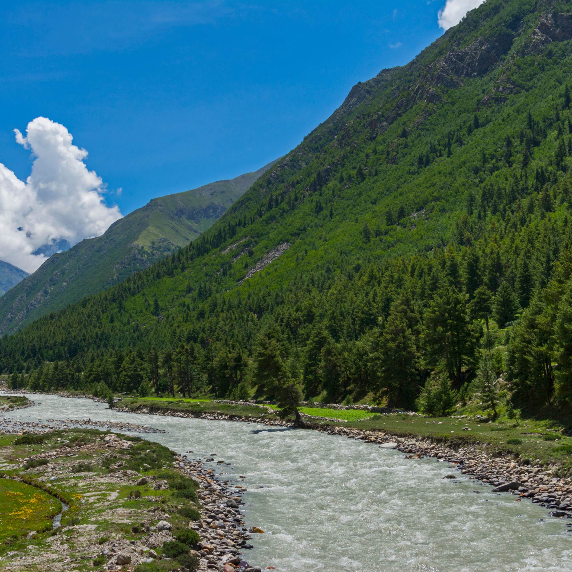
Sangla town and Baspa riverside
2 km downhill
Your base for visiting Kamru Fort. Walk along the Baspa river in the evening, explore the town market, and eat at one of the small restaurants. Sangla is where you sleep, eat, and recharge.
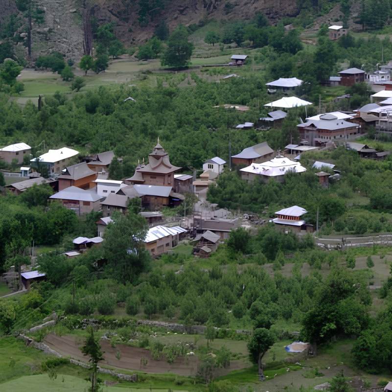
Batseri village
Approx 3 km from Sangla
A quiet traditional village with old wooden houses and a Shakti temple. Less visited than Kamru, and a nice short walk from Sangla if you want another village experience without the steep climb.
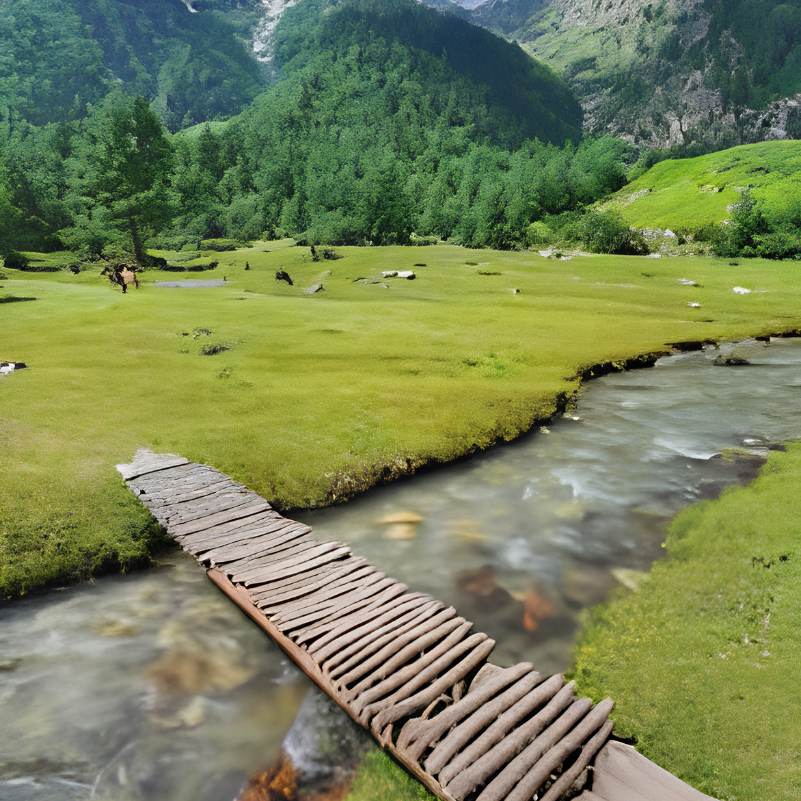
Rakcham
Approx 15 km from Sangla
A small hamlet on the road between Sangla and Chitkul, with a few homestays and a quiet riverside setting. A good lunch stop if you are driving to Chitkul.
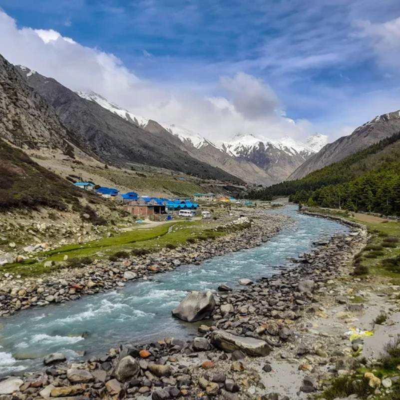
Chitkul
Approx 25 km from Sangla
Often called the last inhabited village on the old Indo Tibet road. Most Sangla itineraries include a day trip to Chitkul. The drive up the Baspa Valley is worth it on its own.
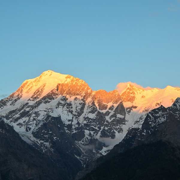
Kalpa and Kinner Kailash viewpoint
Approx 40 km from Sangla via Karcham
The other major stop in Kinnaur, known for its views of the Kinner Kailash range. Most travellers combine Sangla and Kalpa in a Kinnaur trip, spending a couple of nights at each.
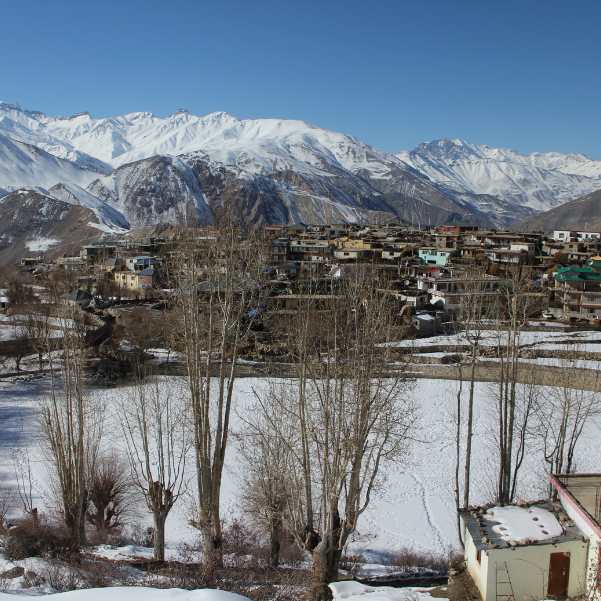
Nako Lake and Village
Approx 150 km from Sangla
A Buddhist village around a sacred high altitude lake in upper Kinnaur, on the road toward Spiti. Worth a night if you are continuing the Kinnaur to Spiti circuit.
Our packages with Kamru Fort
Curated trips that include a visit to Kamru Fort.
 Group Tour5D/4N
Kinnaur Valley Weekend Group Trip With Sangla Chitkul and Kalpa
1D Sangla•1D Kalpa
₹7,999₹9,999SAVE INR 2,000/ person 4D/3N
4D/3NKinnaur Valley Scenic Circuit With Sangla Chitkul and Kalpa
1D Shimla•1D Sangla+1
₹16,999₹17,999SAVE INR 1,000/ person
Common questions about Kamru Fort
Where exactly is Kamru Fort?
Kamru Fort is in Kamru village, about 2 km uphill from Sangla town in the Baspa Valley, Kinnaur district, Himachal Pradesh. It sits on a rocky spur at roughly 2,600 metres above sea level, overlooking the Baspa River.
Is there an entry fee for Kamru Fort?
Entry is currently free. You may be asked for a small local maintenance donation at the temple, so keep some cash handy. These things can change, so check locally before you go.
What are the timings for Kamru Fort?
There are no strict tourist timings. The temple complex follows daylight hours and the priest's schedule. Late morning to early afternoon is the most reliable window. Do not go after dark. The stone steps are uneven and completely unlit.
Can you drive to Kamru Fort?
You can drive from Sangla to the base of Kamru village, but the last stretch is on foot only. That means roughly 300 stone paved steps, steep and polished smooth by centuries of use.
How long does a visit to Kamru Fort take?
About 1 to 1.5 hours for most people, including the 20 to 30 minute uphill walk, time at the fort, and the return. If you walk the full 2 km from Sangla through the village, add another 30 to 40 minutes. That walk is worth doing.
What parts of the fort can I actually see?
The temple complex and courtyard are open. The interior of the multi-storey wooden tower is generally locked to the public. Only the priest and members of the Bushahr royal family are allowed inside. This is a long standing tradition.
Is Kamru Fort suitable for elderly visitors?
It depends entirely on fitness. The stone steps are steep and uneven. Fit seniors with good knees and no altitude related health concerns can manage at a slow pace with a walking stick. Anyone with heart or breathing issues should talk to their doctor first.
Is Kamru Fort suitable for kids?
Older kids who can walk and climb on their own usually enjoy it, especially the village walk with its animals and orchards. Carrying a toddler up 300 steps at altitude is hard work. Use your judgement.
What is Kathkuni architecture?
Kathkuni is a traditional Himalayan building technique that alternates layers of wood (usually deodar cedar) and stone. The interlocking structure makes buildings flexible and resistant to earthquakes. You can see the technique clearly in Kamru Fort's tower, where the weathered deodar beams and stone courses are exposed. It is one of the best surviving examples in Himachal Pradesh.
Can women visit Kamru Fort during menstruation?
Some travellers report that women who are menstruating are asked not to enter the temple area. This is a local religious custom. Whether it is enforced on a given day can vary. Be aware of it and respect local norms.
Is Kamru Fort safe for solo travellers?
Yes. Kamru village is small, the community is respectful, and the walk from Sangla is straightforward. Standard precautions apply, especially if you are walking back in low light.
What is the best time to visit Kamru Fort?
April to June and October to early November. The stone steps are dry, the road to Sangla is generally open, and the light is good for seeing the wood carvings. Monsoon months are possible but the steps get slippery. Winter visits depend on snow and road conditions.
What should I wear to Kamru Fort?
Cover your shoulders and legs. Wear sturdy shoes with grip for the stone steps. At the temple entrance, you will be given a traditional Kinnauri cap and a Gachhi, the woven waist belt worn during worship in this region. Both are mandatory, not optional. They are provided on the spot. Wear them properly for the duration of your visit. This is a genuine local tradition, and the community takes it seriously.
Can I take photos inside the fort?
Photography inside the temple and tower areas is strictly banned. No phone, no camera, no exceptions. You can photograph freely in the courtyard, on the stone steps, and from outside the fort. No drones either. This is a sensitive border zone.
Related guides
Posts about Kinnaur
- Yulla Kanda Trek Guide 2026: Route, Best Time, Cost and Planning
- Kinnaur Snowfall Guide 2026: When & Where to Look for Snow
- Christmas & New Year in Kinnaur: A 2026-27 Winter Trip Guide
- Kinnaur in November 2026: Weather, Snow Chances & 7-Day Trip Plan
- Yulla Kanda Trek Distance and Route 2026: Yulla Khas to the Lake
- Yulla Kanda Krishna Temple in 2026: Location, Beliefs & Visiting Etiquette