
Larji Dam
A concrete gravity dam wedged into a limestone gorge where the Beas, Sainj, and Tirthan rivers converge near the Mandi and Kullu district border, marking the exact point where the highway splits toward two of Himachal's most rewarding valleys
- River confluence
- 126 MW hydroelectric
- Beas River gorge
- Gateway junction
- Sainj and Tirthan fork
- Petrol pump
- Aut tunnel
- Transit point
What makes it special
Larji Dam sits in a narrow limestone gorge where three rivers come together: the Beas flowing down from Kullu, the Sainj arriving from the east, and the Tirthan from the southeast. The location is near the border of Mandi and Kullu districts, close to the town of Aut on the Delhi to Manali highway. If you have driven through the 3 km Aut tunnel and wondered why it exists, the dam is the answer. The reservoir behind it drowned the original valley road decades ago, and the tunnel was carved through rock to keep traffic moving to the upper Kullu valley and Manali.
The dam is a 126 MW run-of-the-river project managed by HPSEBL (Himachal Pradesh State Electricity Board Limited). It uses three Francis turbines of 42 MW each, housed in an underground powerhouse blasted into the gorge wall. The powerhouse is closed to the general public for security reasons. From the road, what you see is the concrete gravity diversion structure, the gorge walls rising steeply on either side, and the reservoir lake stretching behind it. It is a genuinely dramatic piece of geography and engineering, even if you have no interest in hydropower.
For most travellers, the real significance of Larji is the junction it creates. Just past the dam, the road forks. Left follows the Sainj Valley upstream toward Sainj town, Shangarh, and the GHNP treks. Right heads toward Banjar, Jibhi, Gushaini, and the Tirthan Valley. Every vehicle heading into either valley passes through this point. There is a petrol pump at Larji, and it is the last reliable fuel stop before the deeper reaches of both valleys. Fill up here. There is also a GHNP Information Centre with brochures and basic park orientation.
A critical safety note. The gorge below the dam and the turquoise water pooling among the exposed rocks look inviting, and people are drawn to climb down for photographs. Do not do this. The Larji project operates controlled spillway releases that can cause water levels to surge rapidly and without warning. In 2014, a sudden release killed 14 students who had walked down to the riverbed downstream. This is not a scenic river bank. It is an active hydroelectric discharge zone. Photograph the gorge from the road or designated viewpoints only. Do not step onto the rocks near the water, do not picnic on the riverbed, and do not let children near the edge. The water can rise from ankle depth to chest depth in minutes.
The reservoir lake behind the dam is calmer and more accessible visually from the road. In winter (roughly November through February), migratory birds settle on this lake, though it is not a formal birdwatching site. The state government has proposed development plans under the 'Nai Raahein Nai Manzilein' initiative, including potential houseboat and shikara operations on the reservoir. As of now, these remain proposed government development plans and are not currently active commercial operations. Check locally for any updates if this interests you.
In July 2023, catastrophic floods on the Beas deposited massive volumes of silt and debris into the turbine chambers, knocking all three generating units offline. Restoration cost over 245 crore rupees and took nearly two years. All three units were reportedly back in operation by January 2025, with additional slope stabilization and rockfall barriers installed around the project site.
Quick answers
- What is Larji Dam?
- A 126 MW hydroelectric dam on the Beas River, positioned in a limestone gorge near the Mandi and Kullu district border close to Aut on the Manali highway. For travellers, it is the junction where the road forks: left into the Sainj Valley (Shangarh, GHNP treks), right toward the Tirthan Valley (Banjar, Jibhi, Gushaini). It has the last reliable petrol pump before either valley and a GHNP Information Centre.
- How much time do I need?
- 5 to 15 minutes. Fuel up, glance at the gorge from the road, and continue into your valley. Do not climb down to the riverbed. In winter, scan the reservoir lake for migratory birds from the roadside.
- Left or right at Larji?
- Left at Larji follows the Sainj River upstream toward Sainj town, Ropa, and Shangarh. Right heads to Banjar, Jibhi, and the Tirthan Valley. If you are on a bus from Aut, confirm which direction it goes before boarding. Sainj buses and Banjar buses leave from the same stand.
Quick facts
Everything you need to know at a glance.
At a glance
- Location
- On the Beas River near Aut, close to the Mandi and Kullu district border. About 40 km from Mandi, 60 km from Kullu on NH 3.
- What it is
- 126 MW run-of-the-river hydroelectric project (HPSEBL). Commissioned 2006. Three 42 MW Francis turbines in an underground powerhouse (closed to public).
- Why it matters for travellers
- Gateway junction. Left fork for Sainj Valley. Right fork for Tirthan Valley and Banjar.
- Petrol pump
- Yes. Last reliable fuel stop before the deeper valleys. Fill up here.
- GHNP Info Centre
- At Larji. Brochures and basic park orientation available.
- Reservoir
- Dam created a lake visible from the road. Migratory birds in winter. The Aut tunnel was built to bypass it.
On the ground
- Mobile network
- Good. Jio, Airtel, BSNL all work at Larji.
- Fuel
- Petrol pump available. Fill up before heading into either valley.
- ATM
- None at Larji. Nearest at Sainj town (~18 km) or back at Aut.
- Food
- A couple of dhabas at Larji and Aut. Functional, not worth a detour. Eat at your valley destination.
- Safety
- Do not descend to the riverbed or rocks near the water. Spillway releases cause rapid, unpredictable water level surges.
Suitable for
- Couples — suitable
- Families — suitable
- Seniors — suitable
- Solo — suitable
- First-timers — suitable
- Pet-friendly — suitable
How to reach Larji Dam
2 approach routes, with seasonal access.
From Mandi (via NH 3)
Year round.- Distance
- About 40 km
- Time
- 1 to 1.5 hours
- Road
- National highway. Good condition year round.
The standard approach from Delhi, Chandigarh, or anywhere south. After Mandi, continue on NH 3 toward Kullu. You will enter the 3 km Aut tunnel, which was built specifically to bypass the reservoir behind Larji Dam. Exiting the tunnel, the dam and the junction appear almost immediately. Left fork for the Sainj Valley, right for Tirthan. The gorge is visible from the road as you pass through.
From Kullu (via NH 3 south)
Year round.- Distance
- About 60 km (roughly 15 km past Bhuntar)
- Time
- 1.5 to 2 hours
- Road
- National highway.
From Kullu or Manali, head south on NH 3 past Bhuntar. You approach Larji from the upper valley side, so you do not pass through the Aut tunnel. The dam and gorge appear on your left as the valley narrows near the Mandi district boundary. The junction fork is just past the dam structure.
Best time to visit
Season by season, so you can plan around the weather rather than hope.
- Recommended
Spring and early summer
March to June
Dry roads, clear gorge views, and both valleys at their most accessible.
- Road
- Dry, clear. Highway in good condition.
- Gorge
- Sharp visibility. Good for roadside photos.
- Reservoir
- Calm. Turquoise tones visible.
Clear weather and dry roads make this the simplest season to transit through Larji. The gorge is sharply visible, the reservoir reflects the limestone walls, and the onward valleys are opening up for treks and village visits. Most travellers pass through without stopping long, but the gorge is at its photographic best from the road in this window.
Monsoon
July to September
The Beas runs heavy, the gorge fills with noise, and the road needs patience.
- Road
- Can be disrupted by landslides near the gorge.
- River
- High and fast. Maximum danger downstream of the dam.
- Dam operations
- More frequent spillway releases.
The Beas swells dramatically during monsoon. The gorge becomes a channelled torrent, and the dam discharges more frequently. Landslides near the gorge can cause road delays. Transit through Larji is still possible but slower. The river downstream is at its most dangerous in this season. Stay well clear of the water.
- Recommended
Autumn
October to November
Post monsoon clarity, the gorge at its sharpest, and migratory birds arriving.
- Road
- Good condition.
- Gorge
- Best clarity of the year.
- Reservoir
- Settling. Migratory birds arriving by late November.
The cleanest window. Post monsoon air clears the haze, and the gorge walls and reservoir stand out sharply. By late November, migratory birds begin appearing on the reservoir lake. The onward valleys are dry, the roads are in good shape, and this is the best season for both Sainj and Tirthan treks.
Winter
December to February
Cold gorge, migratory birds on the reservoir, roads open but valleys beyond are chilly.
- Road
- Open. Cold.
- Reservoir
- Migratory birds present.
- Temperature
- Cold in the gorge. Wind funnels through.
Cold but passable. The gorge funnels wind and the temperature drops noticeably at Larji. Migratory birds are present on the reservoir. Roads remain open, but the valleys beyond Larji are properly cold. The petrol pump and info centre stay operational. A brief stop is practical; lingering is not comfortable.
Things to see & do
3 things worth your time at Larji Dam.
Navigate the junction
Transit stop: 5 to 15 minutesLarji is the fork in the road. Left takes you along the Sainj River toward Sainj town, Shangarh, and the GHNP treks on the Sainj side. Right takes you toward Banjar, Jibhi, and the Tirthan Valley. Know your direction before you arrive. If you are on a bus, the bus has already decided for you.
Fill up at the petrol pump
5 to 10 minutesThis is the last reliable petrol pump before both the Sainj and Tirthan valleys. Whether you are driving to Shangarh or Gushaini, top up your tank here. Fuel availability deeper into either valley is not something you want to gamble on.
View the gorge and reservoir from the road
5 to 10 minutesThe gorge at Larji is genuinely dramatic: steep limestone cliffs rising on both sides, the concrete dam wedged between them, and the reservoir stretching behind into the valley. From the road, the water often appears turquoise against the grey rock. Worth pausing for, but photograph from the road or designated viewpoints only. Do not descend to the rocks or riverbed. In winter (November to February), migratory birds settle on the reservoir lake and are visible from the road.
Know before you visit Larji Dam
The practical bits, from people who have been.
Critical: Stay off the riverbedControlled spillway releases cause rapid, dangerous water surges below the dam. Do not climb down to the rocks or water.
The exposed rocks and turquoise pools below the Larji Dam look tempting, especially for photographs. They are extremely dangerous. The 126 MW hydroelectric project operates controlled spillway releases that can cause water levels to surge from a trickle to a torrent within minutes, with no audible or visible warning at river level. In 2014, a sudden release killed 14 students who had walked down to the riverbed downstream of the dam.
This is an active hydroelectric discharge zone, not a scenic river spot. Do not step onto the rocks near the water. Do not sit, picnic, or swim anywhere below the dam structure. Keep children well away from the edges. The gorge and the water should only be viewed and photographed from the road or from safe, designated roadside viewpoints above. The underground powerhouse is closed to the general public for security reasons.
The junctionLeft fork for Sainj Valley. Right fork for Tirthan and Banjar. Confirm your bus direction at Aut.
Left at Larji goes to the Sainj Valley: Sainj town, Ropa, Neuli, Shangarh, and the GHNP Sainj side treks. Right goes to Banjar, Jibhi, Gushaini, and the Tirthan Valley.
If you are arriving by bus from Aut, confirm which direction the bus is heading. Sainj buses and Banjar buses depart from the same stand at Aut but diverge at Larji. Getting on the wrong one means a long backtrack.
Fuel, info, and connectivityPetrol pump here (last reliable fuel). GHNP info centre. Good mobile signal. No ATM at Larji.
The petrol pump at Larji is the last dependable fuel stop before you head into either the Sainj or Tirthan valleys. Fill your tank here without exception. The GHNP Information Centre at Larji has brochures and a basic orientation for the park, useful if this is your first visit to the area. Mobile signal is solid at Larji (Jio, Airtel, BSNL all work). There is no ATM at Larji. The nearest is at Sainj town, about 18 km into the Sainj Valley, or back at Aut. Carry sufficient cash for your entire onward journey.
Nearby attractions
Other places worth the detour.
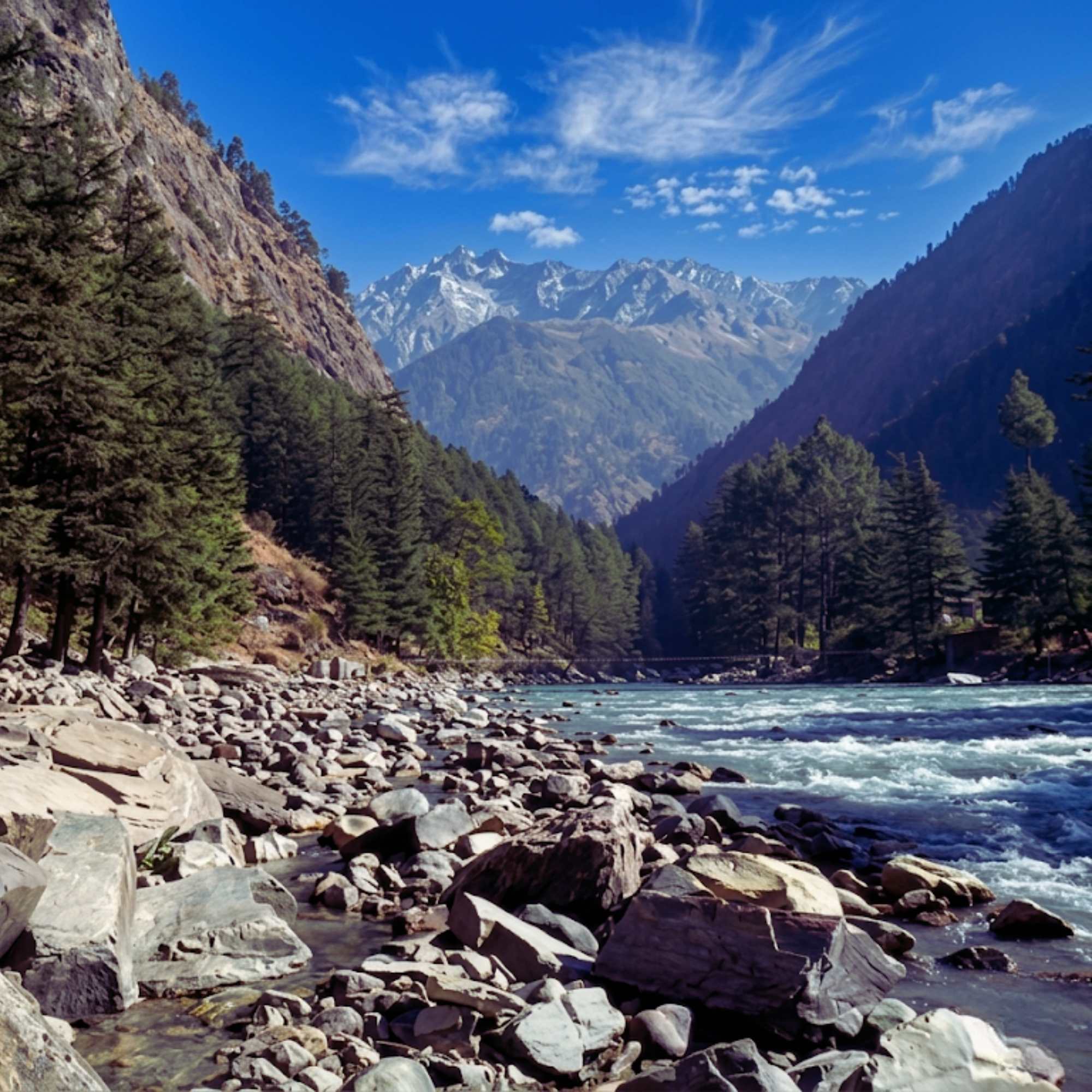
Sainj Valley
Starts at Larji, extends 27 km to Neuli
The valley that begins at Larji and runs upstream along the Sainj River. Villages, homestays, meadows, and the GHNP buffer zone.
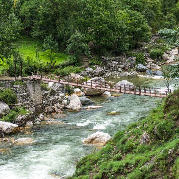
Tirthan Valley
About 34 km from Larji to Gushaini
The twin valley on the other side of the junction. Turn right at Larji for Banjar and the Tirthan side of the GHNP.
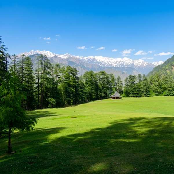
Shangarh Meadows
About 35 km from Larji via Ropa
The most visited village in the Sainj Valley. Sacred meadow, Shangchul Mahadev Temple, and the starting point for several GHNP treks.
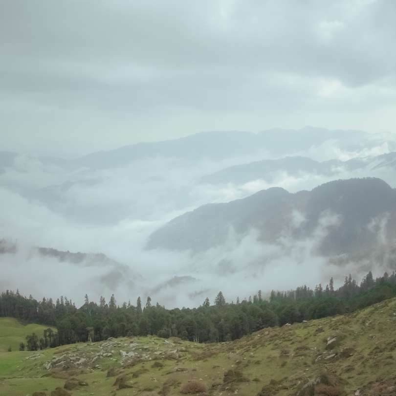
Great Himalayan National Park
Entries at Ropa (Sainj side) and Sai Ropa (Tirthan side)
UNESCO World Heritage protected wilderness. The GHNP encompasses the watersheds of the Sainj and Tirthan rivers, both of which meet the Beas at Larji.
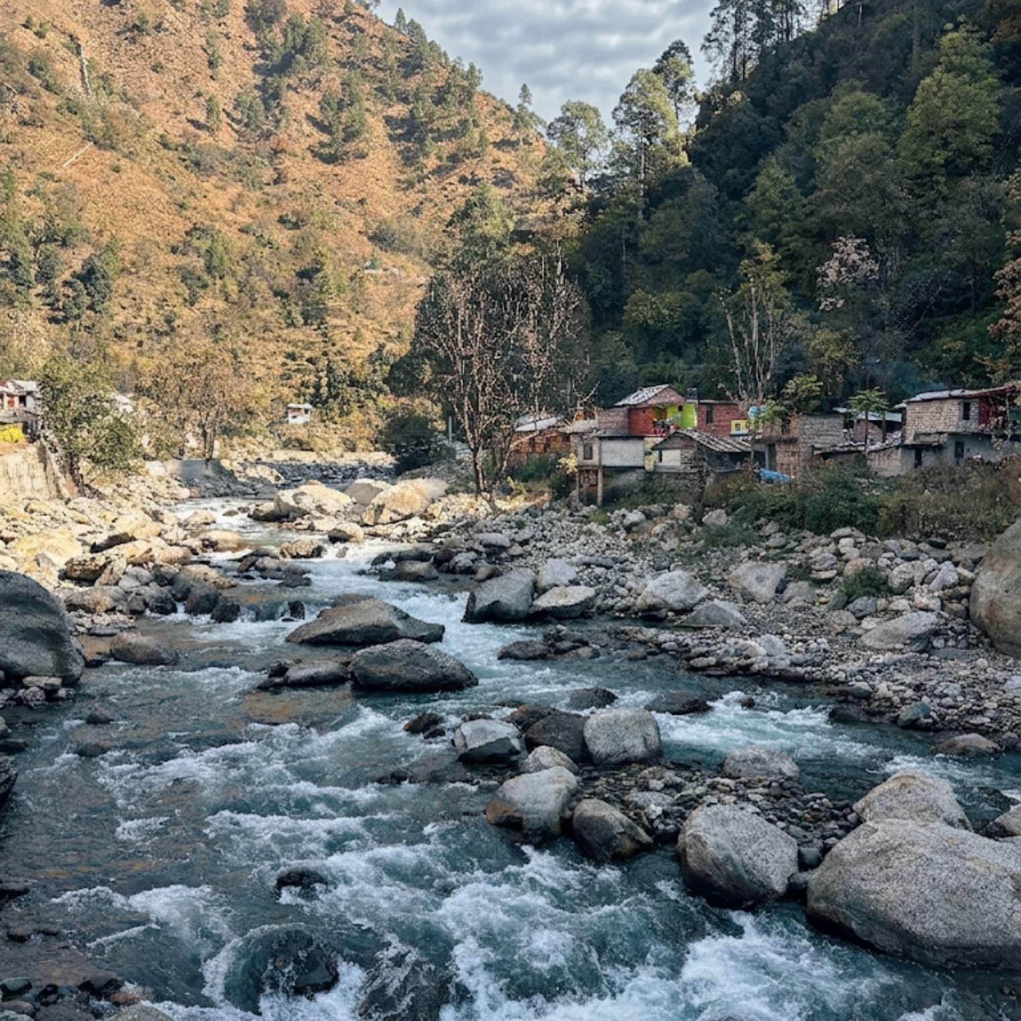
Sainj River
Flows through Larji
The river that flows through the Sainj Valley and meets the Beas at Larji. One of four GHNP watershed rivers.
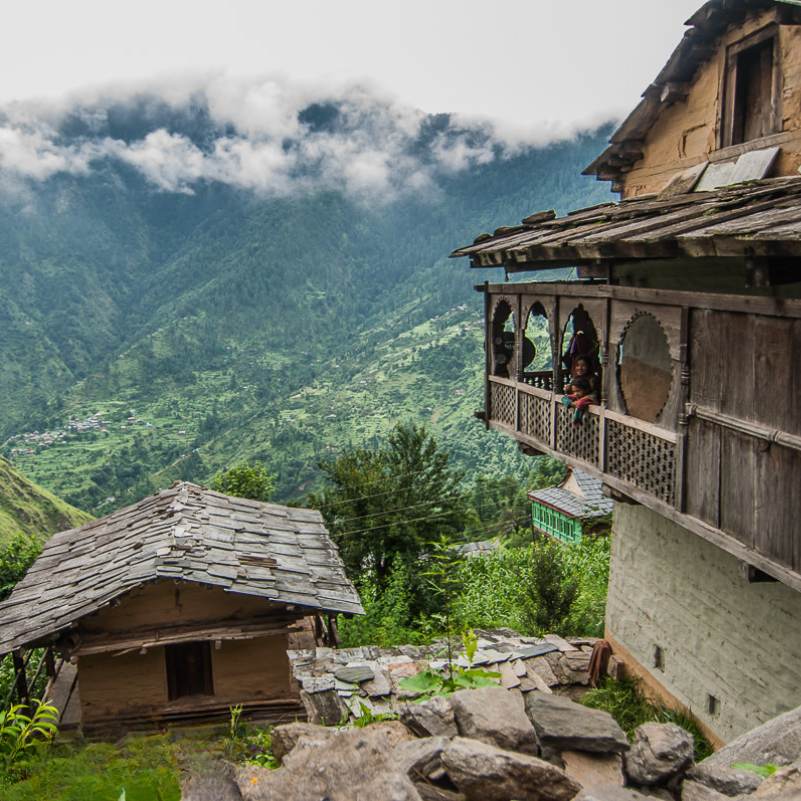
Gushaini
About 34 km from Larji
A village on the Tirthan side with GHNP access, trout fishing, and several guesthouse options. Reached by turning right at Larji.
Our packages with Larji Dam
Curated trips that include a visit to Larji Dam.
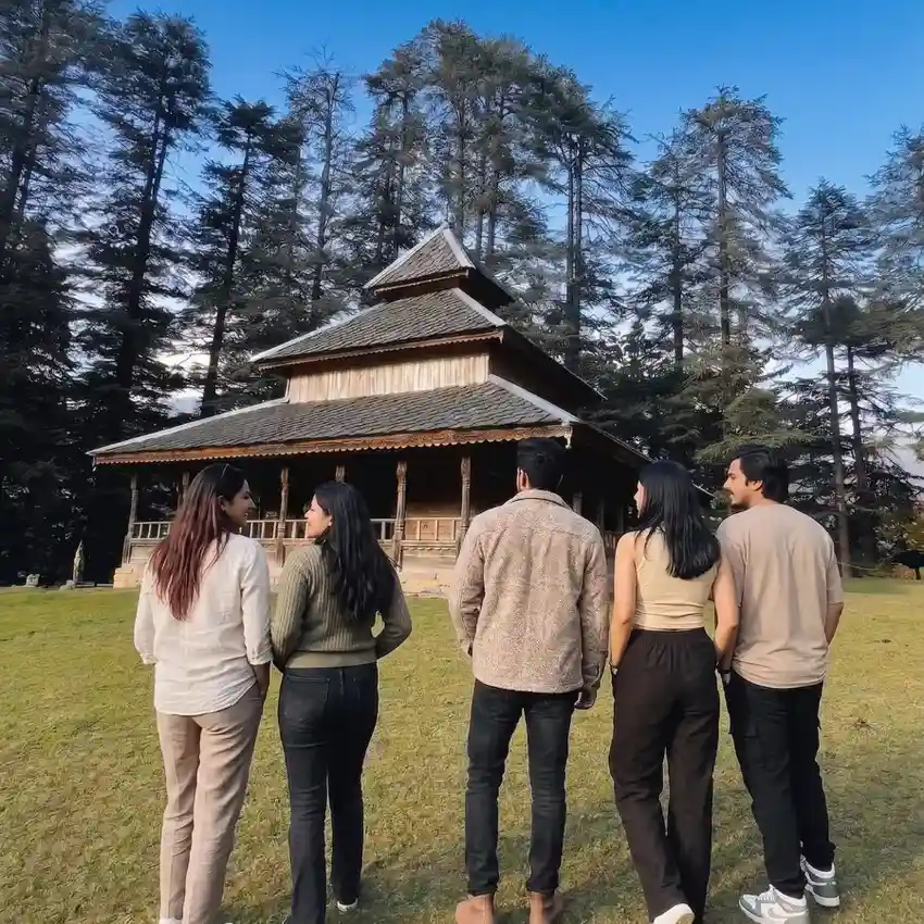 Group Tour5D/4N
Shangarh Sainj Valley Weekend Group Trip
2D Shangarh
₹8,499₹8,999SAVE ₹500/ person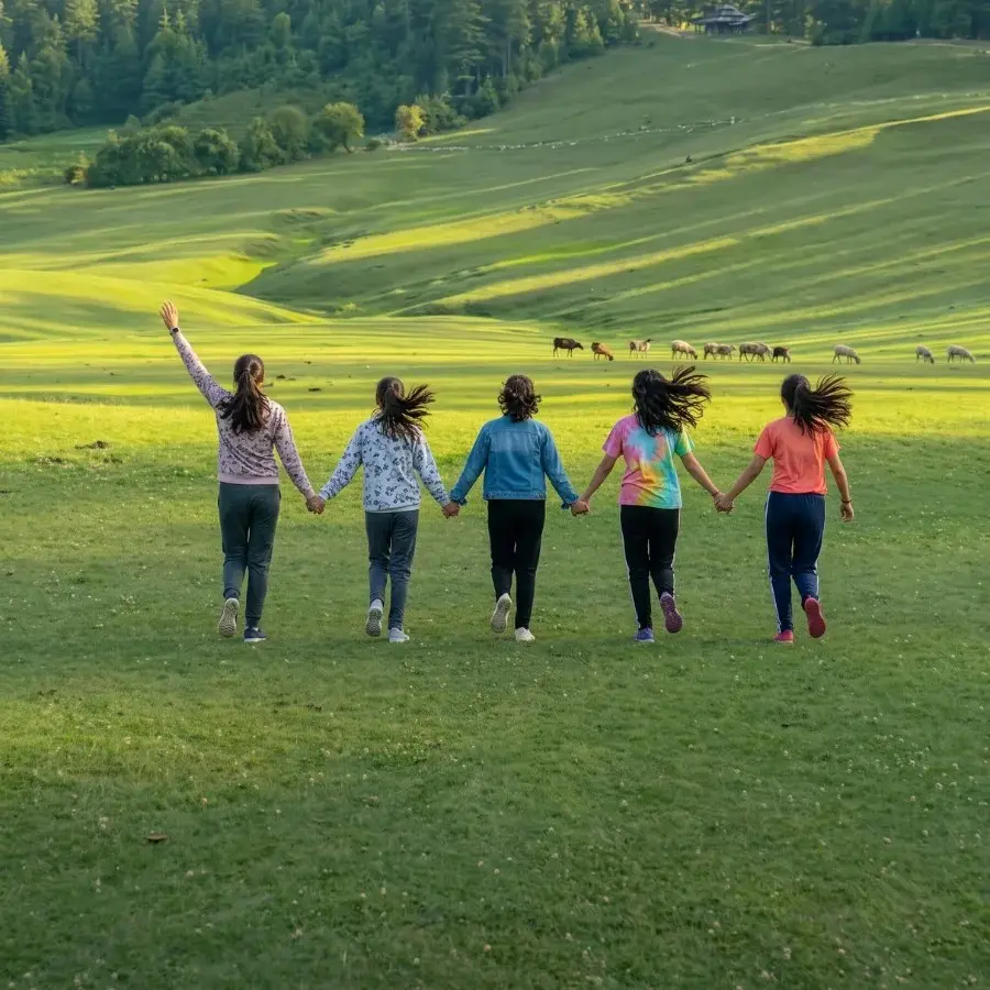 5D/4N
5D/4NMost Loved Shangarh Sainj Valley Tour With Private SUV
2D Shangarh
₹12,999₹16,999SAVE ₹4,000/ person
Frequently Asked Questions
What is Larji Dam?
A 126 MW run-of-the-river hydroelectric project on the Beas River, managed by HPSEBL. It sits in a limestone gorge near the Mandi and Kullu district border, close to Aut on the Manali highway. The dam uses three 42 MW Francis turbines in an underground powerhouse (closed to the public). For travellers, it is primarily the gateway junction where the road forks toward the Sainj Valley (left) and the Tirthan Valley (right).
Where exactly is Larji Dam?
Near the border of Mandi and Kullu districts, close to Aut on NH 3 (the Delhi to Manali highway). About 40 km from Mandi and 60 km from Kullu. The dam is positioned just downstream of where the Sainj and Tirthan rivers flow into the Beas, at the narrowest point of a steep limestone gorge.
Is it safe to go near the water below the dam?
No. The gorge and exposed rocks below the dam look inviting but are extremely dangerous. HPSEBL operates controlled spillway releases that cause water levels to surge rapidly and without warning. In 2014, 14 students were killed when water was suddenly released while they were on the riverbed downstream. Do not climb down to the rocks or water under any circumstances. View the gorge from the road or designated viewpoints only.
Is Larji Dam worth stopping at?
As a brief 5 to 15 minute transit stop, yes. The gorge is visually dramatic from the road. The petrol pump is the last reliable fuel before both valleys. The GHNP Information Centre is useful for first time visitors. But this is not a destination you plan time around. Most travellers pass through on the way to Sainj or Tirthan.
How do I get to Sainj Valley from Larji?
Turn left at the junction just past the dam. The road follows the Sainj River upstream through Sainj town, the Ropa Forest Complex, and Neuli, eventually reaching Shangarh. Turn right for Banjar, Jibhi, and the Tirthan Valley.
Is there a petrol pump at Larji?
Yes. It is the last reliable fuel stop before the deeper Sainj and Tirthan valleys. Fill up here regardless of which direction you are heading.
Can I visit the underground powerhouse?
No. The underground powerhouse of the Larji project is closed to the general public for security reasons. You can view the dam structure and gorge from the road.
What about the proposed houseboat and shikara plans?
The Himachal Pradesh government has proposed tourism development on the Larji reservoir under the 'Nai Raahein Nai Manzilein' initiative, including potential houseboat and shikara operations. As of now, these remain proposed government development plans and are not currently operational. Check locally for updates.
Can I see migratory birds at the reservoir?
Yes, between roughly November and February. Migratory birds use the reservoir lake as a winter stopover. You can spot them from the road. This is not a formal birdwatching site with hides or guides, but if you are passing through in winter, it is worth scanning the water.
What is the connection between the dam and the Aut tunnel?
The reservoir created by the Larji Dam submerged the original road into the upper Kullu valley and Manali. The 3 km Aut tunnel was bored through rock to bypass the flooded section and keep traffic moving. When you drive through that tunnel, the dam is the reason it exists.