
Chang La Pass
A 5,360 metre pass on the Leh to Pangong road, one of the most iconic high altitude crossings in the world, maintained by the Indian Army and BRO, and the gateway to the Changthang Plateau
- Mountain Pass
- ~5,360 m / 17,590 ft
- 75 km from Leh
- On the Leh to Pangong road
- May to Oct
What makes it special
Chang La is the pass you cross on the way to Pangong Lake. That is the honest framing. Almost nobody comes here as a destination. You come here because the road from Leh to Pangong goes over it, and for somewhere between five and fifteen minutes at the top, you are standing at roughly 5,360 metres with about half the oxygen your lungs expect. Every breath feels shallow. Your heartbeat is louder than usual. And around you, hundreds of prayer flags strung between poles and cairns snap and flutter so hard in the wind that the sound fills the entire pass, a constant, rhythmic crackling that drowns out conversation and car engines alike. It is the first thing you notice after the altitude.
The pass sits on the route from Leh to the Changthang Plateau, specifically on the Leh to Karu to Sakti to Zingral to Chang La to Durbuk to Tangtse to Pangong road. You turn left off the Leh Manali highway at Karu, about 36 km from Leh, and climb steadily through Sakti village and Zingral before the road gets steeper and the surface turns to loose dirt and slush for the final 10 to 15 km on either side of the pass. The ascent from Zingral is the challenging stretch, with tight switchbacks, occasional water crossings in summer from snowmelt streams, and altitude that hits you about halfway up. The descent toward Durbuk on the Pangong side is equally steep, and during peak snowmelt (June through early August), watch for the Pagal Nallah section between the pass and Tangtse. These are glacier fed meltwater streams with unpredictable flow that cross the road at several points. They can be shallow and harmless in the morning and knee deep by mid afternoon, carrying loose stones and gravel with them. The risk climbs significantly after around 2 PM, when the day's sun has had maximum time to melt the snowfields above the road. Low clearance vehicles, particularly sedans and hatchbacks, can get stuck or suffer undercarriage damage in the deeper crossings. SUVs and high clearance vehicles handle them far more comfortably. Your driver will know the nallahs, but if you are self driving, stop before each crossing, check the depth and flow by watching other vehicles or wading on foot first, and never stop in the middle of a stream bed.
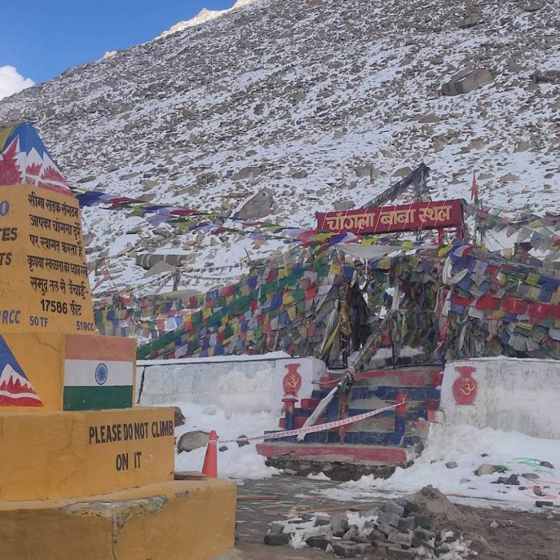
A small temple at the top is dedicated to Changla Baba, a figure deeply woven into the lore of this pass. Local drivers, army vehicle operators, and truckers who cross Chang La regularly stop here before the descent to offer a brief prayer for safe passage. You will notice garlands, coins, and small offerings left at the shrine. For the people who drive this road for a living, the temple is not a tourist curiosity. It is a ritual, a moment of asking for protection before a road that demands respect. The name Chang La itself is often translated as "Northern Pass" from Tibetan ("byang" meaning north, "la" meaning pass), fitting its role as the gateway to the Changthang, literally "Northern Plateau." Some historical sources interpret it differently depending on the direction of travel, but the northern reading aligns with the geography. Nearby, DRDO's Extreme Altitude Research Centre focuses on high altitude life sciences and is among the highest permanent research stations globally.
The Indian Army's presence at the top is more than a tea stall. It is a safety post in a genuinely high risk environment. At 5,360 metres, altitude sickness can escalate quickly, and the army post is equipped with emergency oxygen cylinders for travellers who show signs of serious distress. Soldiers stationed here have helped countless visitors who arrived dizzy, nauseous, or struggling to breathe. The tea stall itself serves hot chai, coffee, and Kashmiri kahwa, and in the biting cold and thin air, a warm drink is not a comfort but a genuine physical need. A public washroom is also available, which is more than most Ladakh passes can say. Do not think of the army presence as a backdrop for your photo. Think of it as the reason the pass is crossable at all.
Here is what matters most. Do not linger. At 5,360 metres the pass is actually higher than Pangong Lake itself (which sits at roughly 4,225 m), over a kilometre above the lake you are driving to see. Most travellers feel the altitude more at Chang La than they do at Pangong. A quick stop is the smart move. Get out, take your signboard photo, drink your tea, use the washroom, and get back in the vehicle. Do not spend more than fifteen minutes at the top. The symptoms that catch people off guard here, headache, slight nausea, dizziness, sometimes breathlessness, usually ease as you descend the other side. If they do not ease within an hour of descent, take it seriously.
The pass is maintained by the Border Roads Organisation (BRO) and is kept open through most of the year because it serves a strategic military purpose. Heavy snowfall can temporarily block it, but BRO clears the road quickly, often within hours. However, for tourists, the pass is effectively restricted from November to April. While the road may be physically open for military convoys, civilian permits for the Pangong area are generally not issued in winter, and tourist infrastructure on both sides of the pass, camps, tea stops, homestays, shuts down entirely. The practical tourist window is late May to October. Attempting a winter crossing without military or research clearance is not advisable and may not be permitted at civilian check posts.
An honest note on the altitude claims. The signboard at the top has historically displayed various ranking titles. Ignore them. As of 2026, several newer roads sit well above Chang La, most notably Umling La in eastern Ladakh at over 5,800 m. GPS verified measurements place Chang La at around 5,360 m (17,586 ft), putting it in roughly the same bracket as Khardung La. What makes this pass iconic is not a ranking. It is the combination of altitude, the gateway role to the Changthang, the stark landscape, the relentless wind, and the fact that every Pangong bound traveller must cross it. The ranking debate does not matter to your lungs. At 5,360 metres, the thin air is very real, and your body will tell you within five minutes of stepping out of the car.
One thing worth knowing if you are crossing both passes on the same trip: most riders and drivers who have done both consider Chang La the tougher crossing. The altitude is nearly identical, but Chang La's gradients are steeper, the road surface on the descent toward Durbuk can be rougher, and the Pagal Nallah water crossings on the Pangong side add a hazard that Khardung La simply does not have. Khardung La's north side has its own rough patches, but the overall crossing is more predictable.
Quick answers
- What is the altitude of Chang La Pass?
- Roughly 5,360 metres (about 17,586 feet) by GPS measurement. One of the most iconic high altitude passes in the world, and the mandatory gateway to the Changthang Plateau. It sits over a kilometre above Pangong Lake (roughly 4,225 m), so the hardest altitude moment on the Pangong trip is the pass, not the lake.
- How long should I stop at Chang La Pass?
- Fifteen minutes, maximum. The air is seriously thin, and most people notice a dull headache or slight nausea within minutes of stepping out. Get your signboard photo, grab a cup of tea at the Army safety post, use the washroom, and get back in the car. The longer you stay, the harder the altitude hits.
- How far is Chang La from Leh and how is the road?
- About 75 km from Leh. Allow 3 to 3.5 hours. The first 36 km to Karu is smooth highway, but after the Karu turn the road climbs steeply through Sakti and Zingral, with unpaved and slushy stretches near the top. On the descent toward Tangtse, watch for the Pagal Nallah meltwater crossings, especially after 2 PM when flow peaks. The pass itself is just the midpoint on the way to Pangong Lake.
Quick facts
Everything you need to know at a glance.
At a glance
- Altitude
- Roughly 5,360 m / 17,586 ft (GPS verified). One of the most iconic high altitude passes in the world and the gateway to the Changthang Plateau.
- Location
- On the Leh to Pangong Lake road, between Zingral and Durbuk. About 75 km east of Leh in Ladakh.
- Name
- Often translated as "Northern Pass" (Tibetan "byang" = north + "la" = pass), gateway to the Changthang ("Northern Plateau"). A small temple at the top is dedicated to Changla Baba, a guardian figure for local drivers who cross the pass regularly.
- Nearest settlements
- Sakti village on the Leh side (about 20 km). Tangtse on the Pangong side (about 34 km). Leh is 75 km.
- Open season
- BRO keeps the road open year round for military use. Tourist access is generally restricted from November to April because Pangong area permits are not issued in winter and all tourist infrastructure shuts down. Practical tourist window: late May to October.
- Time at the pass
- Fifteen minutes at most. Enough for the signboard photo, a cup of tea, and the washroom. Do not spend longer at this altitude.
- Difficulty
- The 75 km drive from Leh takes 3 to 3.5 hours due to the steep climb and rough final stretch. The altitude at 5,360 m is the real test. Spend at least 48 hours acclimatising in Leh before attempting.
On the ground
- Mobile network
- Very patchy. BSNL postpaid may briefly work near the army post. Jio and Airtel are effectively dead. Download offline maps before leaving Leh.
- Food
- Hot tea, coffee, and Kashmiri kahwa at the Army safety post. Biscuits. No proper meals at the pass or on either side until Tangtse (34 km further).
- Army safety post
- More than a tea stall. The Army post carries emergency oxygen cylinders and soldiers are trained to assist travellers showing altitude distress. If anyone in your group is struggling, approach the post immediately.
- Washrooms
- Available at the pass, maintained by the army. Cleaner than most high altitude stops in Ladakh.
- Fuel
- Nothing at the pass. Karu (36 km from Leh) is the only fuel pump on the entire route. Beyond Karu there is zero official fuel until you return. Fill your tank in Leh, top up at Karu, and carry a reserve jerry can if self driving.
- Parking
- Open gravel area at the top. Usually enough space, though July weekends get busy with tourist vehicles.
- Photography
- Allowed at the signboard, temple, and surrounding landscape. Do not photograph military installations, army posts, or personnel.
- Drones
- Prohibited. This is a military maintained road. Drones have been confiscated at the pass.
- Pagal Nallah (water crossings)
- Glacier fed meltwater streams on the descent toward Tangtse, mainly June to early August. Flow rises through the day and is worst after 2 PM. Low clearance vehicles are especially vulnerable. Aim for morning crossings.
Seasonal weather
- May to Jun5°-10°Early season (May to Jun)
- Jul to Aug10°-5°Summer (Jul to Aug)
- Sep to Oct5°-10°Autumn (Sep to Oct)
- Nov to Apr-5°-25°Winter (Nov to Apr)
Suitable for
- Couples — suitable
- Families — with some care
- Seniors — with some care
- Solo — suitable
- First-timers — suitable
- Pet-friendly — not suitable
How to reach Chang La Pass
2 approach routes, with seasonal access.
From Leh
Generally open year round (BRO maintained). Tourist window late May to October.- Distance
- About 75 km
- Time
- 3 to 3.5 hours
- Road
- Tarred highway to Karu, then tarred mountain road with unpaved and slushy stretches near the pass
- Last fuel
- Karu, 36 km from Leh. This is the only fuel pump on the entire route. Nothing at the pass. In Tangtse and Durbuk you may find locals selling fuel in bottles at steep markups, but treat this as emergency backup, not a plan. Fill up fully at Karu.
The standard route. Leave Leh by 7:30 to 8 AM. Take the Leh Manali highway to Karu (36 km, about 45 minutes), and fill fuel here because this is genuinely the last pump you will see until you are back. Turn left onto the Pangong road, climb through Sakti village and Zingral. The road steepens sharply after Zingral and the last 10 to 15 km before the pass can be loose gravel and slush with snowmelt stream crossings in summer. Allow about 2 hours from Karu to the pass top. Keep your stop at the top short, then continue down toward Durbuk and Tangtse. On the descent, especially in June through early August, be prepared for the Pagal Nallah, meltwater streams with unpredictable flow that cross the road at multiple points. Flow rises through the day as the sun warms the glaciers above, and the risk increases significantly after around 2 PM. Aim to cross this section before early afternoon if you can.
From Pangong Lake (return)
Same as above.- Distance
- About 100 km from Pangong (Spangmik) to the pass, then 75 km to Leh
- Time
- 5 to 6 hours total to Leh with stops
- Road
- Same road in reverse. Pangong to Tangtse is rough in stretches.
- Last fuel
- None until Karu. If self driving, carry a reserve jerry can. Black market bottles in Tangtse or Durbuk are unreliable.
The return route from Pangong. Drive from Spangmik or Tangtse, climb back up to the pass (the ascent from the Pangong side is equally steep), cross, and descend toward Zingral and Karu. Plan to leave the lake by 7:30 to 8 AM. An early start matters for two reasons: you want to reach the Pagal Nallah section before the afternoon melt intensifies (flow gets noticeably worse after 2 PM), and you want daylight for the descent on the Leh side. You can stop at Shey Palace or Thiksey Monastery between Karu and Leh on the way back.
Best time to visit
Season by season, so you can plan around the weather rather than hope.
Early season
May to June
Road opening, possible snow patches, dramatic scenery, light traffic.
- Temperature at the pass
- Roughly minus 10 to 5°C
- Road
- Open but may have snow patches and ice in May
- Crowds
- Low
- Tourist access
- Permits issued from late May onward; early May access can be uncertain
The road opens for tourists. Snow may still be present near the pass, and the surface can be icy in the early morning. Temperatures at the top hover around minus 5 to 5 degrees even on sunny days. The drive is dramatic, with snow walls on either side in early May. By June, the road is mostly clear and the first Pagal Nallah streams begin appearing on the Tangtse side. The air at the top feels thin enough that you notice each breath, and the prayer flags are still stiff with ice in the morning before the sun hits them.
- Recommended
Summer
July to August
Clearest road, warmest temperatures (still cold), busiest with tourist traffic, Pagal Nallahs at peak flow.
- Temperature at the pass
- Roughly minus 5 to 10°C
- Road
- Generally clear, but Pagal Nallah crossings active
- Crowds
- High, peak in July
- Pagal Nallah
- Strongest flow; aim to cross before early afternoon
The warmest the pass gets, which is still cold enough to see your breath. Daytime temperatures at the top might reach 5 to 10 degrees if the sun is out. Road is generally clear, though the Pagal Nallah meltwater streams on the descent toward Tangtse are at their most active in this window. This is peak tourist season and you will share the pass with lines of taxis and bikes heading to Pangong.
- Recommended
Autumn
September to October
Sharp light, cold air, thin crowds, calmer water crossings. The quiet crossing.
- Temperature at the pass
- Roughly minus 10 to 5°C
- Road
- Generally passable, early morning ice possible by late September
- Crowds
- Low
- Pagal Nallah
- Flow reduces as snowmelt eases; crossings much calmer than summer
Tourist numbers thin out and the light gets sharper. Temperatures drop noticeably, and by October the road surface near the pass can be icy in the early morning. This is the cleanest photography window, with clear skies and sharp mountain outlines. The Pagal Nallah crossings are significantly calmer than in July and August because snowmelt slows as temperatures drop. The air at the top is dry and biting. Dress for genuine cold.
- Closed
Winter
November to April
Army keeps the road open, but tourists are effectively restricted. Extreme cold.
- Temperature at the pass
- Minus 15 to minus 25°C
- Road
- BRO clears snow for military use; physically open most days
- Tourist access
- Effectively restricted. Civilian permits for the Pangong area are generally not issued in this window. Tourist infrastructure on both sides of the pass shuts down entirely.
- Who crosses
- Military convoys and authorised personnel only
BRO and the Indian Army keep the road open through most of winter for military logistics and supply convoys. Heavy snowfall can block it temporarily, usually cleared within hours. However, civilian permits for the Pangong Lake area are generally not issued from November through April, and tourist infrastructure on both sides, camps, tea stops, homestays, and dhabas, shuts down entirely. Even the Army tea stall at the pass may not serve civilian visitors in deep winter. Temperatures at the pass crash to minus 15 to minus 25 degrees. This is not a window for leisure travel. Attempting a winter crossing without military or research clearance is not advisable and may be stopped at civilian check posts.
Things to see & do
4 things worth your time at Chang La Pass.
Stop for the signboard photo
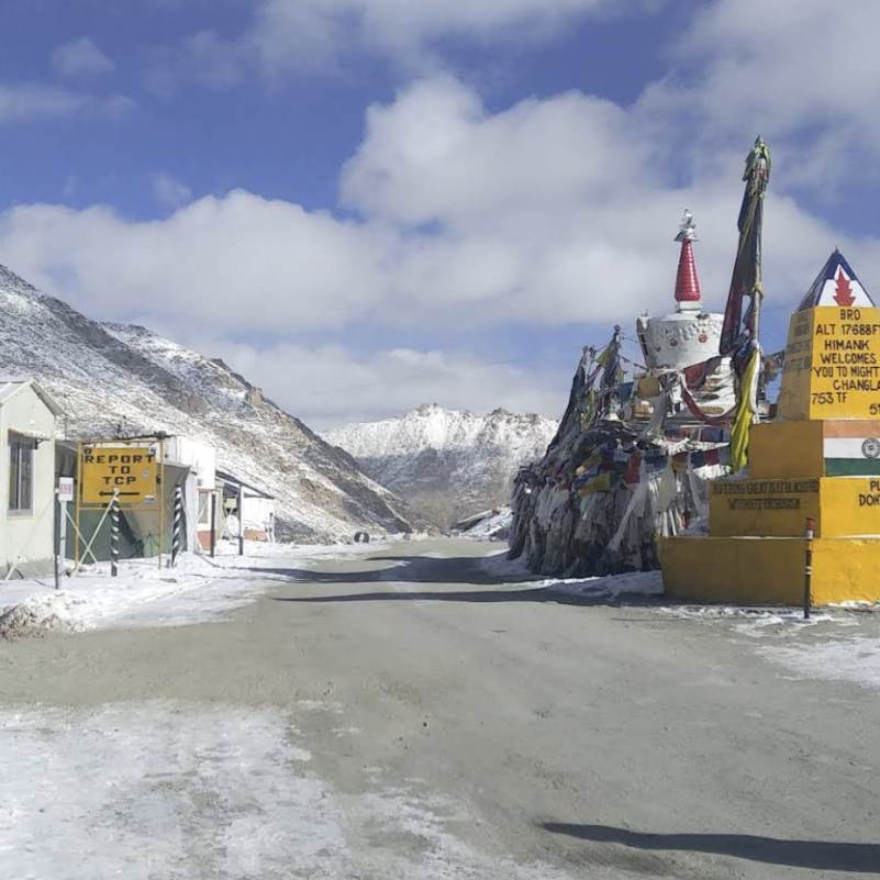
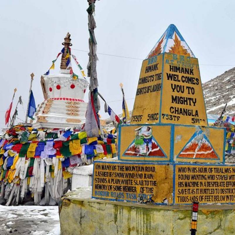
5 minutesEveryone does this, and there is nothing wrong with it. The painted board at the top announces the altitude and the pass name against a backdrop of bare mountains. The flags stretch in every direction, faded cotton in five colours, snapping hard enough in the wind that you can hear them from 50 metres away. The sound is constant, a rhythmic crackling that fills the space. Queue up, get your shot, and move on. In peak July, there may be a short line. In September, you will likely have the board to yourself.
Stop at the Army safety post for chai
5 to 10 minutesThe Indian Army maintains a small post at the top that serves as both a tea stall and an emergency safety point. Hot tea, coffee, and Kashmiri kahwa are served, and at 5,360 metres, in wind cold enough to make your knuckles ache, a warm drink is a genuine physical need. The post carries emergency oxygen cylinders and the soldiers here are trained to assist travellers showing signs of altitude distress. If anyone in your group feels dizzy, nauseous, or unusually short of breath, this is the place to stop and ask for help before continuing the descent. The kahwa is the one to get if they have it.
Visit the Changla Baba Temple
5 minutesA small temple at the pass dedicated to Changla Baba, a figure from local lore who has become the guardian spirit of this crossing. Watch what happens when a local driver or an army truck reaches the top. They stop, step out, and spend a moment at the shrine before continuing. Garlands, coins, and offerings accumulate daily. For the people who drive this road week after week, the prayer is not ceremonial. It is personal, a quiet ask for safe passage on a road that demands respect. Travellers are welcome to step inside briefly.
Take in the view from the top
2 to 5 minutesIf the sky is clear, stand on the open ground near the signboard and look around. To the south, the road drops toward the Changthang Plateau. To the north, you can trace the route you climbed from Zingral. On a cloudless day, snow covered ridges line the horizon in every direction, and the starkness of the landscape is the thing that stays with you. No trees, no green, no soft edges. Just rock, ice, wind, and sky. The prayer flags, hundreds of them strung between cairns and poles, create a wall of colour and sound. Keep this as a stand still moment rather than a stroll. At this height, even walking uphill twenty feet for a better angle can leave you gasping. Your breathing is audibly faster, and you can feel your pulse in your temples. Plant your feet, take it in, and head back to the car.
Know before you visit Chang La Pass
The practical bits, from people who have been.
What Chang La actually isA brief, intense stop on the way to Pangong. Not a destination. But fifteen minutes at 5,360 m, wind cutting through your jacket, prayer flags crackling in every direction, stays with you.
Chang La is a transit point, not a destination. Almost every traveller who crosses it is on the way to or from Pangong Lake. You stop, you photograph the signboard, you drink tea, and you leave. The value of Chang La is what it unlocks on the other side: the Changthang Plateau and the lake.
That said, even a brief stop at 5,360 metres is a genuinely intense physical experience. The altitude hits you in ways a number on a signboard cannot prepare you for. You feel it in your temples and in the odd lightness of each breath. The wind at the top is biting even in July, cold enough to make your eyes water within seconds. The prayer flags are so dense they create a wall of colour and sound, a constant crackling that fills the pass from edge to edge. The Changla Baba temple draws a quiet prayer from every local driver who crosses, and the Army's safety post provides hot drinks and emergency oxygen. If the sky is clear, the view is a full circle of bare peaks and open sky that you simply do not get at lower elevations. This is one of the most iconic high altitude crossings in the world, and you feel it in your body the moment you step out of the car.
Altitude: the one thing that actually matters hereSpend at least 48 hours acclimatising in Leh first. No shortcuts. Army post at the top has emergency oxygen. Keep your stop brief and get moving.
At 5,360 metres, altitude is the primary concern. Oxygen levels are roughly 50% of sea level. Most people feel it within two to five minutes of stepping out: a dull headache pressing behind the temples, slight breathlessness, sometimes dizziness or nausea. Your heartbeat speeds up and you can feel your pulse in your chest.
The rules are simple. Keep your stop brief. Do not run, jump, or exert yourself. The signboard selfie jump is a genuinely bad idea at this altitude. Do not drink alcohol before or after the crossing. Stay hydrated on the drive up, but sip slowly.
If symptoms do not ease within an hour of descending from the pass, tell your driver immediately. Severe headache, vomiting, confusion, or breathlessness at rest are warning signs of High Altitude Cerebral or Pulmonary Oedema and demand immediate descent to Leh. The Army post at the top carries emergency oxygen and the soldiers are trained to recognise altitude distress. If anyone in your group is in trouble, go straight to the Army post before attempting the descent.
The most important preparation happens before you reach the pass. Spend at least 48 hours acclimatising in Leh at 3,500 metres before any drive over Chang La. Two full nights and the days in between, doing light walking, drinking water, letting your body adjust. Three nights is better. If you flew into Leh from Delhi or Mumbai, do not attempt the Pangong drive on day one or day two. Your body needs that 48 hour minimum to begin producing extra red blood cells and adapting to the lower oxygen. Skipping this step is the single most common reason people feel terrible at the pass.
How to fit Chang La into your itineraryCross it on the way to Pangong. Leave Leh by 8 AM. Allow 3 to 3.5 hours. Tourist access generally limited to late May through October.
Most travellers cross Chang La as part of a two day Pangong trip from Leh. The pattern is simple: leave Leh by 7:30 to 8 AM, reach Chang La by around 11 AM, stop briefly, continue to Pangong by early afternoon, spend the night at Spangmik or Man, and return over the pass the next morning.
If you are doing the Leh, Nubra, Pangong circuit, you may cross Chang La only on the return leg if you take the Shyok route from Nubra to Pangong.
Pair the Pangong drive with a quick stop at Sakti village (for the Takthok Monastery, the only Nyingmapa gompa in Ladakh) on the way up, and Shey or Thiksey on the return, both of which sit on the Leh Manali highway between Karu and Leh.
The tourist window is effectively late May to October. From November to April, civilian permits for the Pangong area are generally not issued, and tourist infrastructure on both sides of the pass shuts down. Do not plan a Pangong trip through Chang La in winter.
Small practical things that matterILP or PAP required. Dress warm. Fuel up at Karu, the only pump on the route. Watch Pagal Nallah after 2 PM. Army post has emergency oxygen.
You need a permit to be on this road. Indian citizens need an Inner Line Permit (ILP) covering the Pangong Lake area, which includes the Chang La route. Apply online through the LAHDC Leh portal before your trip, or arrange it through a travel agent in Leh. Foreign nationals need a Protected Area Permit (PAP) through a registered Leh travel agent. Carry printed copies. The check post at Karu, and sometimes one at the pass itself, will ask for them.
Dress warm even if Leh felt comfortable in a T shirt. The top of the pass is significantly colder and windier than Leh town. Gloves and a proper jacket are not optional. The wind alone will cut through anything lighter.
Carry water and light snacks for the drive. There is tea at the top but no food until Tangtse on the far side.
Fuel is a serious concern. Karu is the only fuel pump on the entire Leh to Pangong route. Nothing at the pass. In Tangtse and Durbuk, locals sometimes sell petrol in bottles at steep markups, but availability is inconsistent and you should never rely on it. Fill your tank in Leh, top up at Karu, and carry a reserve jerry can if self driving.
If you are on a motorcycle, the road surface 10 to 15 km on either side of the pass can be loose gravel and slush. Water crossings are common in June and July from snowmelt.
Watch for the Pagal Nallah streams on the descent toward Tangtse, especially in June and July. Flow rises through the day and gets worse after 2 PM. Low clearance vehicles are especially vulnerable. Aim to cross before early afternoon.
If anyone in your group feels seriously unwell at the pass, go straight to the Army safety post. They carry emergency oxygen and can provide initial assistance before you begin the descent.
Use the washroom at the pass. The next one is in Tangtse, roughly an hour and a half further.
Do not fly a drone at the pass. This is a military area and drones have been confiscated.
Nearby attractions
Other places worth the detour.
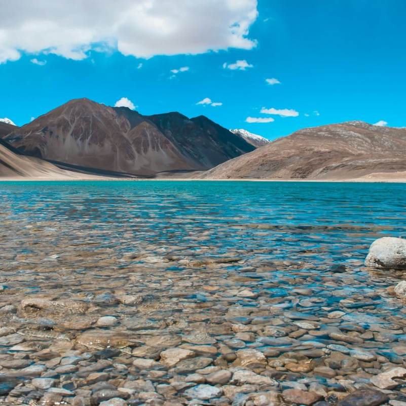
Pangong Lake
About 100 km beyond the pass
The reason you are crossing Chang La. A 134 km saltwater lake at roughly 4,225 metres, about 100 km beyond the pass. Stay at least one night at Spangmik or Man for the sunset colour show.
Tangtse
About 34 km from the pass toward Pangong
A small settlement about 34 km past the pass on the Pangong side. The closest place to the pass with proper tea stops, dhabas, and basic homestays. A small monastery sits on the hilltop above the village. Useful as a lunch stop on the drive.
Takthok Monastery (Sakti village)
About 20 km from the pass toward Leh
The only Nyingmapa (oldest school) Buddhist monastery in Ladakh, built into a cave. Located in Sakti village, which you pass through on the way up to the pass from Karu. Worth a 20 minute stop if you have time on the return trip.
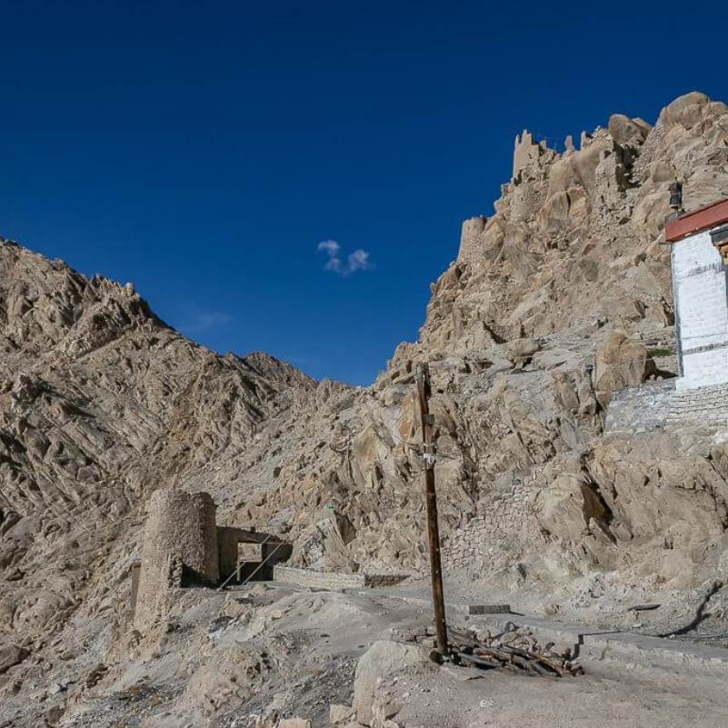
Shey Palace
About 15 km from Karu toward Leh
The former summer capital of the Namgyal dynasty, with a 12 metre Shakyamuni Buddha. On the Leh Manali highway between Karu and Leh, an easy stop on the return from Pangong.
Khardung La Pass
About 75 km from Chang La via Leh
The other major high pass near Leh, on the route to Nubra Valley. Similar altitude to Chang La but generally considered a less demanding crossing, as the gradients are more gradual and the road lacks the Pagal Nallah water crossings that make Chang La trickier. Most Ladakh itineraries cross both on separate days.
Tso Moriri Lake
About 215 km from Pangong via Chushul, or via Leh
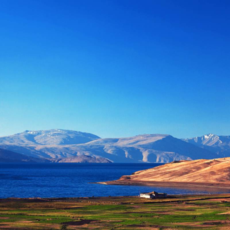
The other big Changthang lake, at 4,522 m. Reachable from Pangong via the Chushul route if it is open, or separately from Leh. A quieter, more remote alternative to Pangong.
Our packages with Chang La Pass
Curated trips that include a visit to Chang La Pass.
 Group Tour6D/5N
Leh Ladakh Group Tour With Nubra Valley and Pangong Lake
2D Leh•1D Nubra Valley+1
₹18,999/ person 7D/6N
7D/6NLeh Ladakh Tour With Turtuk Village Nubra Valley and Pangong Lake
2D Leh•2D Nubra Valley+1
₹27,999₹33,999SAVE INR 6,000/ person 4D/3N
4D/3NLeh Ladakh Quick Escape
2D Leh•1D Pangong Lake
₹20,999₹24,999SAVE INR 4,000/ person
Common questions about Chang La Pass
What is the altitude of Chang La Pass?
About 5,360 metres (17,586 feet) based on GPS corrected data. The signboard at the top has displayed various ranking titles over the years, but as of 2026, several newer roads sit well above it. What matters at 5,360 m is the thin air, not a ranking. Every breath delivers noticeably less oxygen than your body expects, and you will feel it within minutes.
How far is Chang La Pass from Leh?
About 75 km. Allow 3 to 3.5 hours for the full drive. The first 36 km to Karu is smooth highway, but the remaining 39 km climbs steeply through Sakti and Zingral with rough, unpaved sections near the top.
Do I need a permit for Chang La Pass?
Yes. Indian citizens need an Inner Line Permit (ILP) covering the Pangong Lake area, which also covers the Chang La road. Apply online through the LAHDC Leh portal. Foreign nationals need a Protected Area Permit (PAP) arranged through a registered Leh travel agent. You do not need a separate permit specifically for the pass, but you must have the Pangong area permit to be on this road. Carry printed copies.
When is Chang La Pass open for tourists?
Late May to October is the practical tourist window. BRO keeps the road physically open through most of the year for military use, clearing snow quickly after storms. Tourist access is effectively restricted from November to April. Civilian permits for the Pangong area are generally not issued in winter, and all tourist infrastructure on both sides, camps, tea stops, homestays, shuts down entirely. The road may be open for military convoys, but that does not mean it is open for you.
How long should I spend at Chang La Pass?
Fifteen minutes, maximum. Enough for the signboard shot, a warm cup of tea at the Army post, and a washroom break. The altitude starts making itself felt quickly, and the longer you sit at 5,360 m, the harder the headache hits.
Can I trek to Chang La Pass?
You can, but almost nobody does because the altitude is not kind to people on foot. Trekking routes exist historically, but the standard approach is by vehicle on the tarred (and partly unpaved) road from Leh via Karu and Sakti.
How does Chang La compare to Khardung La?
Similar altitude, but a notably different experience. Khardung La (about 5,359 m by GPS) is on the route to Nubra Valley north of Leh. Chang La (about 5,360 m) is on the route to Pangong Lake east of Leh. Most riders and drivers who have crossed both consider Chang La the tougher crossing. The gradients are steeper, the road surface on the descent toward Durbuk tends to be rougher, and the Pagal Nallah meltwater crossings on the Pangong side add a genuine hazard that Khardung La does not have.
Is food available at Chang La Pass?
Tea, coffee, Kashmiri kahwa, and basic biscuits at the Army safety post at the top. No proper meals. The nearest dhabas are in Sakti village on the Leh side and Tangtse on the Pangong side.
Can I cross Chang La on a motorcycle?
Yes. Motorcyclists regularly cross Chang La on Leh to Pangong rides. The last 10 to 15 km on either side of the pass can be loose gravel, slush, and water crossings in summer. Watch for the Pagal Nallah streams on the descent toward Tangtse, which get stronger after 2 PM. Experience with high altitude riding is essential. Carry warm gloves; your hands will numb at the top. Fuel up at Karu, the only pump on the route.
Is Chang La Pass safe for families and seniors?
Families cross it regularly on the way to Pangong. Children may feel altitude effects more quickly than adults, so keep the stop short and watch for signs of discomfort. The Army post has emergency oxygen if needed. Everyone in the family should spend at least 48 hours acclimatising in Leh before attempting the crossing. Senior travellers with heart, lung, or blood pressure conditions should consult a doctor before any pass above 5,000 metres.
Is there mobile network at Chang La Pass?
Effectively non existent for most carriers. BSNL postpaid is the only network with any chance of a signal, and even that works only intermittently near the army post. Jio and Airtel do not function at the pass. Download offline maps and any content you need before leaving Leh.
How much time should I spend acclimatising in Leh before crossing Chang La?
At least 48 hours. Two full nights and the days in between, doing light activity, staying hydrated, and avoiding alcohol. Three nights is better. If you flew into Leh from the plains, do not drive to Pangong on day one or two. This is the single most common mistake travellers make, and the single easiest one to avoid.
Where can I get fuel on the Chang La route?
Karu is the only fuel pump on the entire Leh to Pangong route. Nothing at the pass. In Tangtse and Durbuk, locals sometimes sell petrol and diesel in bottles at inflated prices, but this is inconsistent and not something you can plan around. Fill up in Leh, top up at Karu, and carry a reserve jerry can if self driving. Running out of fuel between Karu and Pangong is a serious problem with no easy fix.
What are the Pagal Nallahs and should I worry about them?
Pagal Nallahs are glacier fed meltwater streams that cross the road on the descent from Chang La toward Tangtse, mainly active from June through early August. They are called "pagal" (crazy) because their flow is unpredictable, shallow in the morning and potentially knee deep by mid afternoon as the day's sun melts the snowfields above. Low clearance vehicles are especially at risk. SUVs handle them much more comfortably. Aim to cross before 2 PM when flow is lower.
Related guides
Posts about Ladakh
- Manali to Leh Highway 2026: Every Pass, Stop and Distance
- Umling La Ladakh Guide 2026: Route, Altitude, Permit, Safety & Reality Check
- Turtuk Ladakh Travel Guide 2026: Balti Culture, Apricot Orchards and Why It Is Perfect for Families
- Offbeat Ladakh for Couples in 2026: Quiet Routes Beyond Pangong and Nubra
- Aryan Valley Ladakh Guide 2026: Dah, Hanu, Brokpa Culture, Route and Who Should Visit
- Hanle vs Tso Moriri vs Turtuk: Which Offbeat Ladakh Place Should You Choose in 2026?