
Barshaini
A busy transit hub at the NHPC hydroelectric dam in the upper Parvati Valley, where the road from Kasol ends, the Tosh Nala meets the Parvati River, and every trail to Tosh, Kheerganga, Kalga, Pulga, and Kutla starts within a short walk of the same bridge
- Transit point
- Parvati Valley
- ~2,050 m
- Last road head
- NHPC hydro dam
- Kheerganga trek start
- Tosh junction
- Kalga and Pulga access
- 18 to 20 km from Kasol
- No ATM, carry cash
What makes it special
Barshaini is not a destination. It is a functional, busy transit hub where the road ends and the trails begin. That is the most useful thing to understand before you arrive. Every traveller heading to Tosh, Kheerganga, Kalga, Pulga, or Kutla passes through Barshaini. Where you go next depends on which bridge you cross and which trail you take.
What you actually see when you arrive is dominated by the NHPC Parbati Hydroelectric Project. The 800 MW dam sits right at the centre of the junction. Construction infrastructure, concrete, trucks, workers, and the hum of an active hydro project are the first things you notice. This is not a quaint village at the edge of the mountains. It is an industrial transit point with tea stalls bolted onto the margins. If you expected postcard scenery the moment you step off the bus, Barshaini will surprise you.
The good news is that genuine nature starts about 15 minutes away, on the other side of the river. Cross the footbridge over the Parvati River and walk uphill, and within a short climb you are in pine forests heading toward Kalga or Pulga, surrounded by trees, streams, and the kind of valley quiet that Barshaini itself does not have. The dam is the gateway. The mountains are what is behind it.
The junction itself is small. A handful of tea stalls, a few guesthouses, a parking area, and the sound of two rivers converging around the dam infrastructure. There is no market, no ATM, and no medical facility. Mobile data is erratic at best. Most travellers stop here only long enough to figure out which direction to walk.
Here is the practical layout. From the dam area, the road continues uphill alongside the Tosh Nala toward Tosh (about 3 km). That road is an unstable, unpaved dirt track that gets washed out in monsoon and can close without notice. Jeeps attempt it in dry weather for 100 to 300 rupees. Many travellers walk it in 30 to 45 minutes. Past the dam on the right bank, a footpath climbs through trees to Kalga (30 to 45 minutes). Cross the footbridge and go left for Pulga and Tulga (30 to 40 minutes). If you are heading to Kheerganga, both trek routes start from or near Barshaini, one via Nakthan on the left bank, the other via Kalga on the right.
Know your trail before you arrive. Every taxi driver dropping you here assumes you know where you are going next. If you do not, you end up standing at the dam asking other travellers for directions.
A critical note about cash. There is no ATM at Barshaini. The nearest is in Kasol, and even that one runs out on busy weekends. Mobile networks here are unreliable enough that UPI, Google Pay, and other digital payments will fail more often than they succeed. Most dhabas and guesthouses on the trails above are cash only. Carry enough physical rupees from Kasol to cover your entire upper valley stay. This is not optional.
Honest framing. Barshaini is not worth a special trip. It is a transit point dominated by an active hydroelectric dam project. But it is the transit point that every upper Parvati Valley traveller needs to pass through, and knowing what to expect here, the dam, the dirt roads, the erratic signal, the need for cash, makes the rest of the trip smoother. If you want to stay the night, Kalga (30 minutes uphill) or Tosh (3 km by road) are better options with actual views and village atmosphere. Barshaini is where you change modes from road to trail. It does that job and nothing more.
Quick answers
- What is Barshaini?
- The last road head in the upper Parvati Valley, at roughly 2,050 metres, where the Tosh Nala meets the Parvati River at the NHPC hydroelectric dam. A functional transit hub, not a scenic stop. The junction for Tosh (3 km uphill by rough dirt road), Kheerganga (12 to 14 km trek), Kalga (30 min walk up the right bank), and Pulga (30 min walk across the bridge). About 18 to 20 km from Kasol by road (1 to 1.5 hours).
- How much time do I need?
- Most travellers spend 15 minutes here, long enough to get their bearings and start walking. The true nature trails start about 15 minutes away, across the bridge. If you need to stay overnight, basic rooms are available near the dam, but Kalga, Pulga, or Tosh are all better places to sleep.
- What is the most important thing to know?
- Carry enough physical cash from Kasol to cover your entire upper valley stay. No ATM anywhere near Barshaini. Mobile data is erratic, so UPI will not work reliably. Know which trail to take before you arrive. The Tosh road is an unstable dirt track prone to closure.
Quick facts
Everything you need to know at a glance.
At a glance
- Location
- Confluence of Tosh Nala and Parvati River, at the NHPC hydroelectric dam. Upper Parvati Valley, Kullu district, Himachal Pradesh.
- Altitude
- Approximately 2,050 m (about 6,725 feet).
- What it is
- A functional transit hub at the NHPC dam. Last road head in the upper Parvati Valley. Junction for Tosh, Kheerganga, Kalga, Pulga, and Kutla.
- Nearest town
- Kasol, about 18 to 20 km by road (1 to 1.5 hours).
- Entry fee
- None.
- Time needed
- 15 minutes for transit. One night if arriving late or starting Kheerganga at dawn.
On the ground
- Mobile network
- Erratic. Jio and Airtel work in patches but data drops frequently. Do not rely on UPI or digital payments.
- Food
- Tea stalls and small eateries near the dam. Maggi, dal rice, omelettes, chai. Basic supplies.
- ATM and cash
- No ATM. Nearest in Kasol (not always stocked). Mobile networks too unreliable for UPI. Physical cash is mandatory for the entire upper valley stay.
- Accommodation
- A few basic guesthouses near the dam. Functional, not scenic. Kalga, Pulga, or Tosh are better overnight options.
- Road to Tosh
- Unstable, unpaved dirt track. 3 km. Prone to washouts and closure in monsoon. Jeeps in dry weather only.
- Parking
- Available near the dam. Last point for vehicles heading into the upper valley.
Seasonal weather
- March to June22°5°Spring and Summer
- July to September20°12°Monsoon
- October to November16°0°Autumn
- December to February10°-5°Winter
Suitable for
- Couples — suitable
- Families — suitable
- Seniors — with some care
- Solo — suitable
- First-timers — suitable
- Pet-friendly — with some care
How to reach Barshaini
3 approach routes, with seasonal access.
From Kasol (by road)
Year round. Monsoon can cause disruptions between Manikaran and Barshaini.- Distance
- About 18 to 20 km
- Time
- 1 to 1.5 hours
- Road
- Valley road via Manikaran. Generally paved. Landslide prone in monsoon.
From Kasol, take a bus or shared taxi. The road follows the Parvati River through the valley, passing Manikaran Sahib at roughly the halfway point. Buses run roughly hourly from Kasol toward Manikaran and onward to Barshaini. Shared taxis and private cabs are available. The road is paved for most of the way but the Manikaran to Barshaini stretch is narrower, rougher, and landslide prone in monsoon. Budget 1 to 1.5 hours depending on traffic and road conditions.
From Bhuntar (nearest airport)
Year round. Monsoon can cause delays.- Distance
- About 50 km
- Time
- 2 to 2.5 hours
- Road
- State highway to Kasol, valley road to Barshaini.
From Bhuntar (the nearest airport and highway junction on the Kullu to Manali road), take the Parvati Valley road toward Manikaran and continue to Barshaini. Buses run frequently from Bhuntar to Manikaran. From Manikaran, continue by bus or shared taxi to Barshaini. Private taxis available from Bhuntar directly.
From Delhi (overnight bus)
Year round from Delhi.- Distance
- About 520 km to Bhuntar, then 50 km to Barshaini
- Time
- Full travel day
- Road
- National highway to Bhuntar, valley road to Barshaini.
Overnight Volvo or semi sleeper bus from Delhi to Bhuntar or Kasol (10 to 12 hours). From Kasol, continue to Barshaini by bus or taxi (1 to 1.5 hours). Budget a full travel day. Plan to arrive at Barshaini before dark, especially if you are continuing on foot to Tosh, Kalga, or Pulga.
Best time to visit
Season by season, so you can plan around the weather rather than hope.
- Recommended
Spring and early summer
April to June
Dry roads, open trails, and the most comfortable transit window.
- Weather
- 5 to 22 degrees.
- Roads
- Good condition.
- Trails
- All open and dry.
The best window for transit through Barshaini. Roads are dry, all trails to the villages above are open and clear, and the Kheerganga trek is in prime condition. May and June weekends see the most traffic. Jeeps to Tosh run regularly.
Monsoon
July to September
Landslide risk on the approach road. Trails get muddy. Plan for delays.
- Weather
- 12 to 20 degrees. Frequent rain.
- Road
- Landslide risk. Delays possible.
- Trails
- Muddy, slippery.
The road from Manikaran to Barshaini is landslide prone. Heavy rain can block the route for hours or days. The trails to Kalga, Pulga, and Tosh get muddy. Jeeps to Tosh may not run if the road is too damaged. Plan for delays and carry rain gear.
- Recommended
Autumn
October to November
Best roads, clearest air, fewest delays. October is the peak month.
- Weather
- 0 to 16 degrees. Cold nights.
- Roads
- Good condition.
- Trails
- Dry and firm.
Clear roads, clean air, and the best overall conditions for moving through Barshaini. October is ideal. November starts getting cold but the roads are still open. This is the quietest window with the fewest delays.
Winter
December to February
Cold, possibly icy. Many places in the villages above close for winter.
- Weather
- Minus 5 to 10 degrees.
- Road
- Open but can be icy.
- Villages above
- Many places close.
Cold. The road to Barshaini is usually open but can be icy. Trails to the villages above may have snow. Many guesthouses in the surrounding villages close. Come only if you have confirmed accommodation and proper winter gear.
Things to see & do
3 things worth your time at Barshaini.
Start the Kheerganga trek
Full day (4 to 6 hours each way)This is the main reason Barshaini exists on your itinerary. From the dam area, two trails lead to Kheerganga. The left bank trail goes through Nakthan village and is more popular, with river views and dhabas midway. The right bank trail goes through Kalga and then through dense forest past the Rudra Nag waterfall. Most trekkers go up one way and come down the other. Since the 2024 camping ban, Kheerganga is a day trek only. Start by 5 AM, arrive before 10 AM, descend by 2 PM. Staying the night before in Barshaini, Kalga, or Tosh is the standard approach.
Walk or drive to Tosh
30 to 45 minutes walk or 10 minutes by jeepTosh sits about 3 km uphill from Barshaini along the Tosh Nala. In dry weather, jeeps cover the rough road in about 10 minutes (100 to 300 rupees). Most backpackers walk it in 30 to 45 minutes. The road follows the stream and is pleasant in good weather but gets muddy in monsoon. Tosh is the main base for exploring the upper valley, with cafes, guesthouses, and the trail to Kutla continuing beyond.
Walk to Kalga, Pulga, or Tulga
30 to 45 minutes to either villageCross the footbridge over the Parvati River from the Barshaini dam area and walk uphill. Going right leads to Kalga (30 to 45 minutes), going left leads to Pulga (30 to 40 minutes). Tulga sits between the two. All three are small traditional villages with homestays, no road access, and the kind of quiet that Barshaini and Tosh do not have. A night in any of them makes a good Kheerganga base or a standalone village experience.
Know before you visit Barshaini
The practical bits, from people who have been.
The junction: which way to goUnstable dirt road uphill to Tosh. Right bank uphill to Kalga. Across the bridge for Pulga. Real nature starts 15 min across the river.
Barshaini is the junction. Every trail in the upper Parvati Valley passes through here, and knowing the layout before you arrive saves real confusion.
From the dam area, the rough, unpaved road continues uphill alongside the Tosh Nala to Tosh (about 3 km, 30 to 45 minutes on foot or 10 minutes by jeep in dry weather). This road is an unstable dirt track that washes out in monsoon and can close without notice. From Tosh, the trail continues to Kutla.
Stay on the right side of the dam and walk uphill through trees to reach Kalga (30 to 45 minutes). Kalga also connects to the Kheerganga trek via the right bank forest trail.
Cross the footbridge over the Parvati River and turn left to reach Pulga and Tulga (30 to 40 minutes). The left bank also connects to the Kheerganga trek via Nakthan village.
The genuine nature, the forests, the quiet, the views, all starts about 15 minutes from the dam, once you cross the river and begin climbing. Barshaini itself is industrial. The trails beyond it are not.
If you are unsure which direction to go, ask at any tea stall. Everyone at Barshaini knows the trails.
Staying overnightBasic rooms near the dam. Functional, not scenic. Kalga, Pulga, or Tosh are better overnight options.
A few basic guesthouses and rooms operate near the dam. Expect simple rooms, shared facilities, and meals limited to dal rice, Maggi, and chai. Prices are low, generally a few hundred rupees per night. The accommodation here is functional, not scenic. The dam and its construction infrastructure are what you see from most windows.
If you have a choice, stay in Kalga, Pulga, or Tosh instead. All three have better views, better food, and actual village atmosphere. Barshaini is the right choice only if you arrive after dark, or if you need to start the Kheerganga trek at 5 AM the next morning and want the shortest possible walk to the trailhead.
Cash, connectivity, and ground realityNo ATM, no medical facility. Mobile data erratic, UPI unreliable. Physical cash mandatory. Stock up on everything in Kasol.
There is no ATM at Barshaini. The nearest is in Kasol, about 18 to 20 km back down the road, and even that one runs out of cash on busy weekends. Withdraw before you leave Kasol.
Mobile data is erratic. Jio and Airtel show signal bars at Barshaini but data drops frequently. This means UPI, Google Pay, PhonePe, and any app based payment will fail more often than it works. Most dhabas and guesthouses on the trails above are cash only. Carry enough physical rupees from Kasol to cover your entire upper valley stay, including food, accommodation, jeep fares, and a buffer for the unexpected.
No medical facility either. The nearest doctor is in Manikaran or Kasol. Carry basic medicines.
Tea stalls near the dam sell Maggi, biscuits, water bottles, and basic supplies. If you need medicines, variety food, or cash, sort everything out in Kasol before arriving.
The road from Kasol via Manikaran is generally paved but is landslide prone in monsoon, especially the Manikaran to Barshaini stretch. Check road status locally before driving in heavy rain season.
Nearby attractions
Other places worth the detour.
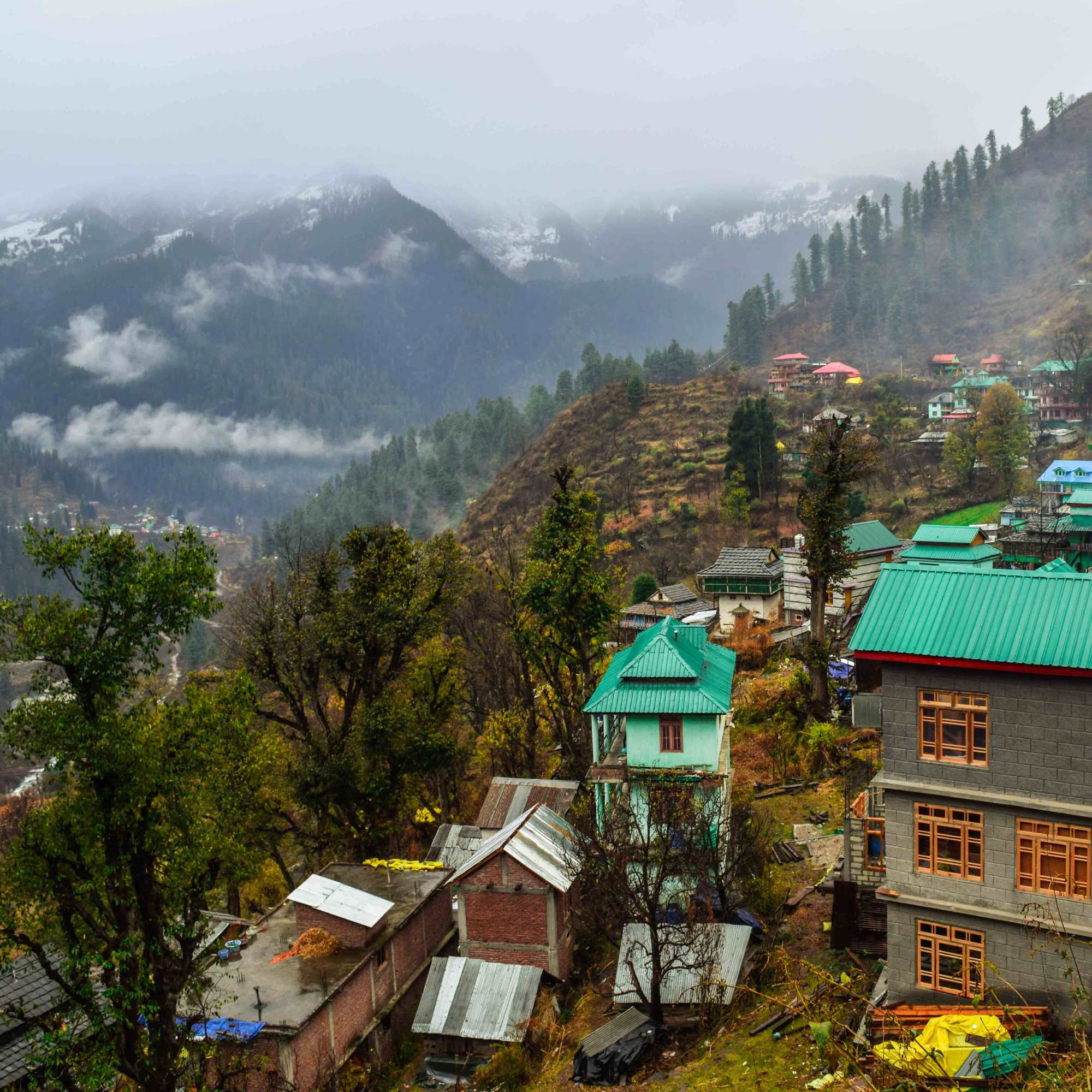
Tosh Village
About 3 km uphill by road
A hillside village at 2,400 metres with mountain views, cafes, guesthouses, and the Jamadagni Rishi Temple. About 3 km uphill from Barshaini by road or foot. The most popular overnight stop in the upper Parvati Valley.
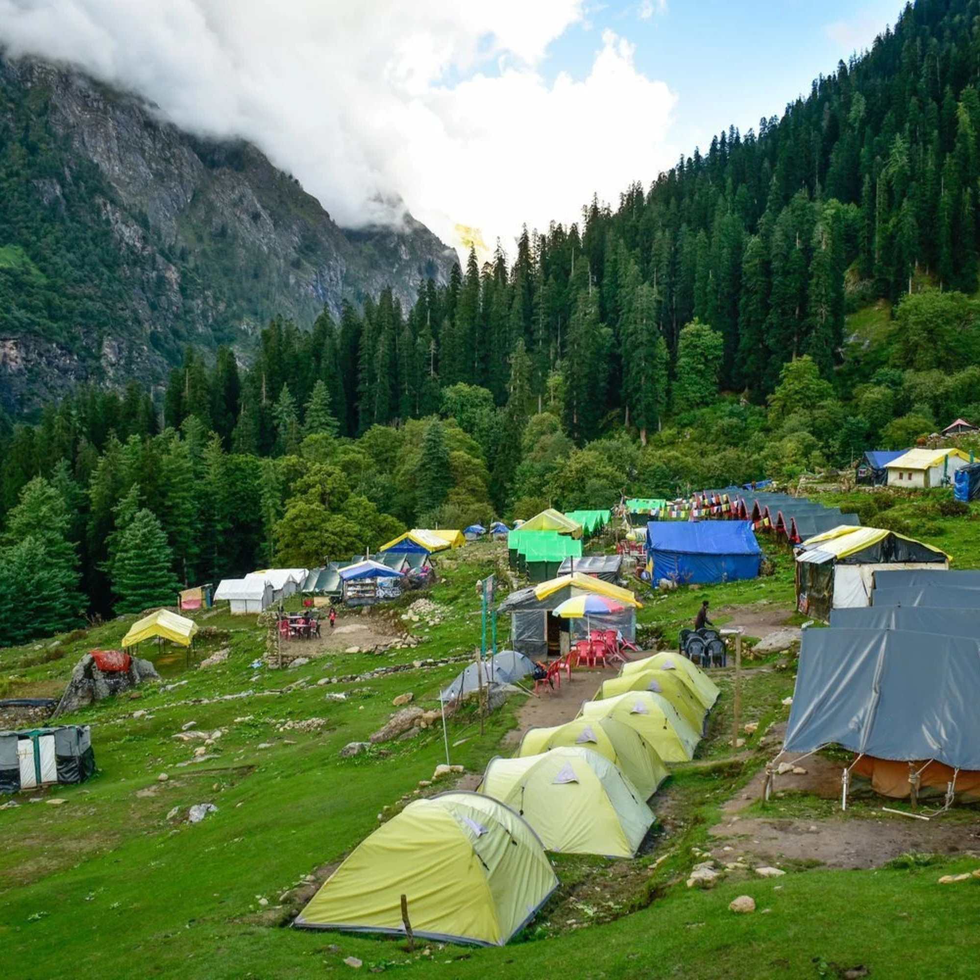
Kheerganga
12 to 14 km trek
A high altitude meadow with natural hot springs at roughly 2,960 metres. Trek starts from Barshaini. Day trek only since July 2024 (camping banned). 12 to 14 km one way via two routes.
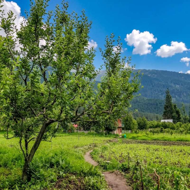
Kalga Village
About 2 km, 30 to 45 min walk uphill
A small village at about 2,280 metres on the right bank, 30 to 45 minutes uphill walk. Homestays, apple orchards, and a quieter alternative to Tosh. Also connects to the Kheerganga trek via the right bank forest trail.
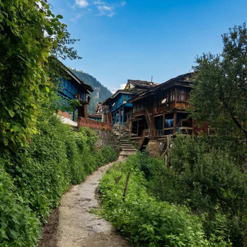
Pulga Village
About 3 km, 30 to 40 min walk
A small village at roughly 2,210 metres on the left bank, 30 to 40 minutes walk after crossing the footbridge. Known for the Fairy Forest, a dense deodar grove above the village.
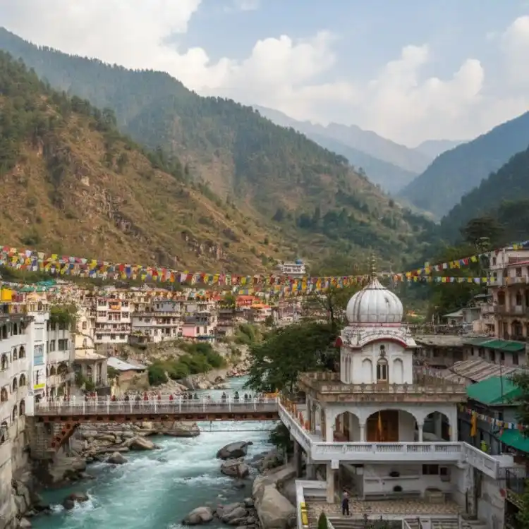
Manikaran Sahib
About 12 km by road
A pilgrimage town with a Gurudwara, Hindu temples, and natural hot springs. On the road between Kasol and Barshaini. Worth a stop on the way in or out.
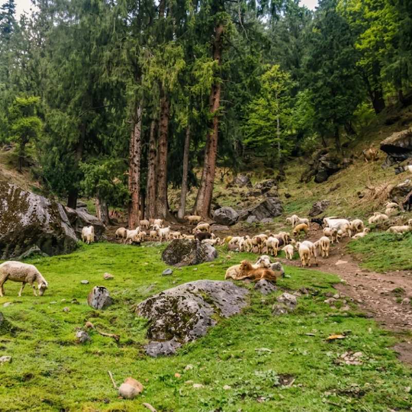
Kutla Village
About 6 km (3 km to Tosh, then 3 km trek)
A tiny grazing settlement at roughly 2,650 metres above Tosh. About 2 to 3 hours trek from Tosh through forest and past a waterfall. A handful of basic homestays and wide mountain views.
Our packages with Barshaini
Curated trips that include a visit to Barshaini.
 4D/3N
4D/3NPerfect Manikaran Kasol Tosh Weekend Getaway
1D Delhi•2D Kasol+1
₹15,999₹19,999SAVE INR 4,000/ person 4D/3N
4D/3NWeekend Trip To Manikaran, Kasol & Tosh
1D Delhi •2D Kasol+1
₹9,999₹14,999SAVE INR 5,000/ person
Frequently Asked Questions
What is Barshaini?
A small settlement at roughly 2,050 metres in the Parvati Valley, dominated by the NHPC Parbati Hydroelectric Project dam where the Tosh Nala meets the Parvati River. It is the last road head in the upper valley and the transit point for treks to Kheerganga, Tosh, Kalga, Pulga, and Kutla. Not a destination in itself. The genuine nature and quiet trails start about 15 minutes away, across the river.
How do I reach Barshaini from Kasol?
From Kasol, take a local bus or shared taxi. The distance is about 18 to 20 km and takes roughly 1 to 1.5 hours by road via Manikaran. Buses run roughly hourly. Taxis charge varying rates, so negotiate before boarding. From Bhuntar (the nearest airport), the total distance is about 50 km.
Is there a road beyond Barshaini?
No. Barshaini is the last road head. The road to Tosh (3 km) is an unstable, unpaved dirt track that washes out in monsoon and is prone to closure. Beyond that, everything is on foot. Kheerganga, Kalga, Pulga, and Kutla are all accessible only by trail.
Can I stay overnight in Barshaini?
Yes, but options are basic. A few guesthouses near the dam. Expect simple rooms, shared facilities, and dal rice meals. The surroundings are industrial, not scenic. Most travellers prefer to stay in Kalga (30 min walk), Tosh (3 km by road), or Pulga (30 min walk) where the views and atmosphere are better. Barshaini works only for a late arrival or a pre dawn Kheerganga start.
Is Barshaini the starting point for the Kheerganga trek?
Yes. Both Kheerganga trek routes start from or near Barshaini. The Nakthan route follows the left bank of the Parvati River. The Kalga route goes up the right bank through forest. The trek is 12 to 14 km one way. Since July 2024, Kheerganga is a day trek only. Overnight camping is banned.
How do I get to Tosh from Barshaini?
Walk or take a jeep from Barshaini. The road is an unpaved, unstable dirt track that continues uphill for about 3 km along the Tosh Nala. Jeeps take about 10 minutes (100 to 300 rupees) in dry weather only. Walking takes 30 to 45 minutes. In monsoon, the road washes out and may be impassable for vehicles.
How do I reach Kalga or Pulga from Barshaini?
Cross the footbridge over the Parvati River at Barshaini. For Kalga, stay on the right bank and walk uphill (30 to 45 minutes). For Pulga, cross the bridge and turn left (30 to 40 minutes). The real nature, forests, and quiet begin within about 15 minutes of crossing the river. Both villages are foot access only.
Is there an ATM in Barshaini?
No. There is no ATM anywhere near Barshaini. The nearest is in Kasol, about 18 to 20 km back, and even that one runs out of cash on busy weekends. Mobile data is erratic here, so UPI and digital payments are unreliable. Physical cash is mandatory for your entire upper valley stay.
Is there mobile network?
Erratic. Jio and Airtel show bars at Barshaini but data drops frequently. Do not count on UPI or app based payments working. Signal weakens further once you start climbing toward the villages above and drops out entirely on the Kheerganga trail.
Is food available at Barshaini?
Tea stalls and a few small eateries near the dam serve Maggi, dal rice, omelettes, and chai. Basic supplies are available. For anything more, stock up in Kasol before arriving.
Is Barshaini worth visiting on its own?
No. It is a functional transit hub at a hydroelectric dam, not a village with activities or atmosphere. But it is the junction every upper Parvati Valley traveller passes through. Knowing the layout, the need for cash, and which direction to walk saves time and confusion on arrival.
Related guides
Posts about Kasol
- Shimla Manali Kasol Itinerary 2026: 7, 8 and 9 Day Routes Without Rushing
- Best Offbeat Places Near Kasol Most Tourists Miss in 2026
- Rasol Village Trek From Kasol 2026: Route, Distance & What to Expect
- Kalga, Pulga & Tulga Villages in 2026: The Offbeat Side of Parvati Valley
- Kheerganga Trek from Kasol 2026: Route, Difficulty, Cost & Best Time
- Snowfall in Kasol 2026: Does It Snow, Best Time & Nearby Snow Places