
Kutla Village
A tiny grazing settlement at roughly 2,650 metres above Tosh, reached by a steep, steady climb through forest and past a waterfall, where a handful of homestays sit on a green meadow between apple orchards and snow covered peaks, and the only sound after dark is the Tosh Nala stream
- Village
- Parvati Valley
- ~2,650 m
- Steep trek from Tosh
- Meadow and apple orchards
- Tosh waterfall en route
- Basic homestays
- No road access
- No ATM, carry cash
- Buddhaban nearby
What makes it special
Kutla is what you get when you walk past the last cafe in Tosh and keep going uphill for another two to three hours. The name comes from Kulvi and means "grazing ground." That is still what it is. A high meadow at roughly 2,650 metres, dotted with rocks, a stream, a few apple orchards, and a handful of seasonal homestays. The permanent population is barely a dozen people. In winter, the snow buries everything and even the locals move lower.
The trek from Tosh is about 3 kilometres but that number is misleading. It is a steep, steady climb with a final stretch that will make your calves burn. You follow the Tosh Nala stream uphill through pine and deodar forest, past walnut trees in the lower section and apple orchards higher up. About halfway, a waterfall drops beside the trail. In peak season (May and June), small tea stalls set up near the waterfall, serving Maggi, chai, and chips. This is the last place where you can buy food before Kutla.
Good footwear matters here. The trail is rocky, root covered in the forest sections, and the last kilometre climbs sharply over loose stone. Sandals and sneakers will slow you down and could twist an ankle. Proper trekking shoes, broken in, are the right call.
When you arrive, the meadow opens up and the mountains close in. On a clear day, snow covered peaks including Papasura and the ridgeline toward Sara Umga Pass fill the sky from almost anywhere in the settlement. The green of the meadow against the white of the peaks is the kind of view that makes the climb worth it. But Kutla is not a village in the way Tosh or Kasol is a village. There are no cafes with menus, no guesthouses with WiFi, no shops. What you find is a few basic rooms run by local families, some seasonal camping setups, and a lot of silence.
Beyond Kutla, the trail continues to Buddhaban, a grassland about 30 minutes to an hour further up at roughly 2,725 metres. Buddhaban serves as a base camp for the Sara Umga La Pass trek, a multi day crossing into the Lahaul Valley. Most people visiting Kutla do not go that far. But if you have an extra half day and reasonable fitness, the walk to Buddhaban and back is worth it for the wider valley views.
One thing you must sort out before you leave Kasol: cash. There is no ATM at Kutla. There is no ATM at Tosh. There is no ATM at Barshaini. The nearest ATM is in Kasol, and it runs out of cash on busy weekends. Mobile signal at Kutla is effectively zero, so UPI, Google Pay, and any digital payment will not work. Withdraw enough physical rupees in Kasol to cover accommodation, meals, jeep fares, and a buffer. Do this before you get on the bus to Barshaini, not after.
Kutla suits solo trekkers and couples looking for a quiet night above the valley noise. People who have done Tosh, liked the views, and wanted the same thing with fewer people around. Backpackers comfortable with very basic facilities, no connectivity, and cold nights even in summer. If you are the kind of traveller who checks phone signal strength before booking a room, Kutla is not your place.
And who should skip it. Families with young children, elderly travellers, and anyone with health concerns at altitude. The trek has a genuinely steep final section, the facilities are basic, and there is no medical help anywhere nearby. If something goes wrong, you are two to three hours of walking from the nearest road at Tosh, and even Tosh does not have a doctor.
Quick answers
- What is Kutla Village?
- A tiny grazing settlement at roughly 2,650 metres above Tosh in the upper Parvati Valley. About 3 km from Tosh by a steep, steady trail (2 to 3 hours uphill). A handful of basic homestays and seasonal campsites on a green meadow with apple orchards and snow peak views. No road, no ATM, no signal. Withdraw cash in Kasol before the bus.
- How much time do I need?
- One night. Trek up from Tosh in the morning, spend the evening and night, trek back the next morning. A day hike from Tosh is possible if you start early, but you lose the evening and morning light, which is the best part of being here.
- Is the trek difficult?
- Steep and steady. The 3 km distance is deceptive. The elevation gain is roughly 250 to 300 metres from Tosh with a sharp final section over rocky ground. Good trekking shoes are essential. Anyone with basic fitness can do it, but it is not a casual walk.
Quick facts
Everything you need to know at a glance.
At a glance
- Location
- Above Tosh in the upper Parvati Valley. Kullu district, Himachal Pradesh.
- Altitude
- Approximately 2,650 m (about 8,700 feet).
- Trek distance
- About 3 km one way from Tosh. 2 to 3 hours uphill (steep, steady climb), 1.5 to 2 hours downhill.
- Nearest town
- Tosh (3 km by trail), then Barshaini (3 km further by road), then Kasol (18 to 20 km by road).
- Time needed
- One night recommended. Day hike possible but rushed.
- Entry fee
- None.
- Difficulty
- Steep, steady climb. Good trekking shoes required. Not technical, but not a casual walk either.
On the ground
- Mobile network
- Effectively zero. Assume offline for your entire stay. No UPI, no digital payments.
- Food
- Homestay meals only (dal rice, roti, Maggi, chai). Seasonal tea stall near the waterfall midway. Carry snacks from Tosh.
- ATM and cash
- No ATM at Kutla, Tosh, or Barshaini. Withdraw cash in Kasol before the bus. Kasol ATM runs out on busy weekends.
- Accommodation
- A few basic homestays and seasonal campsites. 500 to 1000 rupees per night. No hot water. Intermittent electricity.
- Safety
- No medical facility. Nearest help in Kasol or Manikaran, 2 to 3 hours away. Carry first aid and torch.
Seasonal weather
- March to June20°3°Spring and Summer
- July to September16°8°Monsoon
- October to November14°-2°Autumn
- December to February5°-8°Winter
Suitable for
- Couples — suitable
- Families — not suitable
- Seniors — not suitable
- Solo — suitable
- First-timers — with some care
- Pet-friendly — not suitable
How to reach Kutla Village
3 approach routes, with seasonal access.
From Tosh (on foot)
Generally April to November. Trail can be muddy in monsoon, snow covered in winter.- Distance
- About 3 km one way
- Time
- 2 to 3 hours uphill, 1.5 to 2 hours downhill
- Road
- Mountain trail through forest, past a waterfall, along the Tosh Nala stream. No road access.
From the upper end of Tosh village, past the Jamadagni Rishi Temple, the trail heads uphill along the Tosh Nala stream. The first section passes through pine and deodar forest with walnut trees. About halfway, a waterfall appears beside the trail with seasonal tea stalls nearby. After the waterfall, the trail steepens for the final stretch into Kutla. A fallen tree with prayer flags marks the entrance to the settlement. The trail is well worn but rocky and steep in the last kilometre. Proper trekking shoes recommended.
From Kasol (by road to Tosh, then trek)
Road year round to Barshaini. Trek generally April to November.- Distance
- About 21 km by road to Barshaini, 3 km road or walk to Tosh, then 3 km trek
- Time
- 1 to 1.5 hours by road, then 2 to 3 hours trekking
- Road
- State road via Manikaran to Barshaini, rough road to Tosh, mountain trail to Kutla.
From Kasol, take a taxi or bus to Barshaini (about 21 km, 1 to 1.5 hours via Manikaran). From Barshaini, walk 3 km uphill to Tosh (30 to 45 minutes) or take a jeep. From the top of Tosh, the Kutla trek begins. Budget a full day: morning travel from Kasol, afternoon trek to Kutla.
From Delhi (overnight bus)
Year round from Delhi. Trek season April to November.- Distance
- About 520 km to Bhuntar, then 50 km to Barshaini, then walk to Tosh, then trek to Kutla
- Time
- Day 1: Delhi to Kasol/Tosh. Day 2: Trek to Kutla. Day 3: Return.
- Road
- National highway to Bhuntar, valley road to Barshaini, rough road to Tosh, trail to Kutla.
Overnight Volvo or semi sleeper bus from Delhi to Bhuntar or Kasol (10 to 12 hours). From Kasol, continue to Barshaini, then Tosh, then trek to Kutla. You need at least three days: one for travel, one for the trek and stay, one for return. Staying a night in Tosh before trekking to Kutla makes the logistics easier and gives you time to acclimatise.
Best time to visit
Season by season, so you can plan around the weather rather than hope.
- Recommended
Spring and early summer
April to June
Dry trail, green meadow, the best overall window for a first visit.
- Weather
- 3 to 20 degrees. Warm days, cold nights.
- Trail
- Dry and clear. Best condition.
- Crowds
- Low at Kutla. Moderate at Tosh on weekends.
Snow melts off the trail by April in most years. By May the meadow is green, the apple orchards are filling out, and the trail is dry and clear. This is the most comfortable window for the trek. May and June weekends can bring more trekkers through Tosh, some of whom continue to Kutla. Midweek visits are quieter. The waterfall midway is flowing well. Nights are cold even in June. Bring a proper jacket.
Monsoon
July to September
Very green but the trail gets muddy, leeches are likely, and the approach road is landslide prone.
- Weather
- 8 to 16 degrees. Frequent rain.
- Trail
- Muddy, slippery. Leeches common.
- Road access
- Landslide risk on the approach from Manikaran.
The valley turns intensely green and the meadow at Kutla is thick with alpine flowers. But the trail gets slippery and muddy, leeches are common in the forest sections, and the road from Manikaran to Barshaini is landslide prone. Stream crossings can become difficult after heavy rain. The waterfall runs hard. Not dangerous for experienced trekkers, but significantly less comfortable. Most homestay operators at Kutla scale down in monsoon.
- Recommended
Autumn
September to November
Post monsoon clarity, the sharpest views, and the quietest the meadow gets. October is the peak month.
- Weather
- Minus 2 to 14 degrees. Cold nights.
- Views
- Best clarity of the year.
- Crowds
- Very low. Often you have the meadow to yourself.
The best window for photography and quiet. Post monsoon air clears the haze and the peaks stand out sharply. The meadow is still green from the rains, the trail dries out, and the crowds thin to almost nobody. October is the single best month to visit Kutla. November gets properly cold at night and some homestays may close. Carry warm layers.
Winter
December to February
Snow covered, genuinely cold, and most homestays close. For experienced winter trekkers only.
- Weather
- Minus 8 to 5 degrees. Heavy snow possible.
- Trail
- Snow covered. Can be hard to follow.
- Accommodation
- Most places close. Confirm before going.
Snow covers the meadow and the trail from roughly December onward. Kutla sits higher than Tosh and holds snow longer. Temperatures drop well below zero at night. Most homestays and campsites close. The trail can be hard to follow under snow. Only attempt this in winter if you have proper gear, experience in snow conditions, and someone in Tosh who knows you are going up.
Things to see & do
4 things worth your time at Kutla Village.
Trek from Tosh through the waterfall
2 to 3 hours one wayThe trek itself is half the experience. The trail follows the Tosh Nala stream uphill through changing forest. Pine and deodar with walnut trees in the lower section. About halfway, a waterfall drops right beside the trail. In May and June, small tea stalls operate here, and you can sit with a Maggi watching the water come down while Tosh shrinks below you. After the waterfall, the trail steepens for the last push into Kutla. The forest opens up, the meadow appears, and the peaks fill the sky. Do not rush this section. The climb is steep and you will want to stop and look.
Sit with the mountain views
As long as you wantFrom the meadow, you can see snow covered peaks including Papasura and the ridgeline toward Sara Umga Pass. The light changes through the day. Morning mist lifts slowly off the valley floor. Evening turns the peaks golden. If the sky is clear, the stars at night are some of the best in the Parvati Valley because there is zero light pollution. Find a rock on the meadow, sit down, and stay there. Your phone does not work anyway.
Walk to Buddhaban meadow
30 minutes to 1 hour one way from KutlaBuddhaban is a grassland about 30 minutes to an hour uphill from Kutla, at roughly 2,725 metres. It sits on the bank of the Tosh Nala and serves as a base camp for the Sara Umga La Pass trek into Lahaul. The walk to Buddhaban and back makes a solid half day addition. The views widen as you climb, and the campsite area, surrounded by pine trees with the stream running through, is worth an hour of sitting before you head back down.
Walk through the apple orchards
30 minutes to an hourKutla's meadow is dotted with apple orchards, and a slow walk through them is one of the small pleasures of being here. Late summer, when the trees are heavy with fruit, is the best time. The orchards are managed by local families. Do not pick fruit without asking. The older trees, twisted and weathered at this altitude, are worth looking at even outside fruit season.
Know before you visit Kutla Village
The practical bits, from people who have been.
The trek and what to expect3 km from Tosh, 2 to 3 hours of steep, steady climbing. Good footwear essential. Waterfall midway with seasonal tea stalls.
The trail starts from the upper end of Tosh village, past the Jamadagni Rishi Temple, and heads uphill along the Tosh Nala stream. The first section through forest is steady climbing. About halfway, a waterfall appears beside the trail. In peak season, tea stalls set up here. After the waterfall, the trail gets noticeably steeper for the final kilometre. A fallen tree decorated with prayer flags marks the entrance to Kutla.
The total distance is about 3 km but the elevation gain of roughly 250 to 300 metres from Tosh makes it feel longer. The last stretch is steep, rocky, and uneven. Good trekking shoes are essential. Sandals, sneakers, and new shoes you have not broken in are all bad ideas on this trail. Carry at least 1.5 litres of water. The trail is clear in dry weather but slippery after rain. In monsoon, expect mud and leeches in the forest sections.
Where to stay and eatA few basic homestays and seasonal campsites. 500 to 1000 rupees a night. Dal rice meals. No hot water, no WiFi.
A handful of homestays and seasonal campsites operate at Kutla, mostly run by local families. A basic room, shared facilities, no attached bathroom, no hot water, and electricity that comes and goes. Prices generally range from 500 to 1000 rupees per night. Meals are dal rice, roti, Maggi, and chai. There is no menu and no variety. You eat what is available.
In peak season (May, June, and October), confirm availability at Tosh before trekking up. Some campsites offer tented setups with sleeping bags and mattresses. In off season, most places scale down or close entirely.
Cash, signal, and safetyWithdraw cash in Kasol before the bus. No ATM, no signal, no UPI anywhere on the route. Carry medicines and a torch.
Sort your cash out before you leave Kasol. There is no ATM at Kutla, Tosh, or Barshaini. The nearest ATM is in Kasol, about 24 km back by trail and road, and it runs out of cash on busy weekends. Withdraw enough before you get on the bus to Barshaini.
There is no mobile signal at Kutla. BSNL and Airtel may catch a bar in rare patches, but assume you are offline for your entire stay. UPI, Google Pay, and any digital payment will not work. Homestays and dhabas are cash only.
No medical facility either. The nearest doctor is in Manikaran or Kasol, 2 to 3 hours away by trail and road. Carry basic medicines, a torch, a first aid kit, and enough warm clothing for a cold night even in summer. Temperatures can drop to 5 to 7 degrees on a bad night in May.
Tell someone in Tosh where you are going and when you plan to return.
Beyond Kutla: Buddhaban and Sara Umga PassBuddhaban meadow is 30 min to 1 hour further up. Sara Umga La is a multi day pass crossing into Lahaul for experienced trekkers only.
Buddhaban is a grassland about 30 minutes to an hour beyond Kutla, at roughly 2,725 metres. It serves as a base camp for the Sara Umga La Pass trek, a multi day route that crosses into the Lahaul Valley. The pass itself requires proper equipment, experience, and ideally a guide. It is not a casual extension of the Kutla trek.
For most visitors, walking to Buddhaban and back is a solid half day addition from Kutla. The meadow, the stream, and the views are wider than at Kutla, and the solitude is deeper. Going further toward the glacier area beyond Buddhaban should only be attempted by experienced trekkers who know the terrain.
Nearby attractions
Other places worth the detour.
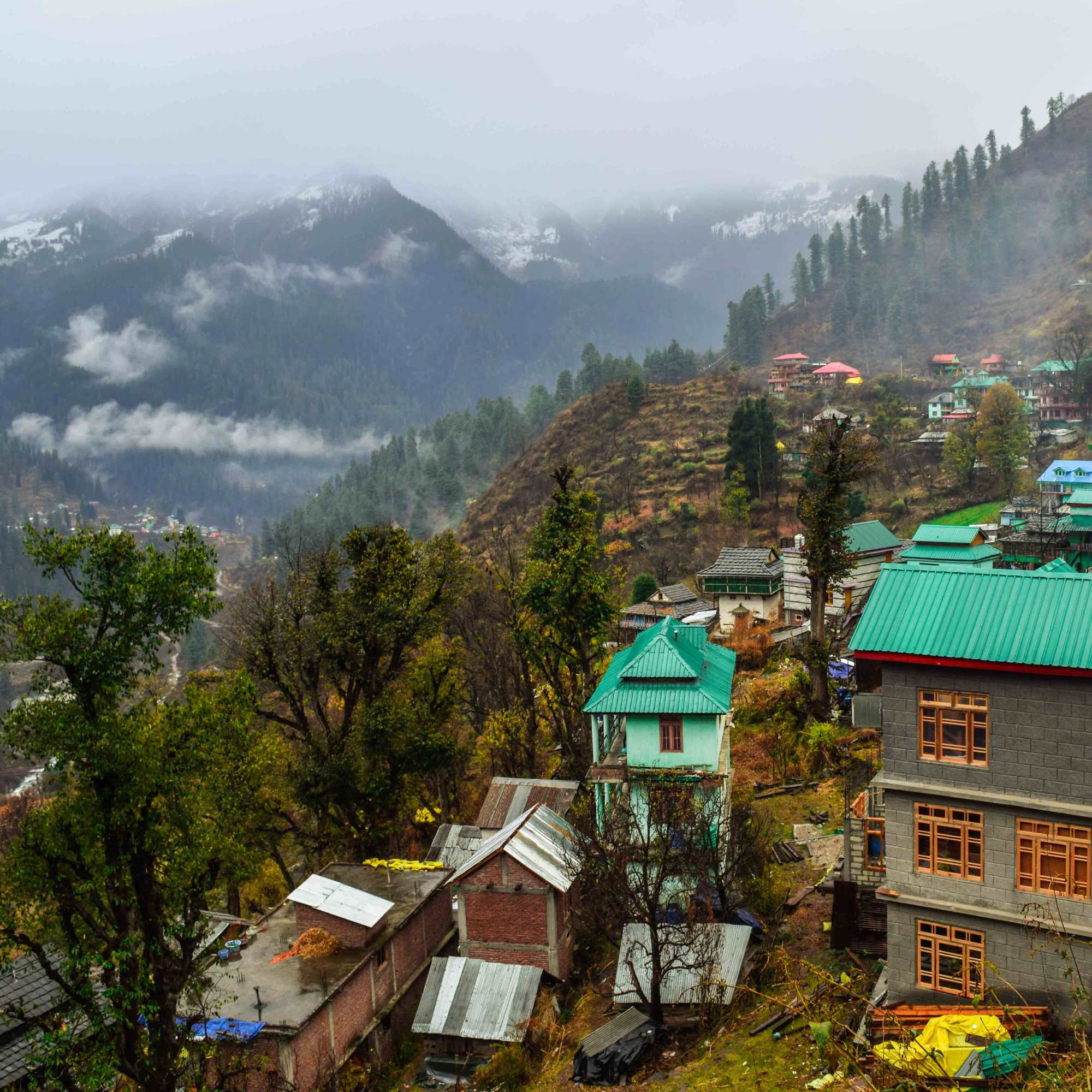
Tosh Village
About 3 km, 1.5 to 2 hours downhill
The starting point for the Kutla trek. A hillside village at 2,400 metres with mountain views, cafes, guesthouses, and the Jamadagni Rishi Temple. Most people stay at Tosh before and after Kutla.
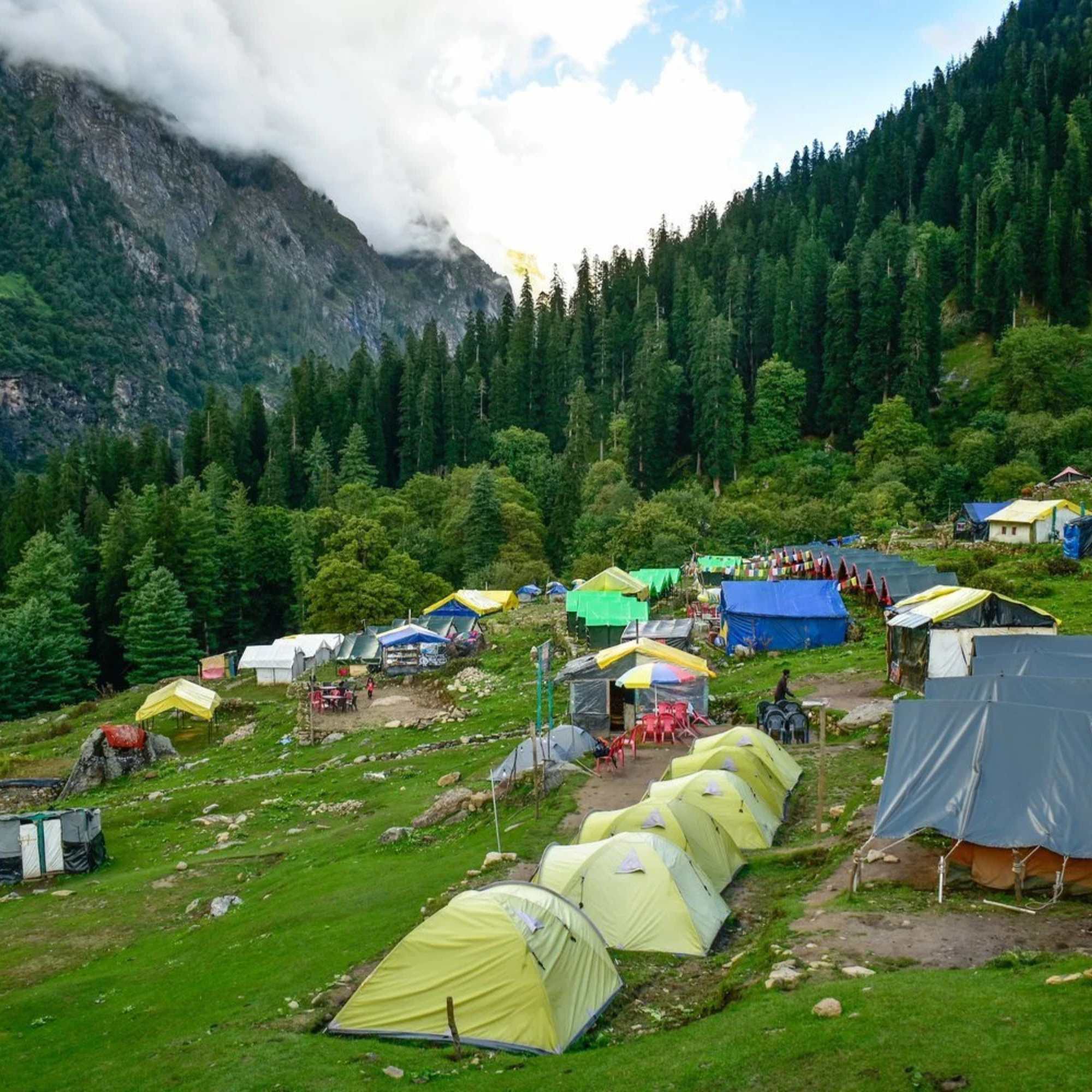
Kheerganga
About 4 to 5 hours trek from Barshaini (separate trail)
A high altitude meadow with natural hot springs at roughly 2,960 metres. The trek starts from Barshaini, not Tosh. A different route from Kutla, but many travellers combine both in one Parvati Valley trip. Day trek only since the 2024 camping ban.
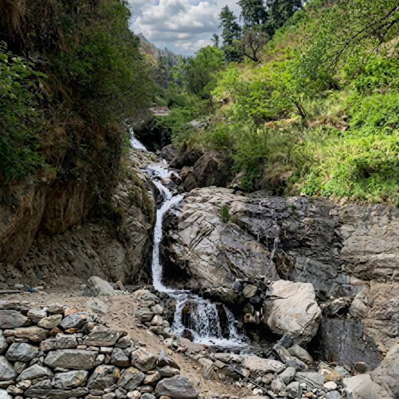
Barshaini
About 3 km downhill from Tosh (6 km from Kutla)
The road head where the Tosh Nala meets the Parvati River. Transit point for both the Tosh/Kutla trail and the Kheerganga trek. A few guesthouses and food stalls.
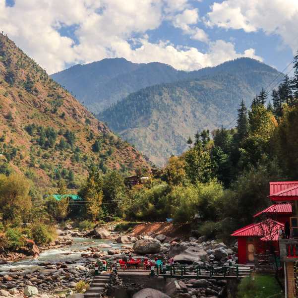
Kasol
About 24 km from Kutla (trek plus road)
The main backpacker hub of the Parvati Valley. Cafes, hostels, shops, and the starting point for transport to Barshaini and Tosh.
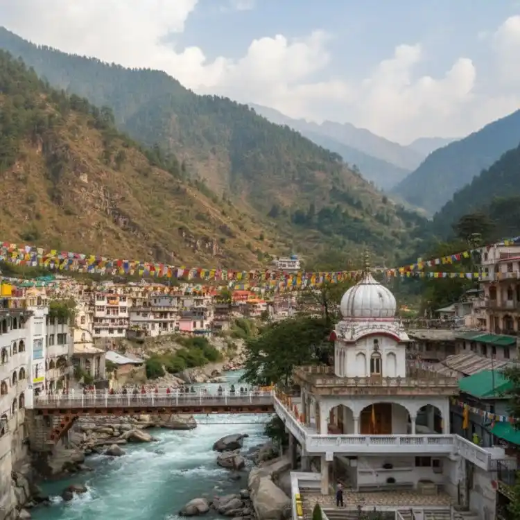
Manikaran Sahib
About 16 km from Tosh by road
A pilgrimage town with a Gurudwara, Hindu temples, and natural hot springs. On the road between Kasol and Barshaini. Worth a stop on the way in or out.
Our packages with Kutla Village
Curated trips that include a visit to Kutla Village.
 4D/3N
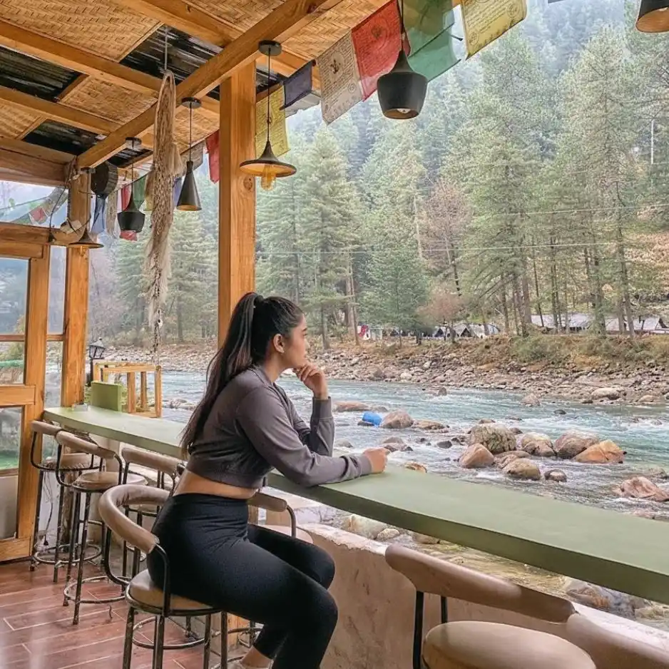
4D/3NPerfect Manikaran Kasol Tosh Weekend Getaway
1D Delhi•2D Kasol+1
₹15,999₹19,999SAVE INR 4,000/ person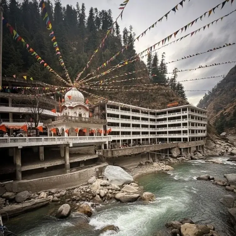 4D/3N
4D/3NWeekend Trip To Manikaran, Kasol & Tosh
1D Delhi •2D Kasol+1
₹9,999₹14,999SAVE INR 5,000/ person
Frequently Asked Questions
What is Kutla Village?
A tiny grazing settlement at roughly 2,650 metres above Tosh in the upper Parvati Valley. The name means 'grazing ground' in Kulvi. A handful of homestays and seasonal campsites sit on a green meadow with apple orchards and views of snow covered peaks. Accessible only by a 2 to 3 hour trek from Tosh. No road, no shops, no mobile signal.
How do I reach Kutla from Tosh?
Walk uphill from the upper end of Tosh village past the Jamadagni Rishi Temple. The trail follows the Tosh Nala stream for about 3 km. A waterfall with seasonal tea stalls appears halfway. The last kilometre is steep over loose stone. Total time is 2 to 3 hours depending on pace and fitness.
How difficult is the Kutla trek?
Steep and steady. The 3 km distance sounds short but the elevation gain of roughly 250 to 300 metres from Tosh includes a sharp final section over rocky ground. Good trekking shoes are essential, not optional. Anyone with basic fitness can do it, but it is not a casual stroll. The descent takes about 1.5 to 2 hours.
Can I stay overnight at Kutla?
Yes. A few basic homestays and seasonal campsites. Simple rooms, shared facilities, no hot water, intermittent electricity. Roughly 500 to 1000 rupees per night. Meals are dal rice, roti, and chai. Confirm availability in Tosh before trekking up, especially in off season.
What is the best time to visit Kutla?
April to June and September to November. October is the best single month for clear views and thin crowds. Monsoon (July to September) makes the trail muddy and leech prone. Winter (December to February) brings heavy snow and most places close.
Is there mobile network at Kutla?
No. Assume you will be completely offline. BSNL and Airtel may catch a bar in rare patches, but you cannot count on calls, data, or any app based payment.
Do I need to carry cash?
Yes, and sort this out before you leave Kasol. There is no ATM at Kutla, Tosh, or Barshaini. The nearest ATM is in Kasol and it runs out on busy weekends. Mobile signal is too unreliable for UPI. Withdraw enough physical cash for accommodation, food, and the return trip before you get on the bus.
Is Kutla suitable for families?
Not recommended for young children or elderly travellers. The steep trek and very basic facilities make it unsuitable for most family trips. Active teenagers who can handle the climb and do not mind basic conditions can enjoy it.
What is Buddhaban?
A grassland about 30 minutes to an hour beyond Kutla, at roughly 2,725 metres. Base camp for the Sara Umga La Pass trek into Lahaul. A good half day walk from Kutla with wider views.
Can I do Kutla as a day trip from Tosh?
Possible but you lose the best parts. Start early, allow 2 to 3 hours up and 1.5 to 2 hours down, with an hour or two at the top. The evening and morning light are what make Kutla worth staying for. One night is the right call.
How is Kutla different from Tosh?
Kutla is 250 to 300 metres higher, has no cafes, no shops, no signal, and far fewer visitors. Tosh has guesthouses, restaurants, WiFi, and a social scene. Kutla is for people who want what Tosh was before the cafes arrived.
What should I carry?
Trekking shoes (broken in, not new), at least 1.5 litres of water, snacks, a warm jacket even in summer, torch, basic first aid, enough cash from Kasol, and rain protection. If staying overnight, carry a change of clothes.
Related guides
Posts about Kasol
- Shimla Manali Kasol Itinerary 2026: 7, 8 and 9 Day Routes Without Rushing
- Best Offbeat Places Near Kasol Most Tourists Miss in 2026
- Rasol Village Trek From Kasol 2026: Route, Distance & What to Expect
- Kalga, Pulga & Tulga Villages in 2026: The Offbeat Side of Parvati Valley
- Kheerganga Trek from Kasol 2026: Route, Difficulty, Cost & Best Time
- Snowfall in Kasol 2026: Does It Snow, Best Time & Nearby Snow Places