
Parvati River
The river that made the valley. Originating from the Man Talai Glacier below the Pin Parbati Pass at over 5,000 metres, it flows roughly 150 kilometres through the entire Parvati Valley, past Kasol, through Manikaran, and into the Beas River at Bhuntar, and it is the constant companion of every walk, every cafe, and every campsite in the valley
- River
- Parvati Valley
- ~1,580 m at Kasol
- Runs through town
- Man Talai Glacier origin
- ~150 km total length
- Joins Beas at Bhuntar
- No entry fee
- Year round
- Riverside walks and camping
What makes it special
The Parvati River is not a place you go to. It is the thing you hear in the background of everything you do in Kasol. Sitting in a cafe, you hear it. Walking to your guesthouse at night, you hear it. Crossing the footbridge to Chalal, you are directly above it. It splits Kasol into two halves, and the sound of water moving over stone is what the valley actually sounds like.
The river originates from the Man Talai Glacier, below the Pin Parbati Pass at over 5,000 metres. From there it flows roughly 150 kilometres through the entire Parvati Valley, passing Kheerganga, Tosh, Manikaran, and Kasol before joining the Beas River at Bhuntar. The valley exists because of this river. The name is the same. When people say "Parvati Valley," they are describing the space this river carved.
In Kasol specifically, the river is wide, rocky, and runs fast. The water is cold year round. It is glacial melt, not rainwater, and the temperature reminds you of that the moment you touch it. In the dry months (roughly October to May), the river runs clear, the water level drops, and large boulders emerge along the banks. You can sit on them. You can walk along the edge. Many people do. In monsoon (July to September), the river turns muddy brown, rises dramatically, and becomes genuinely dangerous. The sound changes too. In winter it is a steady hum. In monsoon it is a roar.
Here is the honest framing. The Parvati River is not a standalone attraction in the way a waterfall or a lake is. Nobody travels to Kasol "to see the river." You come for the valley, the cafes, the treks, the village walks, and the river is what ties all of it together. It is the backdrop, the soundtrack, and the thing that makes the air feel different from any town on a road. If you want to actively engage with the river rather than just be near it, your options are riverside walks, sitting on the boulders, camping on the banks through organised campsites, and fishing (which requires a permit from the forest department). Rafting on the Parvati itself is not really a thing. The established white water rafting in this region runs on the Beas River near the Bhuntar confluence, where the Parvati meets the Beas, roughly 31 km downstream from Kasol.
The best spots to experience the river in Kasol are the footbridge near the market that leads to Chalal, the stretch along the Nature Park, and the river boulders below the main road on the quieter side of town. Early mornings, when the cafes are still closed and the main strip is empty, the river is all you hear.
Quick answers
- What is the Parvati River?
- A Himalayan river that originates from the Man Talai Glacier below the Pin Parbati Pass and flows roughly 150 km through the Parvati Valley before joining the Beas River at Bhuntar. It runs directly through Kasol, splitting the town, and is the defining feature of the valley. Not a standalone destination but the constant backdrop of everything in the area.
- Can I swim or wade in it?
- The water is glacier fed and very cold year round. In dry months, when the level drops and rocks emerge, some people wade in the shallow edges. But the current is stronger than it looks, and every year there are incidents of people underestimating it. Stay cautious, stay shallow, and never wade in monsoon when the river is fast and unpredictable.
- What are the best spots to see the river in Kasol?
- The footbridge near Kasol market that leads to Chalal. The stretch along the Nature Park. The boulders on the quieter bank below the main road. All free, all accessible on foot, and best experienced in the early morning before the town wakes up.
Quick facts
Everything you need to know at a glance.
At a glance
- Location
- Runs through the entire Parvati Valley, including Kasol. Kullu district, Himachal Pradesh.
- Origin
- Man Talai Glacier, below Pin Parbati Pass, at over 5,000 m elevation.
- Approximate length
- Roughly 150 km from source to confluence with the Beas River at Bhuntar.
- Altitude at Kasol
- Approximately 1,580 m (about 5,180 feet).
- Entry fee
- None. The river is accessible from multiple points in Kasol.
- Time needed
- Not applicable as a single stop. The river is the valley's constant companion. A riverside walk takes 20 to 60 minutes.
On the ground
- Access
- Multiple points along Kasol. The footbridge to Chalal, the Nature Park stretch, and boulders below the main road are the easiest.
- Safety
- Glacier fed, fast, and cold. Rocks near the water are slippery. Do not swim in deep sections. Do not go near the banks in monsoon. Current is stronger than it looks.
- Fishing
- The river has trout. Fishing requires a permit from the forest department. Check locally for current rules.
- Camping
- Several organised campsites operate along the river banks near Kasol. Private camping at unmarked spots is not advisable, especially in monsoon.
- Rafting
- No established rafting on the Parvati. The main white water rafting in the region runs on the Beas River near the Bhuntar confluence, about 31 km from Kasol.
Seasonal weather
- March to June28°8°Spring and Summer
- July to September26°14°Monsoon
- October to November22°4°Autumn
- December to February14°-2°Winter
Suitable for
- Couples — suitable
- Families — suitable
- Seniors — suitable
- Solo — suitable
- First-timers — suitable
- Pet-friendly — with some care
How to reach Parvati River
2 approach routes, with seasonal access.
From Kasol main market (on foot)
Year round. Approach with caution during monsoon.- Distance
- Under 500 metres to the nearest riverbank
- Time
- 5 minutes walking
- Road
- Paved road and then open riverbank. Flat.
From anywhere in Kasol's main market, walk toward the river side of the road. The footbridge to Chalal is the most popular access point, about 300 metres from the market centre. The Nature Park is about 500 metres along the road toward Manikaran. Boulders along the quieter bank are accessible via short paths from the main road. No equipment or guide needed.
From Bhuntar (by road to Kasol)
Year round. Monsoon can cause occasional road disruptions.- Distance
- About 31 km to Kasol
- Time
- 1 to 1.5 hours by road
- Road
- State highway along the Parvati Valley. The road follows the river for most of the journey.
From Bhuntar (nearest airport and highway junction), take the Parvati Valley road toward Manikaran. Kasol is about 31 km. Buses run frequently. Taxis available. The road itself follows the Parvati River for most of the way, so you will see the river well before you reach Kasol.
Best time to visit
Season by season, so you can plan around the weather rather than hope.
- Recommended
Spring and early summer
April to June
Clear water, exposed boulders, and the best months for riverside sitting.
- Water level
- Moderate. Boulders exposed. Edges accessible.
- Water clarity
- Clear to slightly milky from snowmelt.
- Safety
- Safe near the edges. Do not wade into deeper sections.
The river runs clear, the water level is moderate, and large boulders emerge along the banks. This is the best time for sitting by the river, walking along the edges, and camping on the banks. The sound of the water is steady and calming rather than overwhelming. Weekends bring more visitors to the popular spots near the Chalal bridge.
Monsoon
July to September
High, fast, muddy, and genuinely dangerous. Stay well back from the banks.
- Water level
- Very high. Banks may flood.
- Current
- Fast and unpredictable. Genuinely dangerous.
- Safety
- Stay well back from the bank. Do not enter the water.
The river rises dramatically. Water turns muddy brown. The current is fast and unpredictable. Boulders that were sitting spots in April are now underwater. This is when the river is at its most powerful and least forgiving. Do not go near the edges. Do not wade. Several drownings have occurred in monsoon over the years when visitors underestimated the current. The river is still beautiful to watch, but from a safe distance.
- Recommended
Autumn
October to November
Post monsoon clarity, dropping water levels, and the river at its most photogenic.
- Water level
- Dropping. Boulders reappearing.
- Water clarity
- Clearing. By late October, often very clear.
- Crowds
- Low. This is the quiet window.
The water starts clearing after the rains. Levels drop. Boulders reappear. The air is clean, the light is sharp, and the river looks its best. October is the single best month for riverside time in Kasol. The sound is gentler, the edges are accessible again, and the valley feels wide and open.
Winter
December to February
Low water, cold air, and the quietest riverside experience of the year.
- Water level
- Lowest of the year. Core channel only.
- Temperature
- Air: minus 2 to 14. Water: extremely cold.
- Experience
- Quiet, still, best with warm layers.
Water level is at its lowest. The river narrows to its core channel. Boulders and gravel banks are fully exposed. The water is clear but biting cold. The air temperature makes sitting by the river for long periods uncomfortable without proper layers. But a short morning walk along the bank in winter sunlight, with the river running quiet and narrow, is one of the most peaceful things you can do in Kasol.
Things to see & do
4 things worth your time at Parvati River.
Walk to the Chalal footbridge and across
30 to 60 minutes round tripThe metal footbridge near Kasol market is where most people first see the Parvati River up close. Stand on the bridge and look upstream. The water moves fast below you, pine trees line both banks, and the trail to Chalal continues on the other side. Crossing the bridge is the start of the walk to Chalal Village, a 30 minute riverside trail that is one of the best easy walks from Kasol. Even if you do not go all the way to Chalal, standing on the bridge for five minutes is worth it.
Sit on the river boulders
As long as you wantIn the dry months (roughly October to May), large boulders emerge along the river banks. The quieter side of the river, away from the main road, has several accessible spots where you can climb down and sit directly on the rocks with the water rushing past. Bring a book, a coffee, or nothing. One thing to watch: the rocks closest to the water are often wet from spray and can be slippery, especially in the mornings. Wear shoes with grip, not flip flops, and test your footing before settling in. Do not do this in monsoon when these boulders are underwater and the current is dangerous.
Walk along the Nature Park stretch
20 to 40 minutesThe Kasol Nature Park sits on the bank of the Parvati River, and several viewpoints inside the park give you a clear, safe view of the water. This is the easiest, most family friendly way to experience the river. Flat paths, benches, and shade. The park is about 500 metres from the market centre.
Riverside camping (organised campsites)
OvernightSeveral campsites along the river banks near Kasol offer tented stays with the river as your neighbour. Swiss tents, dome tents, and family setups are common. Prices and availability change with the season, so book ahead in peak months and confirm directly. Camping on unmarked spots by the river is not advisable, especially in monsoon when water levels can rise unexpectedly overnight.
Know before you visit Parvati River
The practical bits, from people who have been.
River safety is not optionalGlacier fed, cold, and faster than it looks. Rocks are slippery near the water. Never wade in monsoon. Stay cautious even in dry months.
The Parvati River looks calmer than it is. The current beneath the surface is stronger than what you see on top, and the water is cold enough to cramp muscles quickly. Rocks along the bank and in the shallows are often covered in a thin film of algae or wet moss, making them slippery even on sunny days. If you are climbing down to the boulders or walking along the edge, wear shoes with grip and test every step before putting your weight down.
In monsoon (July to September), the river is genuinely dangerous. Water levels rise fast, banks flood, and the current can pull you under in seconds. Several drownings have occurred over the years, almost always because someone underestimated the river in high water.
Even in dry months, do not swim in deep sections. Wading in shallow edges is common and usually fine, but stay where you can see the bottom and keep your footing. If you are with children, hold their hands near the water at all times. The river does not forgive carelessness.
Fishing and permitsTrout fishing is possible but requires a permit from the forest department. Check locally.
The Parvati River has trout, and fishing is technically possible at certain stretches. However, a permit from the forest department is required. Rules around fishing seasons, catch limits, and allowed stretches can change. Check with the forest department office in Kullu or ask your guesthouse in Kasol for current information before planning a fishing trip. Fishing without a permit can result in a fine.
Camping by the riverUse organised campsites. Avoid unmarked spots, especially in monsoon when water can rise overnight.
Several organised campsites operate near Kasol along the river banks. These typically offer tents, basic meals, and bonfire setups. Prices and availability vary by season. Book directly with the campsite or through your accommodation in Kasol.
Setting up camp at unmarked spots by the river is risky, particularly in monsoon. Water levels can rise significantly overnight without warning. Even in dry months, stick to areas where other campers or operators are present. Carry a torch, basic supplies, and let someone know where you are camping.
When the river changes characterCalm and clear October to May. High, fast, and muddy July to September. Two very different rivers.
The Parvati River is essentially two different rivers depending on the season. From roughly October to May, the water is clear, the level is low to moderate, boulders line the banks, and you can sit at the edge safely. From July to September, monsoon transforms it. The water turns brown, the level rises several feet, and the sound goes from a hum to a roar. Plan your riverside time accordingly. The monsoon river is impressive to watch from a safe distance but not safe to interact with.
Worth checking. Local conditions, campsite availability, and fishing rules can shift with the season. Ask at your guesthouse in Kasol for the latest before heading to the river.
Nearby attractions
Other places worth the detour.
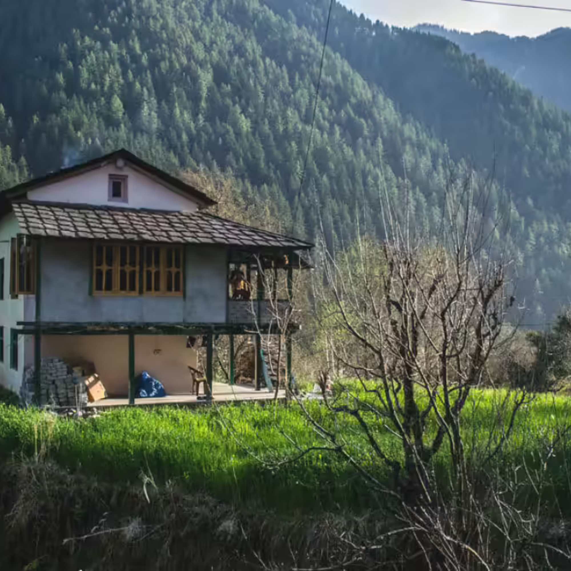
Chalal Village
About 1.5 km, 30 minutes walk across the river from Kasol
The walk to Chalal starts by crossing the Parvati River on the footbridge near Kasol market. The trail follows the river upstream through pine trees. Cafes, guesthouses, and the starting point for the Rasol trek.
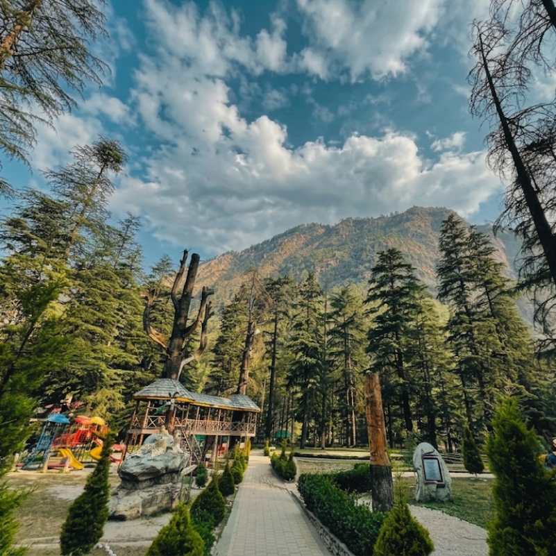
Kasol Nature Park
About 500 metres from Kasol market
A small maintained park right on the bank of the Parvati River. Flat walking trails, benches with river views, and tall trees. The easiest, most family friendly way to spend time near the river in Kasol.
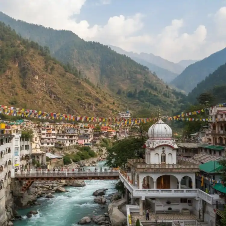
Manikaran Sahib
About 4 km from Kasol by road
A pilgrimage town on the bank of the Parvati River with natural hot springs, a Gurudwara, and Hindu temples. The hot springs at Manikaran emerge along the river and are hot enough to cook food.
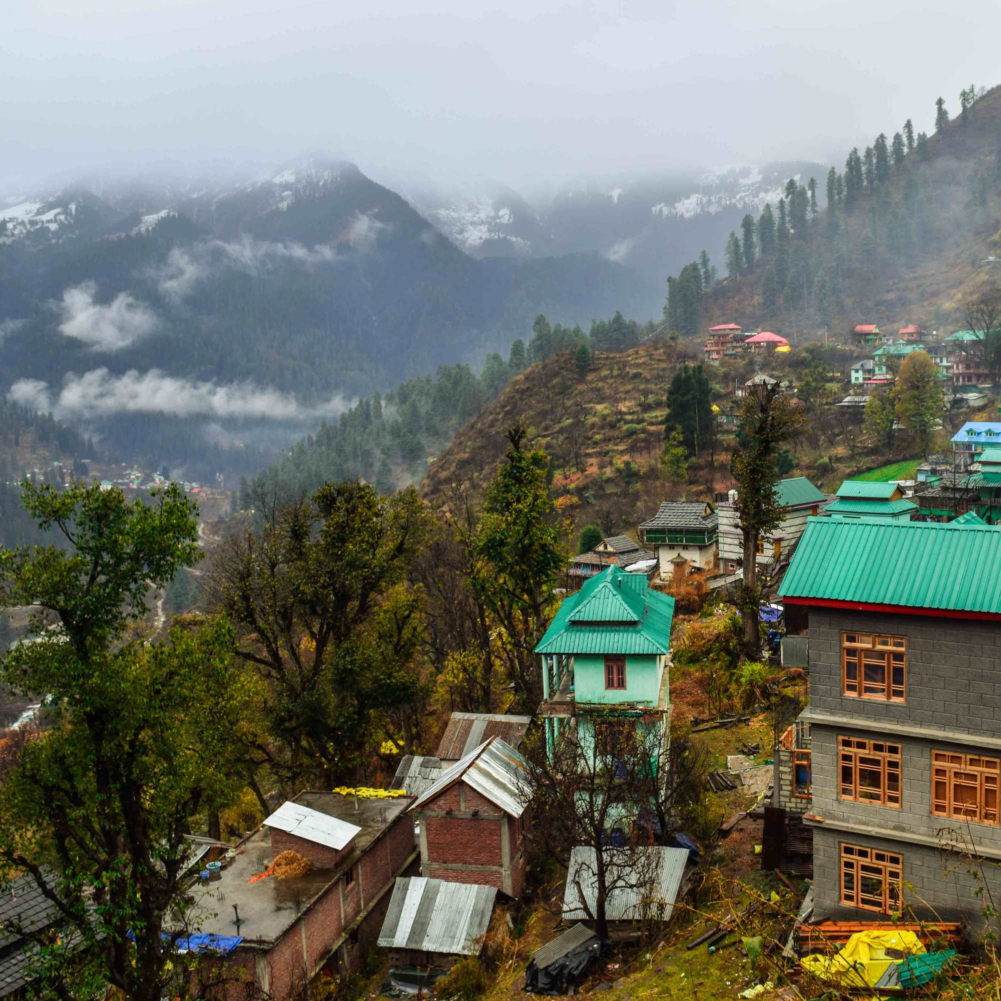
Tosh Village
About 20 km from Kasol by road, then a short walk
A hillside village higher up in the Parvati Valley with wide mountain views. Reachable by road via Barshaini. The river is visible from the approach road.
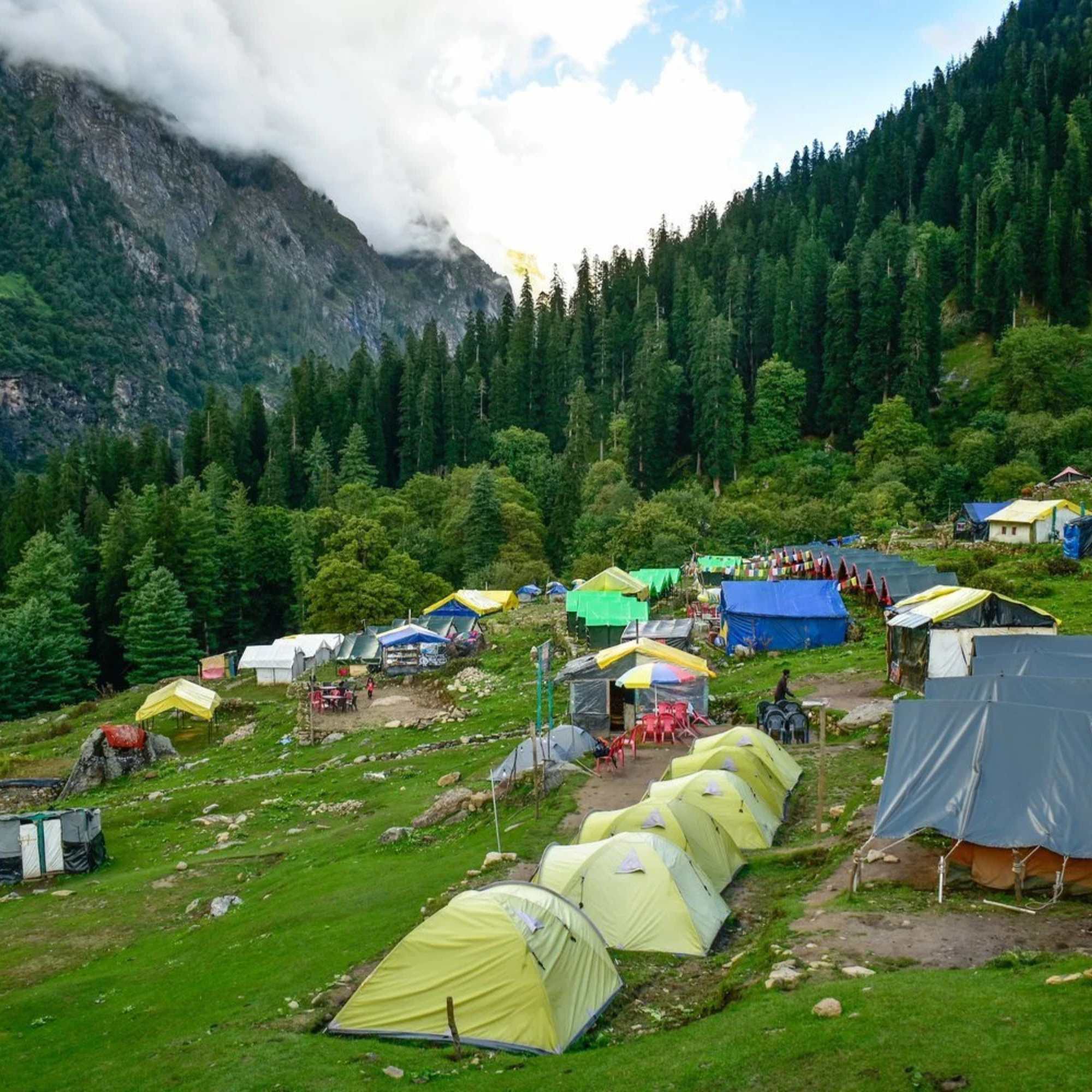
Kheerganga
About 4 to 5 hours trek from Barshaini
A high altitude meadow with natural hot springs fed by the same geothermal system that surfaces at Manikaran. One of the most popular treks in the Parvati Valley. Check locally for trail status.
Our packages with Parvati River
Curated trips that include a visit to Parvati River.
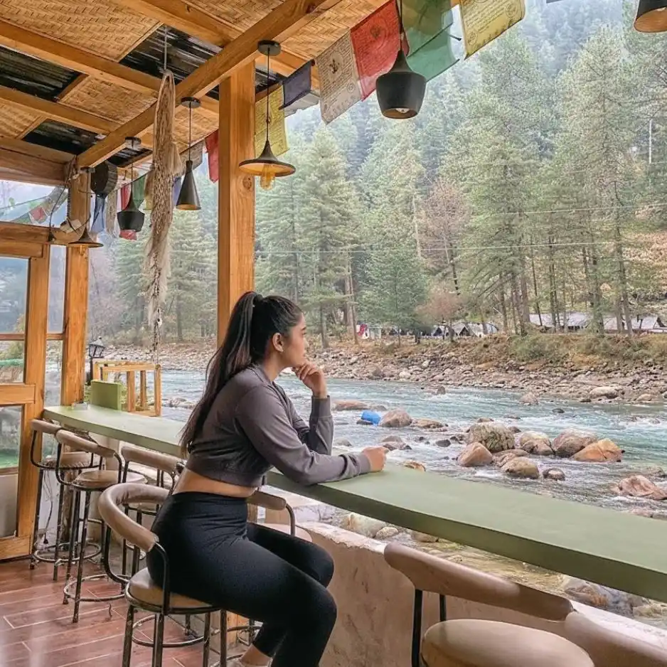 4D/3N
4D/3NPerfect Manikaran Kasol Tosh Weekend Getaway
1D Delhi•2D Kasol+1
₹15,999₹19,999SAVE INR 4,000/ person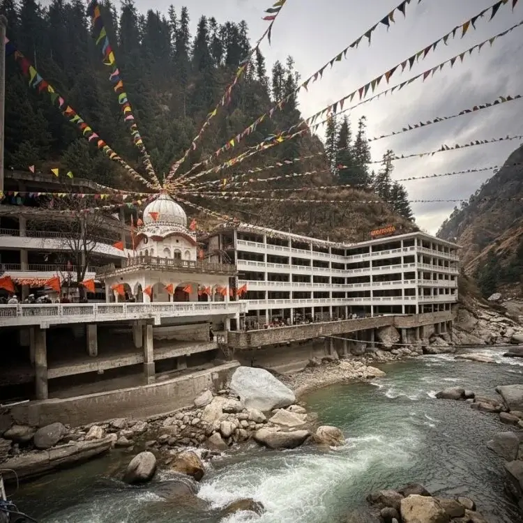 4D/3N
4D/3NWeekend Trip To Manikaran, Kasol & Tosh
1D Delhi •2D Kasol+1
₹9,999₹14,999SAVE INR 5,000/ person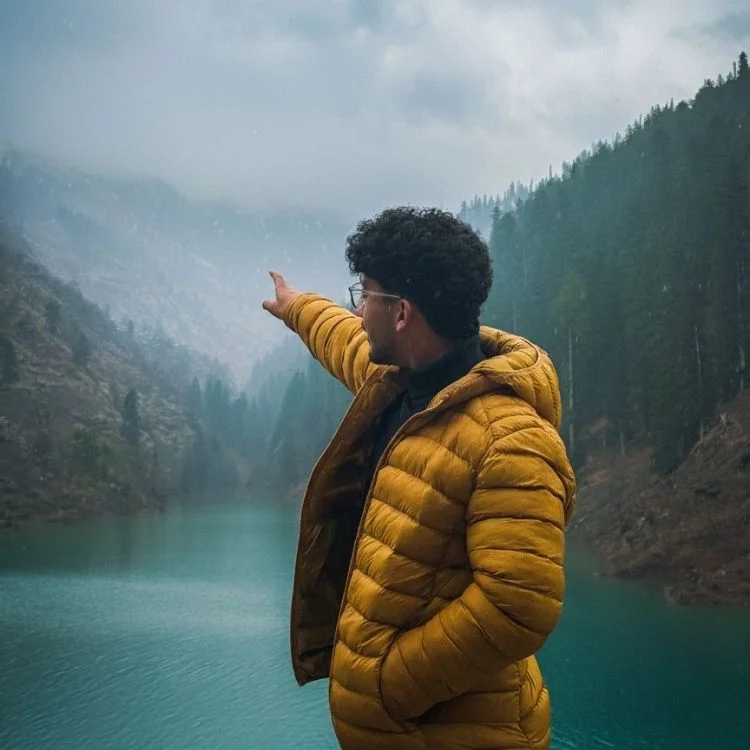 4D/3N
4D/3NBest Manikaran Kasol Tosh Weekend Trip
1D Delhi •2D Kasol+1
₹9,799₹13,999SAVE INR 4,200/ person
Frequently Asked Questions
What is the Parvati River?
A Himalayan river originating from the Man Talai Glacier below the Pin Parbati Pass. It flows roughly 150 km through the Parvati Valley, passing Kheerganga, Tosh, Manikaran, and Kasol before joining the Beas River at Bhuntar. The river is named after the goddess Parvati and is the defining feature of the valley.
Is there an entry fee to see the river?
No. The river runs through Kasol and is accessible from multiple points in town. The footbridge, river boulders, and riverside paths are all free.
Can I swim in the Parvati River?
Not recommended. The water is glacier fed and very cold, and the current is stronger than it looks. Rocks in the shallows are slippery. In dry months, some people wade in shallow edges, but deep sections are dangerous. In monsoon, do not enter the water at all.
Is the river safe in monsoon?
The river is dangerous in monsoon (July to September). Water levels rise dramatically, the current is fast and unpredictable, and banks can flood. Stay well back from the edges. Several incidents have occurred over the years from people getting too close during high water.
Where are the best spots to see the river in Kasol?
The footbridge to Chalal near Kasol market, the stretch along the Nature Park, and the boulders on the quieter bank below the main road. All accessible on foot within 5 to 10 minutes from the town centre.
Can I go fishing in the Parvati River?
Fishing is possible but requires a permit from the forest department. The river has trout. Rules on seasons, catch limits, and allowed stretches can change, so check locally before planning.
Can I camp by the river?
Yes, through organised campsites that operate along the river banks near Kasol. Tents, basic meals, and bonfires are typically available. Avoid camping at unmarked spots, especially in monsoon when water levels can rise unexpectedly.
Is rafting available on the Parvati River?
Not on the Parvati itself. The established white water rafting in this region runs on the Beas River near the Bhuntar confluence, where the Parvati meets the Beas, roughly 31 km from Kasol. That stretch offers grade I to III rapids.
What is the best time to visit the river?
October to November for clear water, low levels, and the best light. April to June for comfortable weather and accessible boulders. Avoid monsoon for riverside activities, though watching the river in monsoon from a safe distance is impressive in its own way.
How is the river different at Kasol compared to higher up the valley?
At Kasol, the river is wide and rocky with moderate flow in dry months. Higher up the valley, toward Barshaini and beyond, it narrows, gets faster, and feels more wild. The character changes with altitude. At Manikaran, geothermal hot springs emerge along its banks, adding steam to the landscape.
Related guides
Posts about Kasol
- Shimla Manali Kasol Itinerary 2026: 7, 8 and 9 Day Routes Without Rushing
- Best Offbeat Places Near Kasol Most Tourists Miss in 2026
- Rasol Village Trek From Kasol 2026: Route, Distance & What to Expect
- Kalga, Pulga & Tulga Villages in 2026: The Offbeat Side of Parvati Valley
- Kheerganga Trek from Kasol 2026: Route, Difficulty, Cost & Best Time
- Snowfall in Kasol 2026: Does It Snow, Best Time & Nearby Snow Places