
Tandi Sangam
The confluence of the Chandra and Bhaga rivers in Lahaul at around 2,570 metres, where the Chenab begins and most travellers stop for 20 minutes on the drive between Manali and Keylong
- Lahaul · confluence
- ~2,570 m
- Keylong · ~7 km
- Manali · ~2 hr via Atal Tunnel
- Key fuel stop
What makes it special
Tandi Sangam is the point in the Pattan valley of Lahaul where two glacier fed rivers, the Chandra and the Bhaga, meet and become the Chandrabhaga, the river that flows out of Himachal into Jammu as the Chenab. The Chandra rises near Chandra Tal below the Kunzum Pass, the Bhaga near Suraj Tal below Baralacha La, and the two take long, separate routes around the Lahauli mountains before finally joining here. On the ground, the sangam is a wide, flat gravel basin below a small village, with a tarred bridge running above it on the Manali to Leh highway. That bridge is where most travellers stop, lean on the railing for two minutes, take a photo, and move on.
Honest framing most travel pages skip. Tandi is not a sightseeing destination in the Chandratal or Kunzum sense. It is a geographical marker and a working village halt. There is a bridge viewpoint, a small dhaba or two on the roadside, a fuel pump about a kilometre up the village road, and a scatter of houses on the slopes above. Twenty minutes is enough for most people. An hour if you walk down to the bank and sit by the water for a bit. If you came hoping for a built up ghat with shops and facilities, you will be disappointed. If you accept what it actually is, which is the quiet, working confluence of two rivers in a village that has been cremating its dead on these banks for centuries, it is one of the more affecting pauses on the drive into Lahaul.
The place carries two very different reasons to matter, and they sit side by side. Spiritually, the sangam is one of the most significant sites in the Lahaul valley, treated by locals with the kind of reverence Hindus elsewhere reserve for Haridwar or Prayag. It is often cited as one of the eight Mahashamshans, or great cremation grounds, of India. The ashes of former Prime Minister Atal Bihari Vajpayee and VHP leader Ashok Singhal were immersed in the Chandrabhaga here, among many others. Practically, Tandi is the reference fuel halt on the Manali to Leh highway. The pump here has been the standard refill point for decades, and even with a newer pump reported near Keylong (operational since September 2021), most bikers and self drivers still top up at Tandi out of habit and caution. Both identities, spiritual and logistical, live on the same bend in the road.
Quick answers
- Is Tandi Sangam worth stopping at?
- Yes, as a short halt on the drive between Manali and Keylong or Leh. Twenty minutes covers the bridge viewpoint, a fuel top up, and a chai from one of the dhabas. Do not plan it as a day destination. The interest here is geographical and religious, not scenic in the postcard sense. If you slow down for an hour and walk closer to the water, the quiet weight of the place grows on you.
- How long should you stop at Tandi?
- For most travellers, 15 to 30 minutes. That covers the bridge viewpoint, a fuel top up at the village pump, and tea from a roadside stall. Stretch it to an hour if you want to walk down closer to the confluence or visit Tupchiling Gompa. If Guru Ghantal Monastery above the village is on your list, budget a full half day, the trek from Tupchiling is strenuous and takes 3 to 4 hours up.
- Is Tandi still the last petrol pump before Leh?
- Almost. A newer pump has been reported near Keylong (operational since September 2021), so technically not the very last one. But the Tandi pump remains the reference refill point on the Manali to Leh highway, and most bikers and self drivers still top up here. The next pump after Tandi or Keylong is at Karu near Leh, roughly 330 to 350 km further. Fill up at Tandi is still the safe rule.
Quick facts
Everything you need to know at a glance.
At a glance
- Altitude
- Around 2,570 m / ~8,440 ft at the confluence. Tandi village on higher ground sits closer to 2,860 m.
- Location
- Pattan valley, Lahaul and Spiti district, Himachal Pradesh, on the Manali to Leh highway (NH3)
- Nearest towns
- Keylong ~7 km north, Sissu ~22 km south, Manali ~70 km south via the Atal Tunnel
- Best season
- May to October for clear viewing. Accessible year round via the Atal Tunnel, though the bridge area can be icy in deep winter.
- Visiting hours
- Open roadside halt, 24 hours. Fuel pump generally daylight hours, timings can shrink in winter. Confirm locally.
- Entry fee
- None. Free to visit the bridge and the banks.
- Time needed
- 15 to 30 minutes for most travellers. An hour if you walk down to the confluence. Half a day if you add Guru Ghantal.
- Known for
- Confluence of the Chandra and Bhaga rivers forming the Chenab, fuel halt on the Manali to Leh highway, cremation ground of deep religious meaning
- Access difficulty
- Easy. Drive up, stop on the bridge. The walk down to the banks is short but on uneven ground.
On the ground
- Mobile network
- BSNL is the most reliable. Jio and Airtel work in patches, mostly towards the Keylong side. Data is slow. Plan for limited connectivity.
- ATMs
- None at Tandi. The nearest ATMs are in Keylong, about 7 km north. Those can run dry on busy days. Carry cash from Manali.
- Fuel
- Tandi pump is about a kilometre up the village road from the bridge, signposted. Generally operational in daylight hours. A newer pump at Keylong is also running since 2021. Fill up here for the Leh stretch.
- Washrooms
- Basic facilities at a couple of the dhabas and the petrol pump. Not always clean. Carry tissue and hand sanitiser.
- Food
- Two or three small dhabas near the bridge. Expect chai, Maggi, momos, and simple dal rice or rajma chawal. Nothing fancy. Carry biscuits as backup if arriving late.
- Parking
- Informal roadside parking near the bridge. No formal charges. Keep to one side, the highway runs right across.
- Permits
- None for Indian nationals. Foreign nationals should carry ID and check current Lahaul and Spiti rules at the Koksar check post.
- Drones
- Use strong discretion. The site is an active cremation ground and a working village. Do not fly if funeral rites are in progress. Ask locals before flying at all.
- Walking surface
- The bridge itself is flat and tarred. The path down to the banks is rough gravel, uneven, and can be steep in places. Wear shoes with grip.
- Guides
- Not needed for the viewpoint. A local guide arranged at Tupchiling is useful if you plan to trek up to Guru Ghantal Monastery.
Seasonal weather
- May to June20°4°Spring
- July to August24°10°Summer monsoon
- September to October18°0°Autumn
- November to March4°-14°Winter
Suitable for
- Couples — suitable
- Families — suitable
- Seniors — suitable
- Solo — suitable
- First-timers — suitable
- Pet-friendly — with some care
How to reach Tandi Sangam
5 approach routes, with seasonal access.
From Manali (via Atal Tunnel)
Year round via the tunnel. Road conditions after heavy rain or snow can vary.- Distance
- About 70 km
- Time
- 2 to 2.5 hours
- Road
- Tarred highway through the Atal Tunnel, then a mostly decent run via Sissu and Gondhla to the Tandi bridge. A few patched sections after monsoon.
- Last fuel
- Fill up in Manali. Tandi is itself the next fuel point.
The standard approach. From Manali, take NH3 south to the Atal Tunnel south portal at Dhundi. The tunnel is 9 km long and generally takes 15 to 20 minutes to cross at the posted speed. Exit the north portal, continue along the highway through Sissu (about 7 km past the portal), Gondhla, and drop into Tandi bridge another 22 km further. On peak weekends and holidays, traffic can queue at the south portal for 30 to 60 minutes, leave Manali by 8 or 9 AM to reach Tandi by late morning. Note that many older travel pages still cite 110 km for this route, which is the old pre tunnel distance via Rohtang Pass. The new distance via the tunnel is about 70 km.
From Keylong
Year round- Distance
- About 7 km
- Time
- 15 to 20 minutes
- Road
- Tarred highway along the Bhaga river
- Last fuel
- Tandi is the pump. Keylong also has one since 2021.
A very short drive if you are already in Keylong. The road follows the Bhaga river south until it drops into the Tandi bridge. Useful if you base in Keylong and want a morning walk down to the confluence, or if you are returning from Jispa and want to stop for fuel and a chai.
From Sissu
Year round- Distance
- About 22 km
- Time
- 35 to 45 minutes
- Road
- Tarred highway through Gondhla
- Last fuel
- Tandi itself
The most common intermediate stretch. From Sissu, the road follows the Chandra river through Gondhla, past the old Gondhla fort, and drops into the Tandi confluence. A natural lunch or tea stop if you are moving from a Sissu overnight towards Keylong or Jispa.
From Jispa
Year round- Distance
- About 28 km
- Time
- 45 minutes to 1 hour
- Road
- Tarred highway, generally in decent condition
- Last fuel
- Tandi itself
Coming south from Jispa or Darcha on the Leh route, Tandi is your refuelling point before the tunnel. The drive follows the Bhaga river south through Keylong, then 7 km further to the bridge. Fill up here, grab a chai, and you are about two hours from Manali.
From Delhi or Chandigarh
Year round- Distance
- Delhi ~580 km to Manali, then 70 km onward. Chandigarh ~310 km to Manali.
- Time
- 14 to 16 hours from Delhi, 8 to 9 hours from Chandigarh, plus 2 hours onward
- Road
- NH 44 and NH 3 to Manali, then the Atal Tunnel
- Last fuel
- Chandigarh, Swarghat, Bilaspur, Sundernagar, Mandi, Manali
Nobody drives all the way from Delhi or Chandigarh to Tandi in one go. The realistic plan is an overnight Volvo or drive to Manali, sleep a night, and continue through the tunnel to Tandi and onwards the next morning. If you are heading to Leh or Jispa and Tandi is just the fuel stop, plan your Manali morning departure to reach the pump by late morning with time in hand.
Best time to visit
Season by season, so you can plan around the weather rather than hope.
- Recommended
Spring
May to June
Clear skies, both rivers running well, the best all round window
- Day temperature
- 14 to 20 C
- Night temperature
- 4 to 7 C
- Rivers
- Running strong and relatively clear
- Crowds
- Low to moderate, builds through June
A good time to see the confluence. The Chandra is swelling with melt from the Kunzum side, the Bhaga running full from Baralacha, and the bridge view is at its cleanest. Days are warm enough for a t-shirt, nights still need a jacket. The Tandi pump is reliably open, the dhabas on the highway reopen from mid May as Leh traffic starts. June is the single best month, warm days, clean light, Leh route open, and not yet peak crowd.
Summer monsoon
July to August
Rivers at full power but both run muddy, and the approach can see landslides
- Day temperature
- 18 to 24 C
- Night temperature
- 10 to 12 C
- Rivers
- Full, fast, and muddy brown from glacial melt
- Crowds
- High, Leh bound traffic at its peak
The confluence is at its most dramatic in terms of volume, but also at its muddiest. The glacial melt and monsoon combined turn both rivers silty brown, so the distinct colour mixing at the sangam is less visible. Tandi itself sits in a partial rain shadow, direct rain is less frequent than in Manali, but the highway approach through the Atal Tunnel exit and onwards can see landslides and debris flows. Build a buffer day into your plan and confirm road status before leaving Manali. This is peak Leh traffic season, the pump queue can be long on some days, and booking ahead matters at Keylong and Jispa.
- Recommended
Autumn
September to October
The sharpest light of the year and the cleanest version of the confluence
- Day temperature
- 10 to 18 C
- Night temperature
- 0 to 3 C
- Rivers
- Settling, cleaner, the colour difference shows again
- Crowds
- Low after the first week of September
If you can time it, late September to mid October is the best window to actually see the sangam. The monsoon settles, both rivers clear up, and the distinct grey of the Chandra and the slightly greener Bhaga become visible again at the meeting point. Traffic thins after the first week of September as the Leh season winds down. Nights get cold quickly by October, carry a proper warm layer. The Baralacha La road typically stays open through September, first snows can close it anywhere from early to late October.
Winter
November to March
Snow, genuine cold, and access that depends on the day
- Day temperature
- -5 to 4 C
- Night temperature
- -10 to -14 C
- Rivers
- Reduced flow, partial freezing in January and February
- Crowds
- Almost none
The Atal Tunnel keeps the road to Keylong open year round, which means Tandi stays technically reachable even in deep winter. In practice, the 7 km from Keylong and the bridge area itself can be icy after snowfall, and dhabas along the highway mostly shut from November to April. Temperatures drop well below freezing at night. The fuel pump runs on shorter hours, confirm before you rely on it. Winter visits are only practical for experienced Himalayan travellers with proper gear and flexible plans. Cremations continue year round regardless of weather, respect the site if you visit off season.
Things to see & do
8 things worth your time at Tandi Sangam.
Stop at the Tandi bridge viewpoint
10 to 20 minutesThe bridge on the Manali to Leh highway is where every vehicle slows down. The confluence sits directly below on the downstream side, the Chandra coming in from the left after its long detour around Lahaul, the Bhaga from the right after dropping down from Baralacha. Walk to the middle of the bridge, lean over the downstream railing, and in clear conditions you can see the two rivers mixing into a single Chandrabhaga. The difference in colour shows best in late spring and autumn, it is muddy all round in peak monsoon. Keep to one side of the road, the bridge is narrow and trucks come through fast.
Walk down to the banks
30 to 45 minutesA rough footpath drops from the roadside down to the river bank near the cremation area. Locals use it daily. The walk is short but the gravel is uneven and the climb back up feels longer than the descent. At water level the scale of the confluence makes more sense than from the bridge, the two rivers meeting at chest height right in front of you. Visit respectfully. If funeral rites are in progress, stay well back and do not photograph. The stones near the water are often slippery, wear shoes with proper grip. This is the version of Tandi that most drive through travellers never actually see.
Fill up at the Tandi petrol pump
10 to 20 minutesThe pump is about a kilometre up the village road from the bridge, signposted. It has been the reference refill point on the Manali to Leh highway for decades. If you are heading towards Ladakh, this is where you top up your tank and, if biking, also fill any spare jerry cans or cold drink bottles. The next pump after Tandi or Keylong is at Karu near Leh, roughly 330 to 350 km further. Queues can build in peak season, especially on weekend mornings when bike groups are rolling through. Confirm operating hours if you are arriving very early or late, and know that winter hours can be shorter.
Pause at Tupchiling Gompa
20 to 30 minutesTupchiling is a small working monastery on a short uphill path from near the Tandi bridge. It serves as the caretaker gompa for Guru Ghantal Monastery above, and most of the sacred relics from Guru Ghantal have been moved here for safekeeping, including some of the wooden idols that make the upper monastery historically important. A quiet 20 minute stop if the door is open and a lama is present. Ask before taking photographs inside. This is also where you collect the key and the directions if you plan to continue up to Guru Ghantal.
Trek up to Guru Ghantal Monastery
Half day to full dayGuru Ghantal, also called Gandhola Gompa, is believed to be among the oldest Buddhist monasteries in Lahaul. Local traditions variously credit Padmasambhava, Rinchen Zangpo, or a lama named Guru Ghantapa with founding it, and the building in its current form is generally dated around the 10th to 12th century. It sits on a ridge above Tupchiling village near the confluence. The trek from Tupchiling is steep, with reports ranging from 3 to 4 hours up depending on fitness, and shorter on the way down. Ask at Tupchiling for the key before climbing, the gompa is often locked and a wasted climb is a real risk. Not a casual add on to a highway stop. Carry water, snacks, good shoes, and do not attempt in rain or snow.
Tea at a highway dhaba
20 to 40 minutesA couple of basic dhabas and a small cafe operate near the bridge and along the approach road. Expect chai, Maggi, momos, and a plate of dal rice or rajma chawal if the timing is right. Nothing fancy, nothing bad. A welcome break if you have been driving since Manali and still have Keylong, Jispa, or Baralacha ahead. Carry small cash, UPI is unreliable here.
Sit quietly by the water
As long as you likeIf you have an hour to spare and the confluence interests you beyond a photograph, walk down to the bank, find a flat stone, and sit. The sound of the two rivers meeting is genuinely different from either of them alone, somewhere between a hiss and a low roar depending on season. No signal, no schedule. People who have lived in Lahaul for years will tell you this is when the place actually works on you. Worth the hour if you can spare it.
Photograph the confluence from the bridge
15 to 30 minutesThe clean shot is from the downstream railing of the bridge in mid morning or late afternoon light, when the V of the confluence is well lit and the colour difference between the two rivers shows. A 24 to 70 mm range covers most of it, a polariser helps cut river glare. Do not photograph the cremation area if rites are in progress, this is a working shamshan for the local community and the sentiment on this is strong. Ground photography from the bridge and the upper bank is enough, keep drones grounded here.
Know before you visit Tandi Sangam
The practical bits, from people who have been.
What Tandi Sangam actually isA working village at the meeting of the Chandra and Bhaga rivers, not a developed pilgrimage site
Tandi is a village of the Pattan valley in Lahaul, sitting above the point where the Chandra and Bhaga rivers meet to form the Chandrabhaga. The river flows north west out of Himachal into Jammu, where it becomes the Chenab, one of the five rivers of Punjab, and eventually crosses into Pakistan as part of the Indus system. The Chandra rises near Chandra Tal below the Kunzum Pass and takes a long loop south and east before turning back north west to reach Tandi. The Bhaga rises near Suraj Tal below Baralacha La and runs more or less directly south. They each wrap a large part of Lahaul before finally meeting at the sangam.
What you actually arrive at is a bridge on the Manali to Leh highway, with the confluence visible in the basin below, a village of scattered Lahauli houses on the slopes above, and a small cluster of services near the roadside. A fuel pump a kilometre up the village road, two or three dhabas, and the small Tupchiling Gompa are the practical stops. The grand temples, paved ghats, and tourist infrastructure you might expect at a sangam this sacred are not here. The site is working and largely unbuilt, which is part of why it has the atmosphere it has.
The petrol pump and the old ruleStill the reference fuel halt on the Manali to Leh highway. A newer pump at Keylong adds a backup.
For decades, Tandi was famous across Indian motorcycle circles as the last petrol pump before Leh. The rule was simple. Fill up at Tandi, because the next pump is 330 km away at Karu, close to Leh. That rule has softened slightly. A newer fuel station at Keylong has been operational since September 2021, which gives you one more option roughly 7 km further on. For planning purposes, the substance of the rule still holds. Fill up at Tandi or Keylong, top up any spare cans if you are biking, and expect nothing in between until Karu.
Practical notes. The Tandi pump is about a kilometre up the village road from the bridge, signposted off the highway. It is generally reliable through the main season from April to October. Winter hours can shrink and availability can vary after heavy snowfall, confirm on the day if you are travelling in the cold months. Queues build on peak weekend mornings when bike groups are rolling through, a 30 to 45 minute wait is not unusual in July. UPI works in patches, most bikers still prefer cash. As of 2026, petrol in Himachal Pradesh is generally priced around Rs 95 per litre, subject to change.
The religious significance, in plain termsOne of the eight Mahashamshans of India. A working cremation ground, not a tourist ghat.
The sangam is treated by local Hindus and Buddhists with the kind of reverence that is usually reserved for Haridwar or Prayag. Three traditions explain the name Tandi, and local people will tell you any or all of them depending on the day. One says Tandi is a corruption of Tan Dehi, meaning the giving up of the body, and links the site to Draupadi, who is said to have left her body here on the Pandava ascent to heaven. A second says Rishi Vashishtha was cremated at this confluence after his meditations near the hot springs of Manali, giving the name its sense of body consumed. A third is a love story, in which Chandra, daughter of the Moon god, and Bhaga, son of the Sun god, climbed the Baralacha Pass from opposite sides and met here to marry, each river named after one of them.
Beyond the stories, the sangam is often listed among the eight Mahashamshans, or great cremation grounds, of India. The local community has cremated its dead on these banks for centuries and continues to. The ashes of former Prime Minister Atal Bihari Vajpayee and VHP leader Ashok Singhal were immersed in the Chandrabhaga here, among many others. Visitors are welcome, but this is a living shamshan, not a heritage site. If rites are in progress, keep your distance, speak quietly, and put the camera away.
Guru Ghantal Monastery and the trek questionAmong the oldest monasteries in Lahaul. A serious 3 to 4 hour trek from Tupchiling, not a quick visit.
Above Tupchiling village, on the ridge overlooking the confluence, sits Guru Ghantal Monastery, also called Gandhola Gompa. It is believed to be among the oldest Buddhist monasteries in Lahaul, with local tradition variously crediting Padmasambhava, Rinchen Zangpo, or a lama named Guru Ghantapa with its founding. The monastery is historically unusual for its wooden idols rather than the clay ones found elsewhere in the region, and it once held a black stone image of Kali and a white marble head of Avalokiteshvara. Most of the relics have since been moved down to Tupchiling for safekeeping.
The honest answer on whether to attempt the trek. This is not a casual add on to a highway halt. Reports vary, but most visitors describe a 3 to 4 hour steep climb from Tupchiling, shorter coming down, on a trail that is not always well marked. The monastery is frequently locked, so you need to ask at Tupchiling for the key before setting out or the climb is wasted. Carry water, snacks, and proper shoes. Plan it only if you have a full half day to spare, you are reasonably fit, and the weather is clear. If you are short on time or travelling with older family members, Tupchiling Gompa at the base is the realistic version.
Who should stop, and who should just drive throughA strong short stop for most travellers, a meaningful longer halt for the spiritually inclined, not a standalone destination
Most travellers on the Leh route: Yes. Stop for 20 to 30 minutes. The bridge viewpoint and the fuel pump are both on your way anyway. Use the halt to stretch, fill up, drink a chai, and see one of the more significant geographical and religious sites in Lahaul before continuing.
Travellers who find places like Haridwar or Prayag meaningful: Plan an hour or more. Walk down to the banks if you are comfortable with uneven ground, sit quietly by the water, visit Tupchiling Gompa. This is where the sangam starts to mean something beyond a photograph.
Families with kids: Yes as a short halt. The bridge is safe to walk on, the dhabas are kid friendly, and the fuel stop is quick. Do not take young children down to the banks, the paths are rough and the river current is strong and icy. The cremation area is not a place for kids regardless.
Seniors: Yes for the bridge stop. The altitude at 2,570 m is lower than most of Lahaul, the drive from Manali is comfortable on tarred road, and the halt itself requires no walking. The descent to the banks is not suitable for most older travellers, stay on the bridge and the roadside.
Skip a dedicated visit if: you were hoping for a developed ghat with temples, shops, and facilities in the Haridwar or Rishikesh sense. Tandi is a working village site, not a religious tourism destination. As a stop on a larger Lahaul or Ladakh trip it is worth the pause, as a standalone trip from Manali it is thin.
Altitude, weather, and safetyLow altitude by Lahaul standards. Winter roads can be icy. River banks are slippery and the water is dangerous.
At around 2,570 m, Tandi is one of the lower points in the Lahaul valley and lower than Keylong, Sissu, or Jispa. Most travellers feel nothing here, which makes it a good natural acclimatisation stop if you are pushing further north. Some people coming up fast from the plains feel mild breathlessness, especially after a long drive. That usually settles in an hour.
Winter specific: The Atal Tunnel keeps access open year round, but the 7 km stretch from Keylong and the bridge area itself can be icy after snowfall. Carry chains for your tyres if self driving in December to February. Most dhabas shut from November to April, the pump runs on shorter hours, and the Baralacha La road towards Leh is generally closed. Dress for serious cold, night temperatures drop well below freezing.
River and bank safety: Do not wade into the water. Both the Chandra and the Bhaga are glacier fed, very cold, and run faster than they look. The current at the confluence point is particularly strong. Keep children off the banks. The gravel path down from the highway is uneven and can be slippery after rain, wear shoes with grip.
Nearest medical help: Keylong, about 7 km north. The primary health centre there handles basic issues. Anything serious means back through the tunnel to Manali.
Photography guide and etiquetteBridge view for the clean confluence shot. Avoid the cremation area entirely with a camera.
The signature photograph of Tandi is from the downstream railing of the bridge, showing the two rivers meeting in the basin below. Mid morning or late afternoon light gives you the cleanest view, with the colour difference between the Chandra and the Bhaga visible in spring and autumn. In peak monsoon both rivers run muddy and the distinction is lost. A 24 to 70 mm range covers the bridge view, a polariser helps cut glare off the water. The upper bank between the highway and the water line gives a second angle, with the bridge framing the top of the shot.
Etiquette is the part most online guides skip. The sangam is an active cremation ground. If you see a funeral pyre, prayer flags, or family members performing rites near the water, put the camera away and walk the other direction. Drones are a hard no when rites are in progress, and a strong maybe otherwise, avoid flying at all if you are unsure. Photographing villagers at Tupchiling Gompa or on the path down needs their permission, a smile and a namaste goes further than a raised lens.
Local tips most travellers missUpdated distance via the tunnel, branch off to Udaipur, carry cash, recheck road and fuel status close to travel
Know that older online sources still cite 110 km from Manali to Tandi, which was the distance via the old Rohtang Pass route. Via the Atal Tunnel it is about 70 km, roughly two hours of driving. This affects your departure time and fuel planning more than you might think.
If you are heading towards Udaipur and the Mrikula Devi Temple in the Pattan valley, the road branches off near the Tandi bridge. Udaipur is about 53 km from here, along a quieter road that follows the Chandrabhaga downstream. A separate day out from a Keylong base, not a spontaneous detour from Tandi itself.
Carry enough cash. The pump generally accepts cash readily, UPI is patchy, and the dhabas prefer cash outright. ATMs are only in Keylong or back in Manali. Top up before you leave.
A small recheck reminder. Fuel availability and hours, road conditions between Keylong and Tandi in winter, and the Baralacha La opening window all shift season to season. Confirm details close to your travel date. Your homestay host, the Keylong check post, or a recent Tripoto or YouTube vlog from the same month usually gives better on ground information than any general travel page.
Nearby attractions
Other places worth the detour.
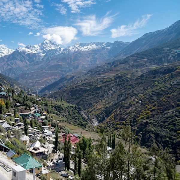
Keylong
~7 km · 15 to 20 min drive
The district headquarters of Lahaul and Spiti, with the only proper market in the valley, an ATM, the Shashur and Kardang monasteries, and the second fuel pump on this stretch. The natural base if you want to pair a Tandi stop with a proper Lahauli town halt.
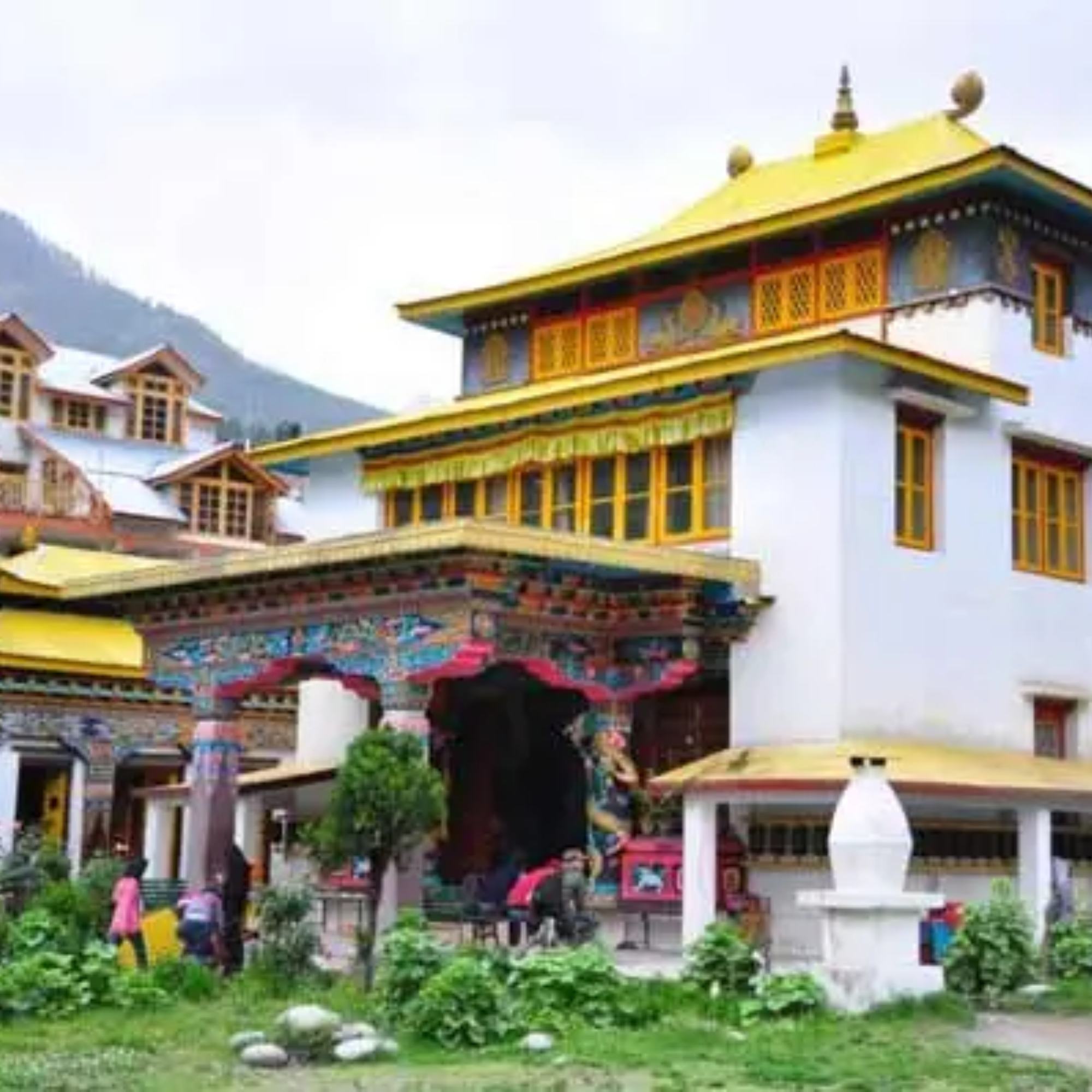
Guru Ghantal Monastery and Tupchiling Gompa
Tupchiling is a short walk from the bridge, Guru Ghantal is a 3 to 4 hour uphill trek from there
Tupchiling is the working caretaker gompa at the base, a quick 20 minute visit. Guru Ghantal above is believed to be among the oldest monasteries in Lahaul and houses wooden idols unusual for the region. Serious half day trek, not a casual add on. Ask for the key at Tupchiling before climbing.
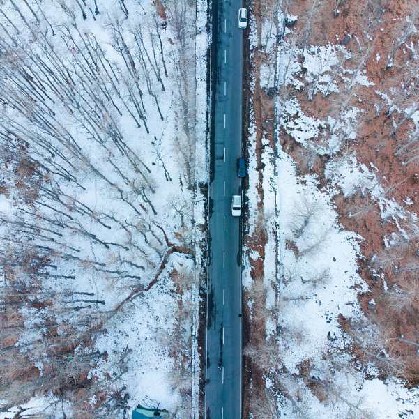
Sissu Village
~22 km · 35 to 45 min drive towards Manali
The first village past the Atal Tunnel, with a waterfall visible from the highway, a small lake, and a helipad sunset viewpoint. A natural pair with Tandi as a short Lahaul circuit.
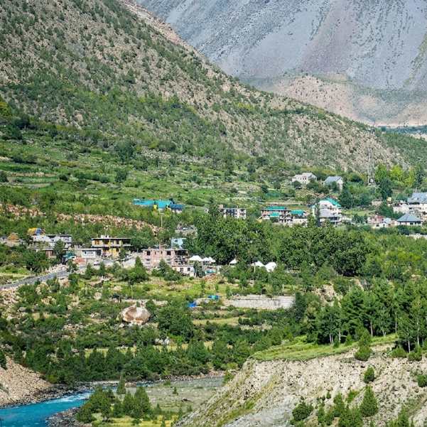
Jispa
~28 km · 45 min to 1 hour drive towards Leh
A quiet Lahauli hamlet on the Bhaga river with riverside campsites, a small monastery, and the calmest overnight halt on the Leh road. The common next stop after Tandi for travellers heading further north.
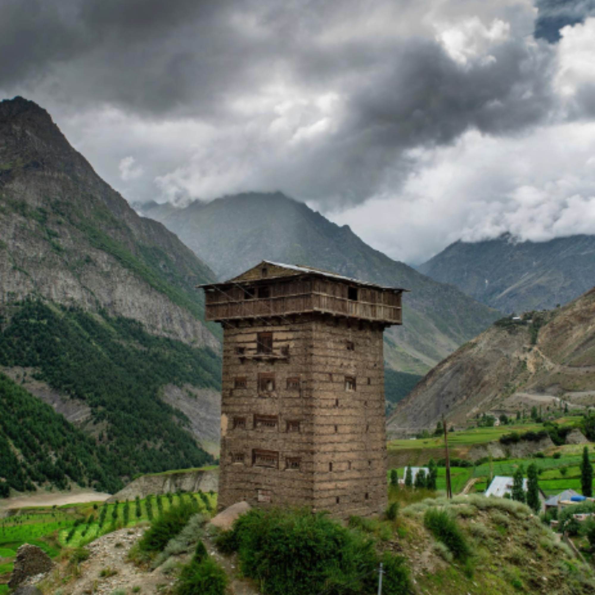
Gondhla Fort
~11 km · 20 min drive towards Sissu
A several centuries old wooden and stone fort in Tibetan style on the road between Sissu and Tandi. Small but worth a 20 minute stop for the architecture and the view down the Chandra valley.
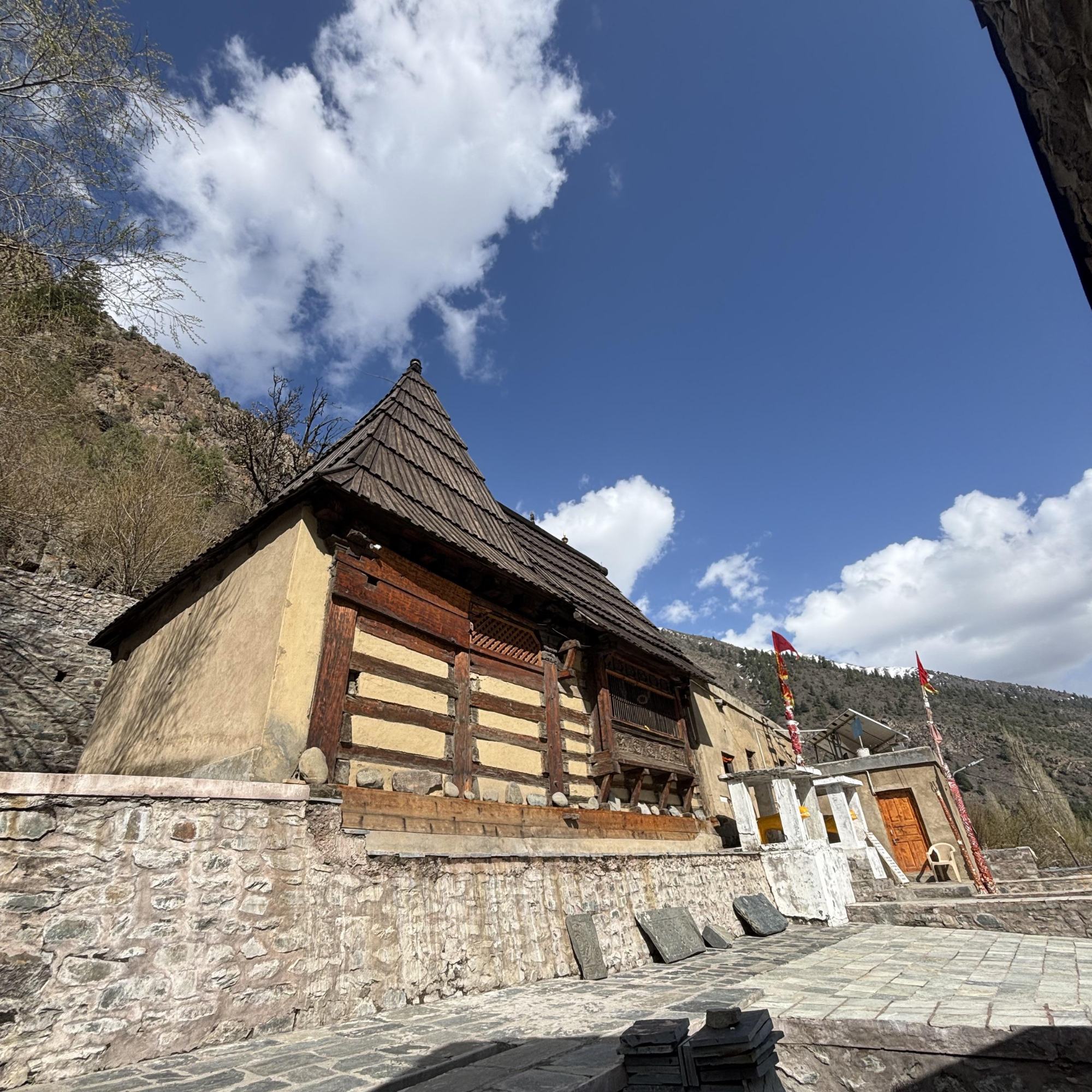
Udaipur and Mrikula Devi Temple
~53 km · 2 hours drive along the Chandrabhaga
The second biggest town in Lahaul, reached by branching off near Tandi bridge and following the Chandrabhaga downstream. The 11th or 12th century wooden Mrikula Devi Temple is the draw, known for its deodar wood carvings. A separate day trip from a Keylong base, not a Tandi detour.
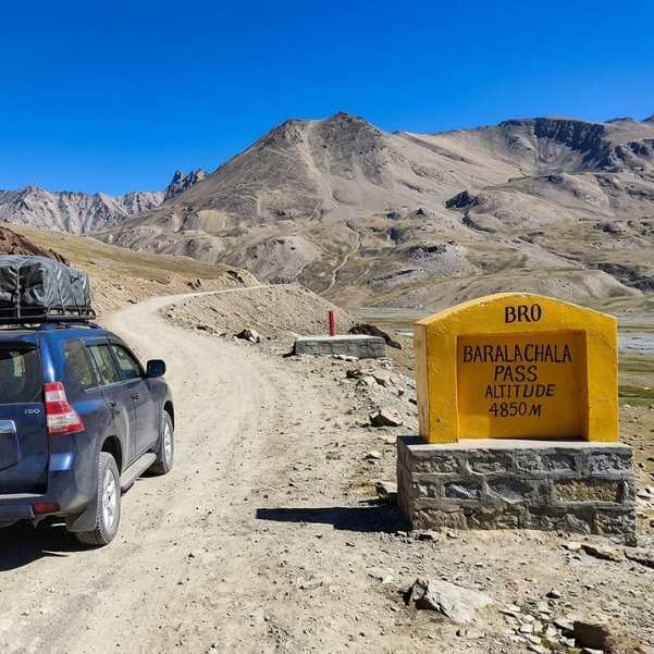
Suraj Tal and Baralacha La
~75 km · 2.5 to 3 hours drive
Source of the Bhaga river, a small alpine lake at around 4,890 m near the Baralacha La pass. A full day out from a Keylong or Jispa base, accessible June to October depending on snow. Do not linger at the pass, the altitude is serious.
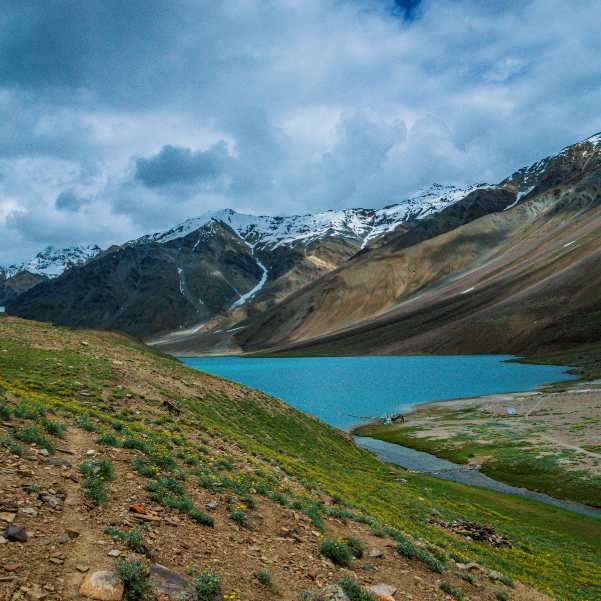
Chandratal Lake
~130 km via Gramphu and Batal · 6 to 7 hours
Source of the Chandra river, a natural crescent shaped glacial lake at around 4,300 m. Not a day trip from Tandi. Plan it as part of a Spiti circuit via the Kunzum Pass.
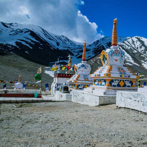
Kunzum Pass
~145 km via Gramphu and Batal · 7 to 8 hours
The high pass at around 4,551 m connecting Lahaul to Spiti, generally open June to October. The waters that feed the Chandra rise in this basin. Part of a multi day Spiti circuit, not a Tandi day trip.
Our packages with Tandi Sangam
Curated trips that include a visit to Tandi Sangam.
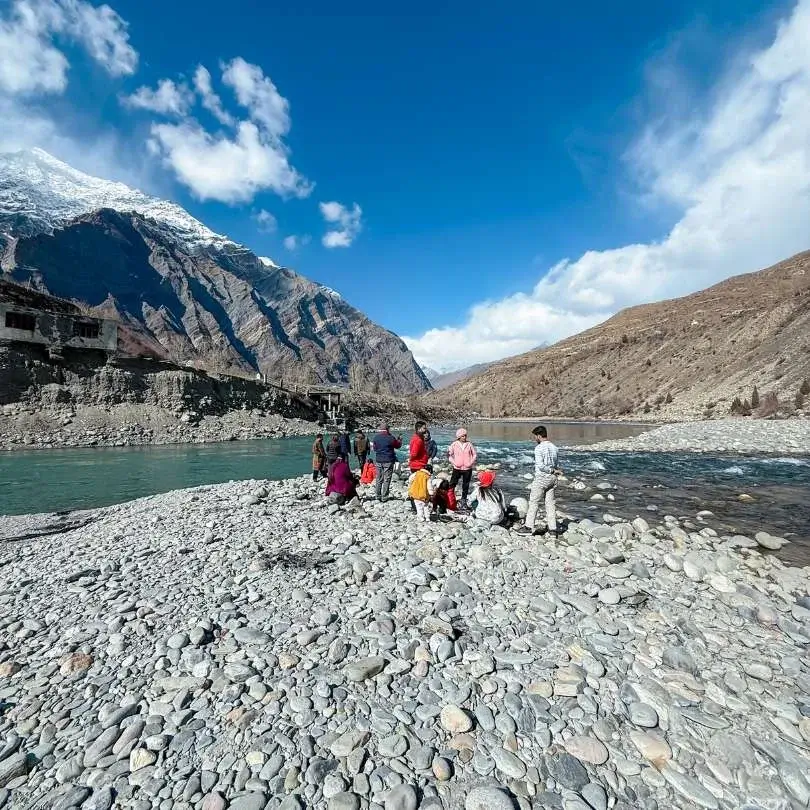 6D/5N
6D/5NMost Loved Sissu Valley Escape With Jispa Riverside Stay
2D Sissu•1D Jispa
₹15,999₹19,999SAVE INR 4,000/ person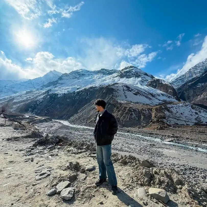 5D/4N
5D/4NClassic Sissu Valley Trip
2D Sissu•1D Manali
₹12,799/ person
Frequently Asked Questions
Where is Tandi Sangam?
Tandi Sangam is in the Pattan valley of the Lahaul and Spiti district in Himachal Pradesh, on the Manali to Leh highway (NH3). The confluence point sits at around 2,570 metres, about 7 km south of Keylong and roughly 70 km from Manali via the Atal Tunnel. The Tandi bridge above the confluence is the standard viewpoint.
Which rivers meet at Tandi Sangam?
The Chandra and the Bhaga meet here. The Chandra rises near Chandra Tal below the Kunzum Pass in Spiti, the Bhaga near Suraj Tal below Baralacha La in Lahaul. At Tandi they merge to form the Chandrabhaga, which flows north west and becomes the Chenab once it enters Jammu. The Chenab is one of the five rivers of Punjab and part of the Indus river system.
How do I reach Tandi from Manali?
Drive through the Atal Tunnel on the Manali to Leh highway. The tunnel is about 9 km long, the total drive from Manali to the Tandi bridge is roughly 70 km and takes about 2 to 2.5 hours depending on traffic. Many older travel pages cite 110 km, which was the old distance via the Rohtang Pass, before the tunnel opened in 2020. HRTC buses heading towards Keylong, Leh, or Udaipur pass through Tandi and can drop you at the bridge.
What is the altitude of Tandi Sangam?
Around 2,570 metres, roughly 8,440 feet, at the river level where the confluence happens. The Tandi village on higher ground sits closer to 2,860 metres. Either way, this is one of the lower points in the Lahaul valley, below Keylong, Sissu, and Jispa. Most travellers feel no altitude effect here, making it a good natural stop if you are pushing deeper into Lahaul.
Is Tandi the last petrol pump before Leh?
Almost. A newer fuel station has been operating near Keylong since September 2021, so technically not the very last one. The Tandi pump remains the reference refill point for the Manali to Leh highway and most bikers and self drivers still fill up here out of habit. After Tandi or Keylong, the next pump is at Karu near Leh, roughly 330 to 350 km further. Fill up at Tandi is still the safe rule.
How long should I stop at Tandi Sangam?
For most travellers, 15 to 30 minutes is enough. That covers the bridge viewpoint, a fuel top up, and a chai from one of the dhabas. An hour if you walk down to the banks or stop at Tupchiling Gompa. A full half day if you plan to trek up to Guru Ghantal Monastery. As a standalone trip it is not worth the drive from Manali, Tandi works best as a halt on a larger Lahaul or Leh itinerary.
What is the religious significance of Tandi Sangam?
The sangam is one of the most sacred sites in Lahaul, often cited as one of the eight Mahashamshans or great cremation grounds of India. Three traditions explain the name. One links it to Draupadi, who is said to have given up her body here on the Pandava ascent to heaven (Tan Dehi meaning the giving up of the body). A second links it to the cremation of Rishi Vashishtha. A third describes a celestial marriage of Chandra and Bhaga, daughter of the Moon god and son of the Sun god, each river named after one of them. The ashes of former Prime Minister Atal Bihari Vajpayee and VHP leader Ashok Singhal were immersed here, among many others.
Is the Tandi cremation ground open to visitors?
The banks are publicly accessible, but this is a working shamshan, not a heritage site. If funeral rites are in progress, keep your distance, speak quietly, and put the camera away. If the area is quiet, you can walk down respectfully, sit by the water, and pay your respects. Drones are not appropriate here regardless of timing. Local sentiment is strong on this, and rightly so.
Can I visit Tandi in winter?
Yes, the Atal Tunnel keeps the road to Keylong open year round, which means Tandi is technically reachable even in deep winter. In practice, the 7 km from Keylong and the bridge area itself can be icy after snowfall, most dhabas shut from November to April, and the pump runs on shorter hours. Temperatures drop well below freezing at night. Winter visits are practical only for experienced Himalayan travellers with proper gear. Cremations continue year round, respect the site whenever you arrive.
How far is Guru Ghantal Monastery from Tandi?
Guru Ghantal sits on a ridge above Tupchiling village, a short walk from the Tandi bridge. Tupchiling itself is easy to reach in 10 to 15 minutes on foot or by vehicle. Guru Ghantal above requires a steep 3 to 4 hour uphill trek from Tupchiling on a trail that is not always well marked. Ask at Tupchiling for the key before climbing, the monastery is often locked. Plan it as a full half day commitment, not a quick detour from a highway stop.
What does the name Tandi mean?
There are three traditional explanations, and locals tell all of them. The most cited is Tan Dehi, meaning the giving up of the body, linked to Draupadi leaving her body here. A second links it to body consumed, referring to the cremation of Rishi Vashishtha at the confluence. A third says the village was founded by Raja Rana Chand Ram under the name Chandi, which shifted to Tandi over time. Revenue records from the region generally support the third account, though the religious traditions remain the ones people quote.
What does the Chandrabhaga become downstream?
The Chandrabhaga flows north west out of Himachal through the Pangi valley of Chamba, enters Jammu, and becomes the Chenab, one of the five rivers of Punjab. It eventually crosses into Pakistan and joins the Sutlej to form the Panjnad, which feeds into the Indus. The waters of the Chenab are allocated to Pakistan under the Indus Waters Treaty of 1960. So the small, braided stream you see below the Tandi bridge is the beginning of a river that reaches the Arabian Sea.
Related guides
Posts about Sissu
- Where to Stay in Sissu in 2026: Best Hotels, Homestays & Areas for Every Budget
- Sissu in October 2026: Weather, Snow Chances, Road Status & Autumn Travel Guide
- Sissu in December 2026: Snowfall, Weather, Road Status & Winter Travel Guide
- Sissu in November 2026: Weather, First Snow, Road Status & Travel Guide
- Best Time To Visit Sissu in 2026: Month Wise Weather, Snow and Road Guide
- Manali To Sissu Road Trip Guide 2026: Route, Distance, Road Status, Cost And Local Tips