
Suicide Point Kalpa
A cliff edge viewpoint on the narrow road between Kalpa and Roghi village, about 3 km from town, where the ground drops near vertically to the Sutlej far below and the sheer scale of Kinnaur valley becomes very real
- Cliff Viewpoint
- ~2,700 m
- 3 km from Kalpa
- Apr to Oct
- Kinnaur, Himachal Pradesh
What makes it special
Suicide Point is a sharp bend on the narrow road between Kalpa and Roghi village where the mountain drops near vertically to the Sutlej River hundreds of metres below. The name sounds alarming, but locals and drivers will tell you it comes purely from the geometry of the cliff itself. There is no recorded history of any tragedy here. The name stuck because looking straight down from this spot makes the depth of the Sutlej gorge very immediate and physical in a way that other viewpoints along the highway do not quite manage.
The authorities have built a small viewing platform with metal railings, and there is an "I Love Kinnaur" signboard that has become the default photo spot. On a clear day, the view opens in a wide arc: the Sutlej gorge dropping away below, ridgelines stacking up in layers toward the horizon, and the Kinner Kailash range visible behind you on the Kalpa side. It is a good photograph. But honestly, similar views appear at every other bend on the Kinnaur highway. What makes this particular spot well known is the combination of the steep drop, the narrow road, and the fact that there is actually a place to stop and stand safely.
A word about the safety setup here. The viewing platform itself has metal railings. Beyond the platform, the main rock outcrops along the cliff edge have minimal or no fencing. People do walk out onto these rocks for photographs, and there is nothing stopping them from getting very close to the edge. Stay well back, especially when taking photos. Wind gusts are common at this exposed point. The ground near the edge can be loose or gravelly. This is not a maintained safety environment.
Most travellers stop for 5 to 15 minutes, take a few photos from behind the railing, register the depth of the valley below, and get back in the car. That is the right amount of time. This is not a destination you plan your day around. It is a stop on the way to Roghi village, which is another 5 km further along the same road, or a short detour from Kalpa when you want something to do between the sunrise and lunch.
If you have a half day, the better plan is to walk from Kalpa to Roghi on the flat footpath through apple orchards (about 45 minutes, no cliff road involved), spend an hour in the village, and then drive back to Kalpa along the cliff road with a stop at Suicide Point on the return. That way you get the calm orchard walk, the quiet village, and the viewpoint in one outing, without repeating the cliff road twice. Roghi, with its old wooden houses and afternoon views of the Kinner Kailash, is honestly the more memorable stop. Suicide Point is a brief pause along the way.
Quick answers
- What is Suicide Point Kalpa?
- A cliff edge viewpoint about 3 km from Kalpa on the road to Roghi village in Kinnaur. The mountain drops near vertically to the Sutlej gorge below. A viewing platform with railings has been installed, though the surrounding rock outcrops have little or no fencing. The name refers to the steep geometry of the cliff face, not to any recorded incident. It is a 5 to 15 minute photo stop, best combined with a visit to Roghi village.
- Is it worth visiting?
- As a quick stop on the way to Roghi village, yes. On its own, it is a 10 minute viewpoint. The real reward is the quiet village and the afternoon light at Roghi beyond. The best plan is to walk to Roghi through orchards, spend time in the village, and stop at the viewpoint on the drive back to Kalpa.
- Is Suicide Point safe?
- The viewing platform has railings. Beyond it, the rock outcrops along the cliff edge have minimal or no fencing. Stay well back from unprotected edges, especially when taking photos. Wind gusts are common. The cliff road to get here is narrow with steep drops and no barriers in many sections. Hire a local driver from Kalpa. Daylight only. Never after rain.
Quick facts
Everything you need to know at a glance.
At a glance
- Altitude
- Approx 2,700 m
- Location
- On the Kalpa to Roghi road, about 3 km from Kalpa, Kinnaur district
- Base
- Kalpa, 3 km
- Open season
- Generally April to October; road impassable in winter
- Time needed
- 5 to 15 min at viewpoint; half day if combining with Roghi (recommended)
- Entry fee
- No fee
- Effort level
- No walking at viewpoint. The cliff road to reach it is narrow and exposed.
On the ground
- Mobile network
- Barely any signal. Treat as offline.
- ATM
- None. Nearest in Reckong Peo, about 10 km.
- Parking
- No formal parking. Cars pull into narrow roadside lay bys or onto the shoulder. Space is tight and the road is barely one lane wide.
- Food
- Nothing at the viewpoint. Eat in Kalpa.
- Safety
- Viewing platform has railings. Beyond it, rock outcrops have minimal or no fencing. Stay well back from the edge. Cliff road daylight only. Hire a local driver.
Seasonal weather
- Apr to Jun22°6°Summer (Apr to Jun)
- Jul to Sep20°10°Monsoon (Jul to Sep)
- Oct to Nov17°0°Autumn (Oct to Nov)
- Dec to Mar8°-10°Winter (road closed)
Suitable for
- Couples — suitable
- Families — with some care
- Seniors — with some care
- Solo — suitable
- First-timers — suitable
- Pet-friendly — not suitable
How to reach Suicide Point Kalpa
2 approach routes, with seasonal access.
From Kalpa (by car on the cliff road)
Generally April to October- Distance
- About 3 km
- Time
- 10 to 15 minutes by car
- Road
- Single lane cliff road, exposed
The road from Kalpa to Suicide Point is carved into a near vertical cliff face. Single lane, with drops of hundreds of metres on one side and no guardrails in many sections. An experienced local driver is not optional. A taxi from Kalpa costs a few hundred rupees and is the sensible choice. Do not attempt this road after dark, in rain, or if heights are a genuine concern for you. The return drive from Roghi back to Kalpa is slightly easier on the nerves because your vehicle hugs the inside mountain wall rather than the outer cliff edge.
From Kalpa (footpath to Roghi, bypassing the road)
Generally April to October- Distance
- About 4 to 5 km walk to Roghi (viewpoint is on the road, not the footpath)
- Time
- 45 min to 1 hour walk to Roghi
- Road
- Flat orchard footpath
The recommended approach. The footpath from Kalpa to Roghi goes through apple and apricot orchards and bypasses the cliff road entirely. It does not pass Suicide Point directly, but you can arrange for your driver to pick you up at Roghi and stop at the viewpoint on the drive back. Walk to Roghi, spend an hour in the village, drive back via Suicide Point. This is the combination that gives you the calm orchard walk, the village, and the viewpoint without doubling back on the cliff road.
Best time to visit
Season by season, so you can plan around the weather rather than hope.
- Recommended
Summer
April to June
Clear views, dry road surface, best light. The main window for this stop.
- Temperature
- 6 to 22°C
- Visibility
- Generally clear. Best gorge views in the morning.
- Cliff road
- Dry surface. Still narrow and exposed, but at its safest.
- Crowds
- Moderate. More traffic on May and June weekends.
- Photography
- Good. Afternoon light into the gorge gives the best depth.
April to June is the straightforward window. The cliff road from Kalpa to Roghi is dry and the surface is at its best, which is still a narrow single lane road with steep drops, but at least not slippery. Visibility is good on most mornings, so the Sutlej gorge is visible in full depth below the viewpoint. Daytime temperatures around Kalpa sit at roughly 15 to 22 degrees, comfortable for standing at an exposed viewpoint without freezing. Afternoons bring warm light into the gorge, which is the better time for photography. May and June weekends bring more traffic on the narrow road, which means more reversing and waiting at passing points. Go on a weekday morning if you can.
Monsoon
July to September
Wet cliff road, landslide risk on the highway, poor visibility. Not worth the risk.
- Temperature
- 10 to 20°C
- Rain
- Intermittent to heavy. Rock fall risk on the cliff road.
- Cliff road
- Wet and dangerous. Local drivers advise against it.
- Highway
- Landslide risk between Rampur and Reckong Peo.
- Visibility
- Often poor. Clouds sit inside the gorge.
This is not a road you want to be on when it is wet. The cliff road from Kalpa to Suicide Point is narrow, has no barriers in many sections, and drops hundreds of metres. Add rain, loose gravel, and the occasional rock fall, and the risk goes up sharply. Even if the road is technically open, most local drivers will advise against it during or just after heavy rain. The Kinnaur highway feeding into Kalpa is also landslide prone during late July and August, so getting to Kalpa itself can be disrupted. Visibility from the viewpoint is often poor, with clouds sitting inside the gorge. If you are in Kalpa during monsoon, walk to Roghi on the orchard footpath instead and skip the cliff road entirely.
- Recommended
Autumn
October to November
Clean air, sharp light, empty road. The best photography window.
- Temperature
- 0 to 17°C
- Visibility
- Excellent. Sharpest gorge views of the year.
- Cliff road
- Dry, less traffic. The calmest driving window.
- Crowds
- Very few. You may have the viewpoint to yourself.
- Photography
- The best. Golden afternoon light on the cliff face and gorge.
October is quietly the best month for this viewpoint. The monsoon has cleared, the air is clean, and the Sutlej gorge is visible in full depth with sharp contrast between the rock layers. Afternoon light turns the cliff face warm and golden. The road is dry and tourist traffic has thinned out, so the drive involves fewer vehicles to wait for at passing points. Temperatures drop, especially in the evenings, and you will want a proper jacket even for a 15 minute stop at the exposed viewpoint. Early November still works but the window is closing. Late November brings the risk of early snowfall on the cliff road, which makes it unsafe.
- Closed
Winter
December to March
Snow and ice on the cliff road. Effectively closed and genuinely dangerous.
- Temperature
- -10 to 8°C
- Snow and ice
- Common on the cliff road from December onward.
- Cliff road
- Not maintained. Black ice, snow, no barriers. Do not attempt.
- Access
- No local driver will take this road in winter.
The cliff road from Kalpa to Roghi is not maintained for winter use. Snow or black ice on a single lane road with drops of hundreds of metres and no barriers is simply dangerous. Even if Kalpa town is accessible, the road to Suicide Point and Roghi is typically impassable or extremely unsafe from December through March. No local driver will take you on this stretch in winter conditions. The viewpoint itself would be exposed to freezing wind with zero shelter. Skip it entirely in this season. If you are in Kalpa in winter, the Kinner Kailash sunrise and the old Chini village walk are your activities. This road is not one of them.
Things to see & do
3 things worth your time at Suicide Point Kalpa.
Stop at the viewing platform
5 to 15 minThe viewing platform sits on a sharp bend where the road hugs the cliff. Metal railings and a small concrete platform give you a place to stand safely. Look straight down and the Sutlej gorge drops away, hundreds of metres of rock and scrub and then the river far below. The scale is what registers. You know Kinnaur is a deep valley, but standing here makes it physical. There is an "I Love Kinnaur" signboard that most visitors photograph. Take your shot, look around, and move on. Beyond the platform, the rock outcrops have little or no fencing. Stay behind the railings and do not climb onto unprotected ledges for a better angle. Five to fifteen minutes is the right amount of time here.
Walk to Roghi and drive back via Suicide Point
Half dayThis is the recommended way to do the whole thing. Walk from Kalpa to Roghi on the flat footpath through apple and apricot orchards, which takes about 45 minutes to an hour and avoids the cliff road entirely. Spend an hour in the village. It is quiet, traditional, and the afternoon light on the Kinner Kailash from Roghi is some of the best in Kinnaur. Then have your driver pick you up at Roghi and drive back to Kalpa via the cliff road, stopping at Suicide Point on the way. You get the calm walk, the village, the viewpoint, and the road, all in the right order and without rushing any of them.
Continue the drive to Roghi village
20 min drive from Kalpa to RoghiIf you are already at Suicide Point by car, the remaining 5 km to Roghi are worth doing. The road continues along the same cliff face, narrow and exposed, before arriving at a small traditional Kinnauri village with wooden houses, a temple, apple orchards, and good afternoon views of the Kinner Kailash range. Roghi is the more memorable stop. Treat Suicide Point as a brief pause on the way, not as the main event.
Know before you visit Suicide Point Kalpa
The practical bits, from people who have been.
Safety at the viewpoint and on the roadViewing platform has railings. Rock outcrops beyond it do not. Cliff road needs a local driver. Daylight only.
The viewing platform has metal railings. Stay behind them. Beyond the platform, the main rock outcrops along the cliff edge have minimal or no fencing. Visitors do walk out onto these rocks for photographs. Do not follow them. The ground can be loose or gravelly, wind gusts are common at this exposed point, and there is nothing between you and a drop of hundreds of metres. No photograph justifies that risk.
The cliff road from Kalpa is narrow, single lane, and has drops of hundreds of metres with no barrier in many sections. Hire an experienced local driver from Kalpa. A taxi costs a few hundred rupees. Do not drive yourself unless you are genuinely comfortable with narrow mountain roads where the edge is right there. Never drive this road after dark or in rain.
There is no formal parking at the viewpoint. Cars pull into narrow roadside lay bys or onto the shoulder, where the road is barely one lane wide. During busy weekends, the narrow road can get congested with vehicles trying to pass. Be patient and keep well clear of the edge when stepping out of the car.
Who this suits and who should skip itBrief stop for most travellers. Skip the road if heights concern you. Walk to Roghi instead.
Worth the stop. Most travellers visiting Kalpa who are already planning a Roghi trip. Anyone interested in photographing the Sutlej gorge depth. First time Kinnaur visitors who want to understand the scale of this valley.
Should skip the cliff road. Anyone with a genuine concern about heights. The viewpoint itself has railings, but the drive to get here involves a narrow road carved into steep rock with no barriers. If the idea of the cliff road causes worry, take the footpath to Roghi instead and skip this viewpoint entirely. You will not miss anything you cannot see from other bends on the Kinnaur highway.
Families. The viewing platform is fine for older kids who will stay behind the railing. The exposed rock outcrops beyond the platform are not a place for children. The cliff road can be unsettling for younger children in a car. Consider the orchard walk to Roghi instead.
Seniors. The viewpoint itself requires no walking. The concern is the drive. Senior travellers with heart conditions or serious discomfort around heights should take the orchard walk to Roghi and skip this road entirely.
How to combine this with the rest of your Kalpa tripPart of a Roghi half day trip from Kalpa. Not a standalone destination. The orchard walk plus drive back is the best plan.
Suicide Point is not a standalone destination. It is a 5 to 15 minute stop on the way to or from Roghi village. The best plan is to walk from Kalpa to Roghi on the orchard footpath (45 minutes, flat, easy), spend time in the village watching the afternoon light on the Kinner Kailash range, then drive back to Kalpa via the cliff road with a stop at the viewpoint. That way you get the walk, the village, and the viewpoint in one half day without repeating the cliff road twice. This is the approach we recommend to most travellers.
If you are doing a full Kinnaur trip, Kalpa usually gets two nights. Use the first evening for the sunrise alarm and the old Chini village walk. Use the second afternoon for the Roghi and Suicide Point loop. That is a clean, unhurried way to see everything Kalpa has to offer.
Nearby attractions
Other places worth the detour.
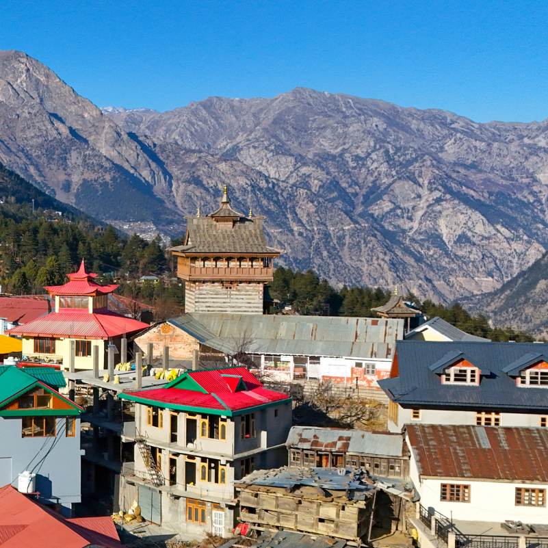
Kalpa
3 km
Your base. The Kinner Kailash sunrise, old Chini village with its temple and monastery, apple orchards, and all the Kinnaur logistics. Suicide Point is a half day addition from here.
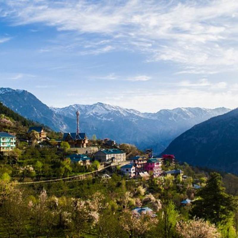
Roghi Village
5 km further along the cliff road (8 km total from Kalpa)
The quieter, older village beyond Suicide Point, with traditional wooden houses, the Roghi Mata temple, and afternoon Kinner Kailash views that some photographers prefer to Kalpa. The real reason to drive this road.
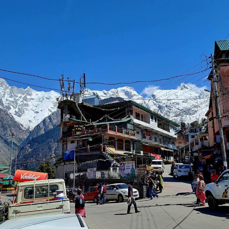
Reckong Peo
About 10 km
The district headquarters 7 km below Kalpa. ATMs, fuel, pharmacy, bus stand, and the Inner Line Permit office. Stock up here before anything else in Kinnaur.
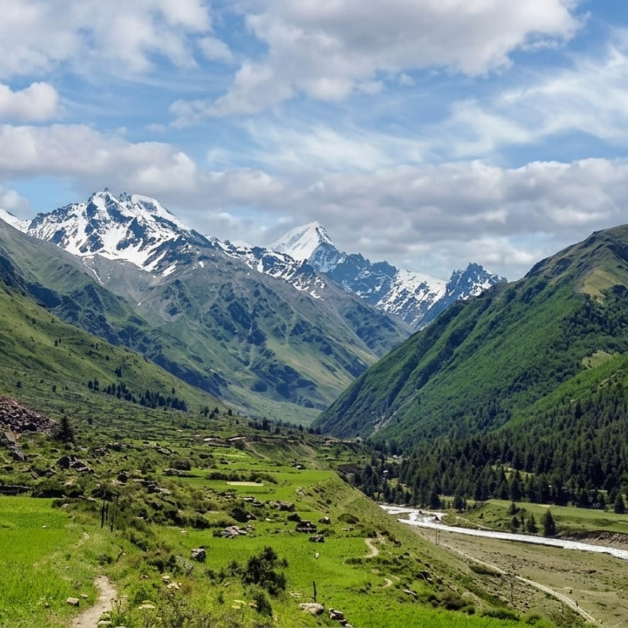
Sangla Valley
About 40 km from Kalpa via Karcham
The green Baspa Valley with apple orchards, Kamru Fort, and the drive to Chitkul. Most Kinnaur trips combine Sangla and Kalpa.
Our packages with Suicide Point Kalpa
Curated trips that include a visit to Suicide Point Kalpa.
 Group Tour5D/4N
Kinnaur Valley Weekend Group Trip With Sangla Chitkul and Kalpa
1D Sangla•1D Kalpa
₹7,999₹9,999SAVE INR 2,000/ person 4D/3N
4D/3NKinnaur Valley Scenic Circuit With Sangla Chitkul and Kalpa
1D Shimla•1D Sangla+1
₹16,999₹17,999SAVE INR 1,000/ person
Common questions about Suicide Point Kalpa
Where exactly is Suicide Point?
It is located on the narrow cliff road between Kalpa and Roghi village, about 3 km from Kalpa town in the Kinnaur district of Himachal Pradesh.
Why is it called Suicide Point?
The name refers strictly to the near vertical geometry of the cliff face dropping to the river. There is no historical record of any tragedies or suicide incidents here.
Is there an entry fee?
No, the viewpoint is located on a public road and is completely free to access.
How much time should I spend here?
A brief stop of 5 to 15 minutes is the ideal amount of time to enjoy the views and take photographs from behind the safety railing.
Is the road to Suicide Point dangerous?
Yes, it is a narrow, single lane road cut into a sheer cliff face with massive drops and no guardrails in many spots. You should always hire an experienced local driver and avoid the route entirely in the dark or during rain.
Can I walk to Suicide Point instead of driving?
While walking the road is possible, it is exposed and tight. A safer, more scenic alternative is to walk from Kalpa to Roghi village via the flat footpath through the apple orchards, then have a taxi pick you up to visit the viewpoint on the drive back.
Is Suicide Point suitable for children?
Only for a closely supervised, brief stop within the railed viewing platform. Do not let children near any of the unfenced rock outcrops or loose gravel edges.
What is the best time to visit Suicide Point?
April to June offers dry, stable road conditions, while October to November provides the sharpest visibility. Avoid the monsoon season (July to September) due to severe landslide risks.
Is there mobile network at Suicide Point?
Mobile connectivity is exceptionally poor or completely non existent at the cliff edge. Assume you will be offline.
Should I visit Suicide Point or skip it?
It is well worth a quick, 10 minute pause if you are already on your way to visit Roghi village, but it should not be planned as a standalone destination.
Related guides
Posts about Kinnaur
- Yulla Kanda Trek Guide 2026: Route, Best Time, Cost and Planning
- Kinnaur Snowfall Guide 2026: When & Where to Look for Snow
- Christmas & New Year in Kinnaur: A 2026-27 Winter Trip Guide
- Kinnaur in November 2026: Weather, Snow Chances & 7-Day Trip Plan
- Yulla Kanda Trek Distance and Route 2026: Yulla Khas to the Lake
- Yulla Kanda Krishna Temple in 2026: Location, Beliefs & Visiting Etiquette