
Raghupur Fort Trek
A short, steep day walk from Jalori Pass to a grassy ridge with old fort walls and a wide view across the Pir Panjal and the Great Himalayan Range
- Day trek
- ~3,300 m / ~11,000 ft
- Jalori Pass · 3 km trek
- Jibhi · 12 km drive
- Apr to Nov, usually
What makes it special
Raghupur Fort is the shorter of the two classic day walks from Jalori Pass, on the opposite side of the road from the Serolsar trail. Roughly 3 km each way, steeper than it looks on a map, and it ends not at a destination so much as a position. A grassy ridge top with the ruined walls of an old hill fort, a small shrine, and an open view across the Pir Panjal, the Great Himalayan Range, and on a clear day, the snow line of Kinnaur to the east.
The fort itself is more an idea than a fort. A handful of low stone walls, the outline of what was once a perimeter, and grass growing through the gaps. Local accounts credit the Mandi rulers and say it was a forward post used to watch for movement on the Sutlej side. Whether or not the dates are exact, the position makes sense the moment you stand on the ridge. You can see for kilometres in every direction.
Here is the honest framing most pages miss. The walk up takes about an hour and a half at a steady pace, and the first half is a sustained climb that catches first time trekkers by surprise. You earn the meadow. Once you are on top, almost everyone slows down, sits on a rock, and stops talking for a few minutes. That is the reason to come up.
Quick answers
- Is the Raghupur Fort trek worth it?
- Yes if you are already in the Jibhi or Shoja area, the Jalori Pass road is open, and you do not mind a steep climb of about 90 minutes. The fort ruins are minor, the meadow and the panorama are the point. Pick this over Serolsar Lake if you want bigger views and fewer people, and you do not mind earning them.
- How long does the trek take?
- Plan 2 to 3 hours round trip from Jalori Pass for a comfortable pace, including 30 to 45 minutes at the top. Roughly 90 minutes up, 60 minutes down. Add another 45 minutes if you stop for lunch at the dhabas at the pass when you get back.
- Can you camp at the meadow?
- Yes, in season, with proper gear and ideally a local guide from Jibhi or Shoja. The meadow is open and flat enough to pitch a tent, water sources are limited so carry your own, and there are no facilities. Most people do it as a day walk and sleep down in the village. Camping is best between May and early October.
Quick facts
Everything you need to know at a glance.
At a glance
- Altitude at the top
- ~3,300 m / ~11,000 ft (sources vary, some quote up to 11,500 ft)
- Location
- Above Jalori Pass, NH 305, Banjar tehsil, Kullu district, Himachal Pradesh
- Nearest base
- Shoja 5 km, Jibhi 12 km, both connect by road to Jalori Pass
- Open season
- Generally Apr to Nov, when the Jalori Pass road is open
- Time needed
- 2 to 3 hours round trip from Jalori Pass
- Difficulty
- Easy to moderate distance, but a steep middle section. About 3 km each way.
- Entry fee
- None. No permits required for Indian trekkers.
- Best start time
- Leave Jalori Pass by 10 to 11 AM at the latest
On the ground
- Mobile network
- Patchy. BSNL sometimes catches signal at the pass and on the meadow, almost nothing inside the forest section. Tell someone your plan before you start.
- ATMs
- None at the pass or on the trail. Nearest ATMs are at Banjar and Aut. Withdraw cash before you head into Jibhi.
- Fuel
- No fuel at the pass, Jibhi, or Shoja. Last reliable pumps are at Banjar and on the Aut side. Tank up on the way in.
- Food on the trek
- Nothing on the trail itself. Eat at the dhabas at Jalori Pass before or after. Plates run 100 to 180 rupees, cash only. Carry snacks and at least 1 litre of water per person.
- Parking
- Park at Jalori Pass near the tea stalls. Limited spots in peak season, arrive by 10 AM for a clean parking spot near the trailhead.
- Permits
- None required. The trek lies outside the Great Himalayan National Park core boundary.
- Drones
- Not welcome. The pass area is close to the Great Himalayan National Park boundary and the small ridge shrine is active. Avoid.
- Walking surface
- Forest path with soft mud, pine needles, scattered roots and small rocks for the first half. Open grass meadow on top. Trekking shoes with grip strongly recommended over sneakers.
- Guides
- Not strictly needed in clear weather, the trail is well used. A local guide from Jibhi or Shoja is sensible if you are trekking in fog, with kids, with elders, or in shoulder season conditions.
Seasonal weather
- April to early June14°2°Late spring
- July to August17°9°Summer monsoon
- September to early November13°0°Autumn
- Mid November to March-2°-15°Winter
Suitable for
- Couples — suitable
- Families — with some care
- Seniors — with some care
- Solo — suitable
- First-timers — suitable
- Pet-friendly — suitable
How to reach Raghupur Fort Trek
4 approach routes, with seasonal access.
From Jalori Pass (the trek itself)
Generally Apr to Nov, when the Jalori Pass road is open. Snow can linger on the upper meadow into early May some years.- Distance
- ~3 km each way from the pass
- Time
- 2 to 3 hours round trip
- Road
- Forest trail. Soft mud, pine needles, roots and small rocks for the first half. Steeper than Serolsar, gentler at the top where the meadow opens up.
- Last fuel
- Tank up at Banjar on the way in. No fuel at Jibhi, Shoja, or the pass.
The trailhead is across the road from the Mata Jalori temple, on the opposite side of the road from the Serolsar trail. Local drivers and dhaba owners point out the start, ask if it is not obvious. The first kilometre is a sustained climb through oak and rhododendron forest. The middle section eases into a more rolling gradient. The last 500 metres opens into a wide grass meadow that runs up to the fort ruins. Pace yourself on the first kilometre, that is where most people get out of breath. About 90 minutes up at a relaxed pace, 60 minutes down.
From Jibhi (drive to Jalori Pass + trek)
Jalori Pass road is generally open Apr to Nov. Closed by snow Dec to March in most years.- Distance
- ~12 km drive, then 3 km trek each way
- Time
- ~45 min drive + 2 to 3 hours total trek
- Road
- Narrow tarred road from Jibhi up to Jalori Pass with tight hairpins. The last 3 km before the pass is steep and rough. Small SUVs and taxis manage fine, large vehicles and low clearance sedans should think twice.
- Last fuel
- Last reliable pumps at Banjar and on the Aut side. Tank up before the climb.
The standard plan. Most Jibhi homestays arrange a return taxi to the pass for around 1,500 to 2,000 rupees in peak season with a few hours of wait time. Leave Jibhi by 8 or 9 AM, reach Jalori by 9 or 10 AM, start the trek, be back at the pass by lunch and at your homestay by mid afternoon. Self drive is doable if you are used to Indian hill roads. Combine the trek with rajma chawal at the pass dhabas after you come down, the plate hits differently when you have just walked up to a meadow at 11,000 feet.
From Shoja (drive to Jalori Pass + trek)
Same as the Jibhi approach. Closed in deep winter.- Distance
- ~5 km drive, then 3 km trek each way
- Time
- ~20 min drive + 2 to 3 hours total trek
- Road
- Short, steep tarred climb from Shoja to the pass. The closest village base.
- Last fuel
- None beyond Banjar. Tank up on the way in.
The shortest approach and the obvious choice if you are already in Shoja. Local taxis run 800 to 1,200 rupees for a return drive. Walking up from Shoja to the pass is doable in around 90 minutes if you are fit and want to stack two hikes in one day, though most travellers find the Raghupur climb itself enough work for one morning.
From Delhi or Chandigarh (approach to Jibhi)
The drive into Jibhi and Banjar is open year round. Only the Jalori Pass section above Shoja closes in winter, which makes the trek itself impossible in those months.- Distance
- ~500 km from Delhi, ~270 km from Chandigarh
- Time
- 12 to 14 hours from Delhi, 8 to 9 hours from Chandigarh
- Road
- NH 3 from Chandigarh to Aut, then NH 305 into the Banjar valley to Jibhi. Mostly decent tar, slower in monsoon because of landslide risk between Mandi and Aut.
- Last fuel
- Chandigarh, Swarghat, Bilaspur, Sundernagar, Aut, Banjar.
Most travellers reach Jibhi by an overnight Volvo to Aut and a taxi onwards, or a long self drive. Aut is the key turn off, just before the Aut tunnel on the Manali highway, easy to sail past at night. From Aut, it is 24 km to Banjar and another 8 km to Jibhi. Plan to sleep one night in Jibhi or Shoja before attempting the trek, you do not want to drive 14 hours and start a steep climb at altitude the same morning.
Best time to visit
Season by season, so you can plan around the weather rather than hope.
- Recommended
Late spring
April to early June
The cleanest window once the pass road clears
- Day temperature
- 10 to 15 C at the meadow
- Night temperature
- 2 to 6 C
- Trail
- Dry, occasional snow patches in early April near the top
- Crowds
- Light to moderate, busier on May weekends
Usually the best time. The Jalori Pass road clears some time in April, and by late April the trail itself is dry. Rhododendrons bloom through May on the lower forest section, the meadow at the top greens up, and afternoons stay clear of the heavy cloud build up that comes later. Mornings at the meadow still drop close to zero, carry a warm layer. Weekends in May get busy on the lower trail, weekdays stay calm.
Summer monsoon
July to August
Skippable unless you actively enjoy forest in rain
- Day temperature
- 14 to 18 C
- Night temperature
- 9 to 12 C
- Trail
- Muddy and slippery, leeches common in the lower forest
- Crowds
- Low
Most travellers skip these two months, fairly. The forest section turns slick, leeches show up after rain, and the meadow on top often disappears into mist by 11 AM, which kills the panorama that is the whole point. The pass road also sees occasional landslide closures between Mandi and Aut. If you do come in August, carry gaiters, a proper rain shell, and do not start the climb if you can see a thunderstorm building. Lightning on the open meadow is a real risk, not a theoretical one.
- Recommended
Autumn
September to early November
The sharpest window of the year for the panorama
- Day temperature
- 8 to 14 C
- Night temperature
- -2 to 5 C
- Trail
- Dry, bright, the easiest underfoot of any season
- Crowds
- Moderate, drops sharply after mid October
If you can time it, late September to mid October is the best of the year. Post monsoon air clears the haze, the oaks below start to turn, and the light at the meadow goes sharp blue overhead with snow lines visible to the east. Weekdays are quiet, October weekends pull crowds from Delhi and Chandigarh. First snow at the meadow usually falls some time in the first half of November, the road closes soon after. By mid November, conditions go from clean and crisp to actively cold within a week.
- Closed
Winter
Mid November to March
Pass road shuts, the trek becomes a serious snow walk
- Day temperature
- -5 to 0 C
- Night temperature
- -12 to -20 C
- Trail
- Snow bound, can be waist deep in Jan and Feb
- Crowds
- Almost none, a few guided snow treks
The Jalori Pass road generally shuts some time in mid to late November after the first heavy snowfall, which makes the standard trek impossible till the road reopens, usually some time in March or April. Local operators from Jibhi and Shoja occasionally run guided snow treks by walking up from lower villages to the pass and onwards to the meadow when snow depth allows, but this is a different proposition. Boots, gaiters, poles, a guide, and a willingness to turn back at any point. Not a casual day out and not something to attempt on your own.
Things to see & do
9 things worth your time at Raghupur Fort Trek.
The climb to the meadow
~90 min one wayThe whole trek in one line. Start across the road from the Mata Jalori temple, climb steadily through oak and rhododendron for the first kilometre, ease into rolling forest, and break out into open grass for the last 500 metres. Pace yourself in the first half, that is where most people slow down. About 90 minutes up at a steady walk, less if you push, more if you stop often.
Walk the fort walls and the small shrine
20 to 30 minutesThe ruins are modest. Low stone walls, the outline of what was once a perimeter, and a small shrine inside the fort outline that locals associate with Shringa Rishi. Walk the perimeter slowly rather than rushing to the highest point. The walls are low enough that you can sit on them. Take shoes off if you go up to the shrine steps, and do not move loose stones, the masonry is fragile.
Sit for the panorama
30 to 45 minutesHonestly the main reason most people come up. From the highest point of the meadow, on a clear morning, you can see the Pir Panjal sweeping north and the Great Himalayan Range running east. Snow lines towards Kinnaur on the cleanest October days. Pick a rock, sit, do not look at your phone, and you will get more out of the trip than from any photograph.
Watch the shepherds and grazing flocks
VariesLocal shepherds bring sheep and goats up to graze the meadow through late spring and summer. On a still afternoon the flock moves across the slope like one slow shape, and the bells carry across the open ground. If you happen to share the meadow with a flock, give them space, do not try to herd or photograph aggressively, and a quiet namaste to the shepherd is welcomed.
Rhododendron bloom on the lower forest
Through the trek, late Apr to early JunThe forest section has good stands of rhododendron that bloom through May. The colour is mostly red here rather than the higher pinks you see further into the Himalaya. Best seen in the morning light on the way up, when the side angle catches the flowers against the dark trunks. Do not pick blooms, the locals view the trees as part of the forest god's territory.
Camp at the meadow (with proper plan)
OvernightOpen and flat enough for a small group of tents, sheltered enough by the ridge to be tolerable in summer. No water source on the meadow itself, so plan to carry up at least 4 to 5 litres per person. No facilities, so a leave no trace plan is non negotiable, especially around toilet waste. Get a local operator from Jibhi or Shoja to run it for you the first time, they bring tents, food, and a guide who knows where to set up. Best done between May and early October on a settled weather forecast.
Sunrise from the ridge
Half day with a camping planIf you camped on the meadow, this is the payoff. First light hitting the snow ranges to the east while you are still at 11,000 feet with a cup of chai. Worth one cold night for. As a day plan it is harder to pull off, you would need to leave Shoja by around 4 AM, walk in headlamp light through the forest, and you would still likely miss true first light. The camping route is the one that works.
Combine with the dhabas at Jalori Pass
30 to 45 minutes after the trekPlan to eat after the trek rather than before. After 90 minutes of climbing and a couple of hours on a windy meadow, the rajma chawal at the pass dhabas earns its 150 rupees comfortably. Cash only, small notes preferred. The dhabas are the soft landing back into civilisation.
Spot Himalayan birds in the forest
Through the walkThe forest section holds Himalayan monal, cheer pheasant, several thrushes, and a few smaller flycatchers. Dawn is much better than midday, and you are likely to hear more than you see because the canopy is dense. Carry small binoculars if birding matters to you, walk softly, and pause for two or three minutes every few hundred metres rather than trying to spot while moving.
Know before you visit Raghupur Fort Trek
The practical bits, from people who have been.
What this trek actually isA 3 km steep day walk from Jalori Pass to a meadow ridge with old fort walls and a wide view.
The Raghupur Fort Trek is a short, steep day hike that starts at Jalori Pass and tops out on a grassy ridge at roughly 3,300 metres. Distance is about 3 km each way, so 6 km round trip, and most travellers do it in 2 to 3 hours including time at the top. The trail begins on the opposite side of the road from the Serolsar Lake trail, climbs through oak and rhododendron forest, and breaks into open meadow for the last 500 metres.
A few words on the altitude figure. You will see anywhere from 11,000 ft to 12,000 ft quoted online, which is roughly 3,350 to 3,660 metres. The honest answer is that no two sources agree, and the meadow itself runs along a ridge so the exact number depends on where you stand. Treat any single figure with a pinch of salt. What matters in practice is that you are starting around 10,200 ft at the pass and climbing roughly 800 ft, which is enough to feel a little out of breath.
The fort itself is a modest set of low stone walls and a small ridge top shrine, not a Mughal era citadel. Local accounts credit Mandi rulers and date it to several hundred years old, though the exact history is thin and most operator pages just repeat the same line. Treat the fort as the excuse, the meadow and the panorama as the reason.
Raghupur or Serolsar? How to pickPick Raghupur for views and a steep workout. Pick Serolsar for a long shaded walk to a sacred lake.
Both walks start at Jalori Pass and they are not interchangeable. Most travellers who arrive at the pass without a plan default to Serolsar because the signboard is bigger, and some of them pick wrong for their mood.
Raghupur Fort: About 3 km each way, steeper, 90 minutes up, ends at a wide meadow with the best panorama of the area. Pick this if you want views, do not mind a real climb, and would rather have fewer people around. Total time 2 to 3 hours.
Serolsar Lake: 5 km each way, mostly flat and shaded, ends at a small sacred lake with a temple. Pick this if you want a destination at the end, are walking with kids or older relatives, or want a shaded forest walk rather than an exposed climb. Total time 5 to 6 hours. Our detailed Serolsar Lake guide covers it in full.
Trying to do both in the same day from the pass is doable but ambitious. The classic plan is six hours minimum, no rest, no proper meal, and you arrive back at your homestay tired in a way you did not need to be. Pick one for this trip, come back another day for the other.
Photography guideFirst and last light from the meadow ridge, early October for the clearest panorama, no drones.
The meadow gives the widest views of any short walk in the Jalori Pass area. For the cleanest panorama, the first hour after sunrise and the last hour before sunset are the windows that work, but both require either an overnight camp on the meadow or a brutally early start from Shoja. As a daytime hiker, you usually arrive between 11 AM and 1 PM, which is workable in October when the air is sharp, but flat and hazy through summer.
A 24 to 35 mm lens covers most of the meadow scene. Bring a polariser if you have one, the haze across the Pir Panjal lifts visibly with one. The forest section is dim under the canopy, so a wider aperture helps if you want to shoot the rhododendron bloom in May.
Photography rules around the small shrine. Photograph the exterior freely, ask before photographing pilgrims or shepherds, and do not photograph inside the shrine. Drones are not welcome here. The pass area is close to the Great Himalayan National Park boundary and the small shrine is active. Keep them grounded.
Who should do this trek, and who should reconsiderGood for fit adults and confident teenagers. Think twice with small kids, slow elders, or weak knees.
This is one of the better short Himalayan day walks for someone who wants a real climb without committing to a multi day trek. It is not as friendly as Serolsar Lake, and it is honest to say so up front.
Fit adults and confident teenagers: Yes. The distance is short, the gradient gives you a workout, and the meadow is a satisfying payoff. Most reasonably active people manage it without prior training.
Families with small kids: Mixed. Children 10 and above usually do well if they walk regularly. Under that, the steep first kilometre wears them down and you end up carrying. If you are travelling with kids under 8 or 9, Serolsar Lake is the better pick.
Seniors: Doable for active seniors used to hill walking. The first kilometre is the deciding factor. If your parents handle stairs at home without breath issues and have walked at altitude before, they will manage with regular breaks. If not, the Serolsar walk or just tea at the pass is a better day.
Pets: Dogs do well on this trail. The forest is shaded, the climb is short, and the meadow is open enough to let them off leash if they recall well. Carry water for them, no streams cross the trail in summer.
Anyone with knee issues: The descent is harder on the knees than the climb. Carry one trekking pole at minimum, two if you have them. Take the descent in small steps and do not rush.
Camping at the meadow, the honest versionPossible May to early October with proper plan, gear, and ideally a local operator. No facilities, carry water.
Camping at Raghupur is one of the better short overnight trips in the Jibhi area. The meadow is wide and flat enough for a small group of tents, sheltered enough by the ridge to be tolerable in summer, and the night sky away from any village light pollution is genuinely good. Operators from Jibhi and Shoja run packaged overnights from May to early October.
The honest caveats: No water source on the meadow itself, so plan to carry up 4 to 5 litres per person for cooking, drinking, and basic washing. No facilities of any kind, which means a proper leave no trace plan including human waste, especially around the small shrine area which locals view as sacred. Weather can switch in 30 minutes at this altitude, so a forecast that holds the night you plan to camp is a hard requirement, not a nice to have.
Self organised vs operator: If this is your first Himalayan camp, use a local operator from Jibhi or Shoja for the first time. They bring tents, sleeping bags rated for the cold, food, water, and a guide who knows where to set up. Self organised is fine if you have camped at altitude before and own the gear, but pick the meadow spots away from the shrine and well clear of the immediate fort wall area.
In winter, do not camp here on your own under any circumstances. The pass road is shut, the temperatures drop hard, and the rescue distance from the meadow back to a village is long. Guided winter snow camps exist but they are a different category of trip.
Where to base for this trekSleep at Jibhi or Shoja and drive up to the trailhead in the morning. No accommodation at the pass or on the trek.
There is no accommodation at the meadow, on the trail, or at the pass itself. Plan to sleep in Jibhi or Shoja and drive up to the trailhead in the morning. Both villages are well set up for travellers in season.
Jibhi has the widest range of stays and the best food scene. Homestays from around 1,500 a night, cabins and boutique cottages upwards of 4,000, and a cluster of cafes for breakfast on the morning of the hike. Good base for first time visitors. Busier on weekends. Our Jalori Pass guide has more on the broader area.
Shoja sits about 5 km below the pass and is the closer base. Quieter, colder at night, fewer options for food outside your homestay. Better if you want an early start and a shorter drive up to the trailhead. The PWD and Forest Department rest houses here are often full, book ahead.
Food on the day of the trek: Eat a real breakfast at your homestay before you drive up. Carry one packed snack and at least 1 litre of water per person. Save the proper meal for the dhabas at Jalori Pass when you come back down, the rajma chawal lands well after a climb.
Safety, weather and gearMild altitude, fast weather, and a meadow with no shelter. Carry layers, a rain shell, water, and proper shoes.
3,300 metres is mild by Himalayan standards but still real. If you arrived from Delhi or another plain in the last 24 hours, you may feel mild breathlessness or a light headache on the climb. Walk slowly for the first 20 minutes, drink water, and eat something warm at the dhabas before you start. Serious altitude sickness is rare on a trek this short, not impossible.
The meadow has no shelter. Weather can switch from sunny to misty in 30 minutes, and from misty to a real storm in 30 more. Carry a rain shell, one warm layer, and a cap, even on a clear morning. If you see a thunderstorm building, do not stay on the open ridge, drop into the forest line for shelter and wait it out. Lightning at this altitude is not a small risk.
Gear that matters: Trekking shoes with grip beat sneakers for both the climb and the descent. A trekking pole is genuinely useful coming down, two if you have weak knees. 1 to 1.5 litres of water per person, snacks, sunscreen, sunglasses, and a small first aid kit with blister tape.
Medical help. There is no clinic at the pass or on the trail. Nearest proper hospital is at Banjar, about an hour from the pass by road, and a better one at Kullu, about 2.5 hours away. Mobile signal is patchy, so tell someone your plan before you start and stick to it.
Local tips most travellers missStart by 10 AM, wear real shoes, eat after not before, and walk the meadow rather than racing to the highest point.
Start the climb from Jalori Pass by 10 AM at the latest. Late starts get caught by afternoon mist on the meadow, which is exactly what you do not want on a trek where the view is the point. The dhabas at the pass open by around 8 AM in season, so you have time for chai before you set off.
Wear real shoes. The forest section has loose pine needles and small rocks where sneakers slide on the descent. Trekking shoes with even basic grip make a noticeable difference, especially after rain.
Save the meal for after. Climbing 800 ft on a full stomach at altitude is a small mistake most first time trekkers make. Eat your breakfast at the homestay, carry one snack for the meadow, and have the rajma chawal at the pass dhabas after you come down. The plate hits differently when you have just walked up to a meadow at 11,000 feet.
When you reach the meadow, do not just walk to the highest point and turn back. Walk along the ridge in both directions for 100 to 200 metres each side. The view shifts, and the spots where most travellers do not bother to walk are usually the ones with the cleanest panorama. Carry small cash for the dhabas and the taxi, change for 500 notes is slow in the morning.
One quiet recheck reminder. The Jalori Pass road status shifts after heavy rain or the first snow of winter, and the trek is impossible when the road is shut. Ask your homestay the evening before you plan to drive up.
Nearby attractions
Other places worth the detour.
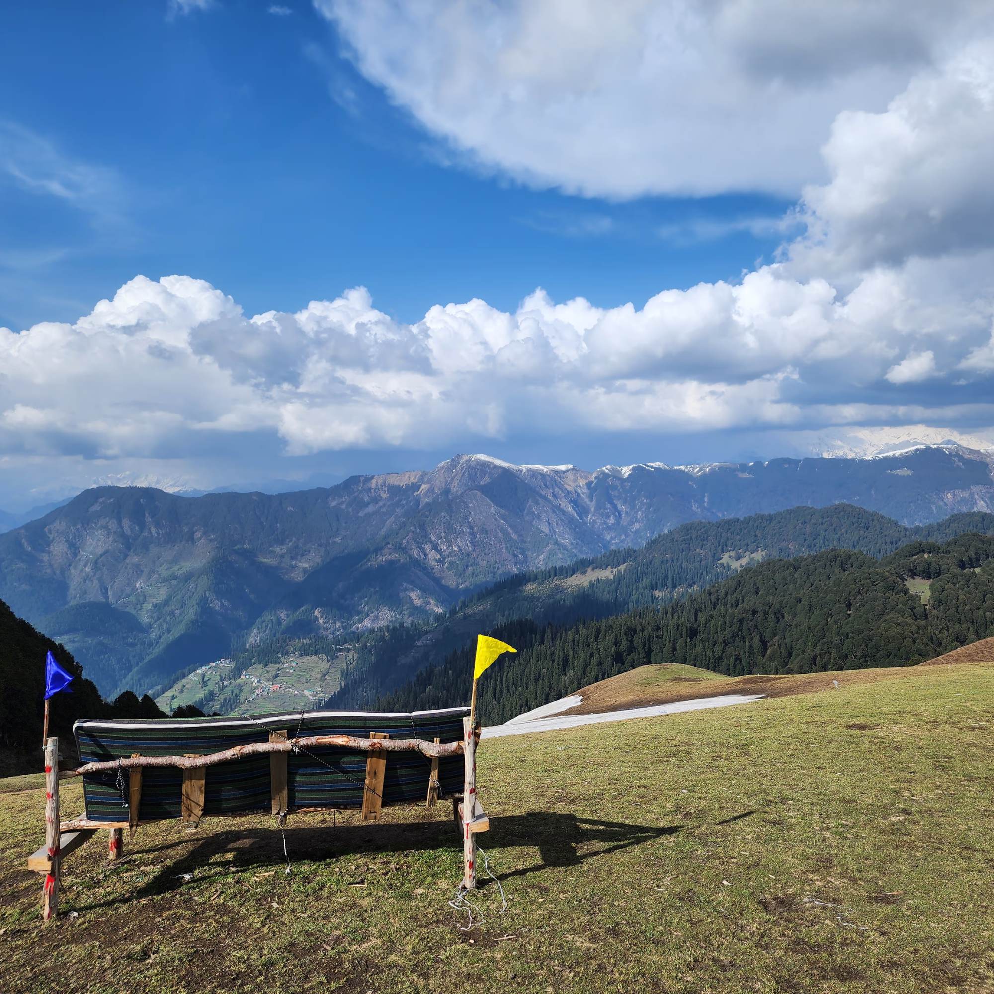
360 Viewpoint
~500 m from Jalori Pass on the Serolsar trail
A short steep spur off the Serolsar path, the highest accessible point on that side of the pass. Useful as a quick add on if you have an extra hour at the pass after the Raghupur descent.
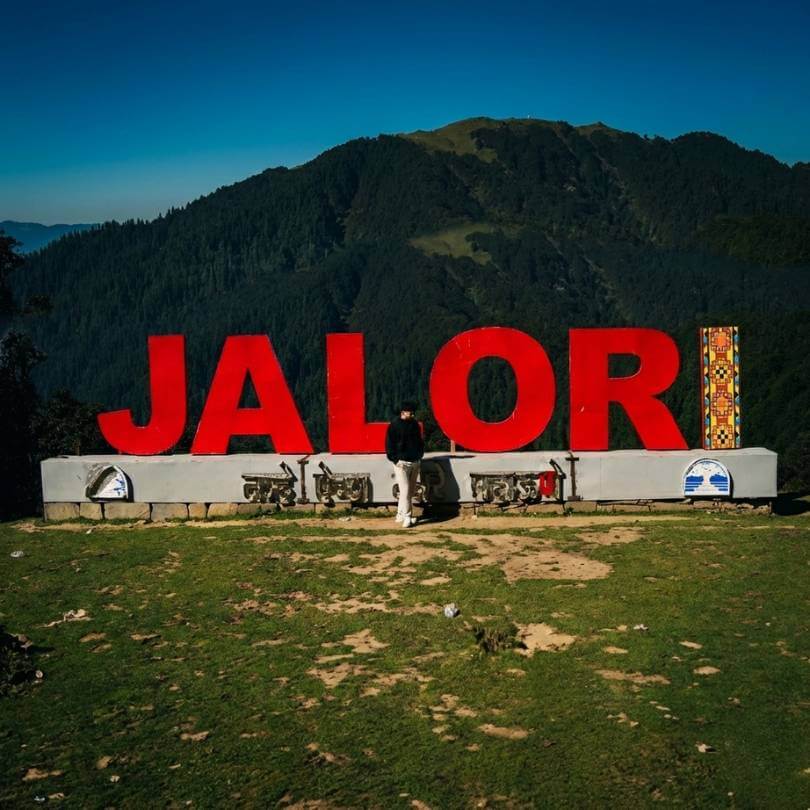
Jalori Pass
Trek starts here
The trailhead. The Raghupur trek begins on the opposite side of the road from the Mata Jalori temple at the top of the pass, around 3,120 metres.
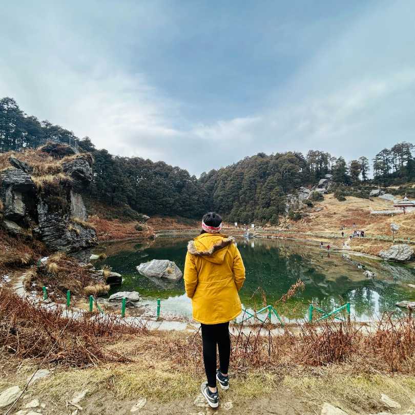
Serolsar Lake
5 km trek from Jalori Pass (other direction)
The other classic day walk from the pass. Longer, easier, mostly flat and shaded, ending at a small sacred alpine lake with a temple on the bank.
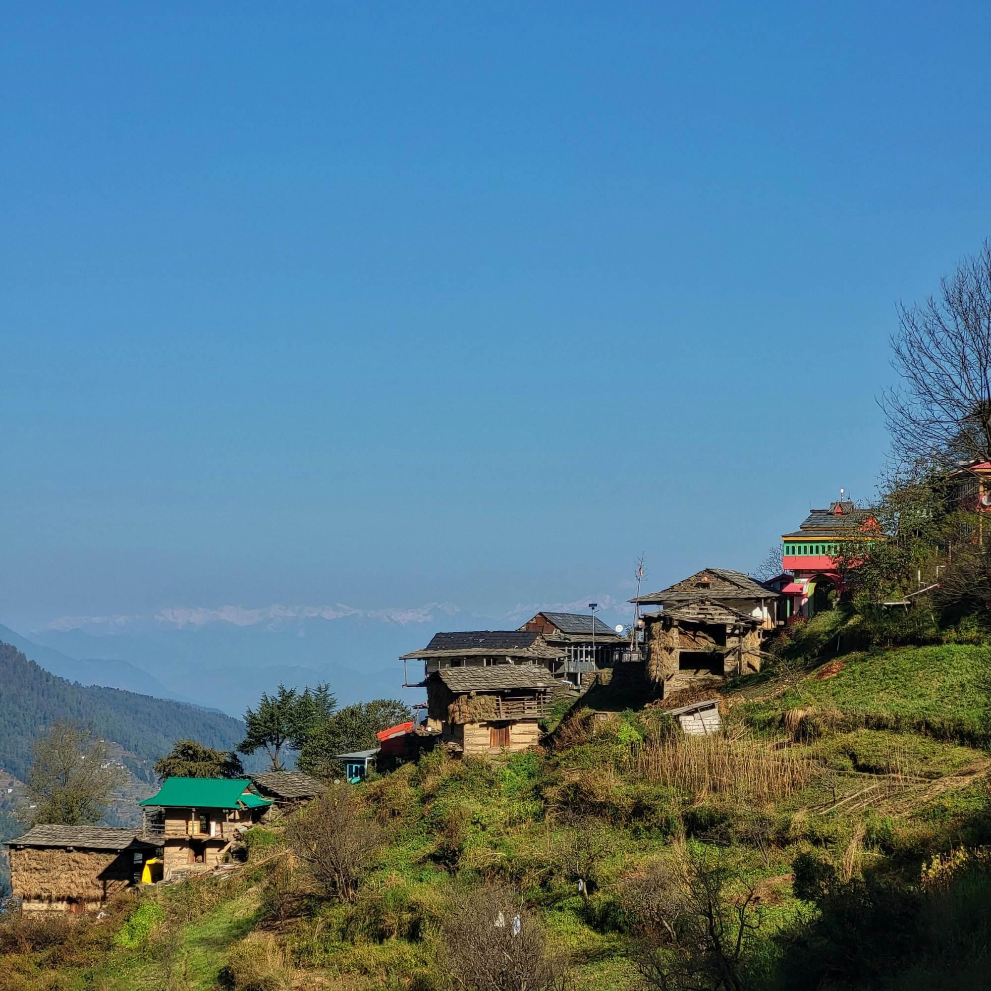
Shoja Village
~5 km · 20 min drive to the trailhead
The closest village to the trailhead. Quieter and colder than Jibhi, fewer food options outside your homestay.
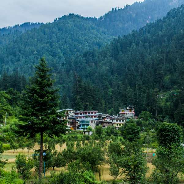
Jibhi Village
~12 km · 45 min drive to the trailhead
The standard base for this trek. Homestays, cafes, Jibhi Waterfall, and a relaxed mountain village feel.
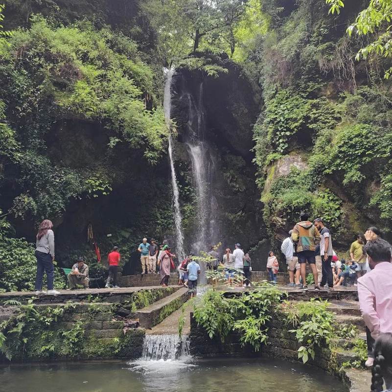
Jibhi Waterfall
~12 km from the pass
A short waterfall a few minutes walk from the Jibhi bazaar. Easy family stop on the drive back from the trek.
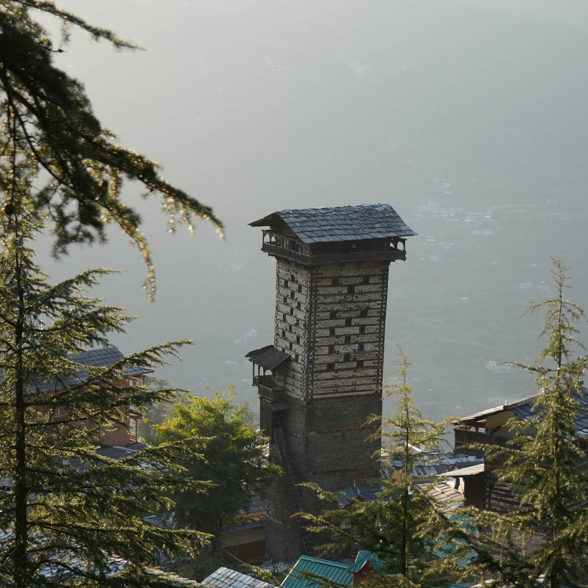
Chehni Kothi
~22 km from the pass
An unusual multi storey traditional tower roughly 400 years old, in a village off the Banjar road.
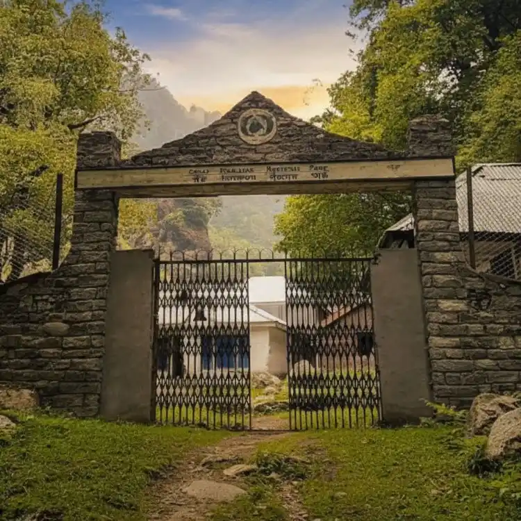
Great Himalayan National Park
Tirthan entry ~30 km from the pass
UNESCO World Heritage site covering the Tirthan, Sainj and Jiwa river catchments. Separate entry permits needed.
Our packages with Raghupur Fort Trek
Curated trips that include a visit to Raghupur Fort Trek.
 Group Tour5D/4N
Best Jibhi Tirthan Valley & Jalori Pass Weekend Tour From Delhi
1D Delhi •2D Tirthan Valley+1
₹5,999₹6,599SAVE INR 600/ person 5D/4N
5D/4NJibhi Tirthan Valley & Jalori Pass Scenic Weekend Tour
1D Delhi•2D Jibhi+1
₹11,999₹15,999SAVE INR 4,000/ person 6D/5N
6D/5NBest Jibhi Tirthan Valley & Shangarh Meadows Trip
1D Delhi •2D Tirthan Valley+2
₹15,999₹19,999SAVE INR 4,000/ person
Frequently Asked Questions
How long is the Raghupur Fort trek?
About 3 km each way from Jalori Pass, roughly 6 km round trip. Most travellers complete it in 2 to 3 hours including time at the meadow on top. About 90 minutes up at a steady pace, 60 minutes down.
How difficult is the Raghupur Fort trek?
Easy to moderate. The distance is short, but the first kilometre is a sustained climb that catches first time trekkers by surprise. Reasonably active adults manage it without prior training. The descent is harder on the knees than the climb, a trekking pole helps.
What is the altitude of Raghupur Fort?
Roughly 3,300 metres, around 11,000 feet. Sources online quote anywhere from 11,000 to 12,000 feet, and the meadow itself runs along a ridge so the exact figure depends on where you stand. Treat any single number as approximate.
Where does the Raghupur trek start?
At Jalori Pass, on the opposite side of the road from the Mata Jalori temple and the Serolsar Lake trail. The trailhead is a short walk from the cluster of tea stalls. Local drivers and dhaba owners point out the start, ask if it is not obvious.
When is the best time to do the trek?
Late April to early June and September to early November are the clean windows. Monsoon months are slippery, leech prone, and often misted out at the meadow. Winter closes the Jalori Pass road and makes the standard trek impossible.
Is the trek possible in winter?
Generally no. The Jalori Pass road shuts some time in mid to late November after the first heavy snowfall, and reopens around March or April. Local operators run guided snow treks by walking up from lower villages in some lighter snow windows, but this needs proper boots, gaiters, poles, and a guide. Not a casual day out.
Can I camp at Raghupur Fort meadow?
Yes, in season, with a proper plan and gear. The meadow is open and flat enough for a small group of tents. There is no water source on the meadow, no facilities of any kind, and no shelter. Use a local operator from Jibhi or Shoja the first time, especially if you have not camped at altitude before. May to early October is the practical window.
Do I need a permit or guide for the Raghupur trek?
No permit is required. A guide is not strictly needed in clear weather and active season, the trail is well used. A local guide from Jibhi or Shoja makes sense if you are trekking in fog, with kids or elders, or if you plan to camp overnight.
What should I carry on the trek?
Trekking shoes with grip, a rain shell, one warm layer, a cap, sunscreen, sunglasses, 1 to 1.5 litres of water per person, snacks, and a small first aid kit. A trekking pole is genuinely useful on the descent. Cash for dhabas and taxis at the pass.
Is there food and water on the trek?
Nothing on the trail itself. Eat at the dhabas at Jalori Pass before or after the trek, plates run 100 to 180 rupees and they are cash only. Carry your own water, the streams in the forest are not safe to drink untreated.
Can I do the trek with kids?
Children 10 and above usually do well if they are used to walking. Under 8 or 9, the steep first kilometre wears them down and you end up carrying. If you are travelling with younger kids, the Serolsar Lake walk is the better day from Jalori Pass.
Can I do both Raghupur and Serolsar in one day?
Doable but ambitious. Serolsar is a 5 to 6 hour walk, Raghupur adds another 2 to 3 hours, and you need to allow time for lunch at the pass dhabas. The classic plan is six hours minimum of walking and you arrive back at your homestay tired in a way you did not need to be. Pick one for this trip, come back another day for the other.
Related guides
Posts about Jibhi
- Jibhi in December 2026: Snowfall, Weather, Road Status and Winter Guide
- Jibhi in October 2026: Weather, Road Conditions, Places and Trip Plan
- Jibhi in August 2026: Weather, Road Safety, Itinerary and Honest Advice
- Jibhi for Honeymoon in 2026: Why Couples Choose It Over Manali
- Best Things to Do in Jibhi for Couples in 2026: Romantic Places, Walks and Hidden Gems
- Jibhi or Kasol — Which Is Better? An Honest, No-Fluff Comparison