
Tosh Waterfall
A waterfall on the trail above Tosh where seasonal cafes serve hot chai within spray distance of the falls, the valley drops away behind you, and you realise the uphill walk was worth it about two sips in
- Waterfall
- Parvati Valley
- ~2,500 m
- On the Kutla hike
- 1.5 to 2 km from Tosh
- Seasonal cafes
- Tosh Nala stream
- Short walk from Tosh
- No entry fee
- Trail rest stop
What makes it special
About 30 to 60 minutes of uphill walking from Tosh Village, the trail opens onto a waterfall that you will hear before you see. The Tosh Nala stream drops maybe 15 to 20 metres down a rock face, fed by snowmelt and high altitude streams, and the spray carries across the path even on windless days. This is the spot on the Kutla hike where everyone pauses. Not because they planned to, but because the combination of falling water, a hot chai, and Tosh shrinking below makes stopping feel obvious.
The walk up from the village is about 1.5 to 2 km through pine forest, with walnut trees lining the lower sections and the Tosh Nala running alongside. Steady uphill, nothing steep. Your legs notice it but your lungs should not complain. Tosh sits at roughly 2,400 metres, and the waterfall is somewhere around 2,500 to 2,550 metres, so the altitude gain is gentle. Proper shoes are smart. Sandals are a mistake, especially near the spray zone where every rock is wet.
What turns this from a nice view into a proper stop is the seasonal cafes. Between roughly May and October, small tea stalls set up within spray distance of the falls. Maggi, chai, chips, biscuits. Trail prices, plastic chairs, sometimes a flat rock as your table. The food is nothing special. The setting is. Eating hot noodles with cold mist hitting your face and the valley dropping away behind you is one of those small Parvati Valley moments that earns its place in your memory without trying.
Think of the waterfall as the halfway marker on the Kutla hike. Everything before this point is a manageable walk through forest. Everything after steepens into a proper climb for another 1.5 to 2 km. If you reached the waterfall comfortably, the rest is doable. If you were already struggling, the second half will test you more, and knowing that here is better than learning it later on a steeper trail.
The flow changes through the year. Snowmelt in May and early June keeps it strong and loud. By late October the cascade thins noticeably. Winter sometimes freezes it partly. During monsoon (July through September), the volume is impressive but the trail turns muddy and slippery in a way that demands real caution. Rocks near the base become greasy. Leeches appear in the forest below. A fall here, with wet rock and no mobile signal, is not something you want to deal with. Stick to dry months if you have a choice.
Honest framing. Nobody plans a Parvati Valley trip around this waterfall. It earns its place as the best thing on the walk between Tosh and Kutla, and that is genuinely enough. If you are hiking to Kutla, you pass right through. If you are spending a day in Tosh and want a short morning walk that goes somewhere worth going, the waterfall makes a satisfying 1.5 to 2 hour round trip on its own. Just do not come all the way from Kasol or Barshaini specifically for this. The walk from Tosh is the right approach.
Quick answers
- What is Tosh Waterfall?
- A mountain waterfall on the trail from Tosh Village (at roughly 2,400 m) to Kutla, about 1.5 to 2 km of uphill walking from the village. Fed by the Tosh Nala stream. Seasonal cafes set up beside the falls from May through October, serving chai and Maggi within spray distance of the water. Marks the halfway point of the Kutla hike, where the path shifts from a steady walk to steeper climbing.
- How much time do I need?
- On its own, 1.5 to 2 hours round trip from Tosh including time at the falls. Add 2 to 3 hours if continuing to Kutla. Most people spend 10 to 30 minutes at the waterfall itself.
- Can I visit the waterfall without hiking all the way to Kutla?
- Yes, and it makes a satisfying short morning hike on its own. Walk up from Tosh (30 to 60 minutes), sit with a chai at the falls, walk back down (20 to 40 minutes). No need to continue to Kutla unless you want to.
Quick facts
Everything you need to know at a glance.
At a glance
- Location
- On the trail from Tosh to Kutla, about 1.5 to 2 km above Tosh Village. Parvati Valley, Kullu district, Himachal Pradesh.
- Altitude
- Roughly 2,500 to 2,550 m. Between Tosh (2,400 m) and Kutla (2,650 m).
- Distance from Tosh
- About 1.5 to 2 km uphill. 30 to 60 minutes walking.
- Entry fee
- None.
- Time needed
- 1.5 to 2 hours round trip from Tosh. 10 to 30 minutes at the waterfall.
On the ground
- Food
- Seasonal cafes (roughly May to October) beside the waterfall. Maggi, chai, snacks. Closed in off season.
- Mobile network
- No reliable signal. Same as upper Tosh area.
- Safety
- Rocks near base are slippery. No medical help. Trail is not technical but continuously uphill.
Seasonal weather
- March to June20°3°Spring and Summer
- July to September16°8°Monsoon
- October to November14°-2°Autumn
- December to February5°-8°Winter
Suitable for
- Couples — suitable
- Families — with some care
- Seniors — with some care
- Solo — suitable
- First-timers — suitable
- Pet-friendly — with some care
How to reach Tosh Waterfall
1 approach route, with seasonal access.
From Tosh Village (on foot)
Generally April to November. Trail can be muddy in monsoon, snow covered in winter.- Distance
- About 1.5 to 2 km one way
- Time
- 30 to 60 minutes uphill, 20 to 40 minutes return
- Road
- Mountain trail through forest along the Tosh Nala stream. Uphill. No road access.
From the upper edge of Tosh Village, walk uphill past the Jamadagni Rishi Temple. The trail follows the Tosh Nala stream through pine forest with walnut trees in the lower section. The climb is steady but not steep for the first 1.5 to 2 km. The waterfall appears on your left, beside the trail, with seasonal tea stalls nearby. To continue to Kutla, stay on the trail past the waterfall for another 1.5 to 2 km of steeper climbing.
Best time to visit
Season by season, so you can plan around the weather rather than hope.
- Recommended
Spring and early summer
April to June
Strong flow, dry trail, cafes open. The best window.
- Waterfall
- Strong flow.
- Trail
- Dry, clear.
- Cafes
- Open.
Strong waterfall flow from snowmelt. Trail is dry and clear. Cafes operating beside the falls. The best window for a visit. May and June weekends bring more trekkers through on their way to Kutla.
Monsoon
July to September
Heavy flow but muddy, slippery trail. Watch your footing.
- Waterfall
- Heavy flow.
- Trail
- Muddy, slippery.
- Cafes
- Some may close.
Heavy waterfall flow but the trail is muddy and slippery. Rocks near the base are especially dangerous. Leeches possible in the forest. Some cafes may close in heavy monsoon.
- Recommended
Autumn
September to November
Clear skies, thinning crowds, good flow through October.
- Waterfall
- Moderate flow. Thinning by November.
- Trail
- Dry, clear.
- Cafes
- Some open through October.
Decent waterfall flow with clear skies. Trail dries out. Thin crowds. October is the best month. By November the flow starts thinning and the cafes begin closing.
Winter
December to February
Thin flow, possible ice, cafes closed.
- Waterfall
- Reduced. May partly freeze.
- Trail
- Snow possible.
- Cafes
- Closed.
Reduced flow. Waterfall may partly freeze. Trail may have snow. Cafes closed. Visit only if you are already in Tosh with proper winter gear.
Things to see & do
2 things worth your time at Tosh Waterfall.
Grab a chai at the waterfall cafes
15 to 30 minutesBetween roughly May and October, small tea stalls appear right next to the falls. Maggi, chai, chips, biscuits. Standard trail pricing, nothing fancy. The draw is where you are sitting, not what you are eating. Cold spray drifts across from the waterfall. Tosh is visible far below. If you are heading on to Kutla, this is the last place to grab food. If the waterfall is your turnaround point, the chai alone makes the uphill walk worthwhile.
Hike from Tosh to the waterfall and back
1.5 to 2 hours round trip, or continue to KutlaStart from the upper edge of Tosh, past the Jamadagni Rishi Temple, and follow the trail along the Tosh Nala. Pine forest and walnut trees line the lower stretch. The path climbs steadily but never gets steep. After about 1.5 to 2 km (30 to 60 minutes depending on your pace), the waterfall appears on your left beside the trail. Spend some time here, then either turn around for an easy downhill return (20 to 40 minutes) or push on toward Kutla, where the trail gets noticeably steeper for the final 1.5 to 2 km.
Know before you visit Tosh Waterfall
The practical bits, from people who have been.
The walk up and what to watch for1.5 to 2 km uphill from Tosh, 30 to 60 minutes. Wear proper shoes. Slippery rocks near the base. Monsoon makes the trail muddy and risky.
From Tosh Village, head uphill past the Jamadagni Rishi Temple. The trail follows the Tosh Nala stream through pine and walnut forest. Steady uphill, about 1.5 to 2 km. After 30 to 60 minutes the waterfall appears on your left beside the path.
Wear proper shoes with grip. The rocks near the waterfall base are wet year round and slippery even in dry weather. During monsoon (July through September), the trail itself turns muddy, the rocks become genuinely dangerous, and leeches show up in the forest below. A slip here, with no phone signal and no medical help nearby, is a real problem. If you are planning the walk in monsoon, go slow, watch every step, and carry a stick if you have one.
Continuing to Kutla? The trail steepens considerably after the waterfall. If the first half felt comfortable, you are fine. If it felt hard, reconsider.
Cafes, connectivity, and practical realitySeasonal cafes May to October. No stays, no signal, no ATM. Carry snacks and water. Check conditions at your Tosh guesthouse.
Small tea stalls appear beside the falls from roughly May through October. Maggi, chai, chips, biscuits at trail prices. These are the real deal, plastic chairs or flat rocks, cold spray from the waterfall included. Once stalls close for the season, there is nothing here. Carry water and snacks from Tosh regardless.
No accommodation at the waterfall itself. The nearest stays are in Tosh (30 to 60 minutes back down) or Kutla (1 to 1.5 hours further up, basic homestays only). No mobile signal. No ATM (nearest in Kasol, which is about 21 km by road from Tosh via Barshaini). Carry cash and basics from town.
Worth checking before you go: cafe openings and trail conditions shift year to year. Ask at your guesthouse in Tosh for the latest.
Nearby attractions
Other places worth the detour.
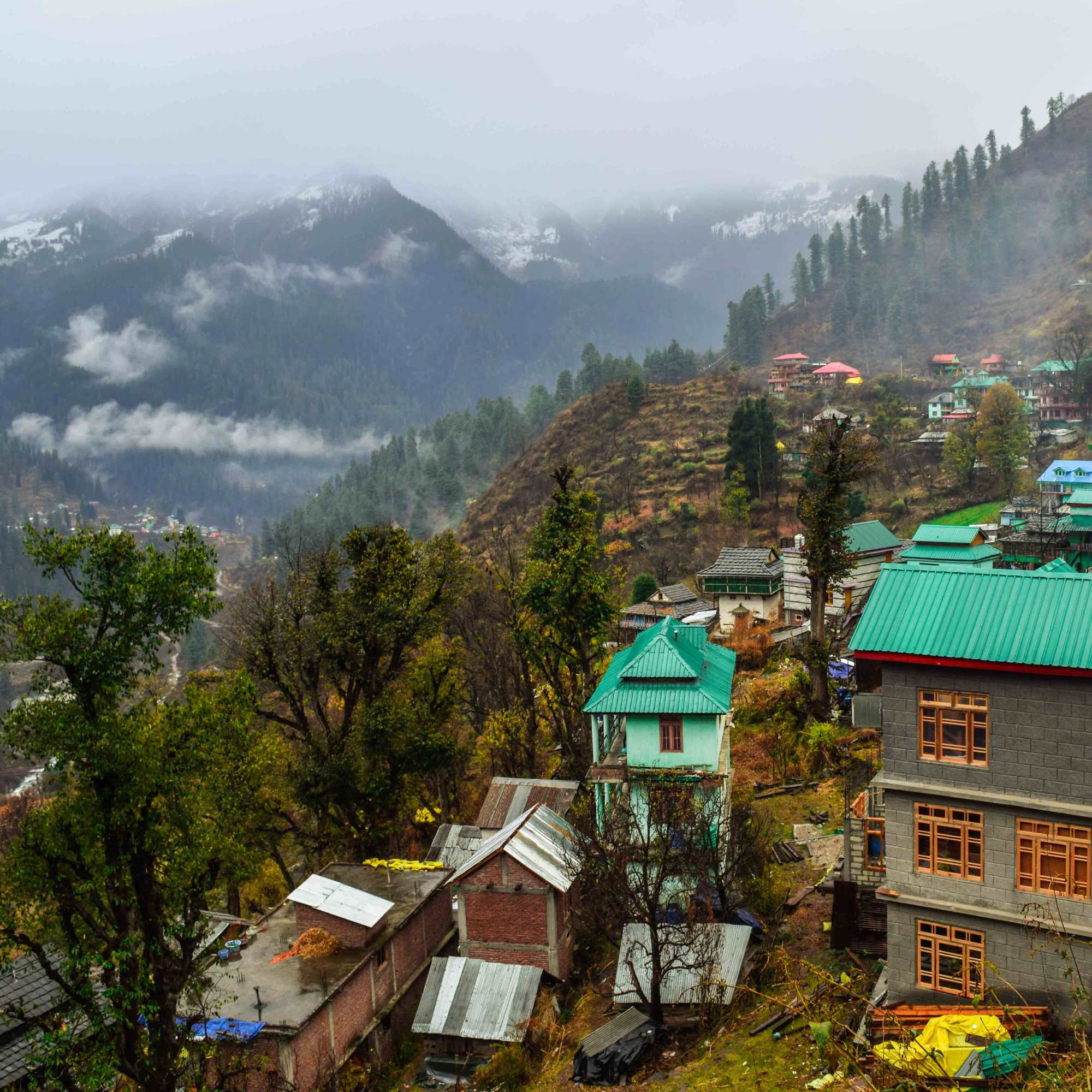
Tosh Village
About 1.5 to 2 km downhill (30 to 60 min)
The starting point for the walk to the waterfall. A hillside village at 2,400 metres with mountain views, cafes, guesthouses, and the Jamadagni Rishi Temple. About 30 to 60 minutes downhill from the waterfall.
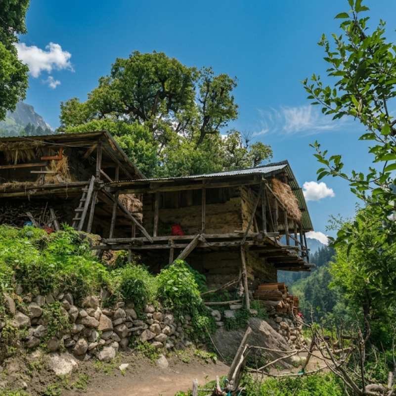
Kutla Village
About 1.5 to 2 km uphill (1 to 1.5 hours)
A tiny grazing settlement at roughly 2,650 metres with basic homestays and wide mountain views. About 1.5 to 2 km further up the trail past the waterfall. The trail steepens after the waterfall.
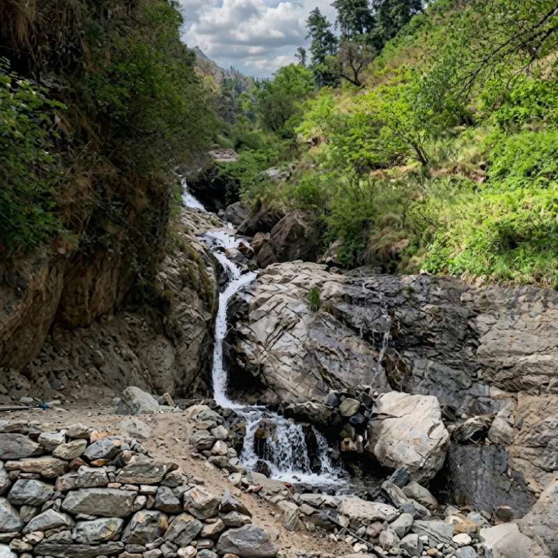
Barshaini
About 5 km total (trail to Tosh, then road to Barshaini)
The last road head in the upper Parvati Valley. About 3 km downhill from Tosh by road. Transit point for the entire upper valley.
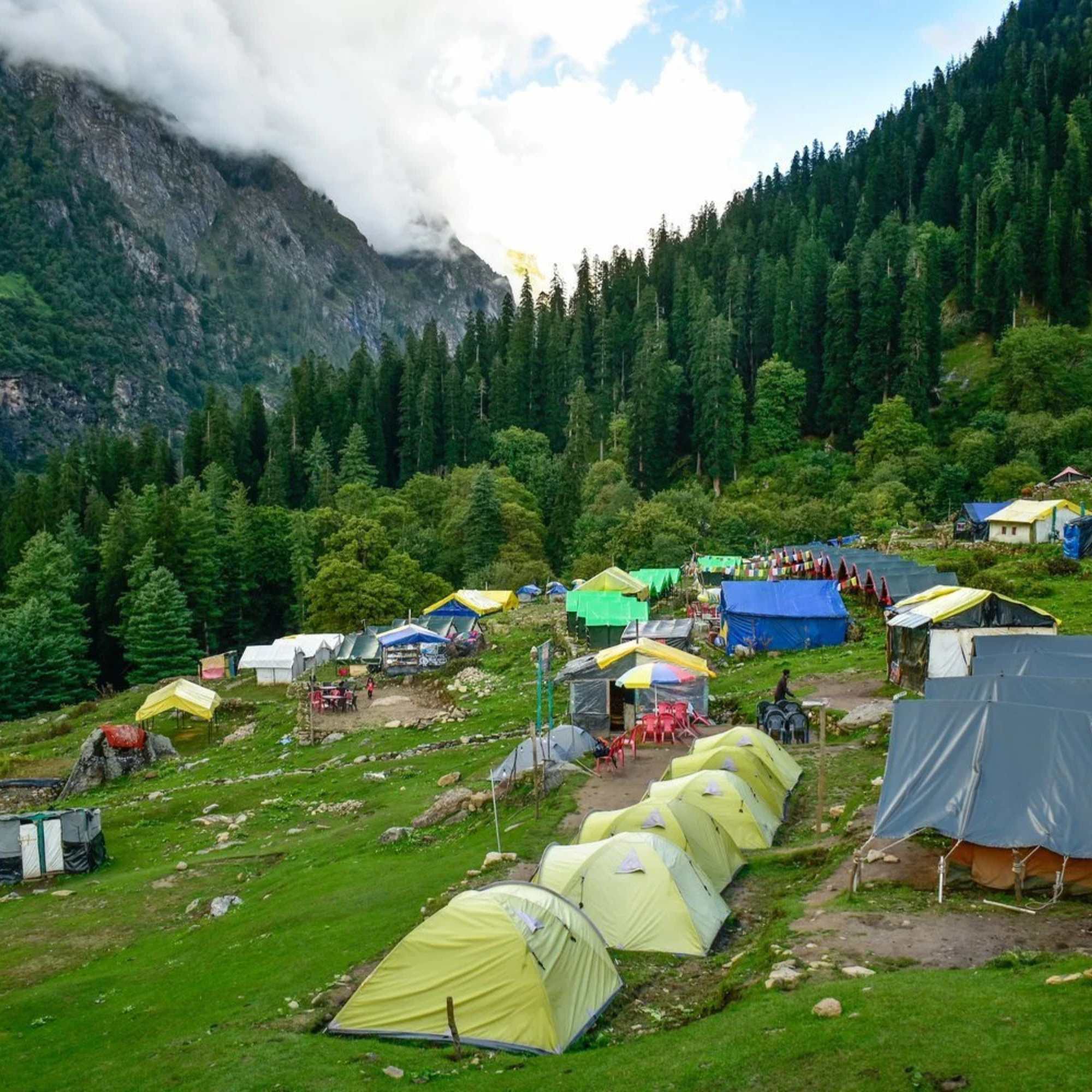
Kheerganga
Separate trek from Barshaini
A high altitude meadow with natural hot springs. Trek starts from Barshaini, not Tosh. A separate trail from the Kutla route but many travellers combine both in one Parvati Valley trip.
Our packages with Tosh Waterfall
Curated trips that include a visit to Tosh Waterfall.
 4D/3N
4D/3NPerfect Manikaran Kasol Tosh Weekend Getaway
1D Delhi•2D Kasol+1
₹15,999₹19,999SAVE INR 4,000/ person 4D/3N
4D/3NWeekend Trip To Manikaran, Kasol & Tosh
1D Delhi •2D Kasol+1
₹9,999₹14,999SAVE INR 5,000/ person
Frequently Asked Questions
What is Tosh Waterfall?
A mountain waterfall about 1.5 to 2 km above Tosh Village on the trail to Kutla. The Tosh Nala stream drops roughly 15 to 20 metres down a rock face, fed by snowmelt from higher in the valley. Seasonal cafes set up beside the falls from May through October. The waterfall sits at the rough halfway mark of the Kutla hike, right where the trail shifts from a steady walk into steeper climbing.
How far is it from Tosh Village?
About 1.5 to 2 km of uphill walking from the upper edge of the village. Most people take 30 to 60 minutes at an easy pace. The trail passes the Jamadagni Rishi Temple and follows the Tosh Nala stream through pine forest. Tosh sits at roughly 2,400 metres. The waterfall is at around 2,500 to 2,550 metres.
Is it on the way to Kutla?
Roughly halfway. The waterfall sits about 1.5 to 2 km from Tosh, with another 1.5 to 2 km of steeper trail between the falls and Kutla. After the waterfall, the gradient picks up noticeably.
Are the cafes near the waterfall always open?
They generally operate from May through October, depending on the season and the operators. In off season and during heavy monsoon rain, stalls may close. Carrying snacks and water from Tosh is always a good backup plan.
Can I visit just the waterfall without going all the way to Kutla?
Absolutely. The walk from Tosh to the waterfall and back makes a comfortable 1.5 to 2 hour round trip. Good for a morning when you want a short uphill hike with a clear payoff at the end.
When is the waterfall at its best?
May and early June have the strongest flow from snowmelt. October gives you decent water with clear skies and fewer people on the trail. Late autumn thins the cascade. Monsoon brings heavy volume but makes the trail muddy, slippery, and leech prone.
How difficult is the walk?
Manageable for anyone with basic fitness who is comfortable walking uphill for half an hour to an hour. Not technical. Proper shoes are important though. The rocks near the waterfall base stay wet year round and get genuinely slippery. Sandals are a bad idea.
What is the altitude?
Roughly 2,500 to 2,550 metres, sitting between Tosh (about 2,400 m) and Kutla (about 2,650 m). Sources vary slightly.
Related guides
Posts about Kasol
- Shimla Manali Kasol Itinerary 2026: 7, 8 and 9 Day Routes Without Rushing
- Best Offbeat Places Near Kasol Most Tourists Miss in 2026
- Rasol Village Trek From Kasol 2026: Route, Distance & What to Expect
- Kalga, Pulga & Tulga Villages in 2026: The Offbeat Side of Parvati Valley
- Kheerganga Trek from Kasol 2026: Route, Difficulty, Cost & Best Time
- Snowfall in Kasol 2026: Does It Snow, Best Time & Nearby Snow Places