
Pin Valley National Park
The cold desert national park beyond the Attargu bridge, the only one of its kind in Himachal and the place in Spiti where the landscape turns quietly green
- National Park
- ~3,500 to 6,000+ m
- Kaza · ~50 km to Mud
- Jun to Oct
- Snow leopard habitat
What makes it special
Pin Valley is the side valley you take when Spiti starts feeling too brown. You turn south off the Kaza to Tabo road at the Attargu bridge, drop into a narrower valley along the Pin river, and within an hour the scenery shifts. There are actual fields of peas and barley, poplar trees lining the road, and villages that look softer than the rest of Spiti. The national park sits beyond these villages, a cold desert reserve set up in 1987 to protect snow leopards, Siberian ibex, and a specific slice of Trans Himalayan ecology. The park's core zone covers roughly 675 sq km, with a buffer of around 1,150 sq km. Altitude runs from about 3,500 metres at the river floor up past 6,000 metres on the ridges. It is the only national park in Himachal Pradesh that sits entirely in cold desert terrain, and it marks the old boundary between the Lahaul and Spiti sides of the district. The Great Himalayan National Park on the Kullu side and the Rupi Bhaba Sanctuary on the Kinnaur side together form one large protected corridor, with Pin sitting in the middle. Honestly, most travellers who say they have "been to Pin Valley National Park" have actually been to Mud village and the road that leads to it. The actual park interior is a foot access zone, reached by crossing the Pin river on a suspension bridge from Mikkim and hiking in. If you are here for a photograph of pretty green fields and a homestay with a valley view, the road is enough. If you want the park, plan a guided day hike from Mikkim or a longer trek.
Quick answers
- Is Pin Valley National Park worth visiting?
- Yes, if you already have two or three days in Spiti. It is the quietest, greenest corner of the valley, and the drive itself is one of the prettier ones in the region. Skip it only if you are rushing a 5 day circuit.
- How much time do you need?
- One full day is the minimum, in and out from Kaza. One night at Mud village is the sweet spot, it lets you see the sunset, the stars, and slow morning light. Trekking into the park interior needs three days and up.
- Can I actually drive inside the park?
- No. The motorable road ends at villages on the park's edge, Mikkim being the main gateway. The interior of the park is reached only on foot, usually with a local guide. Most visitors experience the buffer area around Mud, not the core zone.
Quick facts
Everything you need to know at a glance.
At a glance
- Altitude range
- ~3,500 m at the river to over 6,000 m on the peaks
- Location
- Spiti sub division, Lahaul and Spiti district, Himachal Pradesh
- Area
- Core zone ~675 sq km, buffer ~1,150 sq km (HP Forest Dept)
- Established
- 1987, intention declared by the state
- Nearest town
- Kaza, about 50 km to Mud village via Attargu bridge
- Best season
- June to October, generally
- Entry
- No formal park gate fee at Mud or Mikkim. Guide and horse rates apply if you trek in
- Time needed
- 1 day minimum, 1 to 2 nights at Mud is ideal
- Effort
- Easy on the road. Moderate to hard for treks into the park
On the ground
- Mobile network
- Assume none in Pin Valley. Some homestays in Mud have satellite internet. Inform family before leaving Kaza
- ATM
- None in the valley. Nearest reliable ATMs are in Kaza. Carry enough cash in small notes
- Fuel
- No fuel in Pin Valley. Fill up at Kaza before the drive. Bikers should carry a small jerrycan
- Food
- Small cafes and homestay kitchens at Sagnam and Mud. Thukpa, thenthuk, dal rice, parathas. Carry snacks for the road
- Washrooms
- Basic, inside homestays and a few dhabas. Nothing on the trail into the park
- Permits
- Indian nationals generally do not need a permit. Foreign nationals are typically required to obtain a permit from the SDM office in Kaza or the DM office in Reckong Peo, rules can change, please confirm current requirements for your nationality before travel
- Drones
- This is a national park. Do not fly drones without explicit written permission from the forest department, rules are strict in protected areas
- Walk to park
- From Mikkim, cross the Pin river on the suspension bridge, then around 10 km of hiking to enter the park interior
- Local guide
- Strongly recommended for any hike beyond Mikkim. Trained guides and porters are available through homestays and the forest department
Seasonal weather
- Jun to Aug22°6°Summer
- Sep to mid Oct15°-2°Autumn
- Nov to Mar2°-25°Winter
- Apr to May12°-5°Spring
Suitable for
- Couples — suitable
- Families — with some care
- Seniors — with some care
- Solo — suitable
- First-timers — suitable
- Pet-friendly — not suitable
How to reach Pin Valley National Park
4 approach routes, with seasonal access.
From Kaza
Generally motorable June to October, occasional closures after heavy snow- Distance
- About 50 km to Mud village, about 40 km to Mikkim
- Time
- 2 to 2.5 hours to Mud
- Road
- Tarred on the main highway till Attargu, narrow and partly unpaved after that
- Last fuel
- Kaza petrol pump, the last reliable fuel in the region
The standard approach. Drive south east on the Kaza to Tabo road for about 10 km to the Attargu bridge. Cross the bridge and you are in Pin Valley. The road runs past Gulling, Kungri, Sagnam, Mikkim and ends at Mud, the last village. The stretch after Attargu is narrow, rough in patches, and prone to minor landslides in rain. Take it slow, the scenery is the reason you came.
From Tabo
Generally June to October- Distance
- About 65 km to Mud
- Time
- 3 to 3.5 hours
- Road
- Spiti highway to Attargu, then the Pin Valley road
- Last fuel
- Fill up at Kaza before continuing. No fuel anywhere in Pin Valley
Come up the Spiti highway from Tabo toward Kaza, turn off at Attargu bridge just before Kaza. Easy to pair with a Tabo Monastery night halt on the way in, which also helps with acclimatisation. Pin valley sits at similar altitude to Kaza, so coming from lower Tabo is body friendly.
From Manali via Kaza
Typically late May or June to October, Kunzum closes in winter- Distance
- About 250 km to Mud
- Time
- 2 days, ideally with a night at Kaza
- Road
- Atal Tunnel, Kunzum La, Spiti road, then Pin Valley road
- Last fuel
- Manali, then Kaza. Carry a jerrycan for bikes
Cross over Kunzum La from Manali, night halt at Kaza to acclimatise, then head into Pin Valley the next day. Do not try to reach Mud in one day from Manali, you will lose a day to altitude.
From Shimla via Kinnaur
Kinnaur side generally open most of the year, Pin Valley road June to October- Distance
- About 440 km to Mud
- Time
- 2 to 3 days with proper halts
- Road
- Highway to Shimla, mountain road through Kinnaur
- Last fuel
- Shimla, Reckong Peo, Pooh, Kaza
The gentler route for first timers. Acclimatise slowly through Sarahan or Sangla, Nako, Tabo, then pick up Pin Valley from Attargu. A new road connecting Kafnu in Kinnaur directly to Mud via the Bhaba side was approved in 2022, but as of recent reports construction is still in progress, please verify current status before planning around it.
Best time to visit
Season by season, so you can plan around the weather rather than hope.
- Recommended
Summer
June to August
The green window, everything is running
- Temperature
- About 6 to 22 C
- Roads
- Attargu to Mud road generally open by early June
- Crowds
- Moderate, small by Spiti standards
- Photography
- Green fields, yellow mustard, sharp blue sky
This is when Pin feels like Pin. Barley and green pea fields are in full swing through July and early August, the road is generally in its best shape of the year, and all the homestays at Mud and Sagnam are open. Days are bright, afternoons can feel surprisingly warm at the valley floor. Peak crowd is mid July, plan early starts from Kaza if you want Mud to yourself by evening.
Monsoon risk
Mid July to mid August
Road is open, landslide risk is real
- Temperature
- About 8 to 20 C
- Roads
- Occasional minor landslides, usually cleared fast
- Crowds
- Moderate
- Photography
- Dramatic cloud, unpredictable light
Spiti itself is a rain shadow, so heavy monsoon rain is rare, but the road into Pin is narrow and cut through loose slopes. A single heavy shower upstream can dislodge rocks. If you are travelling in this window, build a buffer day, do not plan a same day return to Kaza if the sky looks unsettled, and listen to local drivers.
- Recommended
Autumn
September to mid October
The sharpest and quietest version of Pin
- Temperature
- About minus 2 to 15 C
- Crowds
- Low
- Roads
- Generally open through early Oct, watch late Oct
- Photography
- Best light of the year, honestly
If I had to pick one window, this is it. The fields turn yellow and red, the air is clearer than mid summer, and Mud village feels genuinely empty on weekdays. Nights get cold quickly, a proper jacket is not optional. Late October is a risk line, an early snowfall can shut the road with almost no warning.
Winter
November to March
Harsh, often closed, but the snow leopard window
- Temperature
- Often well below zero, nights can hit minus 25 C or lower
- Roads
- Prone to long closures after snow
- Crowds
- Very low, mostly wildlife photographers
- Photography
- Snow leopard territory, extremely cold work
November and early December are the only months where wildlife comes down to lower altitudes and a snow leopard sighting becomes a real, if still rare, possibility. This is when serious wildlife travellers plan dedicated expeditions with spotters from Kibber and Mud. From late December through March, snowfall is heavy, the road in and out of Mud can shut for weeks, and many homestays close. Only come in this season on a properly organised expedition, not as a regular holiday.
Spring
April to May
Awkward shoulder, valley is thawing
- Temperature
- About minus 5 to 12 C
- Roads
- Kinnaur side open, Manali side usually closed
- Crowds
- Very low
The Manali route over Kunzum is usually still closed, so access is only from Shimla side through Kinnaur. Snow is melting, fields are brown, not green yet. Good for very quiet travel if you can tolerate cold nights and limited homestays. April and early May can also be decent for wildlife sightings at lower altitudes.
Things to see & do
8 things worth your time at Pin Valley National Park.
Drive the full Attargu to Mud road
2 to 2.5 hours one wayThe drive itself is the headline. Barley fields, poplar trees, the Pin river running alongside, and village stops at Gulling, Kungri, Sagnam, and Mikkim. Pull over a couple of times, especially where the valley widens after Sagnam. Do not rush it, this is the part most travellers remember more than the village itself.
Stay a night at Mud village
OvernightMud sits at roughly 3,770 to 3,810 metres at the end of the road, last inhabited village before the Parvati range. Around 40 houses, a handful of homestays, and views straight up the Pin river valley. Book Tara House, Ibex Homestay, or one of the other simpler places. Evenings are for walking the fields and waiting for the light to drop. Star gazing here is as good as anywhere in India.
Visit Kungri Monastery
30 to 45 minutesThe oldest gompa in Pin Valley, belonging to the Nyingma school, which is rarer in Spiti than the Gelug school of Key and Tabo. Set up roughly in the 14th century by local tradition, the monastery has three separate buildings across a small complex. Quick stop on the way up or down, donation welcome.
Walk into the park from Mikkim
Half to full day, with a guideMikkim is the roadhead for the national park, about 13 km from Mud and 2.5 km from Sagnam. Cross the suspension bridge over the Pin river and follow the trail. A proper entry into the park interior is around 10 km of hiking from here, not a casual stroll. Go with a local guide from a homestay or through the forest department, do not wander in alone.
Try for a snow leopard sighting (serious effort)
3 to 7 days, November or DecemberThe genuine way to see a snow leopard in Pin is through a dedicated winter expedition with trained spotters, usually operating out of Kibber and Mud. You spend days glassing ridges from fixed positions, not driving around. Sightings are never guaranteed. Reality check, even trained spotters often go a week without one. Book with a specialist operator if this is your real goal.
Pin Parvati Pass trek
9 to 11 daysStarts from Mud, crosses the high Pin Parvati Pass at around 5,319 metres, and descends into the Parvati valley near Kullu. Genuinely tough, typically rated one of the hardest trekking circuits in Himachal. Prior high altitude trekking experience is required. Best window is roughly mid July to September.
Pin Bhaba Pass trek
6 to 8 daysThe shorter high altitude option. Crosses the Bhaba Pass at around 4,850 metres (15,900 feet) between Pin Valley and Bhaba valley in Kinnaur. Ends at Kafnu in Kinnaur. Moderate to difficult rating, but considerably more manageable than Pin Parvati. Best from mid July to September.
Short walks around Mud
1 to 3 hoursIf you are not trekking in, walk the Pin river bank below the village, the trail east toward the Parvati range base, or the footpath between Mud and the next hamlet. Quiet, green by valley standards, and a good way to spend a slow afternoon. Carry a bottle of water, the sun hits hard even when the air is cool.
Know before you visit Pin Valley National Park
The practical bits, from people who have been.
What the park actually isThe only cold desert national park in Himachal Pradesh
Pin Valley National Park was declared in 1987 and sits in the Spiti sub division of Lahaul and Spiti district, Himachal Pradesh. Per the state forest department, the core zone covers about 675 sq km with a buffer of about 1,150 sq km. Altitudes quoted across sources vary, the forest department website cites about 3,500 metres at the Pin Spiti confluence up to over 6,000 metres at the highest peaks. The park is part of the Cold Desert Biosphere Reserve and is flanked by the Great Himalayan National Park on the Kullu side and the Rupi Bhaba Wildlife Sanctuary on the Kinnaur side. It protects snow leopard habitat, Siberian ibex, bharal, red fox, Himalayan wolf, and over 400 recorded plant species.
The geography you should understand before you goPin is a side valley, Mud is the end of the road, the park starts where the road ends
The Pin river joins the Spiti river near Attargu, around 10 km from Kaza. The road into Pin Valley branches off at the Attargu bridge, runs past Gulling, Kungri, Sagnam, and Mikkim, and ends at Mud village, roughly 50 km from Kaza. Mud sits at about 3,770 to 3,810 metres, sources differ slightly. The park's boundary sits beyond these villages. The actual protected interior is reached on foot, usually from Mikkim by crossing the Pin river on a suspension bridge. If you drive to Mud and turn around, you have seen the valley and the park periphery, not the core.
Wildlife, honestly framedSnow leopards exist, sightings are rare, ibex and bharal are more realistic
The park's estimated snow leopard count has long been cited at around 12 individuals across the larger area, and the forest department presents it as snow leopard habitat. What most travellers actually see during a summer visit are Himalayan ibex on the upper slopes, bharal (Himalayan blue sheep), red foxes, pikas, ravens, and occasionally a bearded vulture or golden eagle overhead. Snow leopard sightings are a winter story, usually November to February, with trained spotters, and they are never guaranteed. If someone sells you a summer snow leopard tour at Pin, be skeptical.
Who should go, and who should reconsiderGreat for slow travellers, harder for very young kids, seniors with health issues, and pet owners
Pin Valley works beautifully for solo travellers, couples, small groups, and families with kids roughly above 7 or 8. The valley floor is lower than the Key Monastery belt, so acclimatised travellers who have already spent a night or two at Kaza usually feel fine. Seniors with heart, blood pressure, or breathing issues should think carefully about the narrow road and the distance from medical help, Kaza has a community health centre and is the nearest facility. Pets are strongly not recommended, this is a national park with wildlife, and stray and leashed dogs are a known threat to native species. Leave them in Kaza or at home.
Plan your visitOne day in and out works, one night in Mud is far better
Plan A, a day trip from Kaza. Leave by 8 am, reach Mud by late morning, wander the village and the river path, eat at a homestay, drive back by late afternoon. Tight but doable. Plan B, one night at Mud, which is what we recommend. Reach by lunch, afternoon walk, evening at the homestay, sunrise the next morning, leave for Kaza or Tabo after breakfast. Plan C, a proper trek, Pin Bhaba or Pin Parvati, booked well in advance with a trekking operator. Before you go, please reconfirm road status, homestay availability, and permit rules close to your travel date, these details shift from season to season.
Where to stay and eatHomestays at Mud and Sagnam, the valley's hospitality is its strong suit
Mud village has the majority of stays, around 10 to 15 homestays and small guesthouses. Established options include Tara House, Ibex Homestay, Mudh Homestay, and Gatuk Homestay, among others. Rooms are typically simple, with twin beds, heavy blankets, shared or basic attached bathrooms, and home cooked meals. Budgets generally run between 800 and 3,000 rupees per night, higher in July and August. Sagnam, about 12 km before Mud, is larger and also has homestays and a PWD rest house, useful if Mud is full. Food is simple Spitian fare, thukpa, thenthuk, momos, dal rice, and paratha. Pre book for July and August, walk ins work in shoulder months.
Safety and altitudeMud is lower than Kaza, but still real altitude
The valley floor around Mud sits at roughly 3,770 to 3,810 metres, actually slightly lower than Kaza. That means Pin can feel gentler on the body than the Langza or Kibber belt, but it is still real altitude. Do not rush here on day one from Manali. Spend a night at Kaza first, or come up slowly from Tabo. Carry your own regular medicines. The nearest medical help is the community health centre in Kaza, about two hours away on a narrow road. In a serious emergency, plan for a Kaza or Reckong Peo evacuation, not an ambulance at Mud, there isn't one. Avoid alcohol the first night at altitude. If you are trekking into the park, carry basic altitude medication only on a doctor's advice.
Do's and don'ts in a protected areaIt is a national park, not a picnic spot
Do carry back every piece of trash, there is no waste handling in Pin Valley. Do walk only on the road and marked trails, the alpine vegetation is fragile and slow to recover. Do respect crops and fenced fields in the villages. Do greet locals with Julley. Do not feed wildlife or follow animals for photographs, it stresses them and is a real offence in a protected area. Do not play loud music or honk through villages. Do not fly drones without written permission, this is enforced in national parks. Do not light fires or camp inside the park boundary, and do not pluck flowers or medicinal plants, many are protected.
Fuel, cash, and networkTreat Pin Valley as offline and cashless proof
There is no petrol pump in Pin Valley. Fill up at the Kaza pump before you leave and plan your round trip fuel accordingly, roughly 100 km round trip from Kaza to Mud and back. Bikers should carry a spare jerrycan. No ATM anywhere in Pin Valley. Carry enough cash in small notes for stays, meals, guides, and horses, UPI works sporadically at best. Mobile network is effectively zero, a few homestays in Mud have satellite internet for bookings. Tell family at Kaza when you plan to be back, so someone knows if you go overdue.
Local tips from people who keep coming backThe small things that make a Pin day better
Leave Kaza by 8 am, not later, afternoon light in Pin is better than midday and you avoid the worst of the wind. Stop at Kungri monastery even if you did not plan to, a quiet 30 minutes is worth it. Eat lunch at a homestay in Mud rather than carrying a sandwich from Kaza, their thenthuk is the memory you will bring home. Walk the fields after 5 pm, the light on the barley changes every ten minutes. And one last nudge, the road and weather here shift season to season, please reconfirm the current status with your homestay or a local operator close to your date.
Nearby attractions
Other places worth the detour.
Mud (Mudh) village
End of the Pin Valley road, about 50 km from Kaza
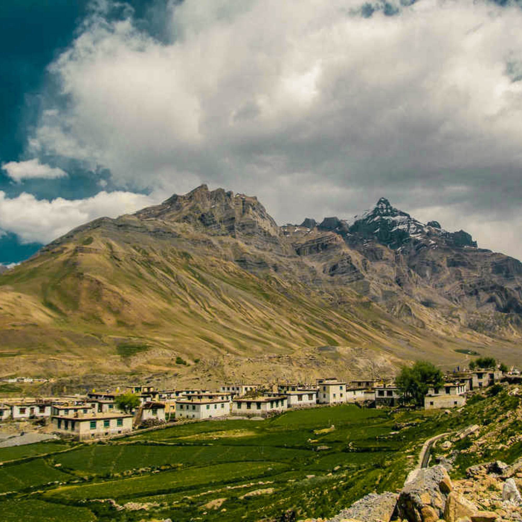
The last motorable village in Pin Valley at roughly 3,770 to 3,810 metres, base for Pin Parvati and Pin Bhaba treks. Homestays, a couple of small cafes, fields, and the Parvati range rising almost vertically behind.
Mikkim
About 13 km before Mud
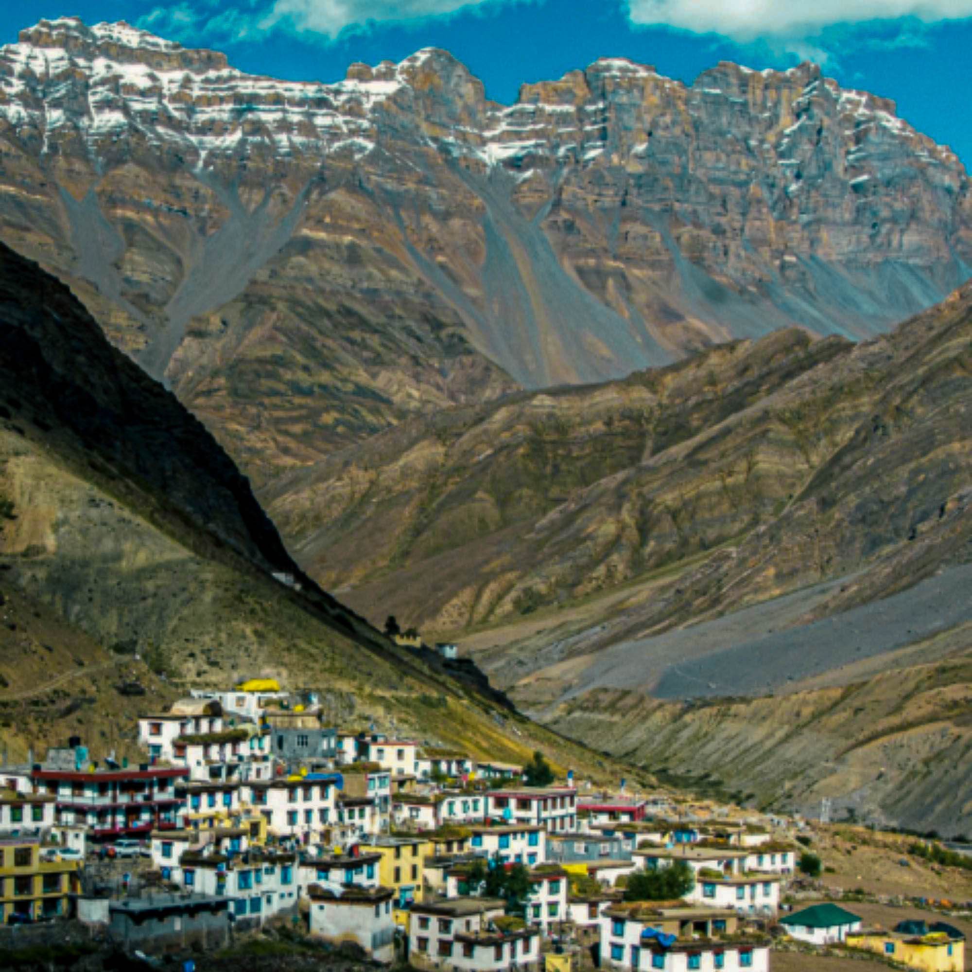
The small village at the roadhead for the national park's foot entry. About 35 residents, a few basic homestays, a suspension bridge over the Pin river that leads toward the park interior. Quick stop or a base for a day hike.
Sagnam
About 12 km before Mud
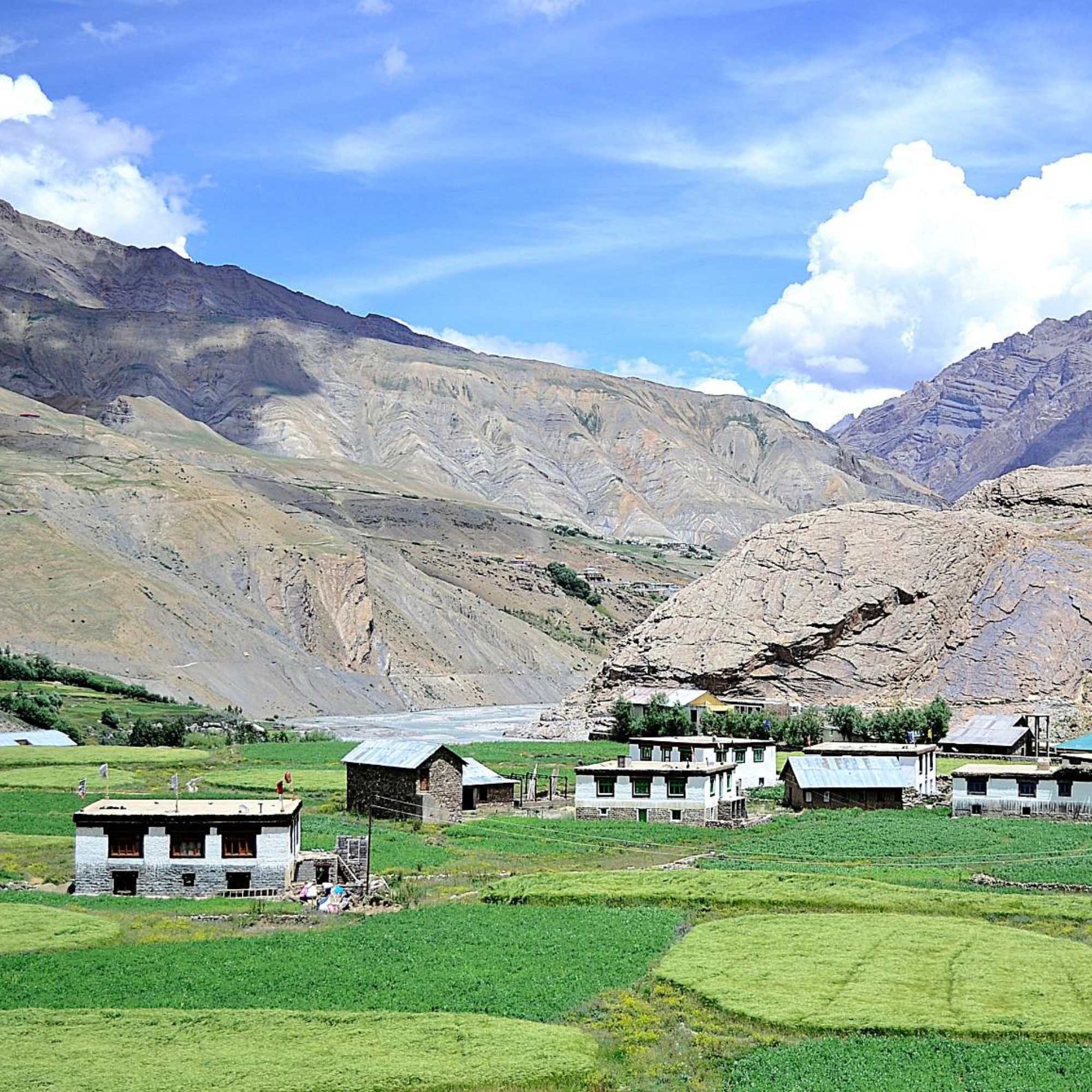
The largest village in Pin Valley, roughly 450 residents, with a PWD rest house, a Himachal Gramin Bank branch, and a handful of homestays. Useful backup if Mud is full or if you want to split the drive.
Kungri Monastery
Near Gulling, about 25 km from Attargu bridge
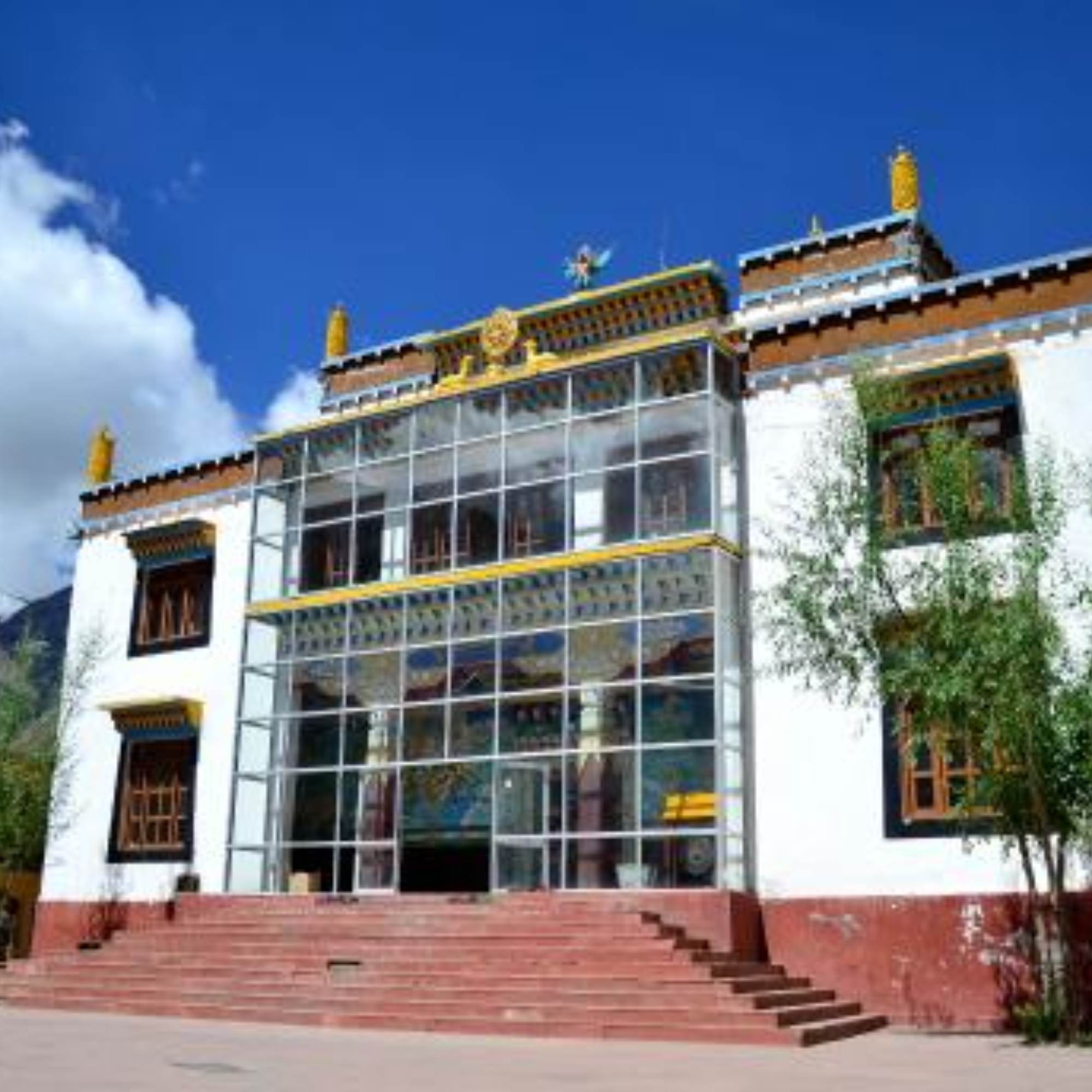
The oldest monastery in Pin Valley, belonging to the Nyingma school of Tibetan Buddhism, rarer in Spiti than Gelug. A quiet 30 minute stop on the drive in, with summer festivals of masked dances on the Tibetan calendar.
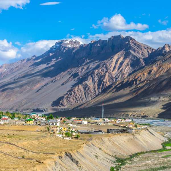
Kaza
About 50 km from Mud, 2 to 2.5 hours
The main town of Spiti Valley and the logistical base for any Pin Valley visit. Fuel, ATMs, homestays, and cafes. Almost every Pin trip starts and ends here.
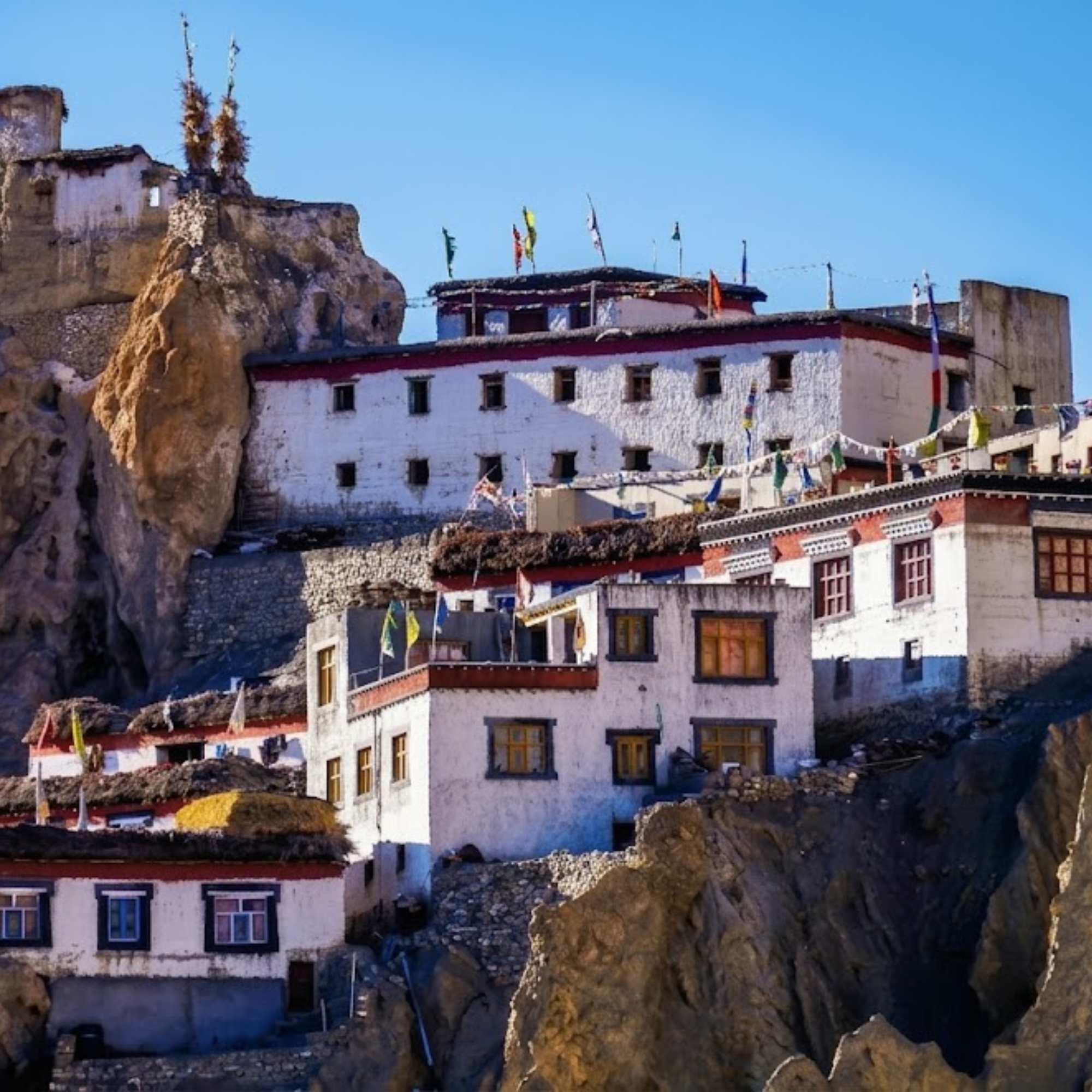
Dhankar Monastery
About 50 km from Mud, 2 hours
The cliffside monastery that looks like it is about to slide off the hill, with a small lake on the trail above. A natural add on stop between Pin Valley and Tabo.
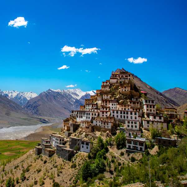
Key Monastery
About 60 km from Mud, 2.5 hours
Spiti's largest gompa, stacked on a hill above the Spiti river at roughly 4,166 m. Natural pairing with a Pin Valley day on a longer circuit.
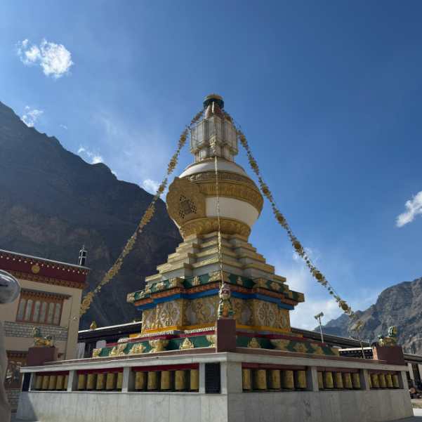
Tabo Monastery
About 65 km from Mud, 2.5 hours
The thousand year old mud brick monastery on the valley floor near Tabo, founded in 996 CE and famous for its early murals. Good companion night halt for a Pin Valley loop from Shimla side.
Our packages with Pin Valley National Park
Curated trips that include a visit to Pin Valley National Park.
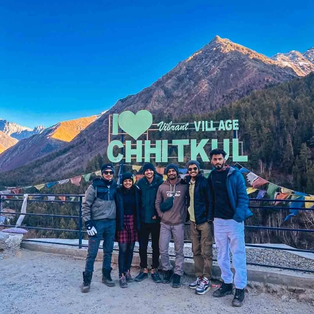 Group Tour9D/8N
Best Selling Winter Spiti Valley Group Tour
2D Sangla•1D Tabo+2
₹18,999₹23,999SAVE INR 5,000/ person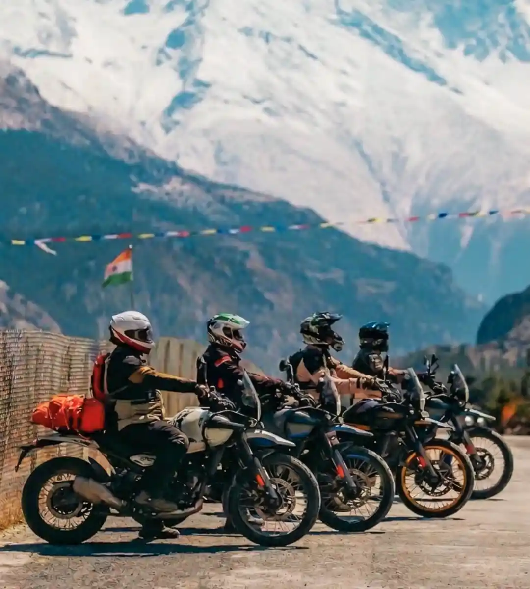 Group Tour10D/9N
Most Loved Spiti Valley Bike Expedition With Chandratal
1D Jibhi•1D Sangla+4
₹34,999₹41,999SAVE INR 7,000/ person
Frequently Asked Questions
Where is Pin Valley National Park located?
In the Spiti sub division of Lahaul and Spiti district, Himachal Pradesh. The road access is via the Attargu bridge, about 10 km from Kaza on the Kaza to Tabo highway. The park sits beyond the villages of Gulling, Kungri, Sagnam, Mikkim, and Mud.
What is the altitude of Pin Valley National Park?
The park spans a wide altitude range, roughly 3,500 metres near the confluence of the Pin and Spiti rivers to over 6,000 metres at the highest peaks. Mud village, the main stay point, sits at about 3,770 to 3,810 metres. Different sources quote slightly different figures, treat all numbers as close approximations.
When was Pin Valley National Park established?
The intention to declare Pin Valley a national park was notified in 1987, and it has operated as a national park since. It is the only national park in Himachal Pradesh that lies entirely in cold desert terrain.
How large is the park?
Per the Himachal forest department, the core zone covers about 675 sq km and the buffer zone about 1,150 sq km. Some sources cite a total protected area of around 1,825 sq km, combining both zones.
What is the best time to visit Pin Valley?
June to early October is the main window for general travel and trekking. September to mid October is the quietest and photographically the best. November and early December are preferred by serious wildlife photographers, because animals descend to lower altitudes, but conditions are cold and road access is uncertain. December to March is effectively closed for regular travellers.
How do I reach Pin Valley National Park from Kaza?
Drive south east from Kaza on the Kaza to Tabo road for about 10 km to the Attargu bridge. Turn off across the bridge and continue roughly 33 km along the Pin river to Mud village, passing Gulling, Kungri, Sagnam, and Mikkim. Total Kaza to Mud is about 50 km, 2 to 2.5 hours. A daily local bus runs Kaza to Mud, usually in the afternoon, confirm current timings locally.
Can I drive inside the national park?
No. The motorable road ends at the villages on the park's edge. Mikkim is the main roadhead. To enter the park interior, you cross the Pin river on a suspension bridge from Mikkim and hike in. A local guide is strongly recommended.
Do I need a permit for Pin Valley?
Indian nationals generally do not need a permit for Pin Valley. Foreign nationals are typically required to obtain a permit from the SDM office at Kaza or the DM office at Reckong Peo. Rules and forms can change season to season, please verify the current requirements for your nationality with a local operator or an official source before travel.
Is there an entry fee for the park?
There is no formal park gate fee at Mud or Mikkim as of recent reports. If you hire a local guide, porter, or pack horse to enter the park, standard rates apply and those are paid separately. Rules can be updated by the forest department, please reconfirm locally.
Can I see snow leopards in Pin Valley?
Realistically, only in winter, usually November through February, on a properly organised expedition with trained spotters. Summer visits almost never produce a snow leopard sighting. Even on dedicated winter trips, sightings are rare and never guaranteed. Summer visitors are more likely to see Himalayan ibex, bharal, red fox, and Himalayan birds like the golden eagle or bearded vulture.
Where can I stay in Pin Valley?
Mud village has the largest cluster of homestays and small guesthouses, around 10 to 15 in total, including Tara House, Ibex Homestay, Mudh Homestay, and Gatuk Homestay. Sagnam also has homestays and a PWD rest house. Rooms are simple, meals are home cooked, budgets generally run between 800 and 3,000 rupees per night. Pre book for July and August.
Is Pin Valley safe for families and seniors?
Families with kids roughly above 7 or 8 usually do fine, especially if you stay a night at Kaza first. Seniors without heart, blood pressure, or breathing issues can manage the road drive to Mud, which sits at a gentler altitude than Kibber or Langza. Seniors with medical conditions should reconsider, the nearest hospital is two hours away at Kaza.
Is there mobile network in Pin Valley?
No, not reliably. Plan to be offline from Attargu bridge onwards. A few homestays at Mud have satellite internet for bookings, but do not count on personal data connectivity. Tell friends or family at Kaza when you expect to be back in signal.
Can I trek the Pin Parvati or Pin Bhaba Pass from here?
Yes. Mud is the Spiti side trailhead for both treks. Pin Parvati Pass is at around 5,319 metres and is a 9 to 11 day hard trek ending near Kullu. Pin Bhaba Pass is at around 4,850 metres and is a 6 to 8 day moderate to difficult trek ending at Kafnu in Kinnaur. Best window is roughly mid July to September. Both treks require prior high altitude experience and a registered trekking operator.
Is the road from Kaza to Mud suitable for sedans?
A sedan with decent ground clearance can make it in good weather, carefully. The road is narrow, partly unpaved, and has rough patches and occasional stream crossings. An SUV or high ground clearance hatchback is much more comfortable. After rain or snow, 4x4 is preferable. If you are unsure, hire a local taxi at Kaza, drivers here know the road well.
What should I carry to Pin Valley?
Warm layers including a jacket even in July, thermals for nights, sturdy shoes, sunglasses, sunscreen, a headlamp, a power bank, enough cash in small notes, personal medicines, and a refillable water bottle. If trekking, add proper trekking gear through your operator. If driving your own vehicle, carry spare fuel, a tow rope, and basic tools.
Related guides
Posts about Lahaul and Spiti
- Winter Spiti from Bangalore in 2026-27: Flights, Leave Days & Delhi 4x4 Departures
- What Does a Winter Spiti 4x4 Trip Really Cost in 2026-27? Package Price vs Total Holiday Budget
- How Many Leave Days Do You Need for a 9-Day Winter Spiti Trip in 2026-27?
- Winter Spiti for 4 to 6 Friends: Private 4x4 Quote vs Shared Group Seats (2026-27)
- Winter Spiti from Mumbai in 2026-27: Delhi or Chandigarh, Total Budget and Return Planning
- Is Winter Spiti a Trek? Walking, Stairs and Driving Effort on a 9-Day Trip (2026-27)