
Kinnaur Kailash
A sacred mountain massif in Kinnaur with its summit at 6,050 metres and a natural Shivling at approximately 4,800 metres, experienced either as a sunrise colour show from Kalpa or as one of the steepest, hardest yatras in Himachal Pradesh
- Sacred Mountain
- Peak ~6,050 m
- Shivling ~4,800 m
- View from Kalpa
- Trek: Jul to Aug
What makes it special
Two altitudes matter here, and getting them wrong will ruin your planning. The summit of Mount Kinnaur Kailash stands at roughly 6,050 metres. That is a technical mountaineering peak. No pilgrim reaches it. No trekking group targets it. What trekkers and pilgrims climb toward is the Shivling, a natural rock pillar roughly 24 metres tall that juts from a shoulder of the massif at approximately 4,800 metres. The Shivling and the summit sit over a thousand vertical metres apart. Every other page on the internet blurs this. Do not let that confusion shape your trip.
The Shivling holds deep significance for both Hindu and Buddhist Kinnauri communities. Local tradition holds that Lord Shiva makes this rock his winter home. For many Kinnauri families, reaching it once in a lifetime carries the weight of a lifelong vow fulfilled.
Now, the two completely different ways to experience this mountain.
The first costs you nothing but an alarm clock. You drive to Kalpa, a village 7 km above Reckong Peo, and the entire Kinner Kailash range fills your window. Set your alarm for thirty minutes before sunrise. Watch the first light strike the Shivling tip, turning it from grey to pale pink. Over the next ten to fifteen minutes, that pink deepens to copper, spreads down the snowfield, and warms to gold. Locals say the rock changes colour through the day. From Kalpa, you can actually watch it happen. No trek, no fitness test. Just a balcony and clear skies. This is how 95 percent of travellers experience Kinner Kailash, and it earns every minute of the drive.
The second costs you everything you have in your legs. The yatra climbs directly from Tangling village (roughly 2,300 m) to the Shivling at approximately 4,800 metres. That is 2,500 metres of vertical gain over 3 to 5 days, mostly on a steep, unrelenting gradient. Above the treeline, the ground turns to loose scree and boulder fields. Your lungs burn. Your legs shake on the steeper pitches. The air carries about half the oxygen you are used to at sea level. This is not a scenic walk with a temple at the end. It is a grinding, vertical slog through some of the harshest terrain in Himachal Pradesh, and it rewards only those who prepare seriously for it.
The trekking window depends entirely on snowmelt and weather. Local authorities and the forest department in Reckong Peo typically permit the yatra during July and August, coinciding with the Hindu month of Shravan. Late June and September access is possible in some years, but conditions are unpredictable at the edges of the season. Always confirm the current year's status with the district administration or a reputable operator before committing. Do not assume a fixed calendar.
A separate, harder route exists: the Parikrama, a 6 to 8 day circumambulation of the entire massif over Charang La and down toward Chitkul. That is an expedition, not a trek, and should never be confused with the standard yatra.
Quick answers
- What is Kinnaur Kailash?
- A mountain massif in Kinnaur district. The summit peak stands at roughly 6,050 metres, a technical mountaineering target that no pilgrim reaches. The Shivling, a natural rock pillar sacred to Hindu and Buddhist communities, sits at approximately 4,800 metres on the massif's shoulder. Most travellers watch it change colour at sunrise from Kalpa. A smaller number climb directly to it during the July to August yatra window.
- Do I need to trek to see Kinner Kailash?
- No. Drive to Kalpa, stay two nights, and watch the sunrise from your hotel balcony. The Shivling and the full range fill the sky across the Sutlej Valley. You will see the rock change colour from grey to pink to gold in fifteen minutes. That is a complete experience. The trek is a separate, brutal undertaking for fit, experienced trekkers only.
- How hard is the Kinner Kailash trek?
- Extremely. The yatra gains 2,500 metres of altitude from Tangling (~2,300 m) to the Shivling (~4,800 m) over 3 to 5 days. The upper route is steep scree and loose boulder fields at half the oxygen you are used to. Acute mountain sickness affects most trekkers. This is not a beginner trek. Go with experienced guides, proper gear, and serious physical fitness, or do not go.
Quick facts
Everything you need to know at a glance.
At a glance
- Altitudes (two different things)
- Mt. Kinnaur Kailash summit: ~6,050 m (technical peak, not trekked to). Shivling: ~4,800 m (the yatra destination, on the massif's shoulder). These are over 1,000 m apart.
- Location
- Kinnaur district, Himachal Pradesh, above Reckong Peo and Kalpa
- View base
- Kalpa (7 km above Reckong Peo) for viewing; Tangling village for trek base
- Trek window
- Strictly weather dependent. Typically permitted in July and August (Shravan). Late June and September possible in some years. Confirm with forest department in Reckong Peo each year.
- Time needed
- View: 2 nights in Kalpa. Yatra (direct ascent): 3 to 5 days. Parikrama (circuit): 6 to 8 days.
- Entry/permit
- No formal fee for viewing. Trek may require local check in. Confirm with forest department.
- Difficulty
- View: effortless. Yatra: very hard. 2,500 m steep gain on scree. Experienced trekkers only. Parikrama: expedition level, passes above 5,000 m.
On the ground
- Mobile network
- Works in Kalpa and Reckong Peo. Zero coverage above the treeline on the trek route.
- ATM
- Reckong Peo has ATMs. Nothing above. Carry all cash needed for the trek.
- Food
- Hotels in Kalpa for viewing. On the trek, carry your own or go with a group that provides meals. No shops or dhabas on the route.
- Stay
- Hotels in Kalpa for viewing. Basic shelters or camping on the trek route. No permanent lodges above base.
- Guides
- Non negotiable for the trek. The upper route is unmarked and conditions change weekly. Not needed for viewing from Kalpa.
Seasonal weather
- Apr to Jun25°6°Summer (view season)
- Jul to Aug20°10°Shravan (core trek window)
- Sep18°5°Late trek (unreliable)
- Oct to Nov18°0°Autumn (best view light)
- Dec to Mar10°-10°Winter (view only, cold)
Suitable for
- Couples — suitable
- Families — with some care
- Seniors — with some care
- Solo — suitable
- First-timers — suitable
- Pet-friendly — not suitable
How to reach Kinnaur Kailash
3 approach routes, with seasonal access.
From Shimla to Kalpa (for viewing)
Generally April to October; winter possible but cold- Distance
- Approx 240 km Shimla to Kalpa
- Time
- 8 to 10 hours; split over 2 days
- Road
- NH 5 mountain highway
- Last fuel
- Rampur, Reckong Peo
The standard approach for the view. Drive from Shimla via NH 5 to Reckong Peo, then 7 km uphill to Kalpa. Most people break the journey at Narkanda, Sarahan, or Rampur. From Kalpa, the Kinner Kailash range is directly across the valley. No onward driving needed.
From Tangling to Shivling (the direct yatra trek)
Generally late June to September. Confirm locally each year.- Distance
- Roughly 12 to 15 km one way, steep ascent
- Time
- 3 to 5 days for the trek; plus travel days to and from Reckong Peo
- Road
- Road to Tangling, then trail. Upper route is unmarked boulder fields.
- Last fuel
- Reckong Peo (last fuel, ATM, and supplies)
This is the direct ascent route, not a circuit. Reach Reckong Peo by road from Shimla (roughly 235 km). Acclimatise for at least one to two nights at Kalpa or Reckong Peo. Then move to Tangling village (roughly 2,300 to 2,500 m), the standard trek start point. The trail climbs steeply through deodar forest, then meadows, then increasingly bare and loose terrain. Camps are typically at intermediate altitudes. The final push to the Shivling viewpoint at roughly 4,800 to 4,950 metres is on scree and loose boulders. You return the same way. This is not a loop. Route details, camp locations, and conditions vary by season and should be confirmed with your guide or operator before starting.
From Charang side (for the Parikrama circuit, separate trek)
Generally late June to September. Confirm locally.- Distance
- Full circuit roughly 50 to 70 km (varies by route and conditions)
- Time
- 6 to 8 days. Plus travel days.
- Road
- Remote mountain trail with high passes above 5,000 m
- Last fuel
- Reckong Peo
The Parikrama is a separate, longer trek that circumnavigates the entire Kinner Kailash massif. The route typically goes from the Charang side over Charang La pass and descends toward the Baspa Valley near Chitkul. It involves high passes, remote terrain, and multiple nights above 4,000 metres. This is not the same as the direct Shivling yatra. It is a full mountain expedition requiring experienced high altitude guides and full logistics support. Do not confuse it with the standard yatra.
Best time to visit
Season by season, so you can plan around the weather rather than hope.
- Recommended
Summer (View Season)
April to June
Clear skies, sharp sunrise light, open roads. The safest window for the viewing experience.
- Temperature (Kalpa)
- 6 to 22°C roughly
- Sunrise clarity
- High. Best probability of clear morning views.
- Trek status
- Closed. Snow covers the upper route.
- Roads
- Generally open. Occasional delays from road work.
- Crowds
- Moderate. Peaks on long weekends.
- Family suitability
- Good for families visiting Kalpa for the view.
The strongest window for the viewing experience. Roads to Kalpa are generally clear, skies are clean most mornings, and the Kinner Kailash range stands sharp against deep blue sky at sunrise. Temperatures in Kalpa sit between about 6 and 22°C. Morning cold bites through a fleece, afternoon sun warms your face. Long weekends in May and June draw visitors from Delhi and Chandigarh, but the crowd is nothing compared to Shimla or Manali. The trek route remains snow covered and closed during this period.
Shravan (Core Trek Window)
July to August
The official trek window. July and August (Shravan). Steep, wet, and the only time you can reach the Shivling.
- Temperature (Kalpa)
- 10 to 20°C roughly
- Trek status
- Core official window. July and August (Shravan). Confirm with forest department.
- Sunrise clarity
- Reduced. Clouds build by late morning.
- Rain
- Intermittent in Kalpa. More frequent on the trek route.
- Roads
- Landslide risk, especially July and August.
- Yatra significance
- Shravan is the most auspicious month for Shiva pilgrimage.
This is when the yatra opens. Snowmelt clears the upper route enough for passage, and local authorities typically permit trekking during these two months, which coincide with the Hindu month of Shravan. July and August are the core window. Organised pilgrim groups operate during this period, and trail conditions are at their most navigable, though "navigable" still means loose scree, wet rock, and altitude that punishes every misstep.
For the viewing experience from Kalpa, July and August are less reliable. Monsoon moisture pushes clouds into the valley by late morning most days. You may need three mornings to get one clear sunrise. The valley is green and the apple orchards heavy with fruit, which has its own appeal, but do not count on crisp mountain views.
The highway between Shimla and Reckong Peo carries real landslide risk in July and August. Build buffer days into your plan.
Late Season (Unreliable Trek Window)
September
Trek window closing. Access unpredictable. Confirm conditions the week you plan to go.
- Temperature (Kalpa)
- 5 to 18°C roughly
- Trek status
- Unreliable. Some years open, some closed by early snow. Confirm within the week.
- Sunrise clarity
- Improving as monsoon retreats.
- Crowds
- Thin.
September is a grey zone. Some years the route stays open. Some years early snow shuts it down without warning. If you are planning a September trek, confirm conditions within the week you intend to start. Do not rely on a booking made months in advance. The weather is drier and colder than July and August, which makes the terrain more stable underfoot but the nights harder. Most organised groups wind down by mid September.
For viewing from Kalpa, September improves as the monsoon retreats. By late September, the skies begin clearing toward the sharp autumn light of October.
- Recommended
Autumn (Best View Light)
October to early November
The sharpest mountain light of the year. Apple harvest. Thin crowds. The best time to see Kinner Kailash from Kalpa.
- Temperature (Kalpa)
- 0 to 18°C roughly
- Sunrise clarity
- The best of the year.
- Trek status
- Closing or closed.
- Orchards
- Apple harvest in Kalpa.
- Crowds
- Very low.
- Photography
- The strongest month for mountain photography.
The viewing experience from Kalpa peaks here. The monsoon clears, the air sharpens, and the Kinner Kailash range stands out with the kind of detail that photographs cannot reproduce. The apple orchards in Kalpa are in full harvest. Tourist numbers drop to almost nothing. Evenings plunge toward freezing by late October. This is the best month for Kinner Kailash photography from Kalpa. The trek route is generally closed or closing. Snow returns to the upper sections. Do not attempt the yatra in October unless you have confirmed conditions with a local guide within the past few days.
Winter
Late November to March
Snow on the peaks, sub zero nights. Dramatic views for prepared winter travellers only.
- Temperature (Kalpa)
- Minus 10 to 10°C roughly
- Trek status
- Closed. No access.
- Sunrise clarity
- Excellent on clear days. Fresh snow on peaks.
- Roads
- Highway generally open. Icy sections and delays.
- Accommodation
- Many stays close. Limited heating in those that remain.
The trek is completely closed. Snow buries the upper route and the Shivling area. No attempt should be made under any circumstances.
The view from Kalpa, however, reaches its most dramatic form. Fresh snow on the range, cold blue sky behind it, and sub zero mornings that make the air sharp enough to cut. Temperatures in Kalpa drop to minus 8 to minus 10°C at night. Many hotels close. Heating in the ones that stay open is limited to a bukhari or an electric heater. The Kinnaur highway generally stays open through winter (unlike the Spiti side), but icy stretches cause delays.
If you handle serious cold well and carry proper gear, the winter sunrise on Kinner Kailash is the most striking version of the view. But this is not a casual winter weekend trip. Plan for the cold or do not come.
Things to see & do
4 things worth your time at Kinnaur Kailash.
Watch the Shivling change colour from Kalpa
30 minutes at dawnStep onto any east facing balcony in Kalpa before dawn. The Kinner Kailash range, with its 6,050 metre summit and the distinctive Shivling pillar on its shoulder, fills the sky across the Sutlej gorge. In the pre dawn grey, the peaks are flat silhouettes. Then the first light hits the Shivling tip, a thin line of pink on dark rock. Over ten to fifteen minutes, the pink deepens to copper, the copper spreads into the snowfield, and the whole face warms to gold before draining to flat white as the sun clears the eastern ridge. Locals believe the Shivling changes colour through the day, shifting with the light. From Kalpa, you see exactly why they say it. The western light at sunset warms the range differently, and the clouds build shapes the morning sky does not produce. Stay two clear mornings to guarantee at least one good sunrise.
The direct ascent to the Shivling (the yatra)
3 to 5 daysThis climb will test you. Read the safety section before planning.
The yatra starts at Tangling village (roughly 2,300 m) and goes straight up. Not along a valley. Not around a ridge. Up. You gain approximately 2,500 metres of elevation over 3 to 5 days, through distinct bands of terrain that get progressively harder. The first day pushes through deodar and pine forest on a steep trail. By day two, the trees thin into alpine meadow and the gradient steepens. Above roughly 4,000 metres, the meadow gives way to bare rock, loose scree, and boulder fields where every footstep slides. The final push to the Shivling at approximately 4,800 metres is the hardest section of any standard trek in Himachal. The scree slope pitches steeply enough that you climb three steps and slip back one. The air carries roughly half the oxygen you breathe at sea level. Your heart pounds at rest.
When you reach the Shivling, the 24 metre rock pillar stands close enough to touch. Pilgrims circle it, tie prayer flags, and sit in silence. The rock, seen from metres away rather than from across the valley, shows the grain and texture that distance hides. According to local belief, the stone shifts colour through the day as the light moves across it. Up close, you see it happen in slow motion: grey in shadow, amber in direct light, dark again as cloud cover rolls through. The mythology and the geology occupy the same ground here. That is the point of the yatra.
You descend the same route. This is not a loop. The return is faster but harder on the knees. The scree that slowed your ascent now slides under your feet on the way down.
The trekking window depends strictly on weather. Snowmelt must clear the upper route, and early season snow must not have arrived. Local authorities typically permit the yatra during July and August (Shravan), the most auspicious window for Shiva devotees. Late June and September access varies year to year. Confirm the current season's status with the forest department in Reckong Peo or your operator before booking anything.
The Kinner Kailash Parikrama (circumambulation, separate from the yatra)
6 to 8 days (approximate)This is not the yatra. This is a full circuit around the mountain, and it is significantly harder.
The Parikrama circumnavigates the entire Kinner Kailash massif. The route crosses Charang La pass at roughly 5,200 metres or higher and descends toward the Baspa Valley near Chitkul. You spend multiple nights above 4,000 metres, cross remote terrain with zero support infrastructure, and cover 50 to 70 km depending on conditions. The passes are steeper and more exposed than the Shivling route. This is a high altitude expedition that demands prior experience above 5,000 metres, a fully equipped support team, and the flexibility to turn back if weather closes the passes. Do not confuse it with the standard yatra.
Other viewpoints around the region
VariesThe Kinner Kailash range is visible from multiple angles in the Reckong Peo area, not just Kalpa. The Roghi village viewpoint (about 2 km from Kalpa) puts the Sutlej gorge in the foreground. The Mathi Devi temple above Reckong Peo frames the range through forest. From the highway between Powari and Reckong Peo on a clear day, the massif rises as a jagged wall directly above the road. Each angle catches different light. For photography, Kalpa at sunrise remains the single strongest position.
Know before you visit Kinnaur Kailash
The practical bits, from people who have been.
Trek difficulty: read this first2,500 m altitude gain on steep scree. Thin air. No medical help above base. People have died here. Read fully.
This trek will hurt. That is not marketing language. It is a medical and physical reality.
The yatra gains roughly 2,500 metres of altitude from Tangling to the Shivling. The upper half of that gain happens on loose, steep terrain where the air is too thin to recover between efforts. At 4,800 metres, your blood carries roughly half the oxygen it holds at sea level. Acute mountain sickness hits most trekkers. Headache, nausea, and breathlessness are normal. If you develop confusion, loss of coordination, or fluid sounds in your breathing, you are in danger. Descend immediately. People have died on this route by ignoring early symptoms and pushing higher.
The terrain above the treeline punishes careless footwork. Loose scree pitches steeply enough that you lose a third of every step to slippage. Boulder fields demand hands and feet. Twisted ankles and falls happen regularly. The weather shifts without warning, with snow and whiteout conditions possible even in the July to August window.
There are zero medical facilities above the base villages. The nearest hospital sits at Reckong Peo, which is hours of hard walking from the upper camps. Carry your own first aid kit, altitude medication (Diamox if cleared by your doctor), and enough food and water purification for the full route.
You need: proper trekking boots with ankle support (not trainers), a sleeping bag rated for minus 10°C, waterproof and windproof outer layers, sun protection for high altitude UV, and an experienced local guide who has completed this specific route recently. The path above the treeline is unmarked in places. Going without a guide is reckless.
This trek is not suitable for children, elderly travellers, or anyone with cardiac, pulmonary, or blood pressure conditions. If you have never trekked above 4,000 metres before, this is the wrong place to start.
Two experiences, clearly separatedView from Kalpa = effortless. Yatra = steep, hard, for prepared trekkers only. Parikrama = expedition level.
Most travellers experience Kinner Kailash from a hotel balcony in Kalpa. They watch the sunrise paint the Shivling pink and gold, walk the old village lanes, and leave with one of the finest mountain memories in the Indian Himalaya. That is a complete experience. It requires zero fitness, zero gear, and zero risk.
The yatra is a separate undertaking. It is a direct, steep climb from Tangling to the Shivling and back, gaining 2,500 metres over 3 to 5 days. It requires weeks of physical preparation, specific gear, acclimatisation nights at Kalpa or Reckong Peo, and professional guides.
Do not confuse the two. Other websites blend them into one page as though the view and the trek are steps in the same experience. They are not. The view is for everyone. The trek is for a small number of prepared people.
And do not confuse the yatra with the Parikrama. The yatra climbs to the Shivling and returns the same way (3 to 5 days). The Parikrama circles the entire massif over high passes (6 to 8 days). They are separate treks at very different difficulty levels.
When the trek opens (it is not a fixed date)Trek officially permitted in July and August (Shravan). Edge months unreliable. View from Kalpa: April to June and October.
The trekking window depends on snowmelt, weather, and official permission. Local authorities and the forest department in Reckong Peo typically permit the yatra during July and August, which aligns with Shravan, the Hindu month considered most auspicious for Shiva pilgrimage. This is the core window. Larger organised pilgrim groups operate during these months, and trail conditions are at their most navigable.
Late June access depends on how quickly the previous winter's snow clears from the upper route. September is sometimes possible but colder, and early snowfall can close the route without warning. Both edge months are unreliable.
The window is not a fixed calendar. It shifts every year. Always confirm the current season's status with the forest department in Reckong Peo, the district administration, or a reputable trekking operator before making any booking or travel commitment. Do not assume.
For the viewing experience from Kalpa, the best windows are April to June (clear skies, warm days) and October (apple harvest, sharp mountain light, thin crowds). Monsoon months reduce the frequency of clear sunrise views.
Sacred groundA living pilgrimage site for Hindu and Buddhist Kinnauri communities. The rock changes colour with the light.
The Shivling rock formation at approximately 4,800 metres is traditionally considered the winter home of Lord Shiva. The pillar is natural, not carved, roughly 24 metres tall, and sits on a shoulder of the massif well below the 6,050 metre summit. Local belief holds that the rock changes colour through the day, a phenomenon tied to the way the stone catches shifting light. From Kalpa, across the valley, this colour shift is visible at sunrise. Up close, at the Shivling itself, the change is subtler but real: grey in shadow, amber in direct sun, dark again as cloud cover passes.
Both Hindu and Buddhist Kinnauri communities worship at this site. The yatra during Shravan carries deep spiritual weight for Shiva devotees, and for many Kinnauri families, completing it represents a lifelong vow fulfilled. This is a living pilgrimage site, not a tourist attraction. Treat the mountain, the route, and every shrine you pass with the seriousness the context demands.
Nearby attractions
Other places worth the detour.
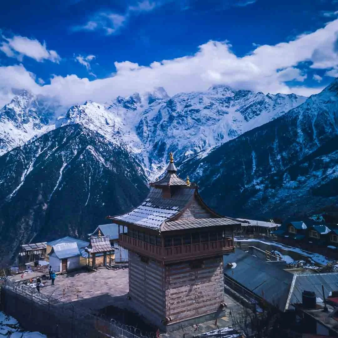
Kalpa
Directly across the valley
The main base for viewing Kinner Kailash. A village 7 km above Reckong Peo with the sunrise view, old temples, and apple orchards. This is where most travellers experience the mountain.
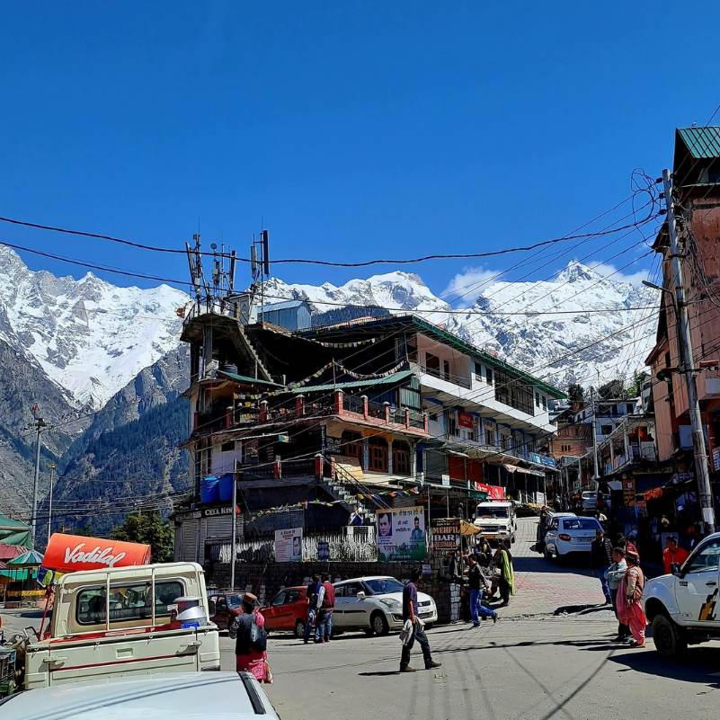
Reckong Peo
At the base of Kalpa, on NH 5
The district headquarters and logistics hub below Kalpa. ATMs, fuel, bus stand, pharmacy, and the SDM office for permits.
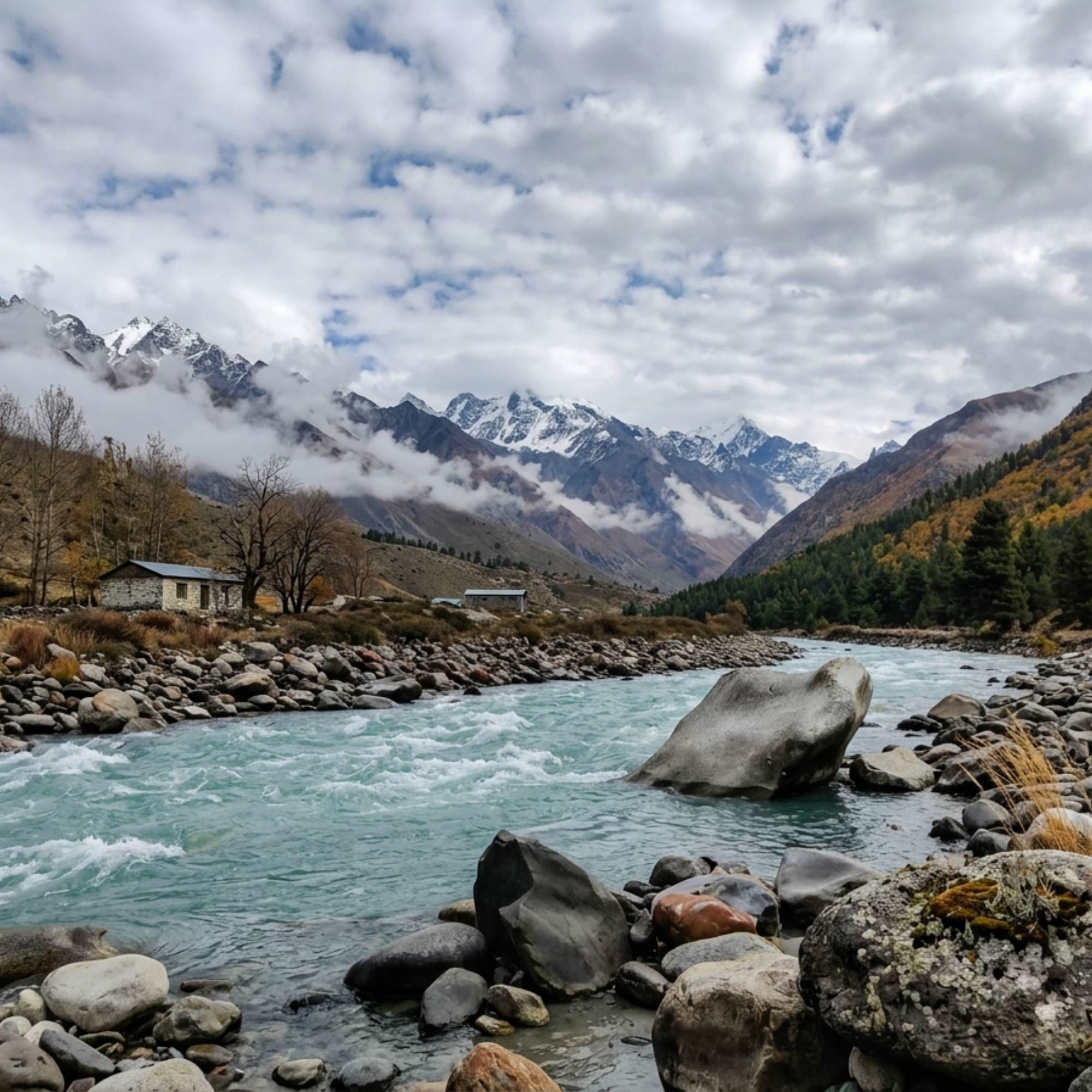
Sangla Valley
35 to 40 km from Reckong Peo via Karcham
The green Baspa Valley with apple orchards, traditional villages, and the drive to Chitkul. Most Kinnaur itineraries combine Sangla and Kalpa.
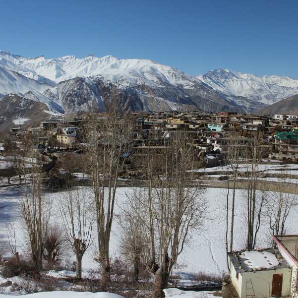
Nako Lake and Village
About 115 km from Reckong Peo toward Spiti
A Buddhist village around a sacred high altitude lake in upper Kinnaur. The natural next stop on the Kinnaur to Spiti circuit after Kalpa.
Our packages with Kinnaur Kailash
Curated trips that include a visit to Kinnaur Kailash.
 Group Tour5D/4N
Kinnaur Valley Weekend Group Trip With Sangla Chitkul and Kalpa
1D Sangla•1D Kalpa
₹7,999₹9,999SAVE INR 2,000/ person 4D/3N
4D/3NKinnaur Valley Scenic Circuit With Sangla Chitkul and Kalpa
1D Shimla•1D Sangla+1
₹16,999₹17,999SAVE INR 1,000/ person
Common questions about Kinnaur Kailash
What is Kinnaur Kailash?
A mountain massif in Kinnaur district, Himachal Pradesh. The summit peak reaches roughly 6,050 metres. On a shoulder of the massif, at approximately 4,800 metres, sits a natural rock pillar roughly 24 metres tall that resembles a Shivling, traditionally considered the winter home of Lord Shiva. The summit and the Shivling are over 1,000 metres apart in altitude. Trekkers and pilgrims aim for the Shivling, not the summit.
How do I see Kinner Kailash?
Two ways. Most travellers see it from Kalpa village, where the range fills the sky across the valley and the sunrise colour change is the main draw. The second way is the Kinner Kailash yatra, a steep, direct ascent to the Shivling at approximately 4,800 metres. The trek is only for fit, experienced trekkers with professional guides.
When is the best time to visit?
For the view from Kalpa: April to June and October for the clearest skies. For the trek: local authorities typically permit the yatra during July and August (Shravan). Late June and September are possible in some years but unreliable. The window is strictly weather dependent and shifts annually. Always confirm with the forest department in Reckong Peo before committing.
How difficult is the trek?
One of the hardest standard treks in Himachal Pradesh. You gain 2,500 metres of altitude from Tangling (~2,300 m) to the Shivling (~4,800 m) over 3 to 5 days. The upper half is steep scree and boulder fields at severe altitude. Acute mountain sickness is common. The terrain punishes every misstep. Only attempt with experienced guides, proper gear, and serious physical conditioning.
What preparation is needed?
Acclimatise at Kalpa or Reckong Peo for at least one to two nights before starting. You need: trekking boots with ankle support, a sleeping bag rated for minus 10°C, waterproof layers, altitude medication (Diamox if cleared by your doctor), first aid kit, sun protection, and enough food and water purification for the full route. Go with experienced local guides or an organised group. Solo attempts are reckless.
What does the trek cost?
Costs include transport to Tangling, guide fees, porter or mule charges, camping gear, food, and personal equipment. Organised packages from local operators typically range from Rs 15,000 to Rs 40,000 or more per person depending on group size and inclusions. Confirm current rates directly with operators.
Do I need a permit?
No formal registration system exists in the way some other yatras work. However, checking in with the forest department in Reckong Peo before starting is advisable. Some organised groups handle this. Rules can change year to year, so confirm locally.
Is the trek suitable for families or seniors?
No. The trek involves extreme altitude gain on steep, unstable terrain with no medical facilities above base. It is not suitable for children, elderly travellers, or anyone with cardiac, pulmonary, or blood pressure conditions.
Can I experience Kinner Kailash without trekking?
Yes. Go to Kalpa, stay two nights, and watch the sunrise. The mountain view requires zero physical effort and is genuinely one of the finest sights in the Indian Himalaya.
What is the Parikrama?
A circumambulation trek around the entire massif, crossing Charang La pass at roughly 5,200 metres and descending toward Chitkul. It takes 6 to 8 days and is significantly harder than the direct yatra. Only for experienced high altitude trekkers with full support.
Related guides
Posts about Kinnaur
- Yulla Kanda Trek Guide 2026: Route, Best Time, Cost and Planning
- Kinnaur Snowfall Guide 2026: When & Where to Look for Snow
- Christmas & New Year in Kinnaur: A 2026-27 Winter Trip Guide
- Kinnaur in November 2026: Weather, Snow Chances & 7-Day Trip Plan
- Yulla Kanda Trek Distance and Route 2026: Yulla Khas to the Lake
- Yulla Kanda Krishna Temple in 2026: Location, Beliefs & Visiting Etiquette