
Hampta Pass Trek
A crossover trek at roughly 4,270 m in the Pir Panjal range that walks you from the green Kullu Valley into the barren Lahaul in under five days, with river crossings, wildflower meadows, and one of the most dramatic landscape shifts in the Indian Himalayas
- Trek
- ~4,270 m / ~14,100 ft
- ~26 km over 4 to 5 days
- Starts from Manali
- Jun to Sep
What makes it special
Hampta Pass is a crossover. Not in the metaphorical sense. You literally walk from one world into another. On the Manali side, the trail moves through thick forests of maple, birch, and pine, along a noisy stream called Rani Nallah, past meadows so green they look edited. On the other side, after you cross the pass at roughly 4,270 metres, everything changes. The green vanishes. The Lahaul Valley is bare rock, grey scree, and cold desert. The transition happens over a single trekking day, and the sheer visual contrast is what keeps people coming back to this trail decade after decade.
The trek covers about 26 km over four to five days of walking, starting from Jobra (a short drive from Manali) and ending at Chatru on the Lahaul side. Most trekkers add a sixth day to visit Chandratal Lake, and honestly, skipping the lake feels like leaving a movie before the last scene. The pass itself sits in the Pir Panjal range, and on a clear day at the top, you get close views of Indrasan (6,221 m) and Deo Tibba (6,001 m), two peaks that dominate the skyline for most of the trek. The trail was historically a trade and shepherd route between Kullu and Lahaul, and local Gaddi shepherds still use it every summer to move their flocks across the range.
Here is what makes Hampta Pass special compared to the many other treks near Manali. Most short treks in Himachal take you up and bring you back the same way. Hampta is a through trek. You start in one valley and finish in a completely different one. The landscape change is not gradual. It is dramatic, almost sudden, and it happens right at the pass. One minute you are looking back at green slopes, and the next you are staring at a barren moonscape dropping away toward Chatru. That single moment of crossing is what everyone remembers.
The difficulty is moderate. It is harder than Beas Kund or Bhrigu Lake, but gentler than Rupin Pass or Pin Bhaba. The altitude gain is steady, the trail is well defined, and the toughest section, the climb from Balu Ka Ghera to the pass and the descent to Shea Goru, is concentrated into one long day. River crossings through icy glacial water are the other real challenge, especially in July when snowmelt is at its peak. You will get your boots wet. That is not a maybe, it is a certainty.
One thing worth knowing before you commit. Hampta Pass is a monsoon trek. The season runs from roughly mid June to late September, which means you trek through rain, mud, and mist on most days. If you want blue sky mountain photography weather, this is not the right trek. If you want wildflowers, gushing streams, green valleys turning into snow slopes, and the raw energy of the Himalayas in full summer mode, this is exactly the right one.
Quick answers
- Is the Hampta Pass Trek suitable for beginners?
- Yes, with a condition. You need decent fitness and ideally one easier trek behind you. The altitude is real at 4,270 m, the pass day is long (7 to 8 hours), and river crossings through ice cold water need some nerve. But the trail is not technical, the distance is short at about 26 km, and if you train for 6 to 8 weeks, most fit beginners handle it well. Going with a reputable trekking operator makes a significant difference.
- How many days does the Hampta Pass Trek take?
- Four to five days of trekking, plus one day for the Chandratal Lake extension. A typical itinerary: Day 1, drive to Jobra and trek to Chika. Day 2, Chika to Balu Ka Ghera. Day 3, over Hampta Pass to Shea Goru (the big day). Day 4, Shea Goru to Chatru. Day 5, drive to Chandratal and back to Manali. Plan to reach Manali a day before to rest.
- What does the Hampta Pass Trek cost with an operator?
- Most operators charge between roughly ₹6,500 and ₹12,000 per person for the standard 5 day package including Chandratal. This generally covers camping, meals, guides, forest permits, and transfers from Manali. Budget packages run larger groups with basic gear. Premium packages offer smaller groups and better equipment. The price difference is usually worth it for safety and comfort.
Quick facts
Everything you need to know at a glance.
At a glance
- Maximum altitude
- Roughly 4,270 m / 14,100 ft at Hampta Pass. Campsites range from about 2,800 m (Jobra) to 3,900 m (Shea Goru).
- Trek distance
- About 26 km over 4 to 5 trekking days. The pass day (Balu Ka Ghera to Shea Goru) is the longest at roughly 9 to 12 km.
- Location
- Pir Panjal range, Himachal Pradesh. Connects the Kullu Valley (Manali side) to the Lahaul Valley (Chatru side).
- Start and end points
- Starts from Jobra, about 27 km from Manali. Ends at Chatru in Lahaul. Return to Manali via the Atal Tunnel, roughly 60 km.
- Difficulty
- Moderate. Suitable for fit beginners with some preparation. The pass day involves 7 to 8 hours of walking with steep ascent and descent.
- Season
- Mid June to late September, generally. June offers snow, July and August bring wildflowers and rain, September has clearer skies.
- Days needed
- 5 days for the trek with Chandratal. Add a buffer day in Manali. Plan 7 days total from your home city.
On the ground
- Mobile network
- Last reliable network is at Manali or Jobra. Assume zero coverage from Chika onwards for 3 to 4 days.
- Permits
- Forest department permit required (Inderkilla National Park area). Operators include this. Independent trekkers should visit the Forest Office in Manali.
- Food on the trek
- Operators provide all meals. Simple vegetarian fare: paranthas, dal, rice, sabzi, soup, chai. No shops on the trail.
- Water
- Stream water at most campsites. Carry purification tablets. Operators usually provide boiled water.
- ATM and cash
- Last ATM is in Manali. Carry cash for tips, emergency supplies, and personal spending.
- Washrooms
- Dry pit toilets at each campsite. No running water. Carry personal hygiene supplies.
- Drones
- Generally not allowed. Parts of the trail are near protected forest areas.
Seasonal weather
- Jun15°-2°Early season (Jun)
- Jul to Aug18°2°Peak monsoon (Jul to Aug)
- Sep15°-5°Late season (Sep)
- Oct to May5°-20°Closed (Oct to May)
Suitable for
- Couples — suitable
- Families — with some care
- Seniors — not suitable
- Solo — suitable
- First-timers — with some care
- Pet-friendly — not suitable
How to reach Hampta Pass Trek
2 approach routes, with seasonal access.
From Manali to Jobra (trek start)
Mid June to late September for trekkers- Distance
- About 27 km by road
- Time
- 1 to 1.5 hours by jeep
- Road
- Paved road with about 40 hairpin bends, gets narrow in the last stretch
- Last fuel
- Fill up in Manali. No fuel on the trek route.
The drive from Manali to Jobra is arranged by your trekking operator, usually in a shared Bolero or Sumo. You leave Manali early, climb through about 40 hairpin bends with views of the Kullu Valley opening up behind you, and reach Jobra in about an hour to ninety minutes. The road is paved but narrow, and during monsoon, small landslides can delay the drive. Jobra is not a village, it is a road head, a point where the tarmac ends and the trail begins. From here, you trek.
From Chatru to Manali (after trek)
Year round via Atal Tunnel, but trek season is Jun to Sep- Distance
- About 60 km via Atal Tunnel
- Time
- 1.5 to 2 hours by jeep
- Road
- Rough road to Gramphu, then highway through Atal Tunnel
- Last fuel
- No fuel between Chatru and Manali.
After the trek ends at Chatru, a jeep takes you back to Manali. If you are visiting Chandratal, the drive goes from Chatru to the lake (about 50 km on a rough road) and then back through Chatru, Gramphu, and through the Atal Tunnel to Manali. The drive takes about 1.5 to 2 hours from Chatru to Manali in good conditions, but rain or road work can stretch it. Most operators handle this entire transfer.
Best time to visit
Season by season, so you can plan around the weather rather than hope.
- Recommended
Early season
June
Snow on the pass, dramatic river crossings, the trail at its most raw and quiet.
- Temperature at camps
- Roughly minus 2 to 15°C
- Snow
- Expect snow near and on the pass
- Crowds
- Low
- River crossings
- High water, cold, requires care
June is when the season opens. Snow still covers large patches near the pass, and the final ascent often involves walking on compacted snowfields. River crossings are serious, the water is at its coldest and the volume is rising with snowmelt. The Kullu side is turning green but has not hit full bloom yet. Nights at Balu Ka Ghera drop below freezing. This is the month for people who want the trek at its wildest and least crowded. Most operators start fixed departures in the second or third week of June.
- Recommended
Peak monsoon
July to August
Green valleys, wildflowers everywhere, rain and mist most days, busiest months.
- Temperature at camps
- Roughly 2 to 18°C
- Rain
- Frequent, sometimes heavy. Carry good rain gear.
- Crowds
- High, peak in mid July
- Wildflowers
- At their best, especially at Jwara and Chika meadows
This is peak Hampta Pass season. The Kullu side explodes with wildflowers, the meadows at Jwara and around Chika are at their greenest, and the mountains are wrapped in cloud and mist for much of the day. It rains, sometimes heavily, sometimes a drizzle that lasts all afternoon. The trail gets muddy and slippery. River crossings are at peak volume, especially in late July and early August. Most operators run their highest frequency of departures in this window. If you are comfortable with rain and mud, this is the most visually rewarding window. Pack rain gear and waterproof bags for your electronics.
- Recommended
Late season
September
Clearer skies, sharper light, fewer trekkers, colder nights. Many regulars say this is the best month.
- Temperature at camps
- Roughly minus 5 to 15°C
- Weather
- Generally clearer, rain eases significantly
- Crowds
- Low to moderate
- Photography
- Best month for clear mountain views
September is when the monsoon eases and the sky opens up. Views of Indrasan and Deo Tibba are at their clearest. The wildflowers thin out but the valleys still have colour. River crossings calm down noticeably. Nights get properly cold, especially at Balu Ka Ghera and Shea Goru, where temperatures drop well below zero. Fewer trekkers on the trail means quieter campsites. If your schedule allows, late June and September are the months most experienced trekkers recommend. Operators start winding down fixed departures by late September.
- Closed
Closed
October to May
Snow blocks the pass. The trail is not accessible for regular trekkers.
- Temperature
- Often well below minus 10°C at camp altitudes
- Pass
- Blocked by snow
- Operators
- All closed
- Access
- Not possible for regular trekkers
By mid to late October, heavy snowfall closes the pass. The trail is buried, campsites are dismantled, and operators shut down for the season. From November to May, the pass is deep under snow and not passable for regular trekking groups. Do not plan a Hampta Pass trip outside the June to September window.
Things to see & do
6 things worth your time at Hampta Pass Trek.
The pass crossing itself
7 to 8 hours (full day)Day 3 is the main event. You leave Balu Ka Ghera early, around 6:30 AM, and climb steadily along the Rani Nallah as it narrows into a thin stream and then disappears under snow. The last stretch before the pass is steep, often on snow or loose rock, and your breathing gets noticeably harder above 4,000 m. At the top, if the weather cooperates, you get a full panorama, green valley behind you, barren grey Lahaul ahead, and the massive faces of Indrasan and Deo Tibba close enough to see their ridgelines. The descent to Shea Goru is steep and loose, requiring careful footing. By the time you reach camp, your legs will know they worked. This single day is what defines the trek.
River crossings
10 to 20 minutes each, two major crossingsTwo river crossings stand out on this trek. One between Chika and Balu Ka Ghera, and another between Shea Goru and Chatru. The water is glacial melt, genuinely cold enough to make your feet ache within seconds. In July, the streams can be knee deep with a strong current, and operators set up ropes for safety. You take off your boots, roll up your trousers, grip the rope, and walk across. It is one of those moments that sounds minor in a description but stays with you for years. Trekking sandals or waterproof shoes help. Dry socks waiting on the other side are a luxury worth planning for.
Wildflower meadows at Jwara
Part of the Day 2 trailBetween Chika and Balu Ka Ghera, you pass through the Jwara meadows, which in July and August turn into a carpet of wildflowers, purple, yellow, white, and orange, stretching across the valley floor. Many trekkers call this Himachal's version of the Valley of Flowers. You do not detour for this. The trail runs straight through it. Walk slow, take it in, and resist the urge to rush through because the next campsite is on the clock.
Camp at Balu Ka Ghera
OvernightBalu Ka Ghera (roughly 3,600 m) is a sandy, boulder strewn flat at the base of the glacial valley leading up to the pass. It is the campsite people remember most, not because it is comfortable, but because the setting is dramatic. Huge boulders, the sound of multiple streams gushing down the valley walls, and a full circle of Pir Panjal peaks above you. The wind picks up after sunset and the temperature drops fast. Sleep in all your warm layers. The next morning, you climb to the pass.
Visit Chandratal Lake (extension day)
Full dayAfter the trek ends at Chatru, most itineraries include a drive to Chandratal Lake, a crescent shaped high altitude lake at roughly 4,300 m. The drive from Chatru is about 50 km on a rough road, taking 2 to 3 hours. The lake itself is a 15 to 20 minute walk from the parking area. The water shifts colour depending on the light, and on a still afternoon, the reflections of the surrounding peaks are unreal. This extension adds a day to the trek but almost everyone who has done it says it was the right call. You drive back through the Atal Tunnel to Manali the same day or the next morning.
Shea Goru campsite
OvernightThe first night on the Lahaul side. After the hard descent from the pass, Shea Goru feels like a reward. The camp sits beside a glacial stream on a green meadow dotted with small flowers, surrounded by the bare brown mountains of Lahaul. The contrast with the Kullu side is sharp. The air feels different, drier and colder. The sky, if it clears in the evening, opens up wider than anything on the other side of the pass. This is also where most trekkers realise the crossover is real, not just a name on an itinerary.
Know before you visit Hampta Pass Trek
The practical bits, from people who have been.
What Hampta Pass Trek actually isA 26 km crossover trek from Kullu to Lahaul in 4 to 5 days, with a dramatic landscape shift at the pass.
Hampta Pass is a through trek in the Pir Panjal range of Himachal Pradesh. It starts near Manali, climbs through forests and meadows in the Kullu Valley, crosses a high pass at roughly 4,270 m, and descends into the barren Lahaul Valley, ending at Chatru. The total trekking distance is about 26 km over four to five days. Most groups add a day to visit Chandratal Lake before driving back to Manali through the Atal Tunnel.
The trail was historically used by Gaddi shepherds and traders moving between Kullu and Lahaul. Today, it is one of the most popular treks in Himachal, and with good reason. In under a week, you walk through pine forests, wildflower meadows, glacial valleys, icy river crossings, a high altitude pass with snow, and a cold desert landscape. Few treks in India pack this much variety into this short a distance.
The key thing to understand is that this is not a loop. You do not return the way you came. You start in one valley and finish in another. The drive back to Manali is by road, not by foot, through the Atal Tunnel from the Lahaul side.
Who should do this trek, and who should notGood for fit beginners and experienced trekkers. Not suitable for seniors with health conditions, young children, or pets.
Hampta Pass works well for reasonably fit adults between roughly 18 and 55 who have some outdoor experience and are willing to train for 6 to 8 weeks beforehand. It is a popular first high altitude trek for people who have done a day hike or a weekend trek and want to step up. Going with a good operator significantly reduces the risk and stress.
Families with children below 10 should reconsider. The altitude, cold, river crossings, and long trekking days are demanding even for fit adults. Kids over 12 who are active and used to the outdoors can manage, but clear it with the operator first.
Seniors with heart, lung, or blood pressure conditions should avoid this trek. At 4,270 m, the oxygen is genuinely thin, and medical help is many hours away.
Pets are not allowed on the trail. Solo trekking without an operator is possible but not recommended, especially for first timers. Join a group. The cost difference is small, and the safety difference is large.
How to plan your tripReach Manali a day before. Trek runs 5 to 6 days including Chandratal. Budget roughly ₹7,000 to ₹12,000 per person.
The standard plan. Reach Manali a day before the trek starts. Rest, sort your gear, meet your group. Day 1, drive to Jobra and trek to Chika. Day 2, Chika to Balu Ka Ghera. Day 3, Balu Ka Ghera over Hampta Pass to Shea Goru. Day 4, Shea Goru to Chatru. Day 5, drive to Chandratal and back to Manali via the Atal Tunnel.
Most operators run fixed departure groups from mid June to late September. Expect to pay between roughly ₹6,500 and ₹12,000 per person for the full package including Chandratal, depending on the operator and group size. Book early for July and August dates.
Travellers should reconfirm permit requirements, road conditions, and operator schedules close to their travel date, as these can shift each season.
Altitude, fitness, and safetyTrain for 6 to 8 weeks. Hydrate. Watch for AMS above Balu Ka Ghera. Operators carry emergency oxygen.
The pass is at roughly 4,270 m. That is high enough for altitude sickness to be a real concern. Most people notice the thin air from Balu Ka Ghera (3,600 m) onwards, a dull headache, faster breathing, mild nausea. The risk increases if you rush, skip meals, or get dehydrated.
Train before you go. Running, stair climbing, or cycling for 6 to 8 weeks makes a measurable difference. On the trek, drink at least 3 to 4 litres of water daily. Eat your meals even if you do not feel hungry. Walk at a steady pace.
If you develop a persistent headache, vomiting, confusion, or breathlessness at rest, tell your trek leader immediately. These can be early signs of serious altitude illness, and the only reliable treatment is to descend. Good operators carry pulse oximeters and emergency oxygen.
Some trekkers carry Diamox (acetazolamide) as a preventive measure. Consult your doctor before the trek if you want to consider this.
What to packLayers, waterproofs, trekking boots, rain cover. Pack light. Operators provide tents, sleeping bags, and meals.
Your operator provides tents, sleeping bags, mattresses, and all meals. You carry your personal gear. Bag offloading to a mule is usually available for around ₹1,500.
Essentials. Good ankle high waterproof trekking boots, broken in before the trek. A rain jacket. Waterproof bags for electronics. Thermal base layers. A warm fleece or down jacket for nights. Trekking sandals for river crossings. Sunglasses and sunscreen. A headlamp. A water bottle with purification tablets. Personal medicines. Cash in small notes.
Nice to have. Trekking poles for the descent from the pass. Dry socks in a waterproof bag. A light waterproof cover for your backpack.
What not to bring. Heavy jeans. Too many clothes. Anything you cannot carry for 6 hours.
Ground reality and common mistakesTrain before you go. Waterproof everything. Do not skip Chandratal. Inform family about zero connectivity.
The most common mistake is showing up without training. Hampta Pass is marketed as a beginner trek, and it is, but "beginner" in the Himalayas still means 5 to 7 hours of walking daily at altitude. People who have not exercised in months struggle badly by Day 2.
The second mistake is underestimating rain. This is a monsoon trek. It will rain. Your bag, phone, and spare clothes will get wet unless you waterproof them. Carry everything valuable in dry bags.
The third mistake is cheap boots. Wet, slippery trails are hard on ankles. Invest in proper shoes with ankle support. Break them in for at least two weeks before.
The fourth mistake is skipping Chandratal. Almost every trekker who skips the lake regrets it when they hear about it from others at camp. Add the day.
A practical note. There is no mobile network from Chika onwards. Tell your family before you start that you will be unreachable for 3 to 4 days.
Nearby attractions
Other places worth the detour.
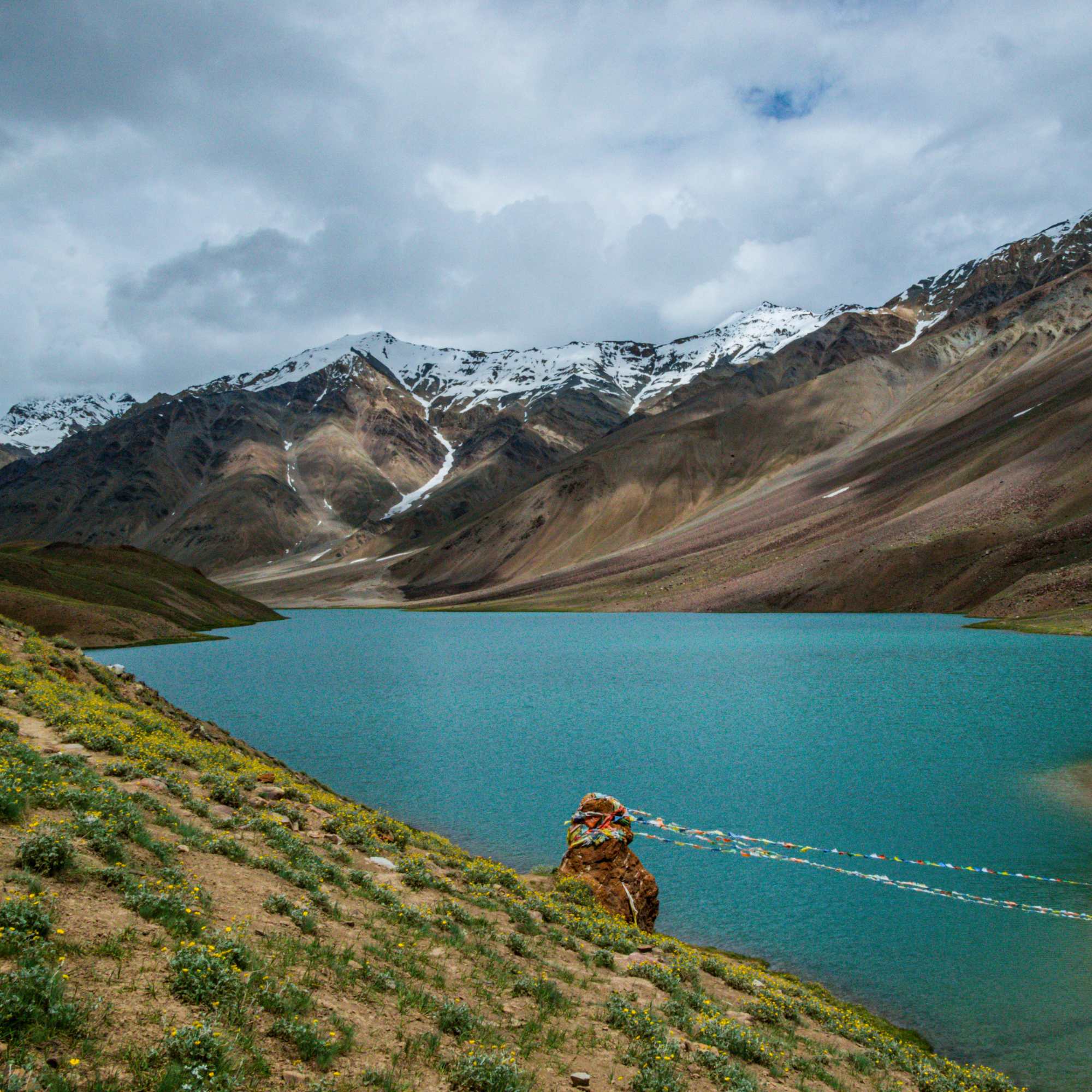
Chandratal Lake
About 50 km from Chatru by road
The crescent moon lake at roughly 4,300 m, usually visited as a day extension after the trek. The drive from Chatru is rough but the lake is one of the most rewarding sights in the Indian Himalayas.
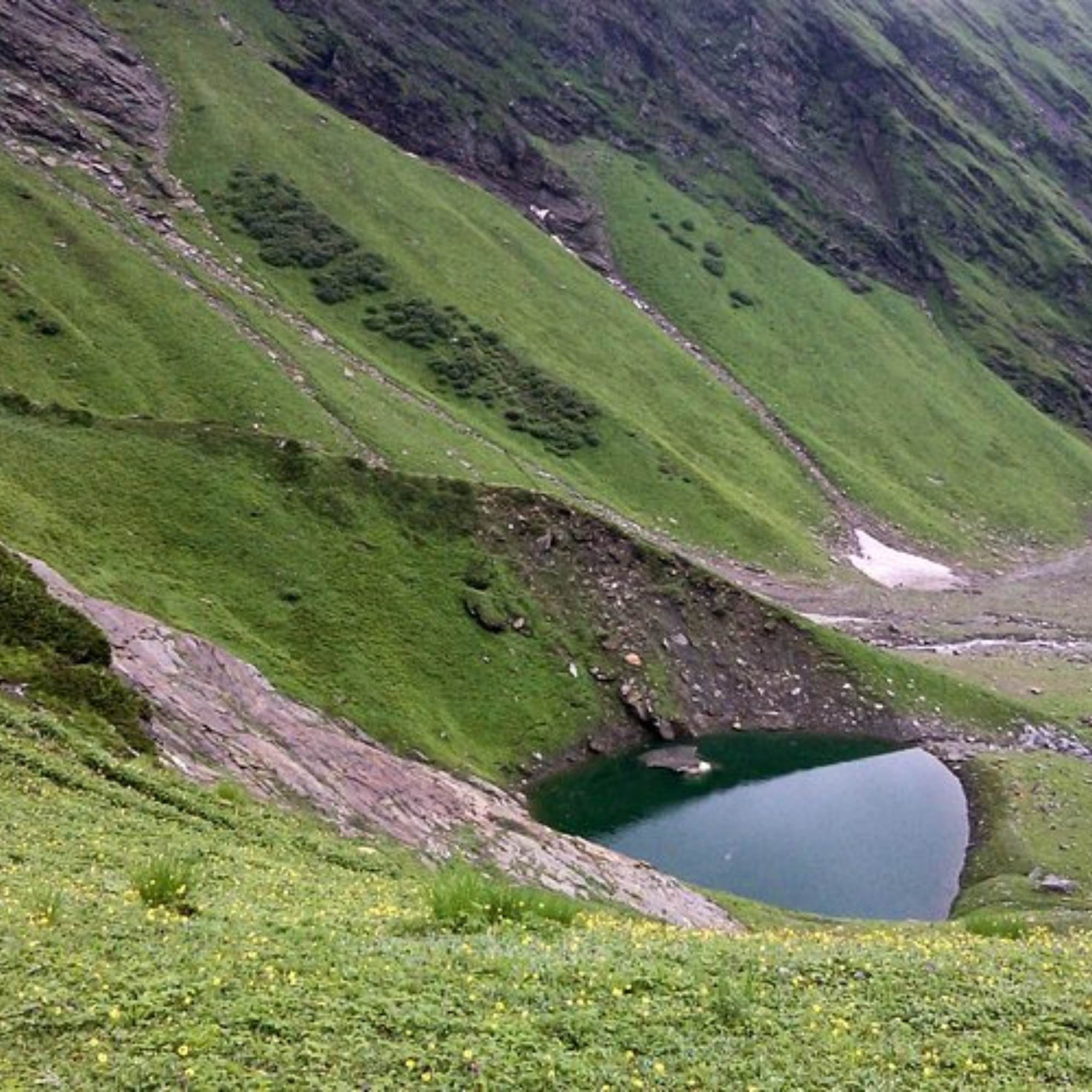
Beas Kund Trek
Starts near Solang Valley, about 13 km from Manali
A shorter, easier trek to the source of the Beas River at about 3,700 m. A good warm up trek if you want to test your fitness before Hampta Pass. Takes 2 to 3 days.
Bhrigu Lake Trek
Starts near Gulaba, about 20 km from Manali
A 3 day trek to a high altitude glacial lake at about 4,300 m near the treeline above Manali. Another good preparatory trek, or a shorter alternative if you have limited time.
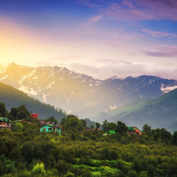
Solang Valley
About 13 km from Manali
The adventure activity hub near Manali with paragliding, zorbing, and in winter, skiing. Useful as a day activity if you have a spare day in Manali before or after the trek.
Rohtang Pass
About 51 km from Manali
The famous high pass on the Manali Leh highway at about 3,978 m. You may cross it or take the Atal Tunnel below it on your return from Chatru after the Hampta Pass trek.
Common questions about the Hampta Pass Trek
What is the altitude of Hampta Pass?
Roughly 4,270 m (about 14,100 ft). Sources vary slightly between 14,009 and 14,140 ft, so treat it as an approximate figure. The altitude is high enough that proper acclimatisation and fitness preparation matter.
How difficult is the Hampta Pass Trek?
Moderate. It is harder than day hikes like Triund or weekend treks like Kheerganga, but significantly easier than technical crossover treks like Rupin Pass or Pin Bhaba. The pass day is the toughest, involving 7 to 8 hours of walking with a steep climb and descent. River crossings through cold glacial water add to the challenge. If you train for 6 to 8 weeks and go with a good operator, most fit adults can handle it.
When is the best time to do the Hampta Pass Trek?
June to September is the trekking season. June is quieter with snow on the pass. July and August offer the best wildflowers but the most rain and the heaviest river crossings. September generally has clearer skies, fewer trekkers, and colder nights. Many experienced trekkers recommend late June or September as the sweet spot.
How do I reach the starting point of the trek?
The trek starts at Jobra, about 27 km from Manali, reached by a 1 to 1.5 hour jeep drive. Get to Manali first, either by overnight bus from Delhi (12 to 14 hours) or by flying to Bhuntar Airport (about 50 km from Manali) and then taking a taxi. Reach Manali a day before the trek starts to rest and acclimatise. Most operators arrange the Manali to Jobra transfer.
Do I need a permit for the Hampta Pass Trek?
Yes. A forest department permit is required because the trail passes through the Inderkilla National Park area. If you are trekking with an operator, this is included in the package. Independent trekkers should visit the Forest Office in Manali a day before the trek. You will also need a vehicle permit for the return drive via Rohtang or the Atal Tunnel. Permit rules and fees can change, so confirm with your operator or the forest office before you go.
Can I do the Hampta Pass Trek solo or independently?
Technically yes, but it is not recommended for first timers. The trail passes through remote areas with zero mobile coverage. Route finding near the pass can be tricky in mist or snowfall. You need to arrange your own food, tents, camping permits, and mule support in a region with limited infrastructure. Most solo trekkers join group departures run by established operators.
What does a Hampta Pass trek package include?
A standard package generally includes camping at all campsites, all meals during the trek, a certified trek leader and support staff, forest permits, safety equipment, and vehicle transfers from Manali to Jobra and Chatru to Manali. Most packages also include the Chandratal Lake visit. Excluded items typically include travel to and from Manali, personal gear, bag offloading charges, and travel insurance.
How fit do I need to be?
You should be able to walk 10 to 12 km on hilly terrain without exhaustion, and climb several flights of stairs without significant breathlessness. Start training at least 6 to 8 weeks before the trek. Running, stair climbing, squats, and cycling are all effective. The pass day involves roughly 600 to 700 m of altitude gain and a steep descent, over 7 to 8 hours.
Is Chandratal Lake included in the Hampta Pass Trek?
It depends on the package. Most 5 day itineraries include a drive from Chatru to Chandratal after the trek. Some 4 day packages skip it. We strongly recommend choosing the option that includes Chandratal. The lake is one of the most rewarding sights in the region.
What is the mobile network situation on the trek?
Effectively none. You will have network in Manali and possibly at Jobra. From Chika onwards, assume zero coverage for 3 to 4 days. BSNL postpaid has the best chance of a faint signal at Chatru, but do not rely on it. Inform family before you start.
Can families with children do the Hampta Pass Trek?
Children above roughly 12 who are active and healthy can manage with preparation. Children below 10 should not attempt this trek. The altitude, cold, long walking hours, and river crossings are demanding. If you are considering it for a teenager, discuss it with the operator beforehand.
What happens if the weather turns bad during the trek?
Weather changes rapidly in the Pir Panjal range. Good operators have contingency plans including buffer days, alternative camping spots, and the authority to turn groups back if conditions are unsafe. This is another reason going with a reputable operator matters.
Related guides
Posts about Manali
- Medical Help in Manali for Tourists 2026: Hospitals, Pharmacies and Emergency Steps
- Vegetarian and Jain Food in Manali 2026: Where to Eat Without Guesswork
- Mobile Network, Internet, UPI and ATMs in Manali 2026: What Works Where
- Shimla to Manali in 2026: Distance, Travel Time, Bus vs Cab and the Best Transfer Plan
- Manali with Pets in 2026: Road Travel, Pet-Friendly Stays, Snow Safety and Practical Rules
- Is Manali Safe for Solo Female Travellers in 2026? Areas, Transport and Winter Safety